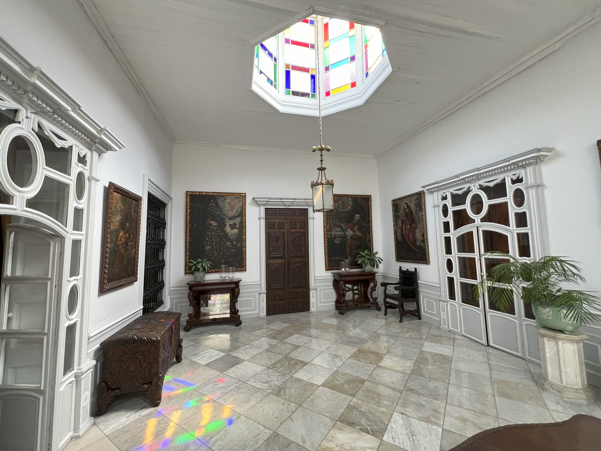
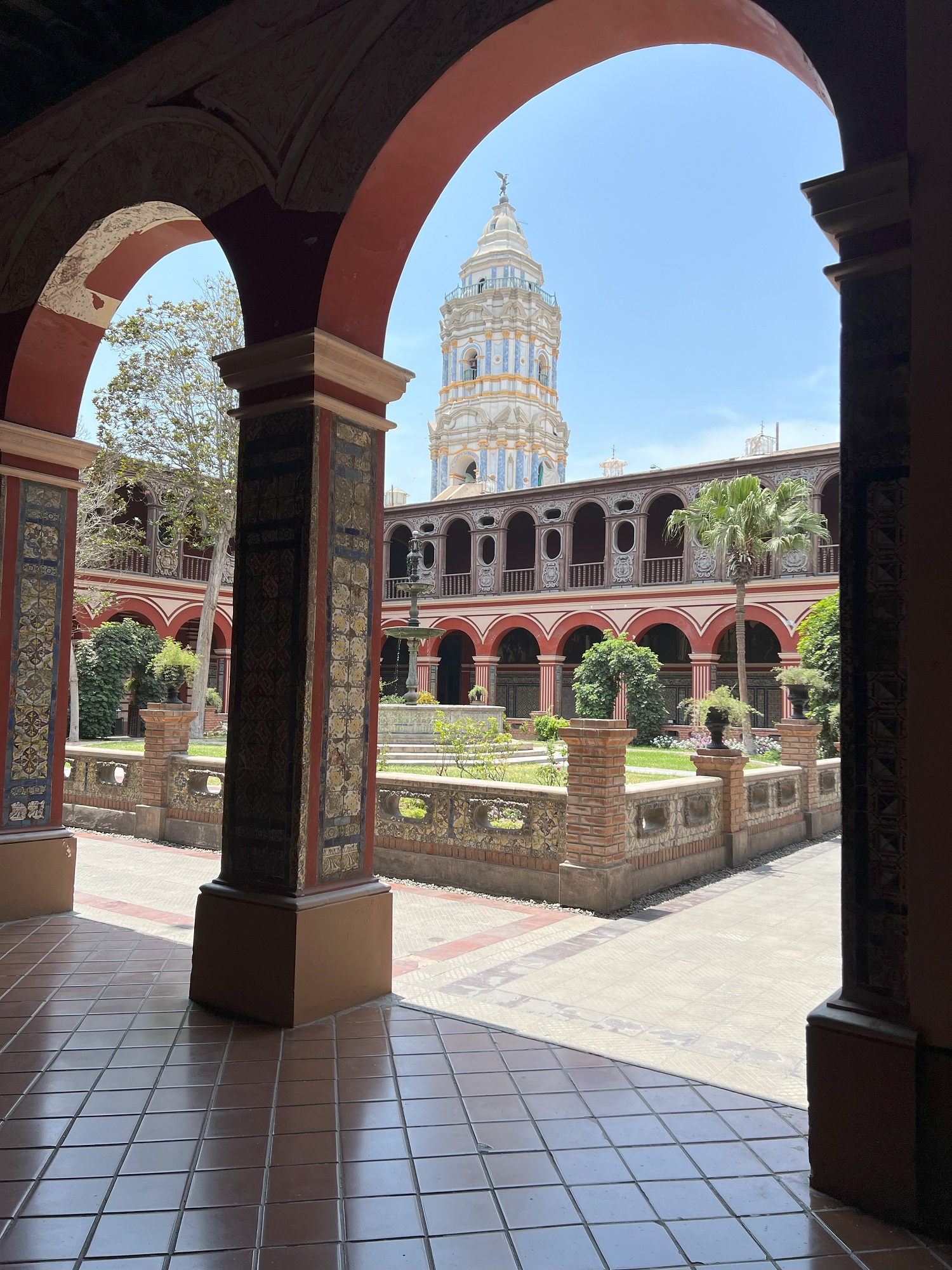
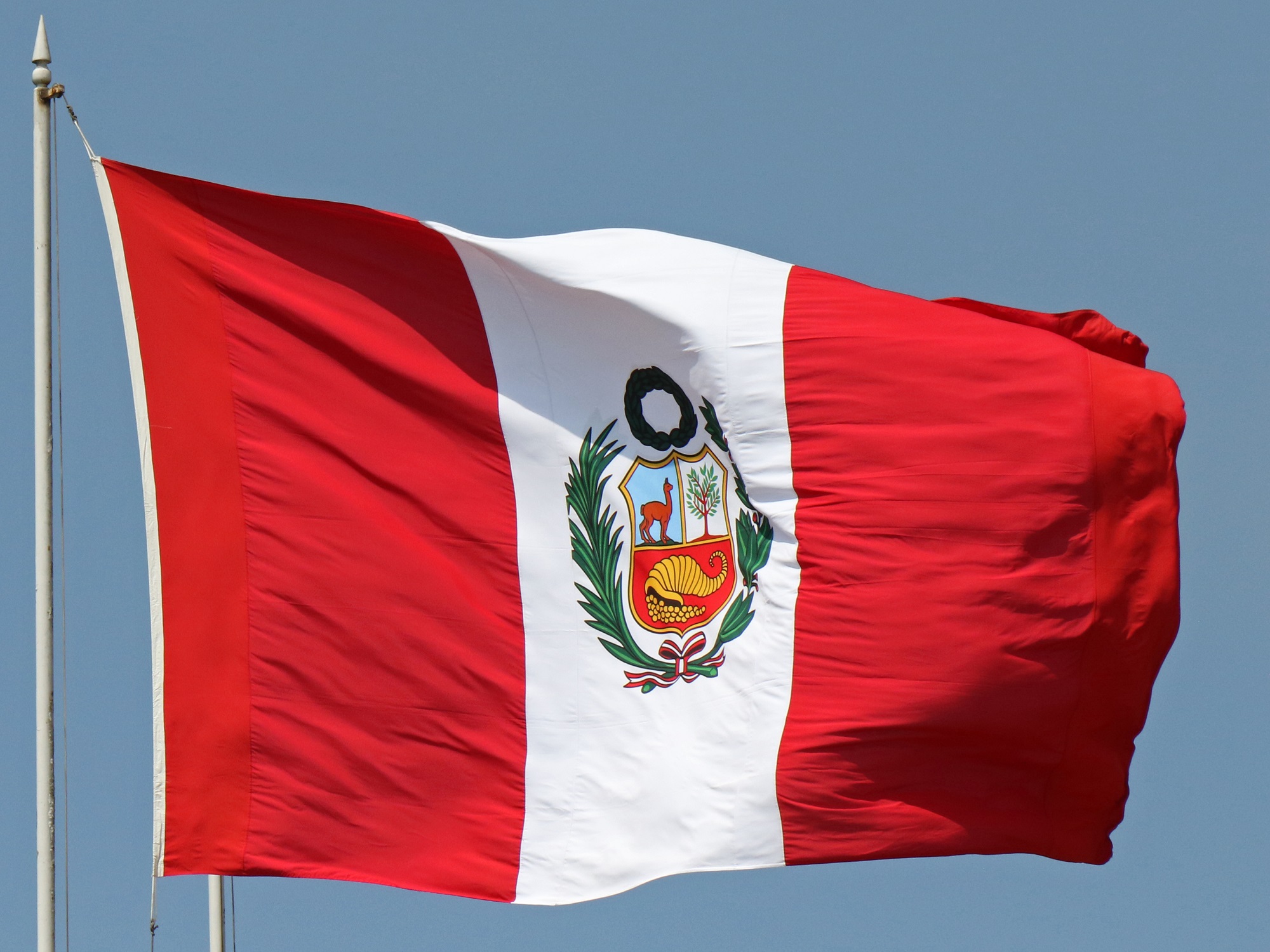
Here are a few pictures of buildings and artifacts that caught my eye.
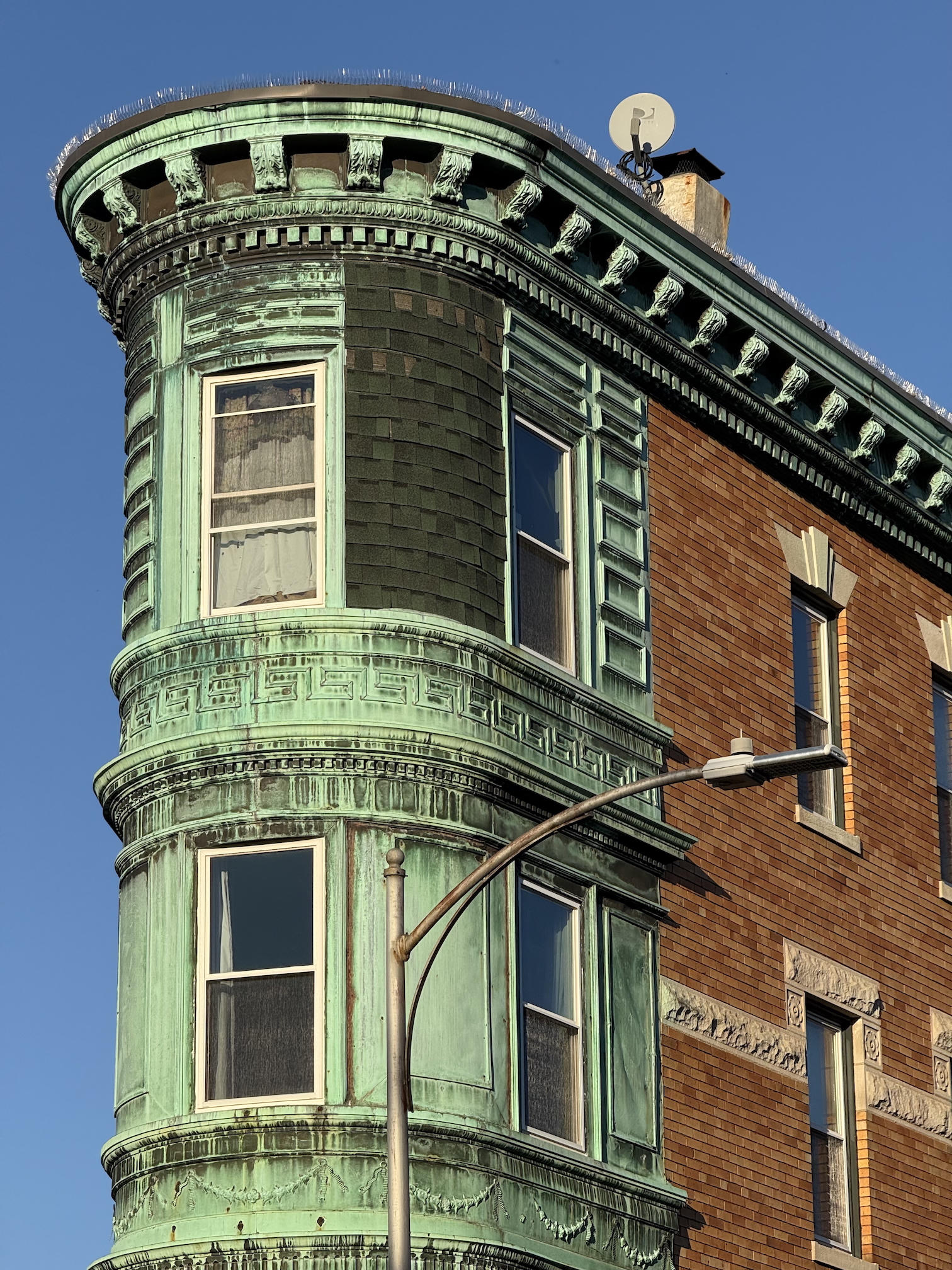
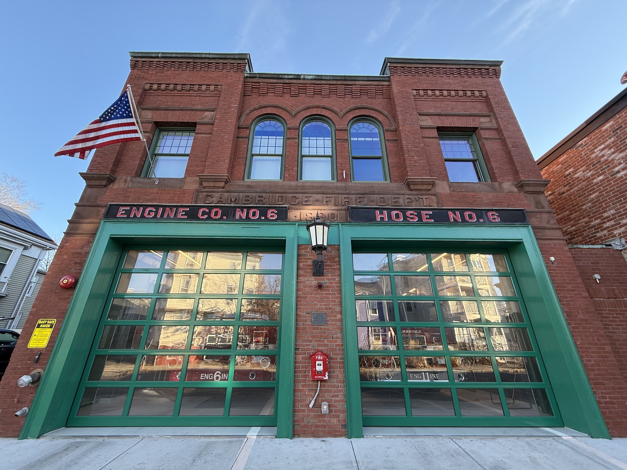
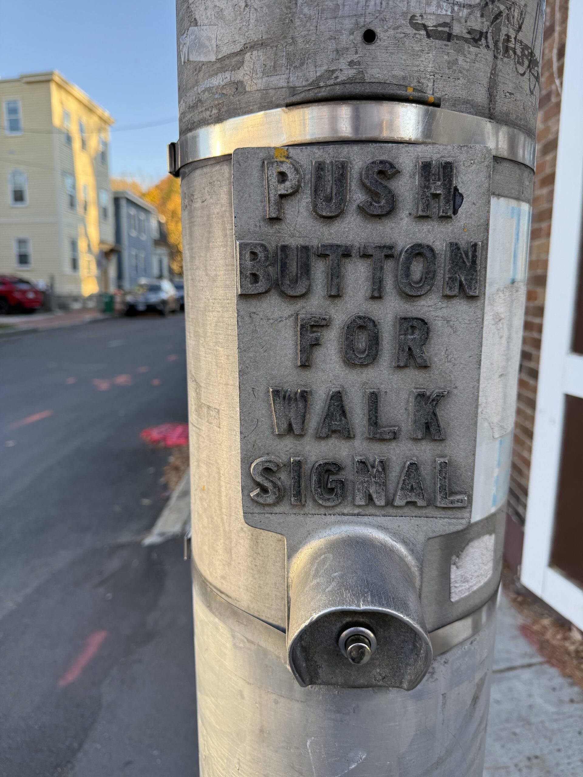
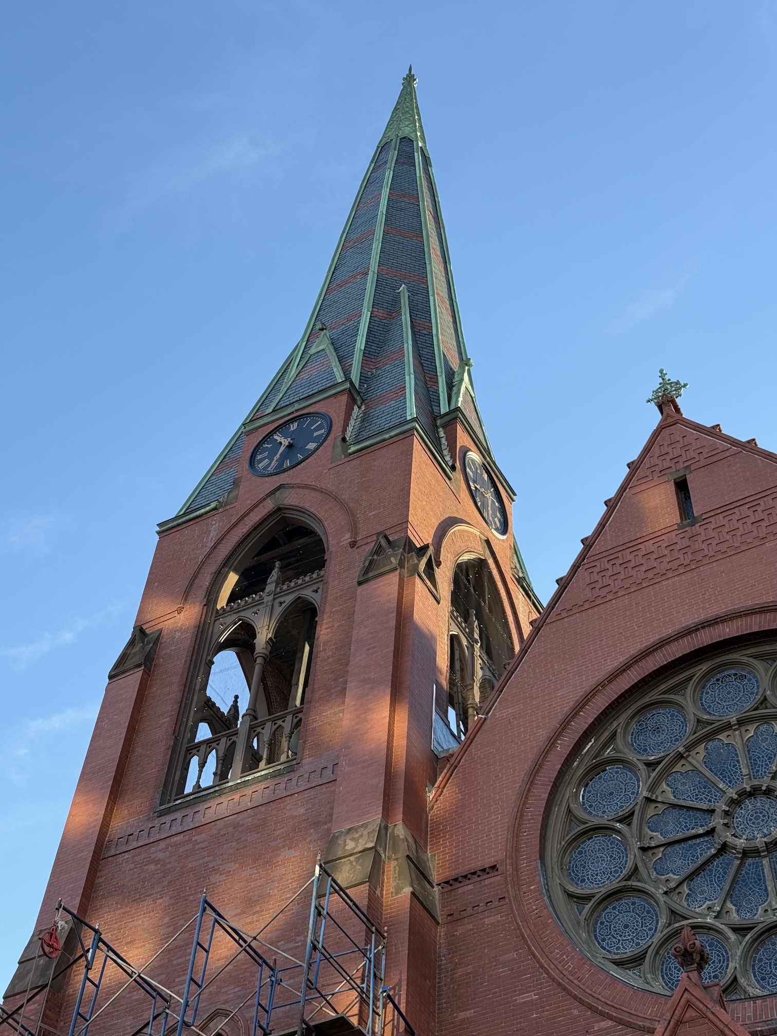
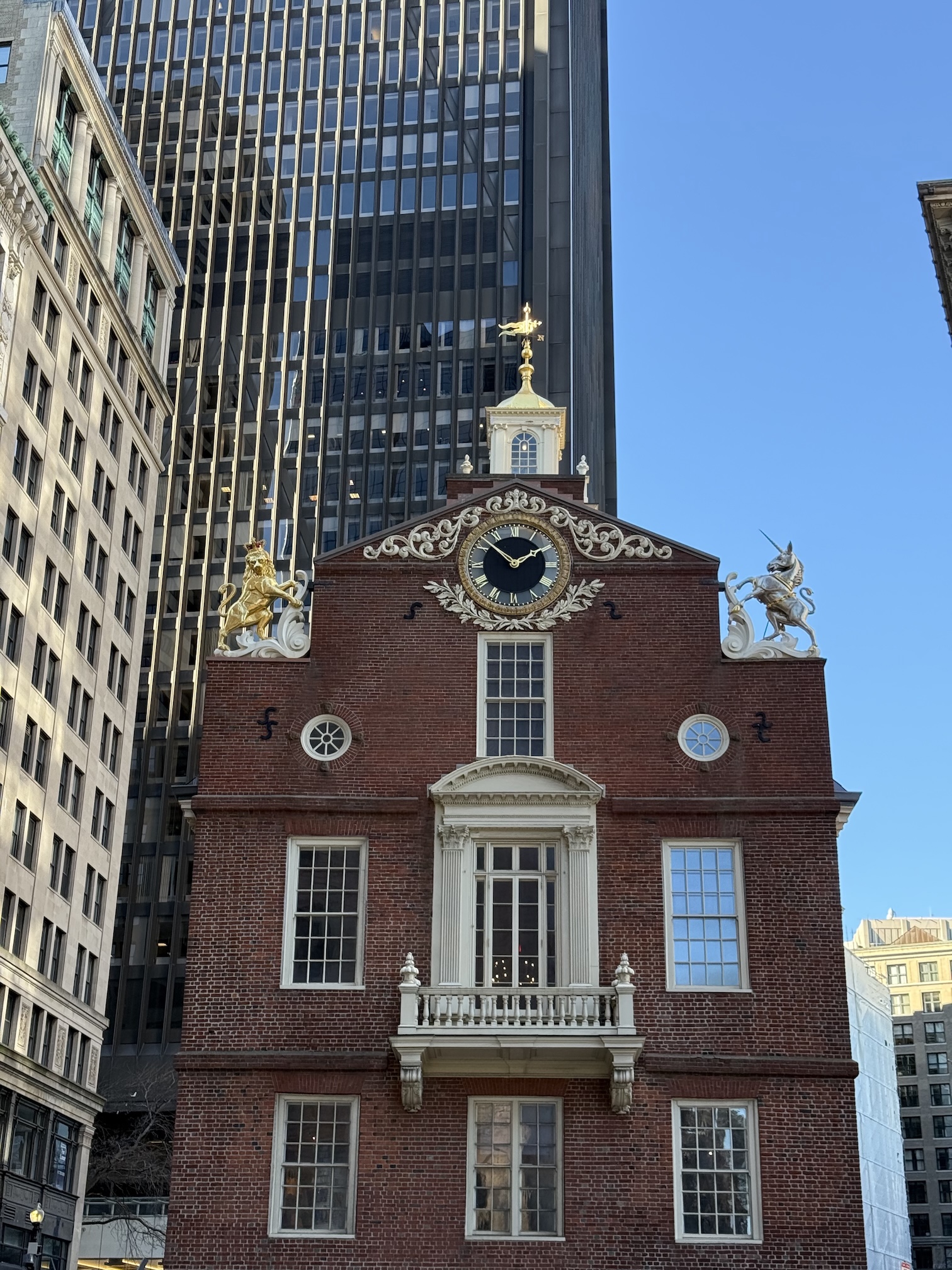
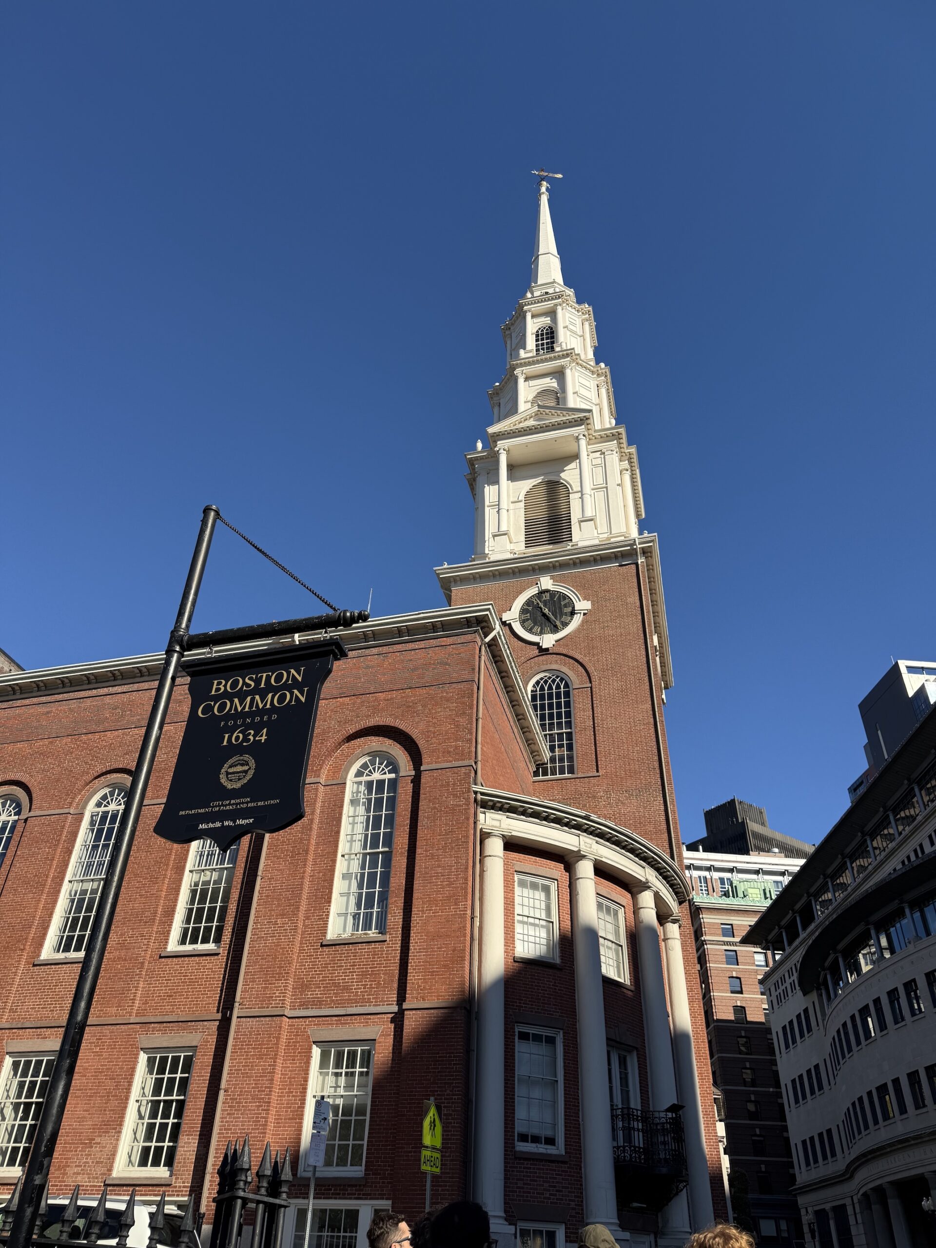
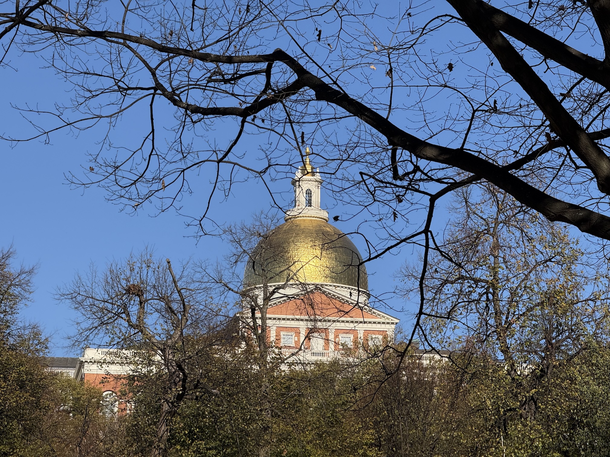
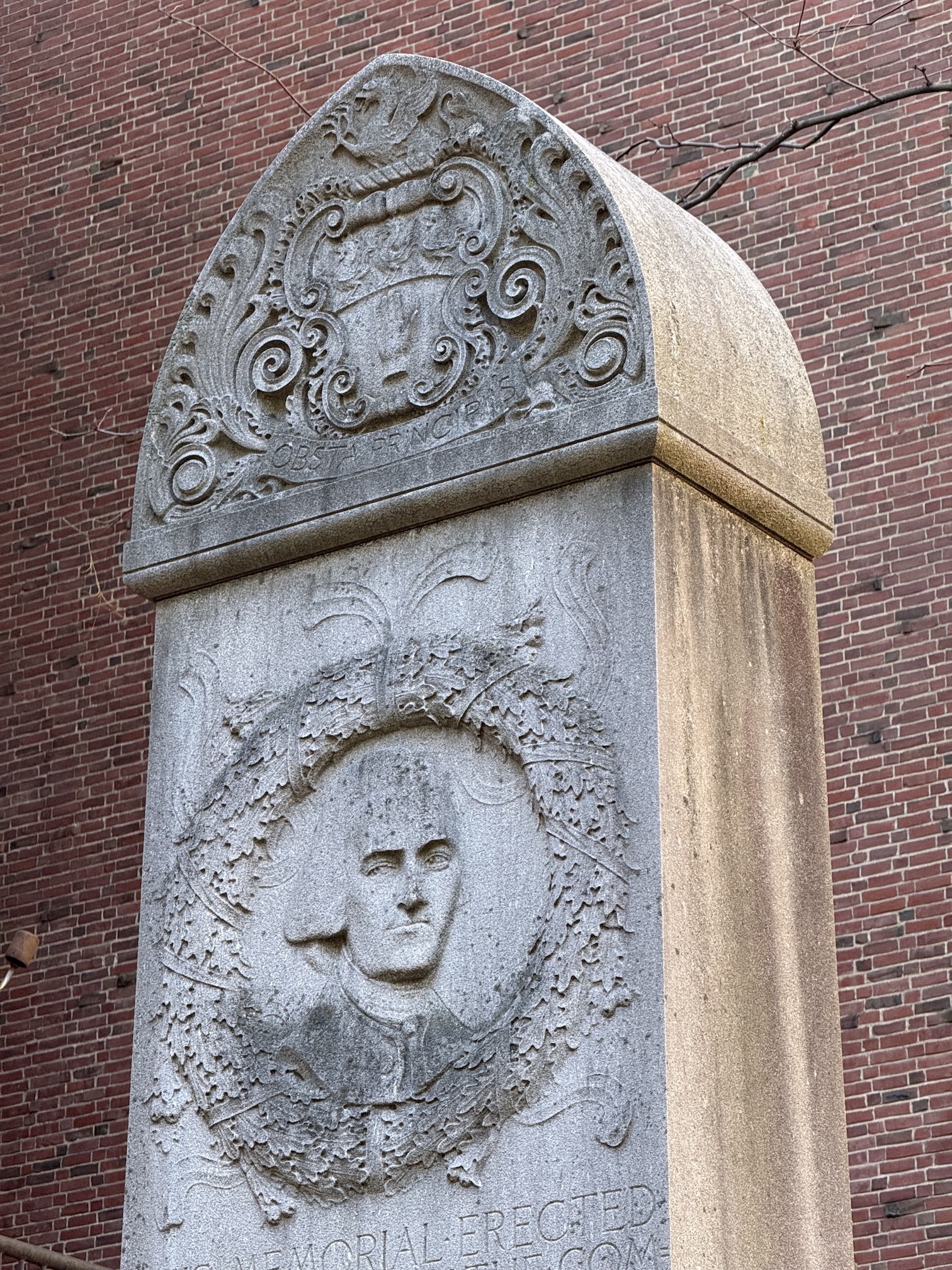
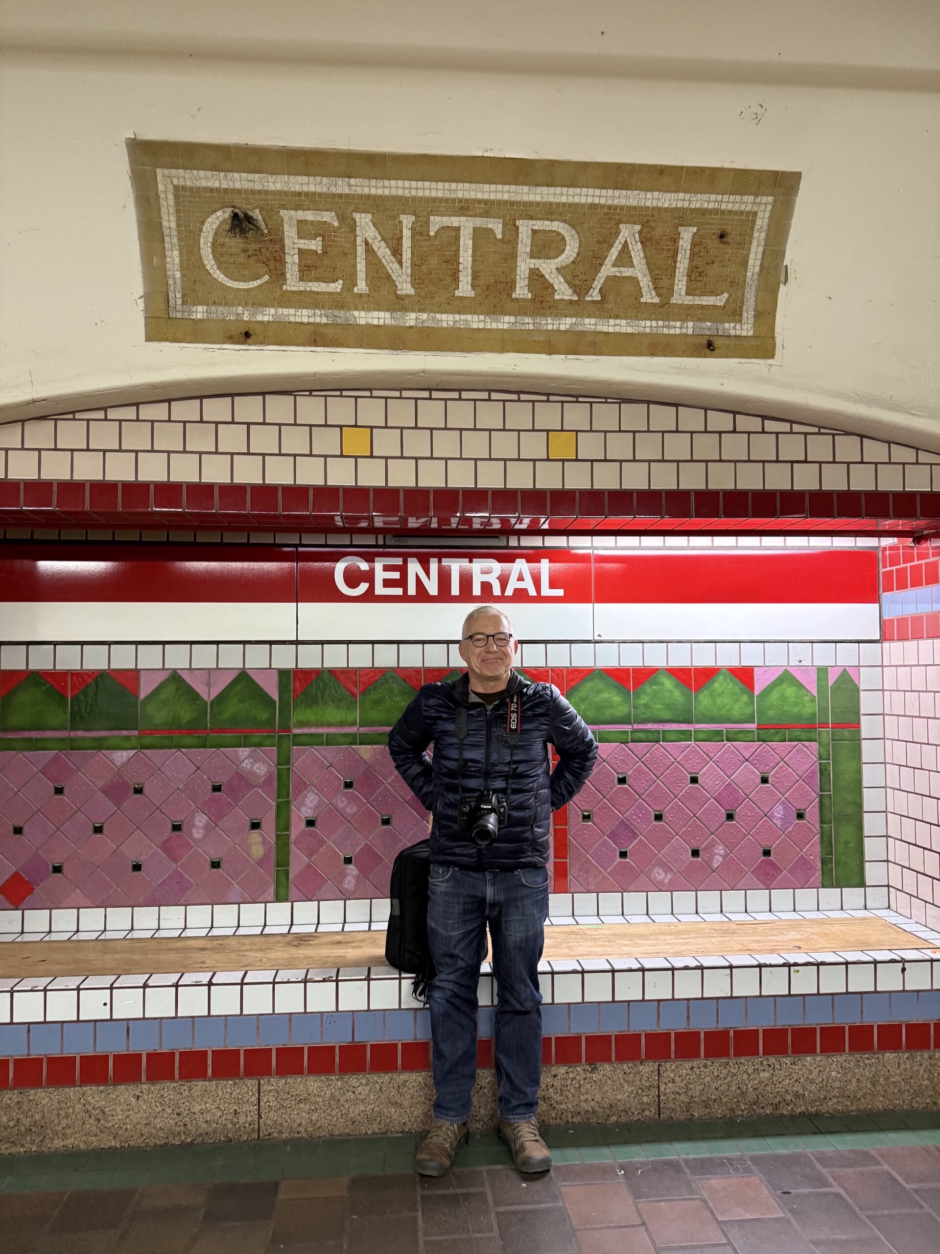
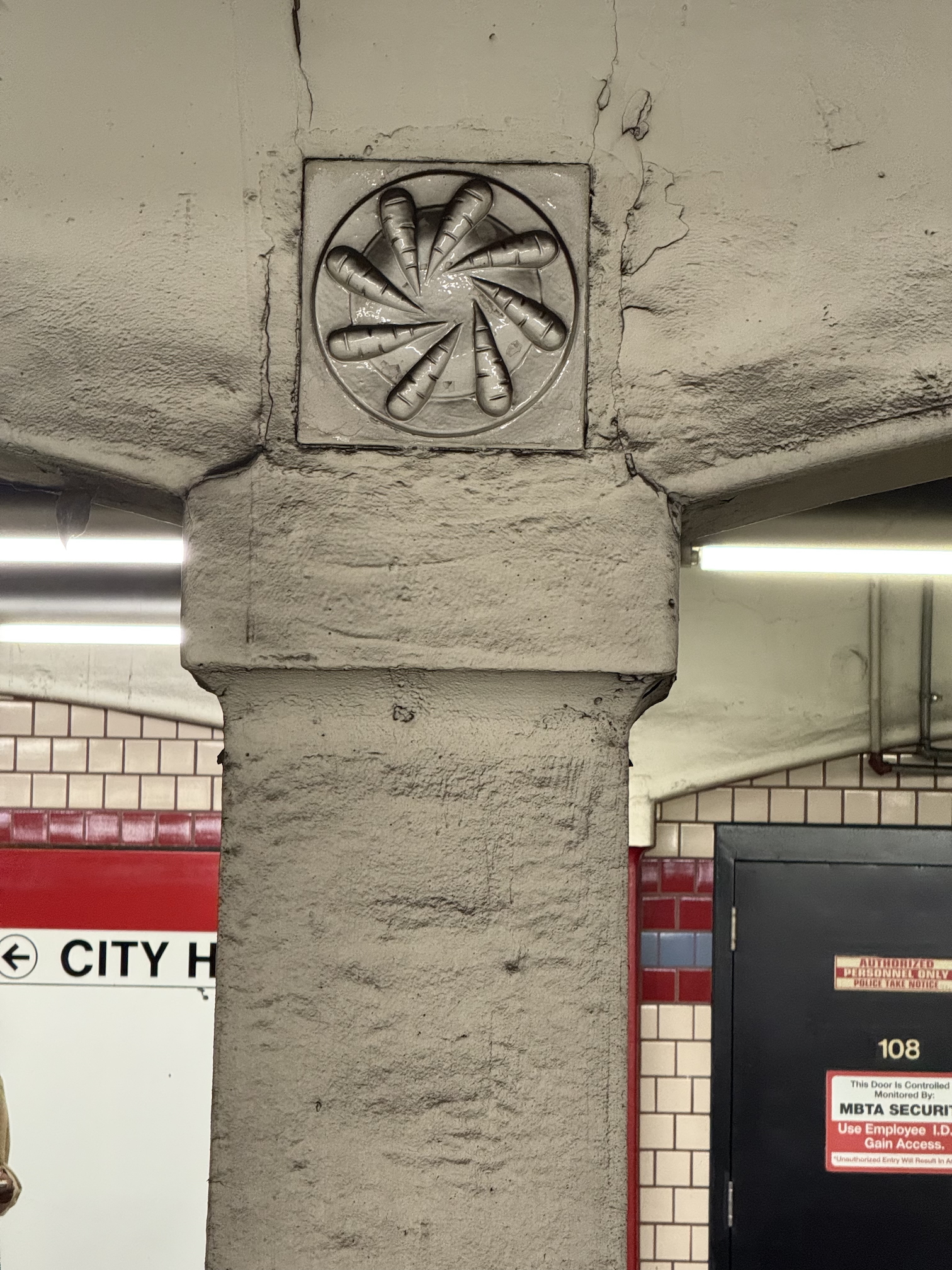
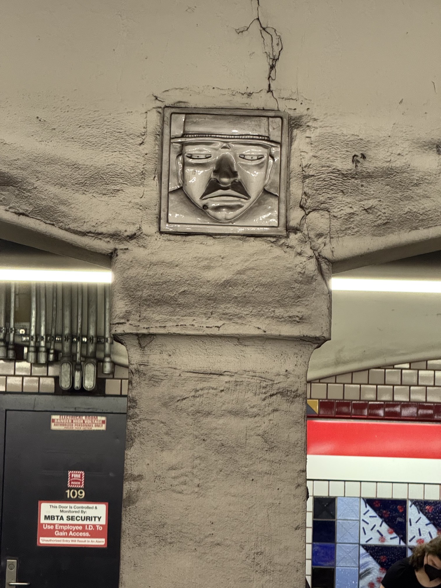
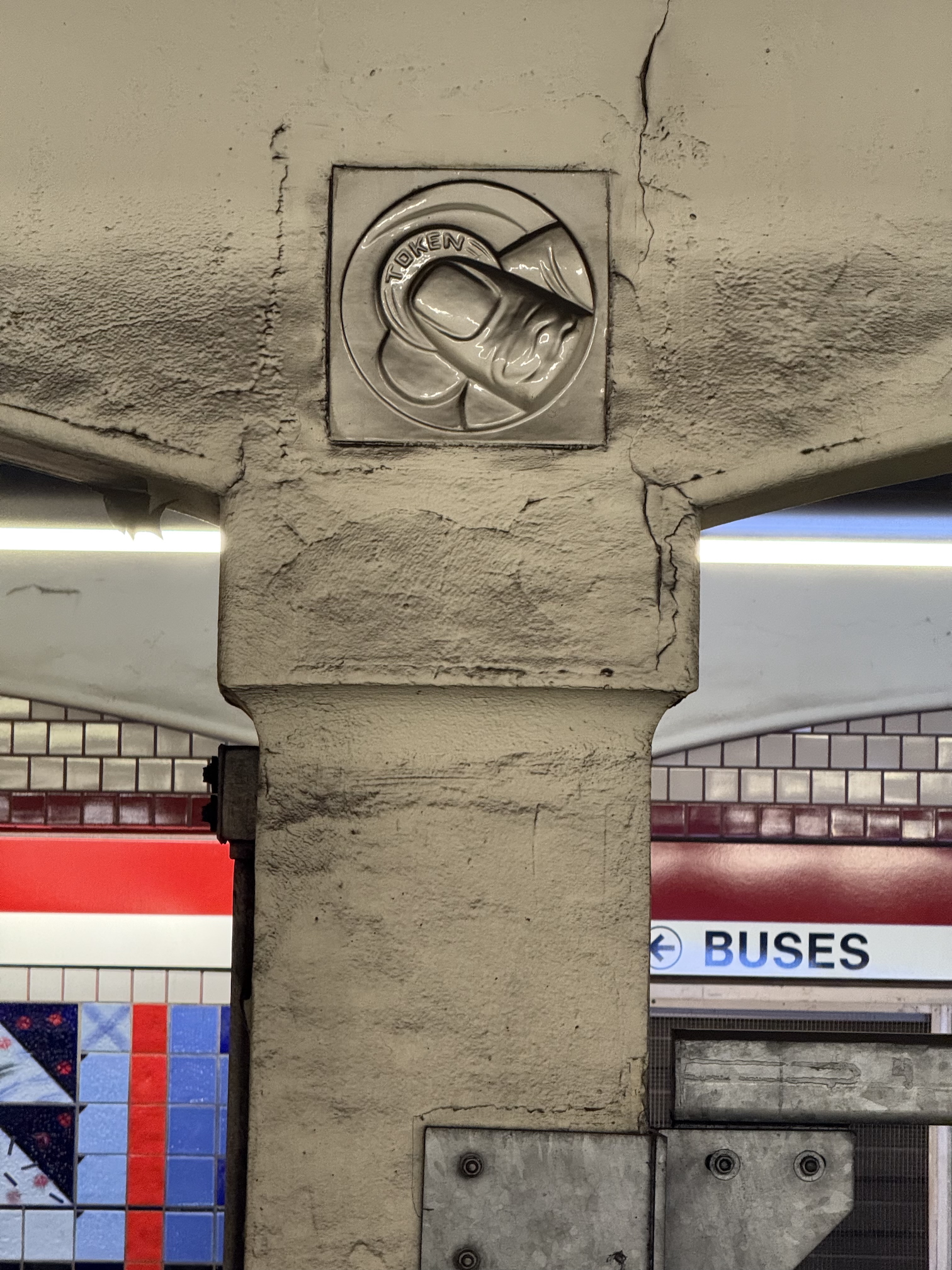
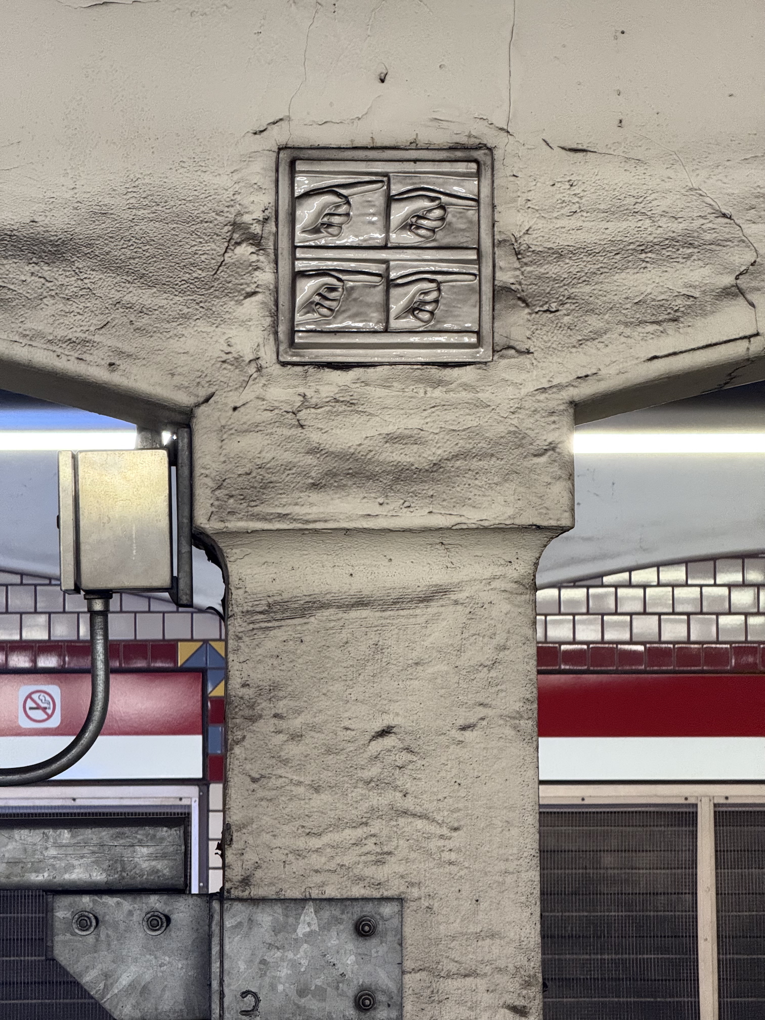
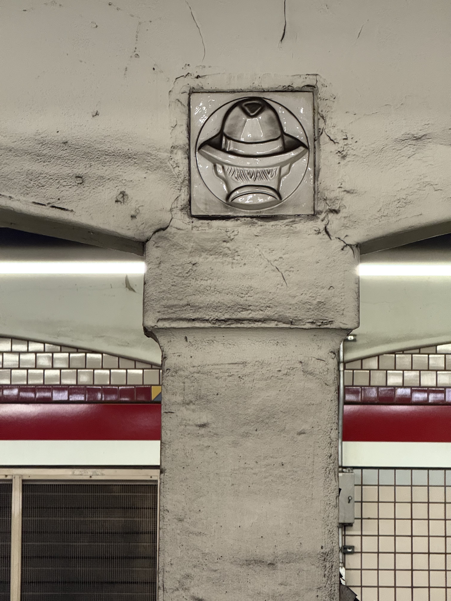
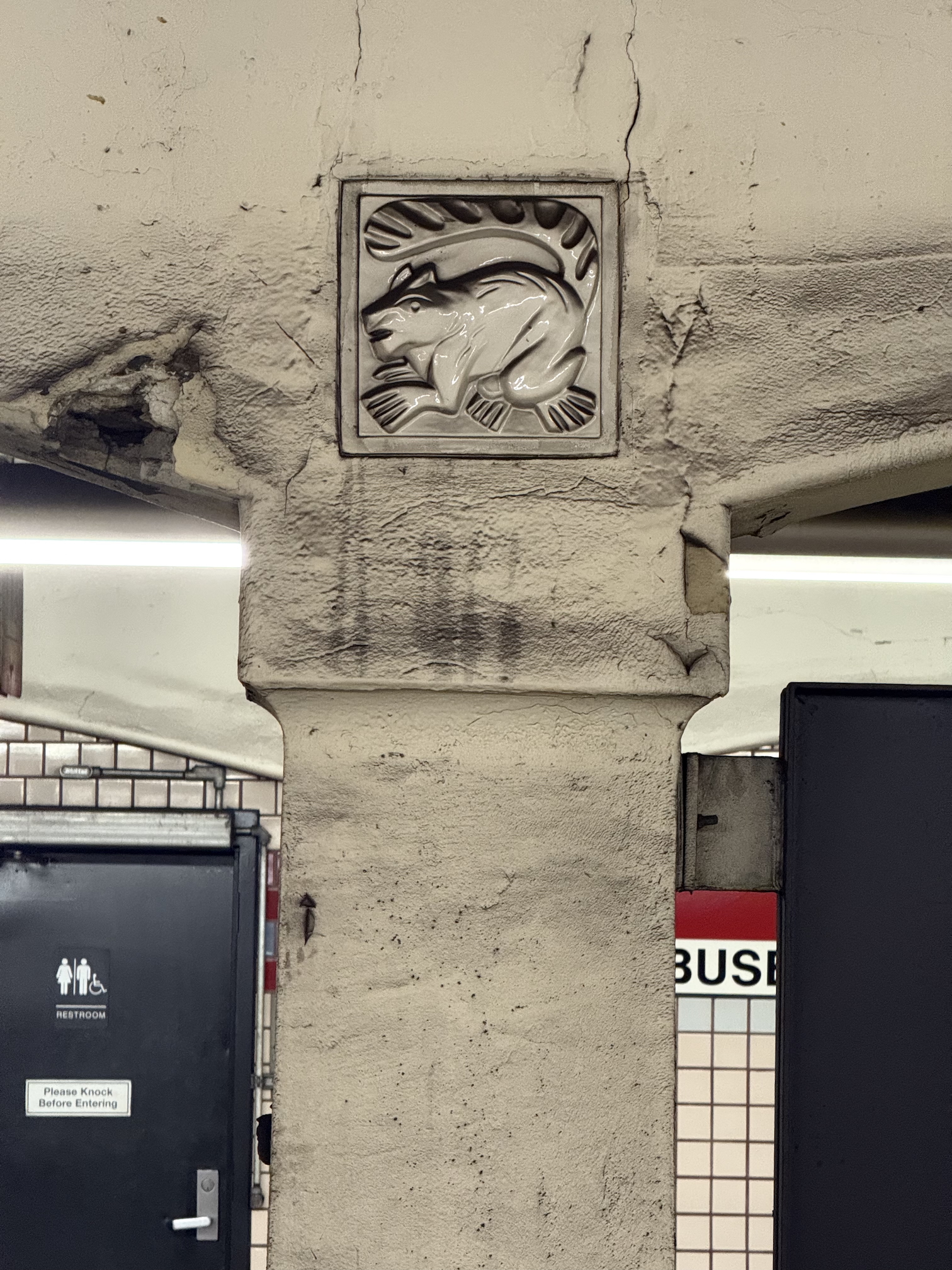
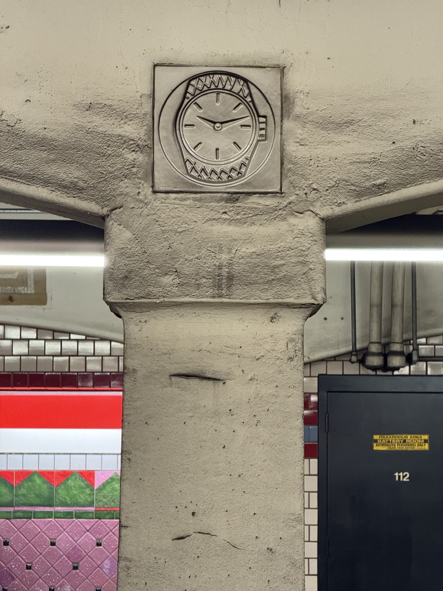
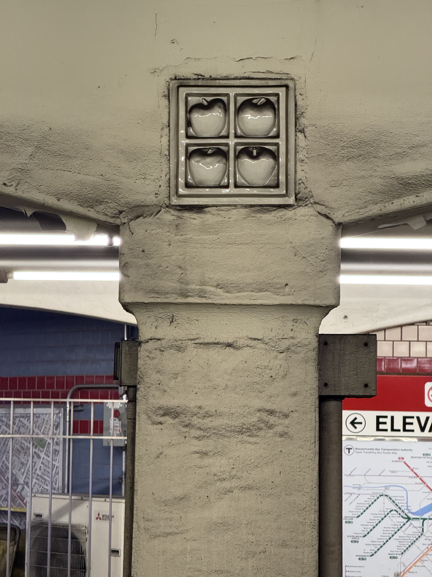
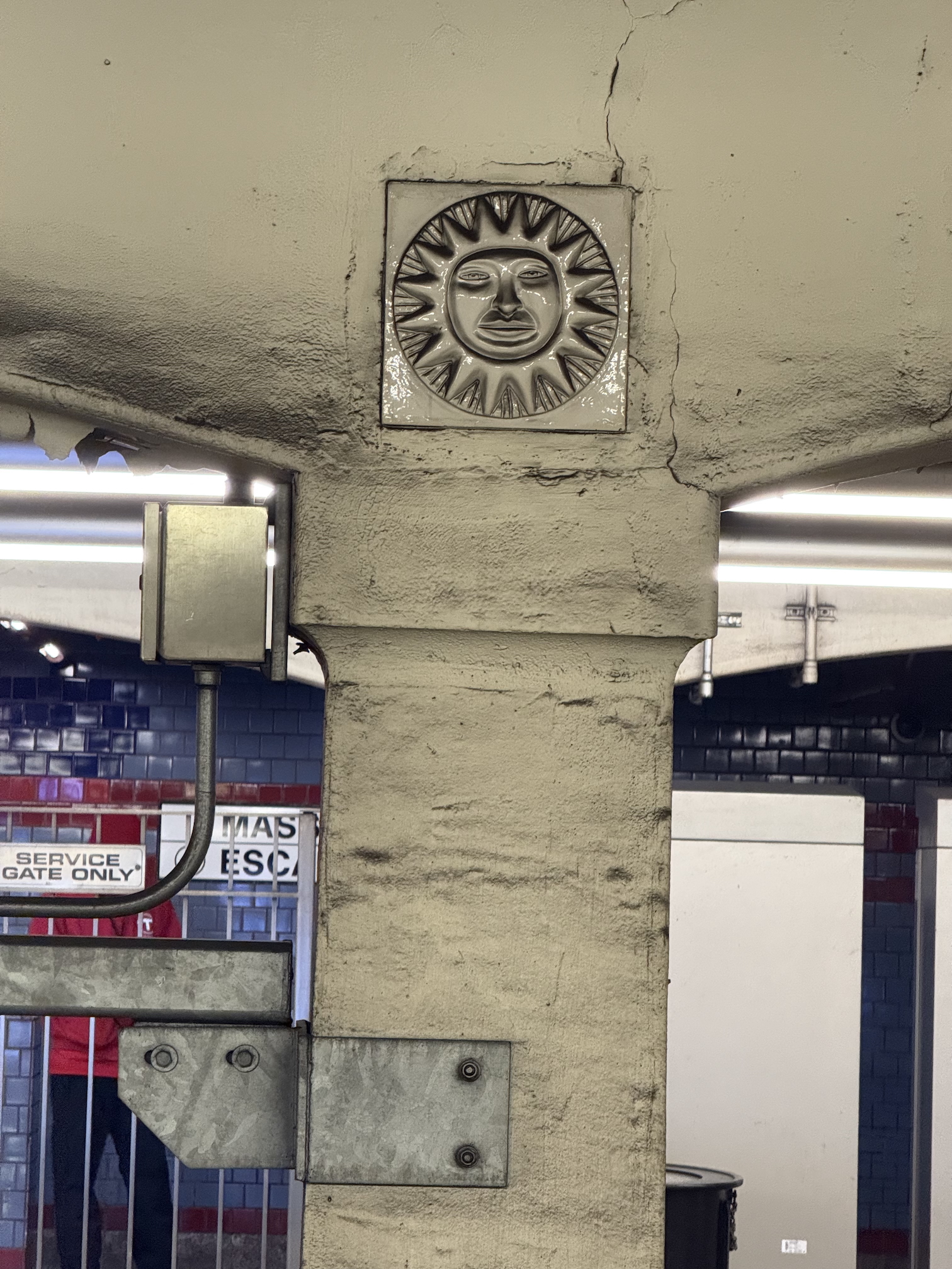
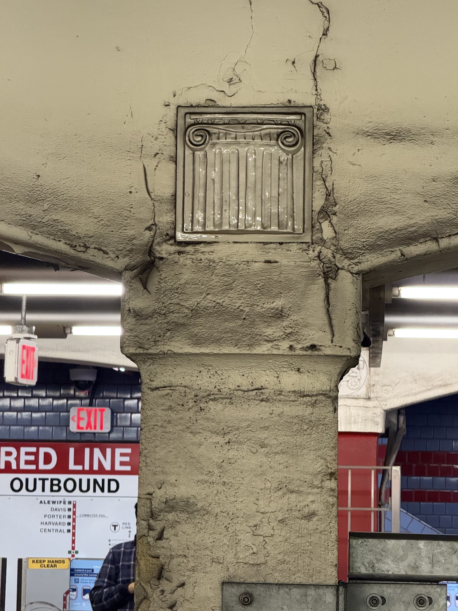
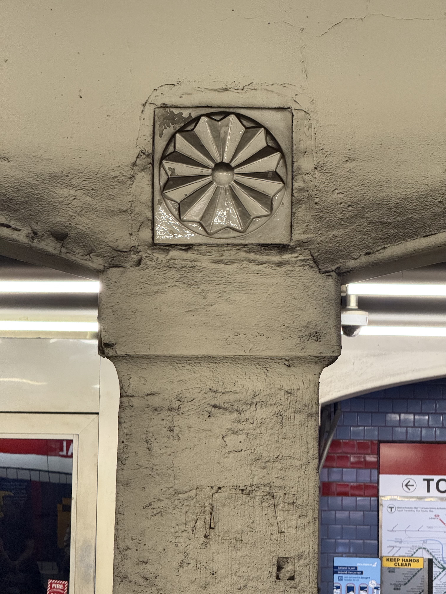
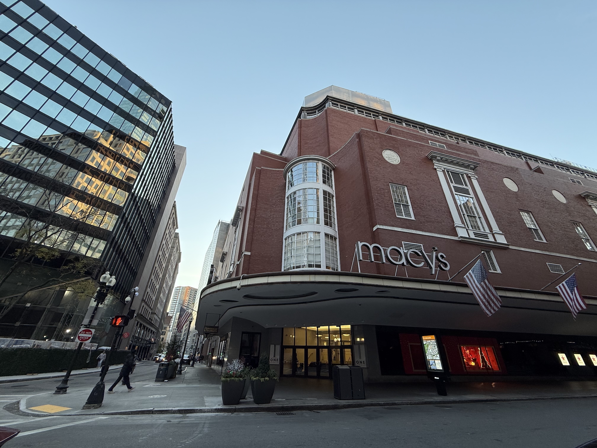
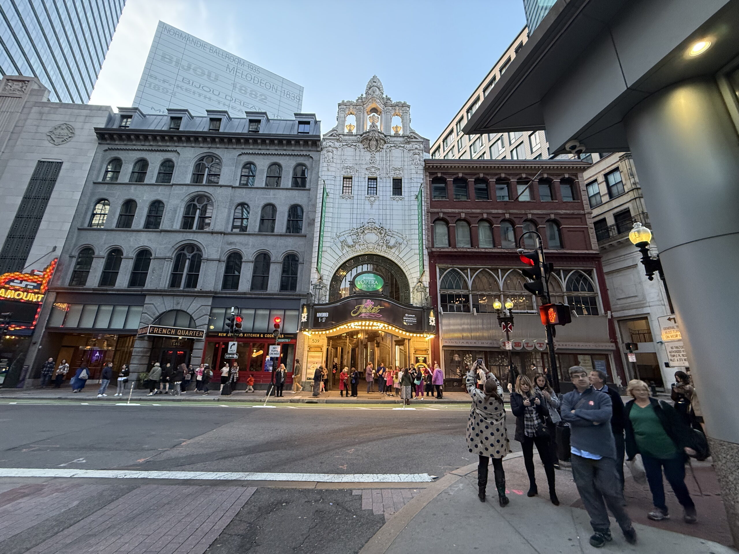
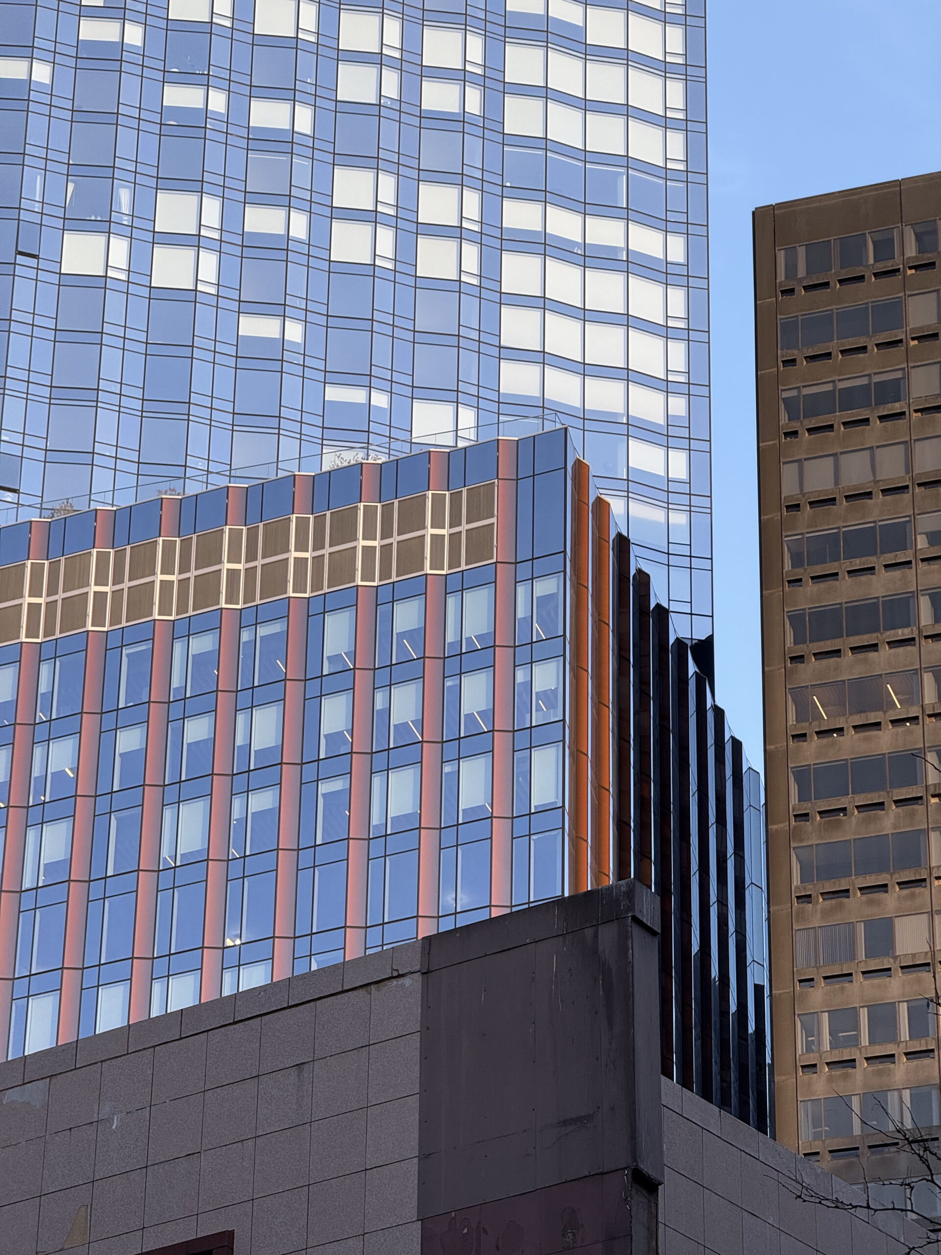
Here is a beautiful flatiron building at the junction of Pleasant Street and River Street in Cambridge with lots of copper on the outside (the green). It was built in 1899, and its most recent renovation was done in 2020 with the repair and replacement of some of the doors and windows, and updates to the wiring and plumbing inside.This firehouse is just a few blocks down on River Street in Cambridge. Engine Company No. 6 was established in 1852 as Pioneer Engine Company No. 6 and was located in a building on Pioneer Street in Ward 2, Kendall Square. They moved into this building at 176 River Street in 1891 and has been there ever since.I love old-fashioned hardware such as this walk signal push-button.The First Baptist Church on River Street is undergoing a few renovations. The church is a tall single-story brick structure, with sandstone trim and decorative detailing in terra cotta, and has Gothic Revival styling. It was constructed in 1881.The Old State House, also known as the Old Provincial State House, was built in 1713. It was the seat of the Massachusetts General Court until 1798. It is the oldest surviving public building in the city.The Park Street Congregational Church is on the corner of the Boston Common. The Boston Common is the oldest public park in the US.The Massachusetts State House (built 1795-1798), also known as the New State House (to distinguish it from the Old Statehouse), as seen from the Boston Common. The building is the state capitol and seat of government for the Commonwealth of Massachusetts. That is gold foil on the dome, put on in 1997 at a cost of $300,000 (and previously done in 1969 for $36,000). Another $20.3 million renovation project has gotten underway just this year.This is the tombstone of John Hancock in the Granary Burying Ground near the Boston Common. Hancock was the first and third Governor of Massachusetts; in office between May 1787 and October 1793.Central Station on the Red Line has benches decorated with colorful tiles.I took pictures of all the little decorative tile inlays on the pillars across the tracks. I posted them all. ..........Macy’s department store in downtown Boston takes up the entire city block, the same way as the one in New York City does.Unable to pay its bills after decades at the heart of Boston’s cultural life, the Boston Opera House closed its doors in 1991 and began physically deteriorating at an alarming rate. Now, however, after a lavish restoration in the early 2000s, the Opera House has a new vitality. The Boston Opera House was completed in 1928 as a tribute to Benjamin Franklin Keith, a leading figure in vaudeville, so popular in the United States in the years before.And here we are today— a collage of modern glass and steel facades, caught in the zoom lens of my phone’s camera.
Here are a few pictures from in and around Harvard Square and Harvard’s campus.
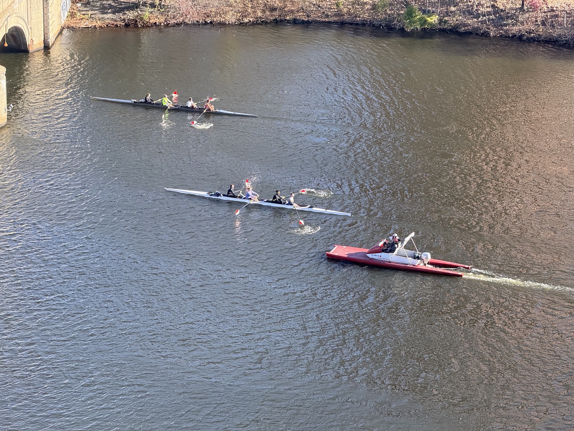
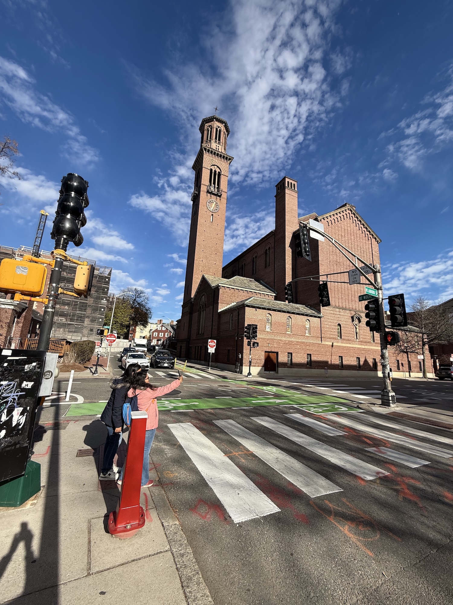
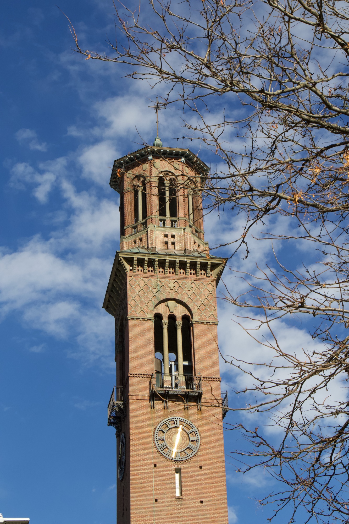
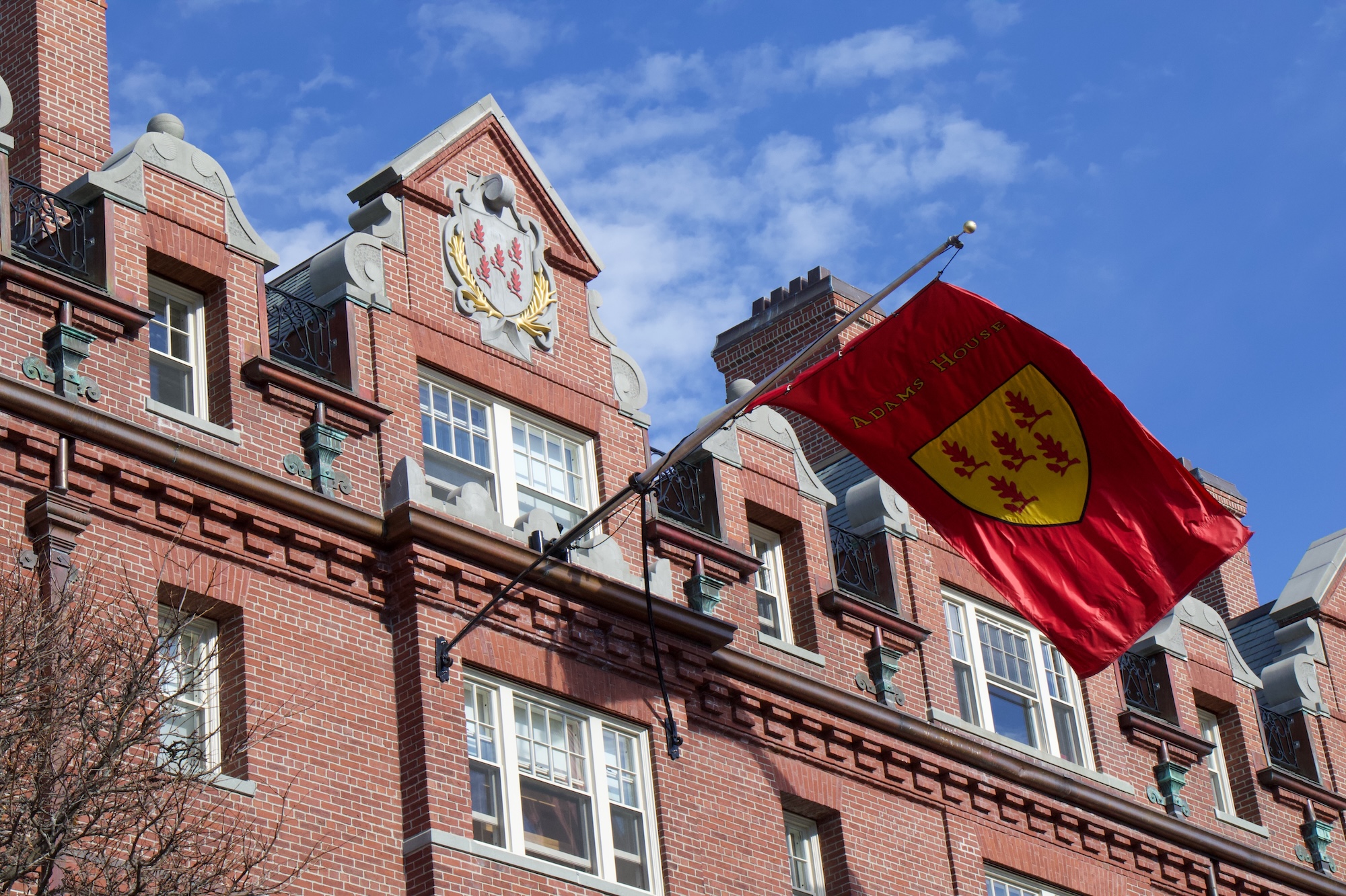
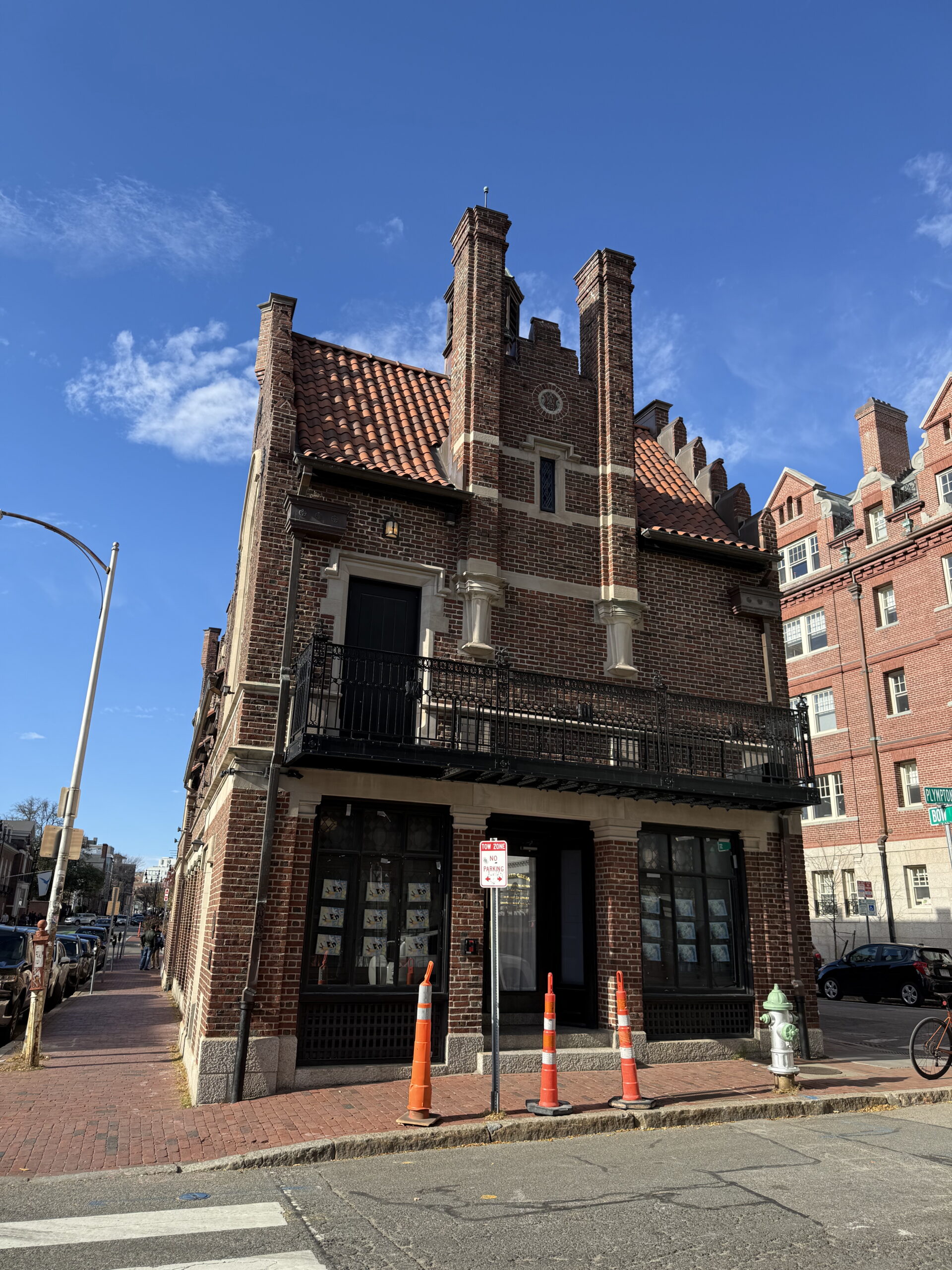
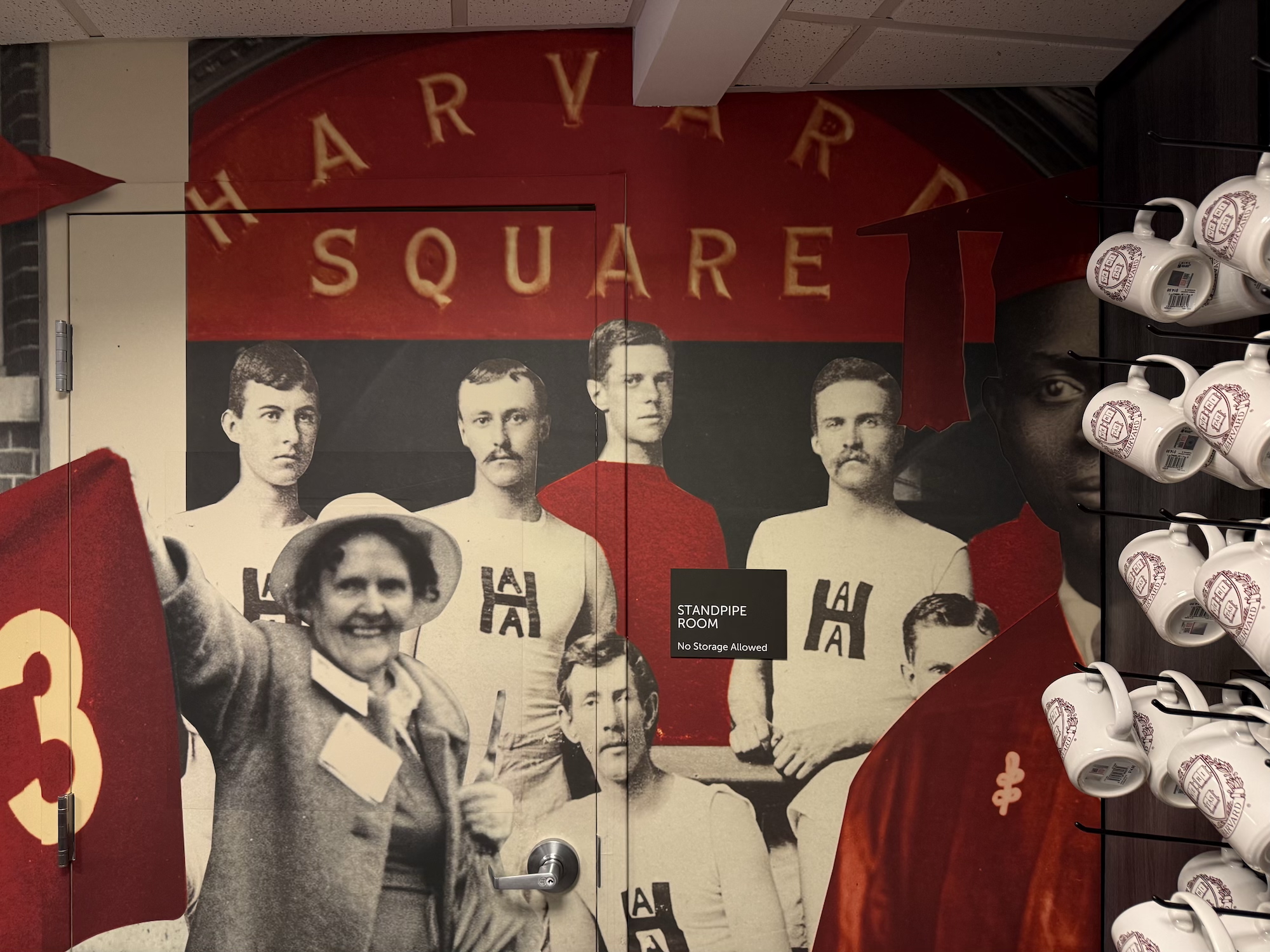
Rowers on the Charles River running through Cambridge.Saint Paul’s Parish church, with its distinctive bell tower, is a Catholic church on Mt Auburn St in Cambridge.A closer look at the bell tower of Saint Paul’s Parish.Adams House, one of twelve undergraduate residential Houses at Harvard University.The Harvard Lampoon Building (sometimes referred to as the Lampoon Castle), designed by Edmund M. Wheelwright and built in 1909 in the Mock Flemish style.Inside the Harvard Coop store, a bookshop founded in 1882, offering textbooks plus branded Harvard and MIT clothing.
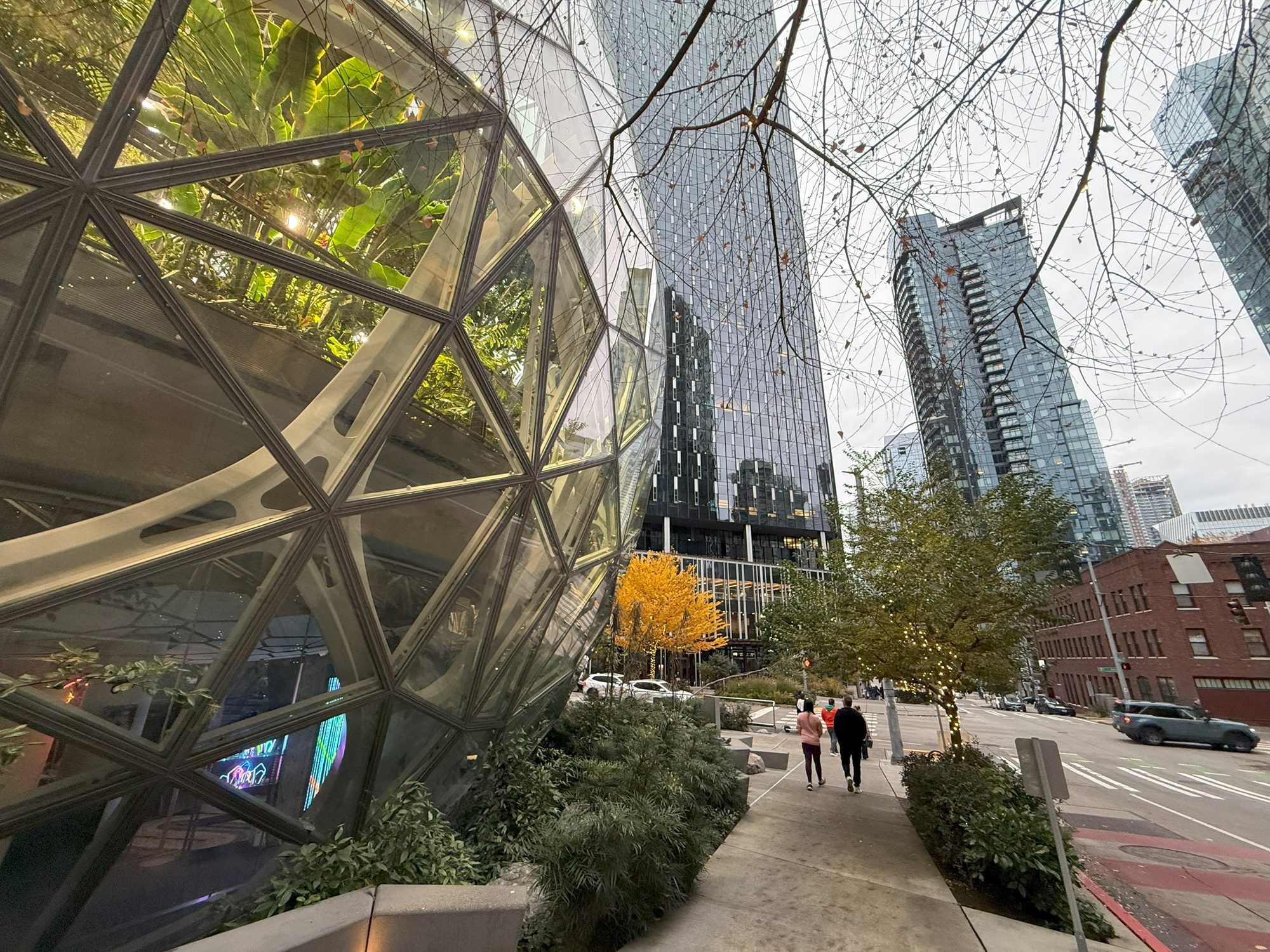
I took the No 8 bus to Westlake Avenue and walked from there to the Amazon Spheres, and back up to Capitol Hill.
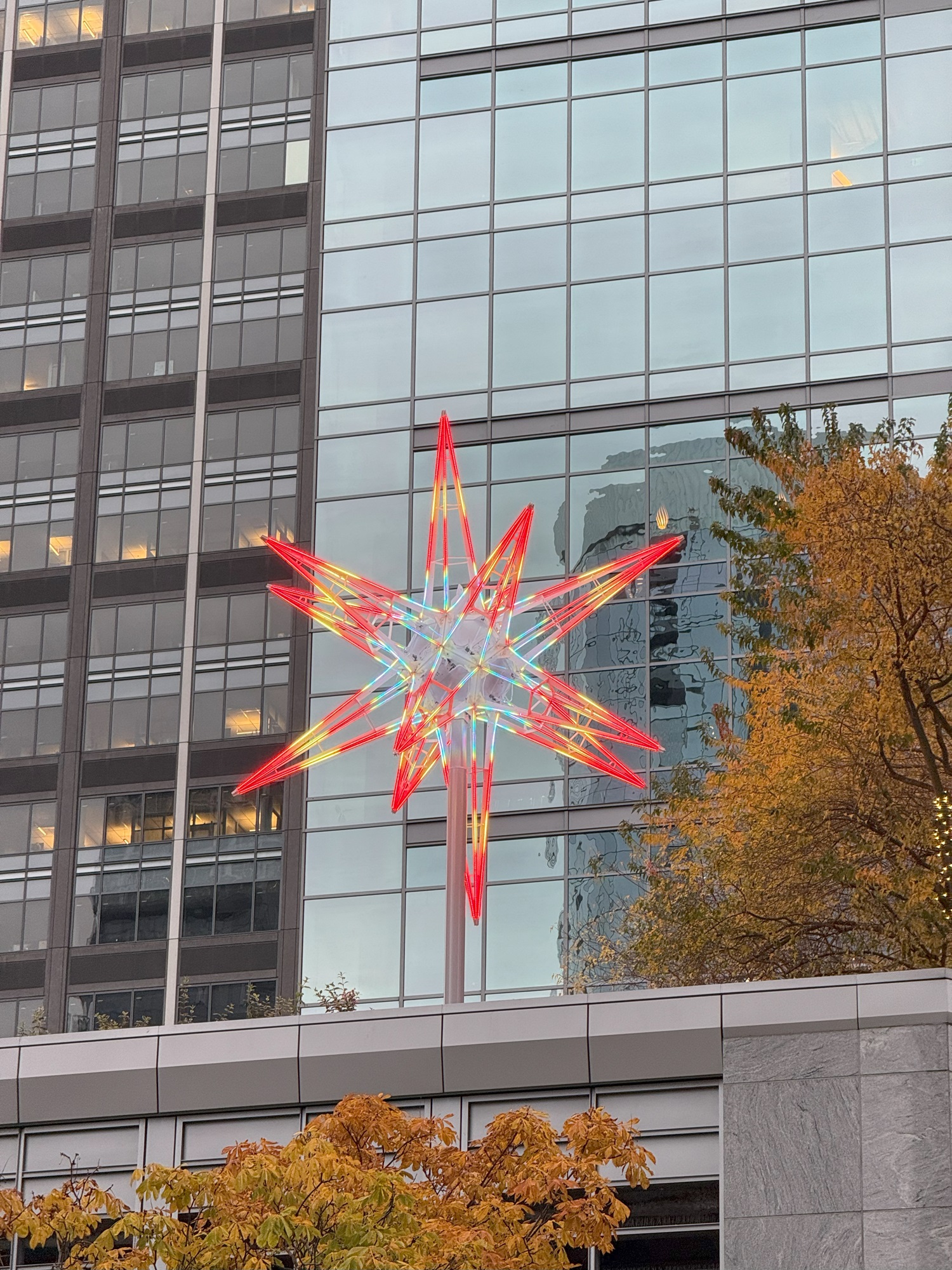
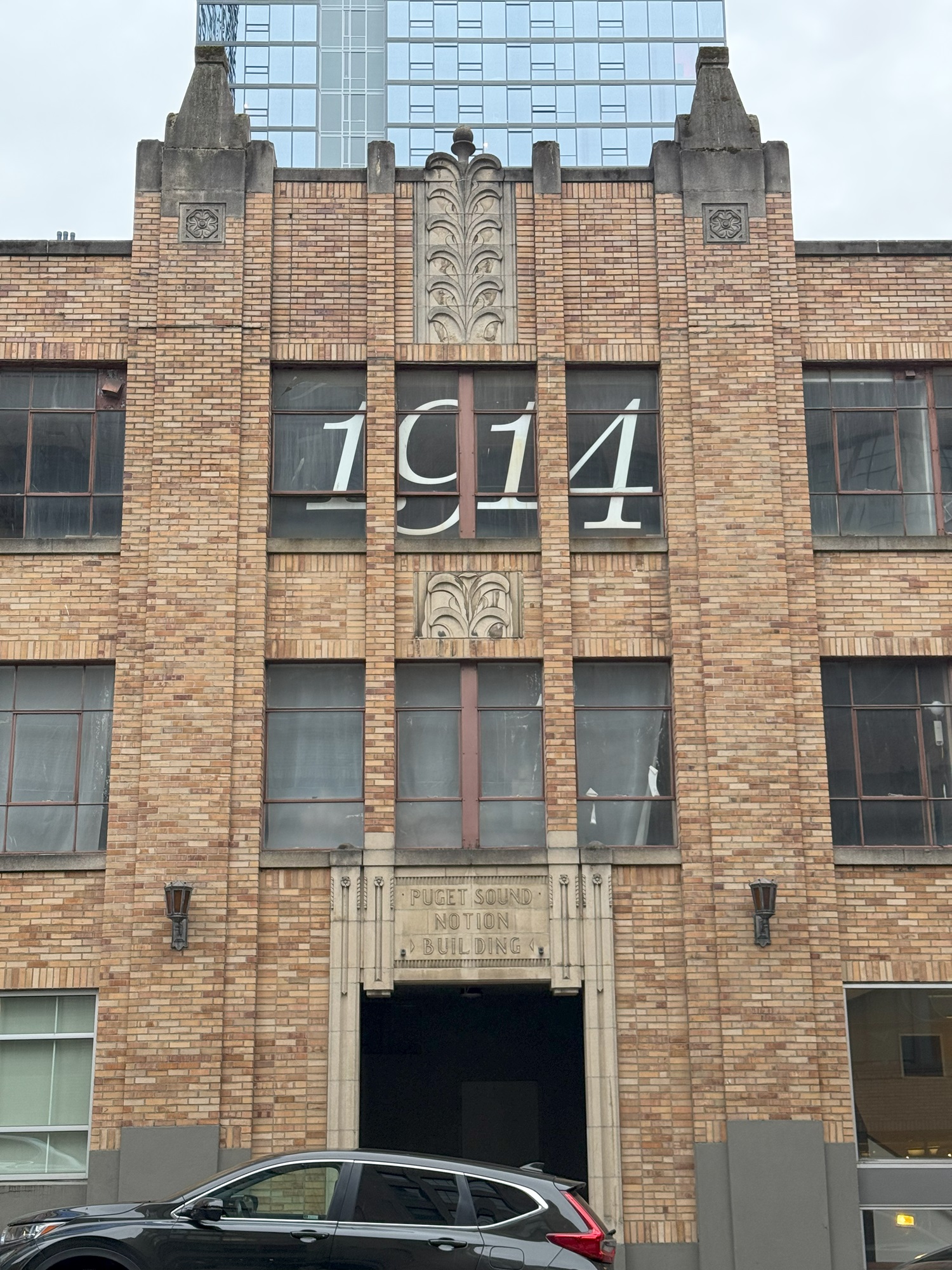
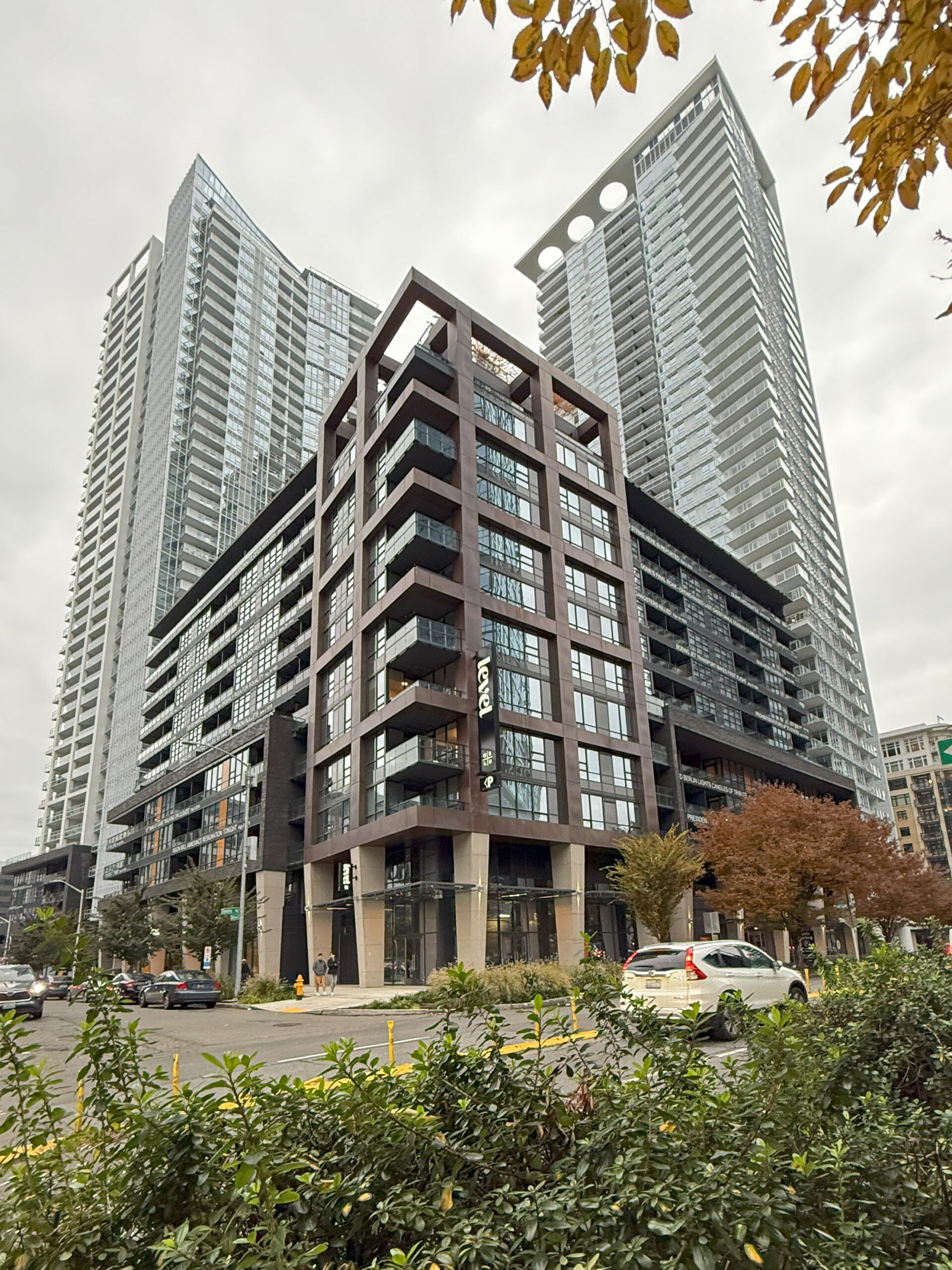
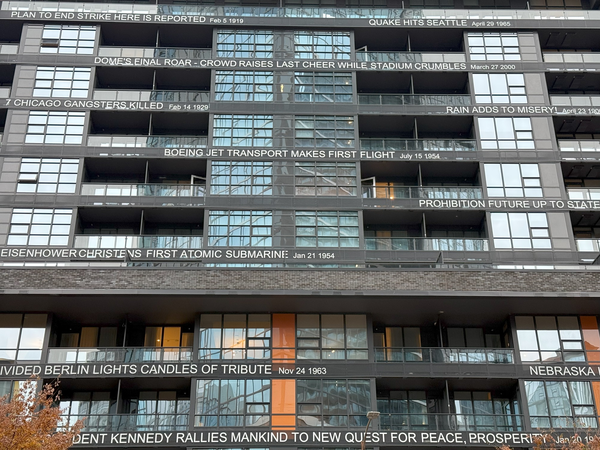
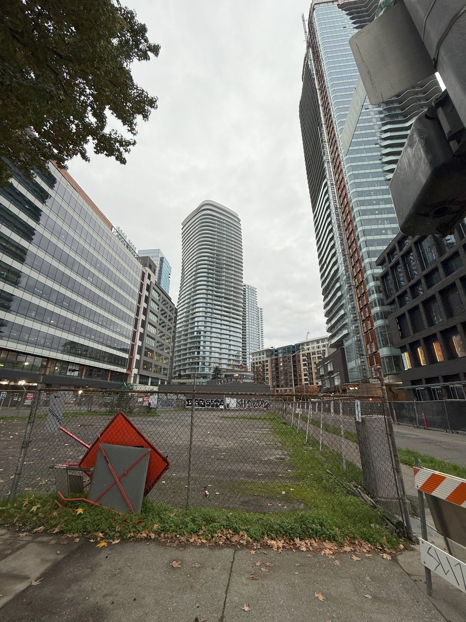
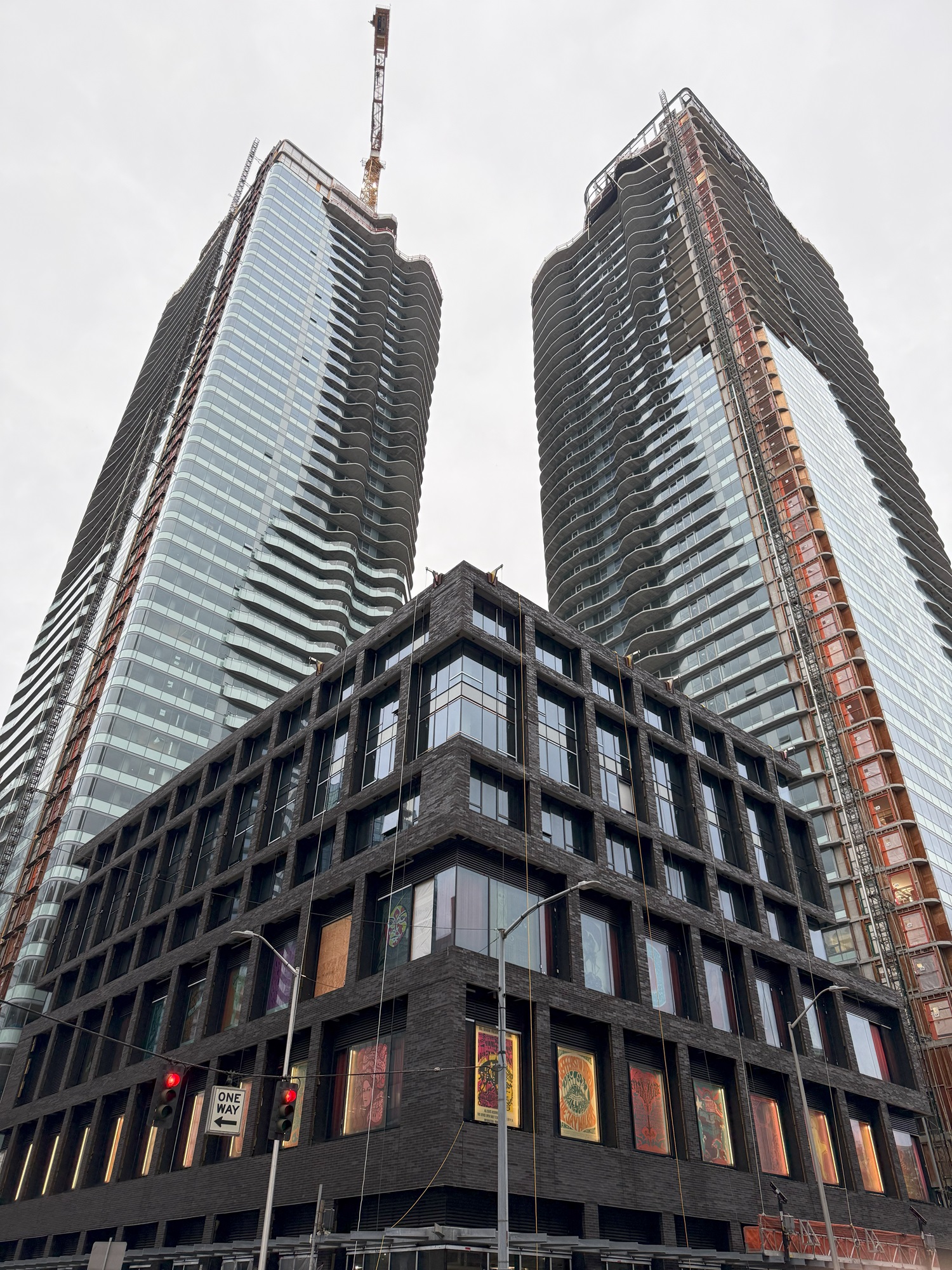
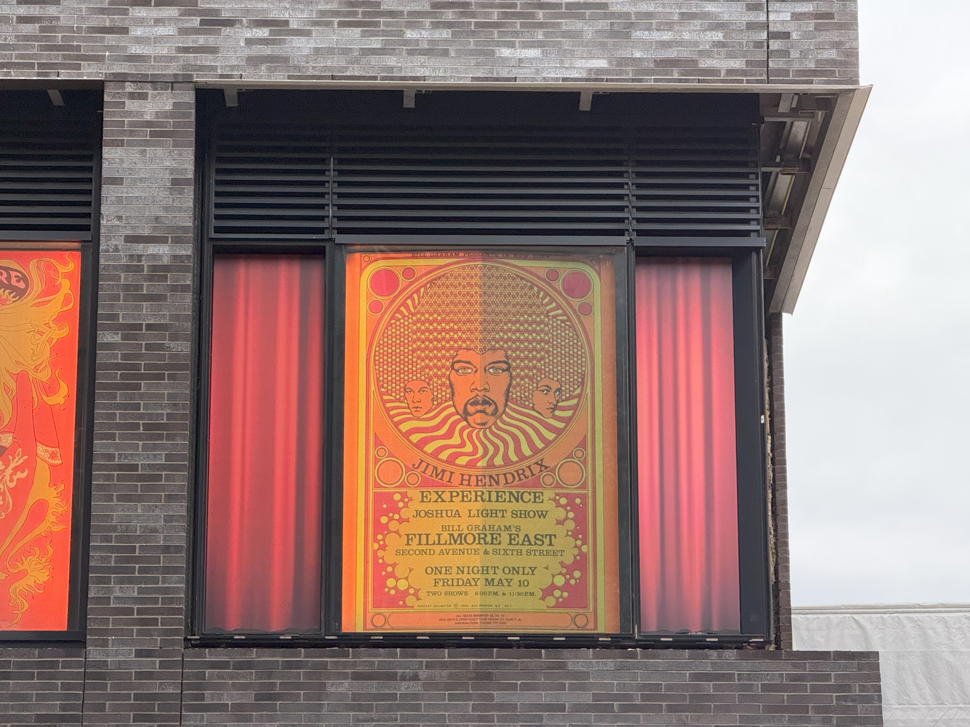
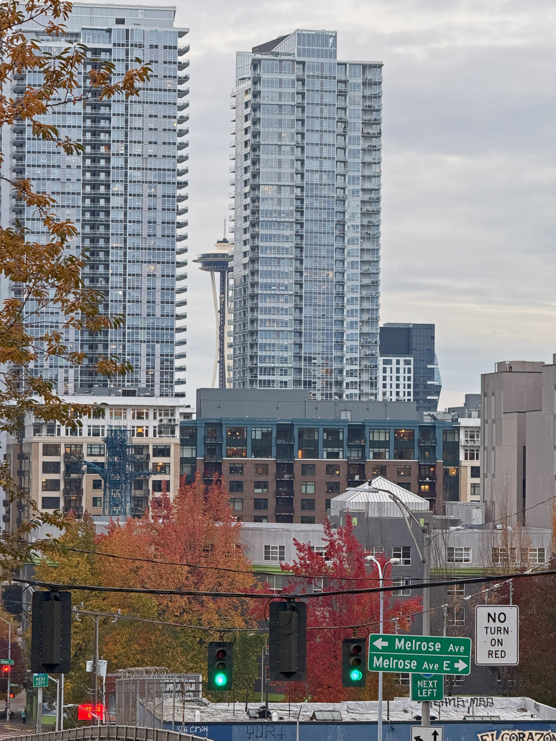
It’s cold and gray outside, but summery and light inside the Spheres. I am on Lenora Street, looking towards the northeast.This art installation off Westlake Avenue is called Kilroy Star and was put up by commercial real estate agency Kilroy Realty in June. (The colors in the star cycle continuously through reds, greens and blues). If my research on the mathematics of polyhedrons is accurate, this is a Kepler-Poinsot polyhedron. This one is called a small stellated dodecahedron. It consists of twelve pyramids with pentagonal bases that are mounted on the faces of a regular dodecahedron.The Seattle architect Louis Svarz (1886-1976) designed this building on Lenora Street for the Puget Sound Notion Company, a wholesaler of notions (sewing accessories). Its construction was completed in 1930. Today the building belongs to Cornish College of the Arts. (The 1914 date in the window is the founding year of the Cornish College).The Omni South Lake Union (also known as 1120 Denny Way) with its two 41-story towers boasts 827 apartments and 272 hotel rooms. It opened in May 2022. sThe balconies on the Denny Way side offers a list of historical events and their dates.I’ve made my way up Denny Way to the junction with Stewart Street. In the distance is REN Seattle, a high-rise apartment tower at 1400 Fairview Avenue. To my right is the 1200 Stewart Street apartment towers that are still under construction after six whole years (construction started in 2018).Here is the 1200 Stewart Street apartment complex. The construction of the towers is complete but it seems that there is still a lot of finishing work on the inside and outside that remains. If I can believe what I read on Redditt, there are plans afoot to suspend a repurposed Boeing 747 fuselage above the residential project’s galleria as a centerpiece and a symbol of industrial innovation— on view as a sensational artifact for both pedestrians at street level and for residents in their dwellings overhead. Hmm.Here’s a closer look at one of the posters in the window. On May 10, 1968 The Jimi Hendrix Experience performed two shows at the Fillmore East in New York City, with support from Sly & the Family Stone and the Joshua Light Show. (Jimi Hendrix is James Marshall “Jimi” Hendrix, an American guitarist, songwriter and singer. He is widely regarded as the greatest guitarist in the history of popular music and one of the most influential musicians of the 20th century. He was born in Seattle on Nov. 27, 1942 and died tragically young at the age of 27 in September 1970 – from Wikipedia).I’ve now made my way across I-5 on the Denny Way overpass, and I always turn around on Melrose Avenue, to take a picture of the Space Needle wedged between the towers of 1120 Denny Way.
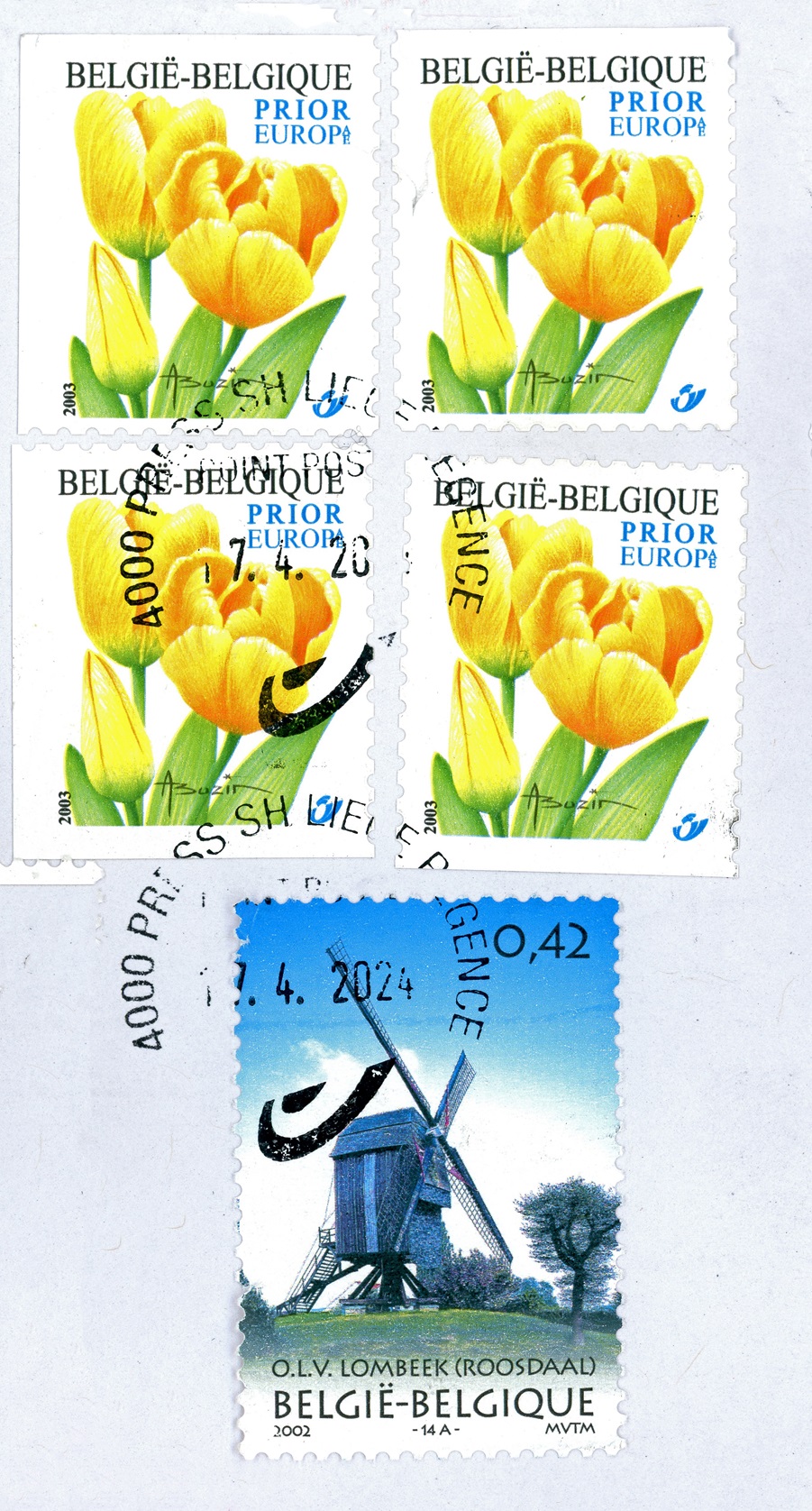
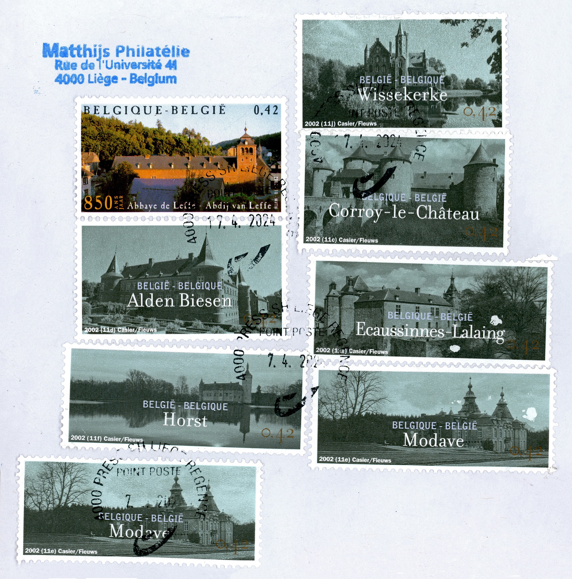
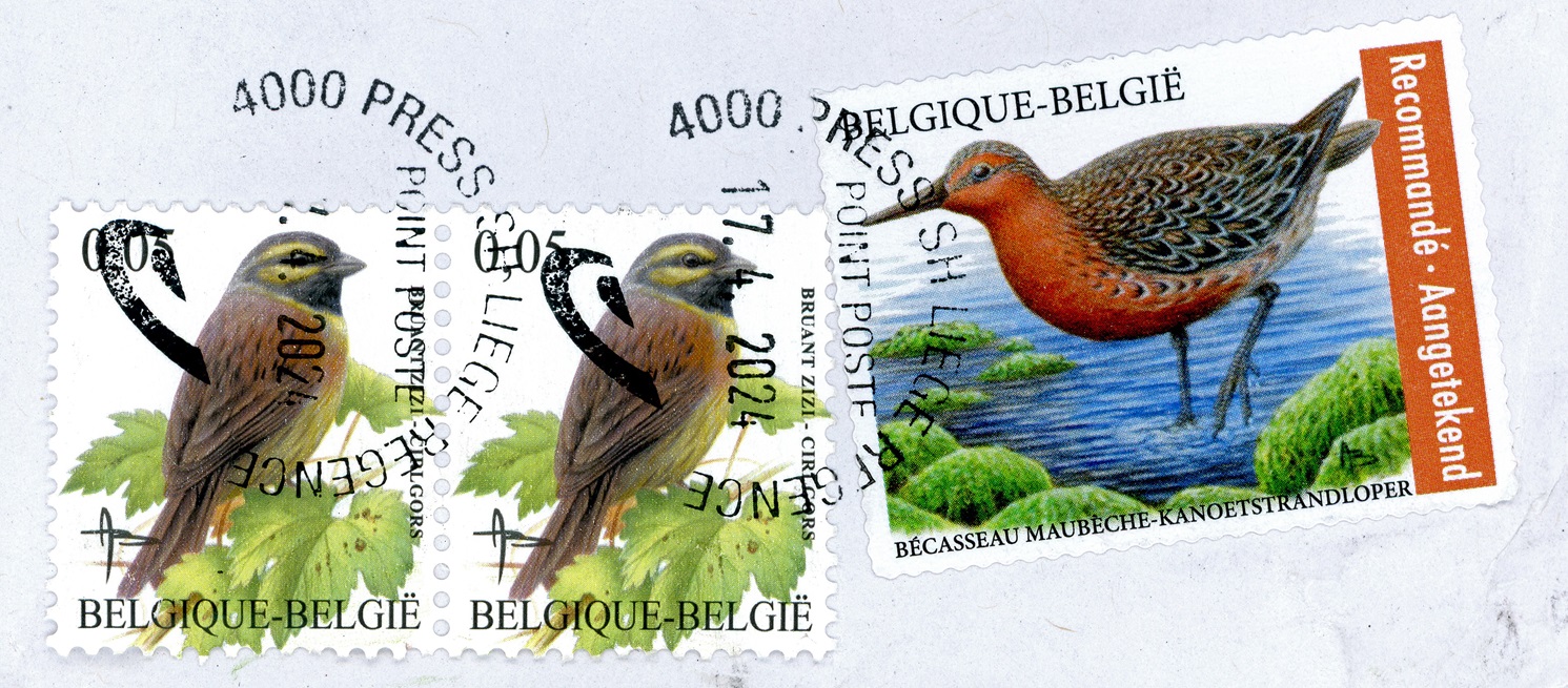
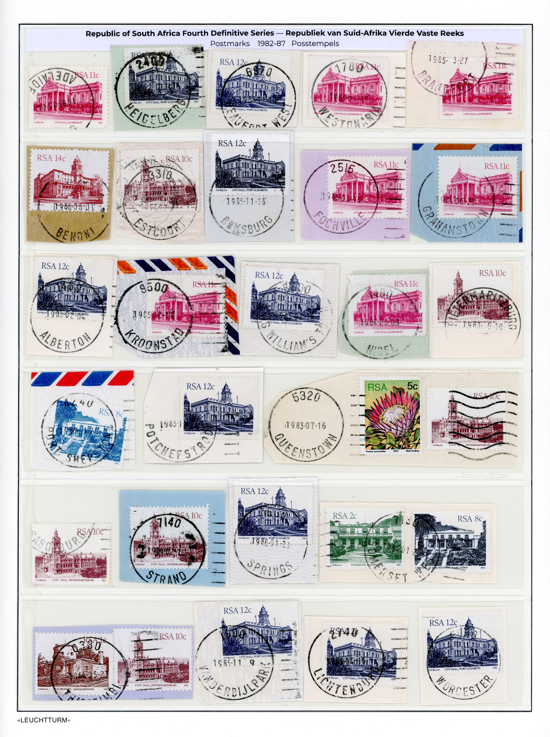
I still have shoeboxes full of South African stamps on paper cutouts, and I dunk them batch by batch into water to separate the stamp from the paper.
Those that have nice postmarks on (place name and date), I keep on the paper, though.
Below is such a page.
Some of these postmarks belong completely to history.
The cities and towns that they denote have been renamed in recent years.
Fourth Definitive Issue (1982-87)— South African Buildings Issued Jul. 15, 1982 Perf. 14½x14, 14×14½ | Litho. and Recess Printing | No watermark 564 A229 1c Brown (’84) | Old Provost, Grahamstown 566 A229 2c Green | Tuynhuys, Cape Town 574 A229 8c Intense Blue (’83) | Leeuwenhof, Cape Town 576 A229 10c Light red-brown | City Hall, Pietermaritzburg 578 A229 11c Cerise (’84) | City Hall, Kimberley 579 A229 12c Deep Ultramarine (’85) | City Hall, Port Elizabeth 580 A229 14c Rose brown (’86) | Johannesburg City Hall (Note- Only the stamps in the picture are listed here; several others were issued as part of the fourth definitive series). [Source: 2021 Scott Standard Postage Stamp Catalogue, Vol. 6A]
Postmarks: ADELAIDE, HEIDELBERG, BEAUFORT WEST, WESTONARIA, BRANDFORT (Winnie Mandela since 2021), BENONI, ESTCOURT, BOKSBURG, FOCHVILLE, GRAHAMSTOWN (now also known as Makhanda), ALBERTON, KROONSTAD, KING WILLIAM’S TOWN (Qonce since 2021), NIGEL, PIETERMATIZBURG, PORT SHEPSTONE, POTCHEFSTROOM, QUEENSTOWN (Komani since 2016), SASOLBURG, STRAND, SPRINGS (now part of the City of Ekurhuleni), SOMERSET WEST, THBAZIMBI, VANDERBIJLPARK, LICHTENBURG, WORCESTER.
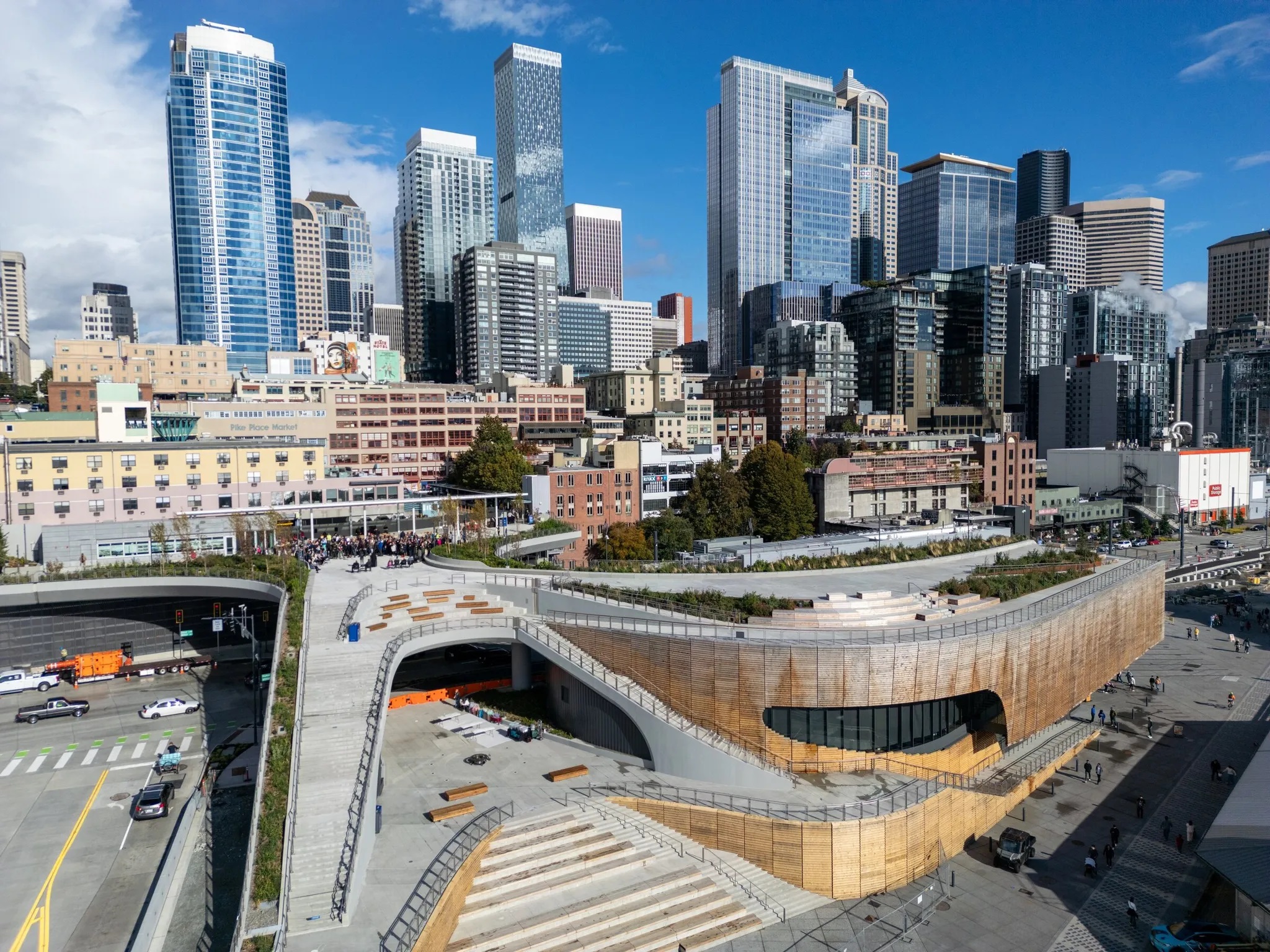
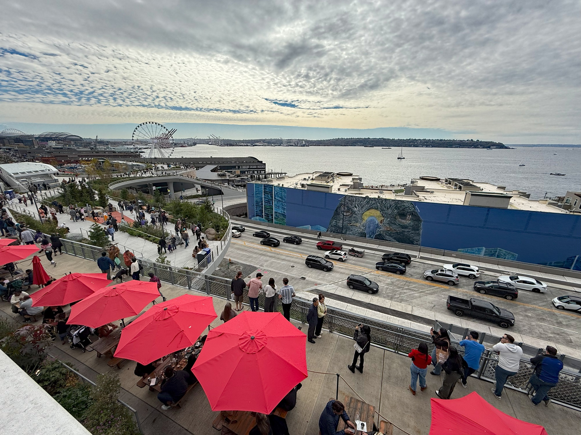
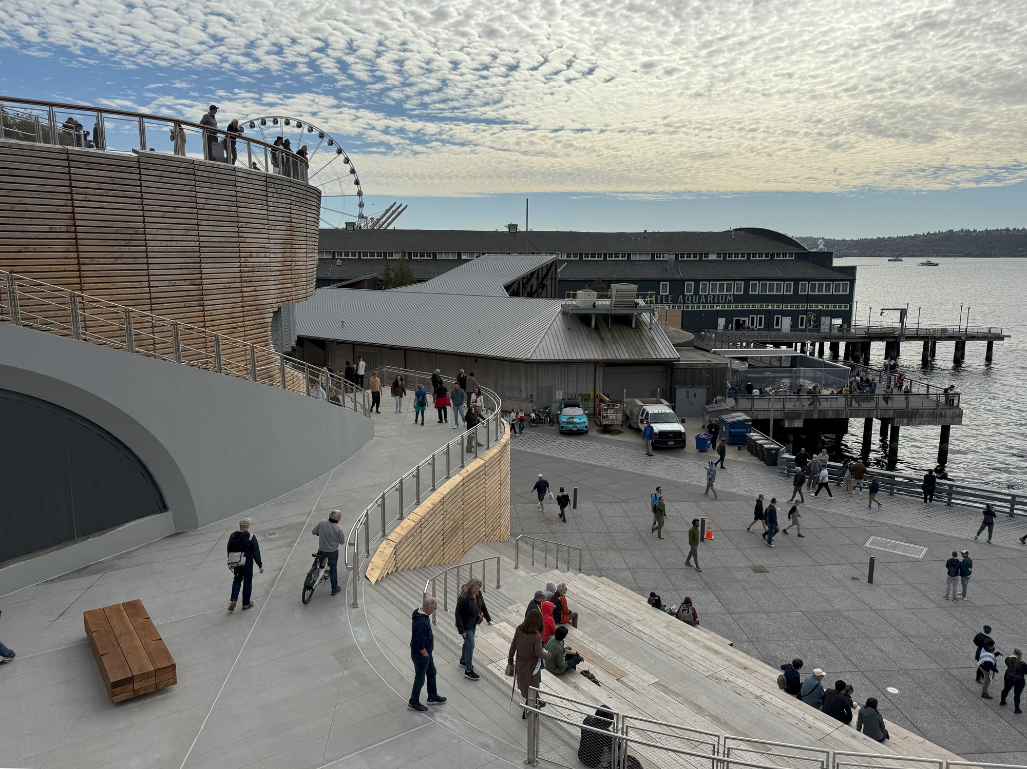
The new elevated Waterfront Park here in the city opened yesterday.
The park is on the central waterfront by downtown Seattle and connects Pike Place Market and downtown neighborhoods with the waterfront.
A few public art installations and a concessions area are still to be added, by early 2025.
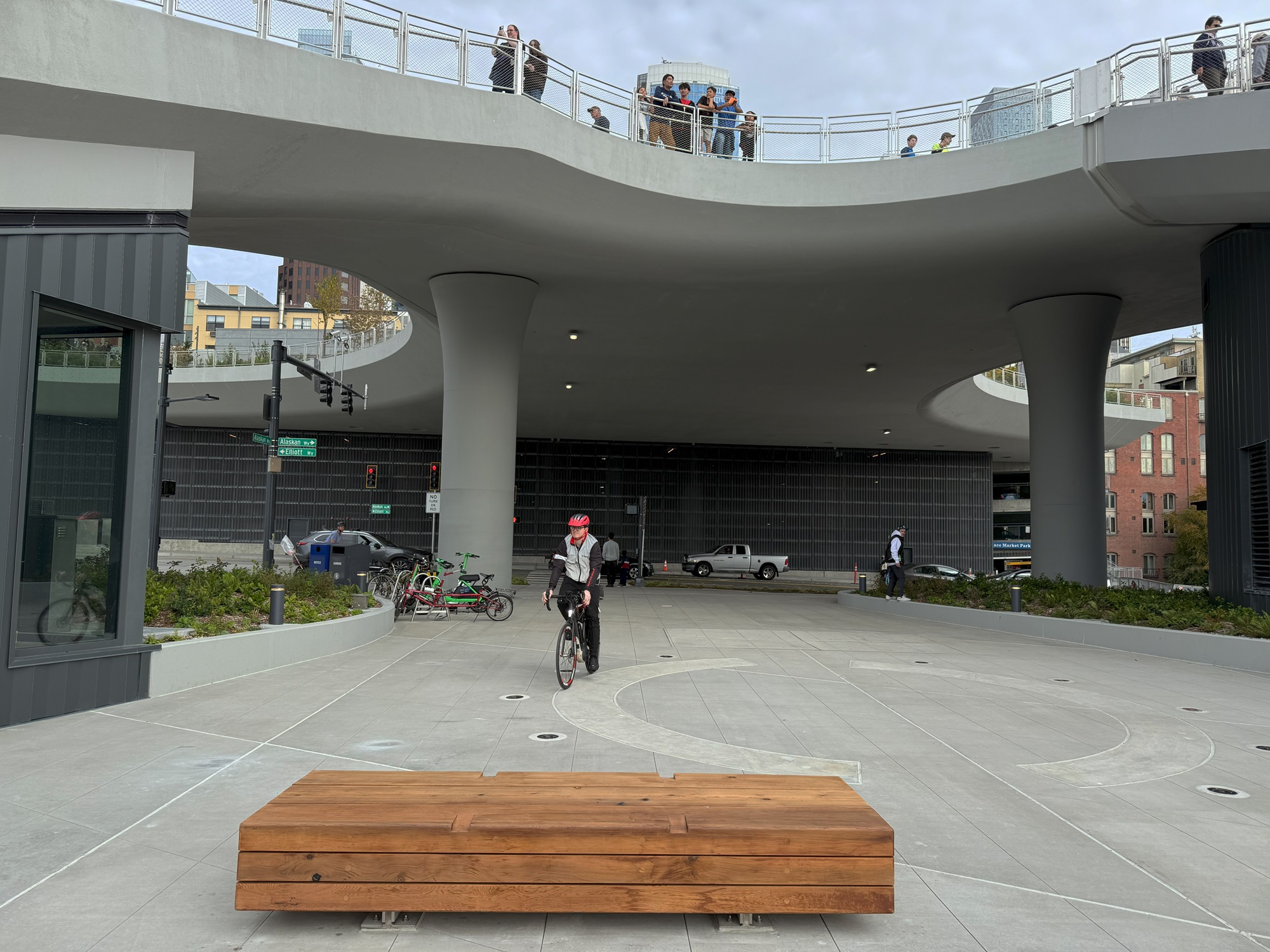
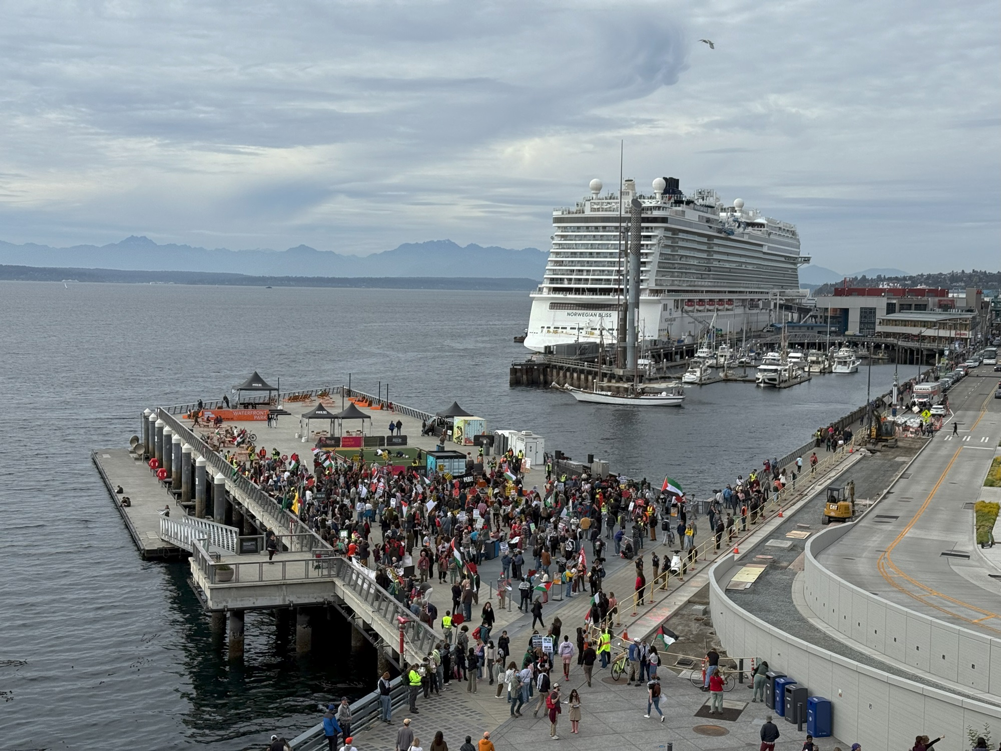
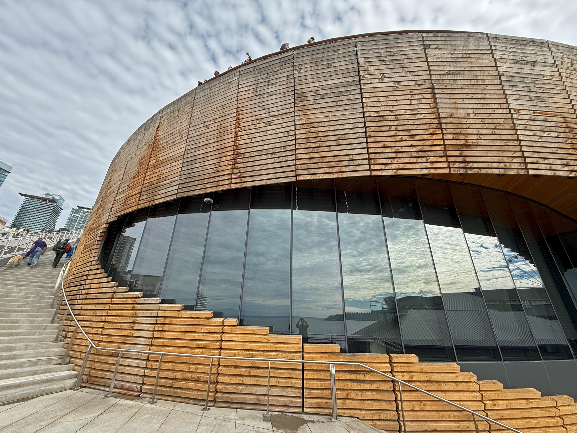
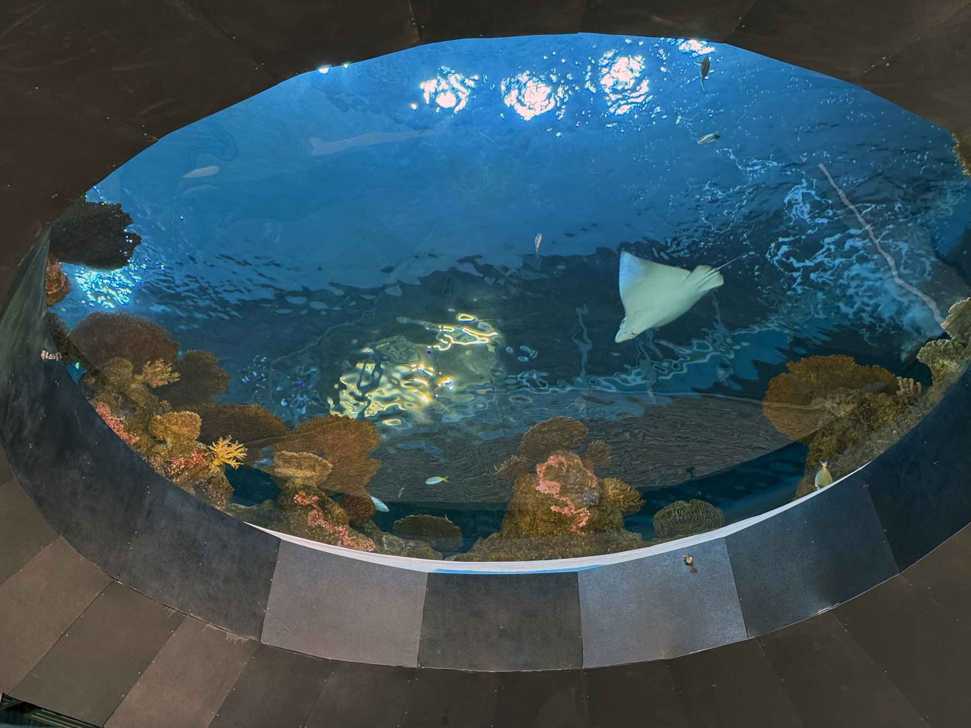
This picture is from Friday, and from the Seattle Times. People wait to take to the Overlook Walk before the grand opening on the Seattle waterfront. [Photograph by Kevin Clark / The Seattle Times]The view from the uppermost deck across from Pike Place Market today, and I am looking more or less south to the Seattle Ferry Terminal in the distance, on the left and behind the Ferris wheel.There are several winding staircases down to the lowest level where the piers are. The blue building is the old part of the Seattle Aquarium, and the structure clad with the wooden slats outside is the new extension of the Aquarium.Looking up from one the decks halfway down. The newly routed Alaskan Way and Elliot Way meet here. The elevated Alaskan Way viaduct that used to run along here is now long gone (demolished in 2019).Looking north towards the Port of Seattle Cruise Terminal (Pier 66). The Norwegian Bliss is about to depart for Alaska. In the foreground Palestinian flags are being waved by anti-war protesters. Some signs read ‘No War in Iran’, as well.This structure houses the new pavilion of the Seattle Aquarium. The wood-clad outside is meant to weather to a gray color, I believe.At the entrance to the aquarium, prospective visitors get a glimpse into one of the large tanks.
I had business downtown and missed the No 10 bus on the way back.
Oh well, I thought, it’s such a beautiful day— let’s just walk back up to Capitol Hill.
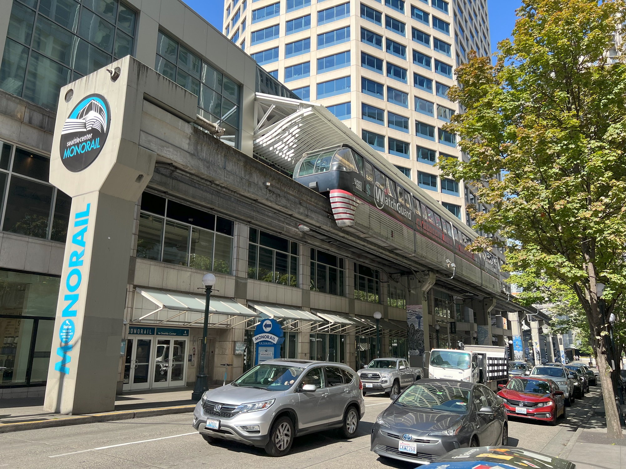
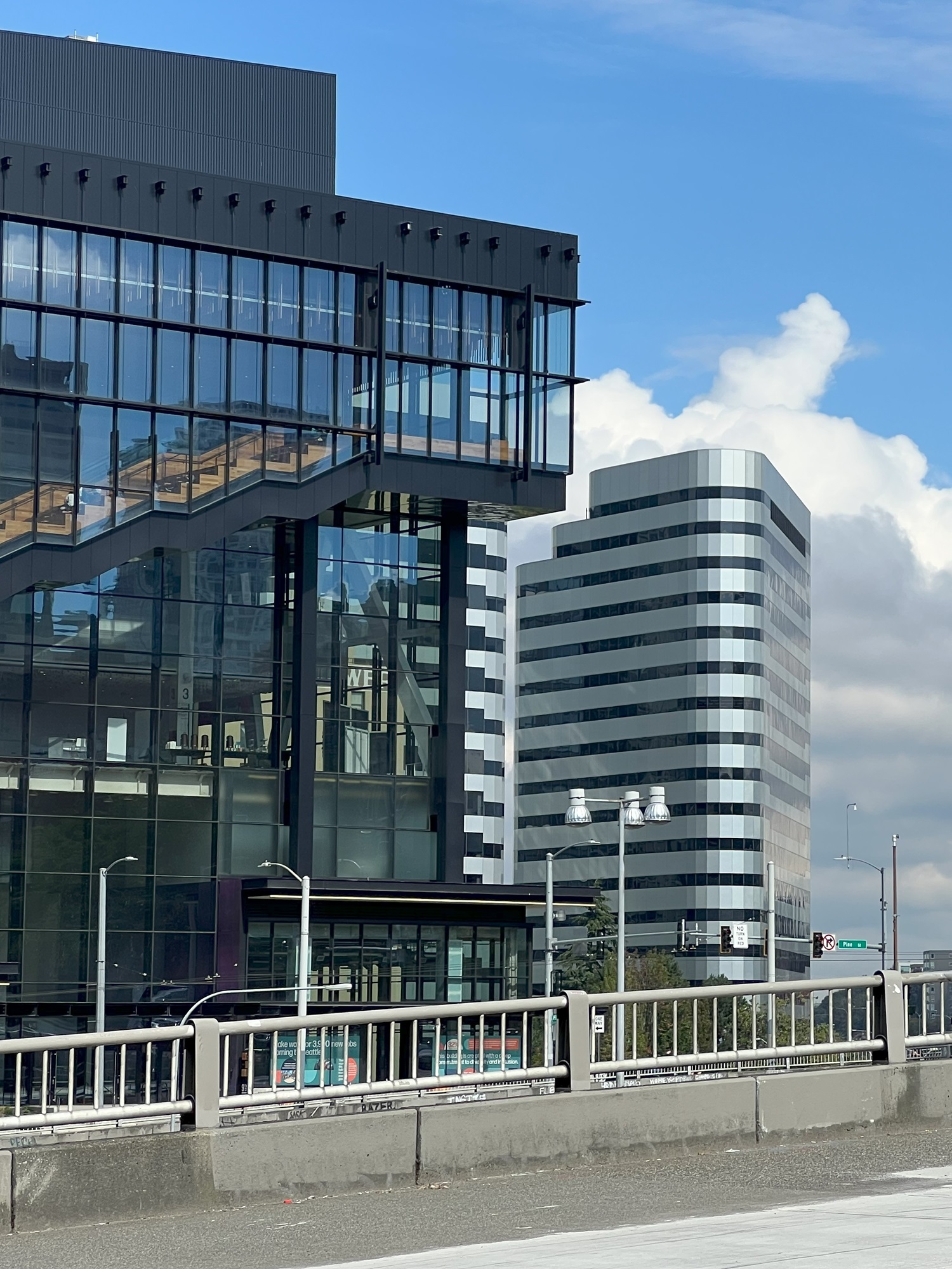
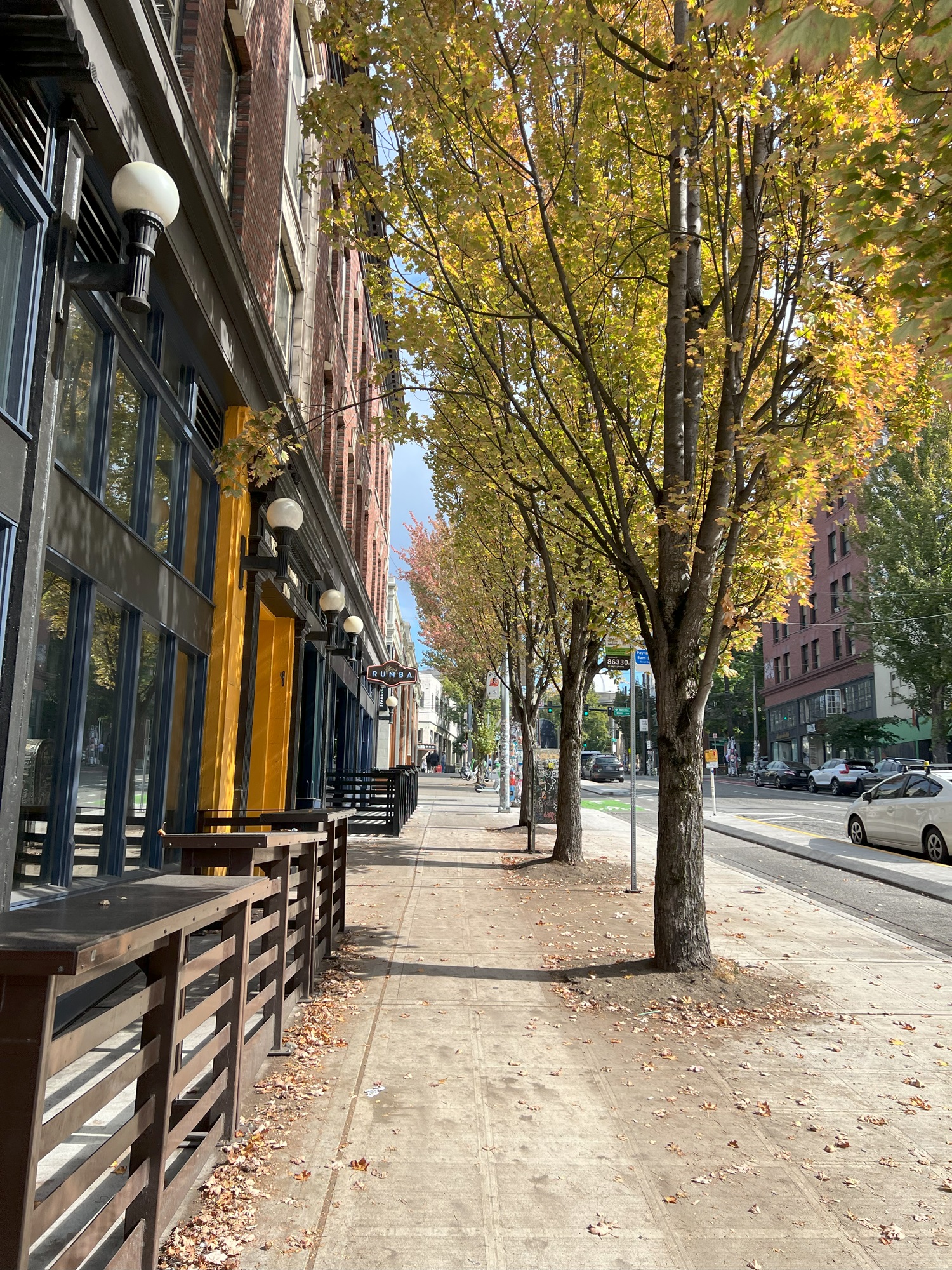
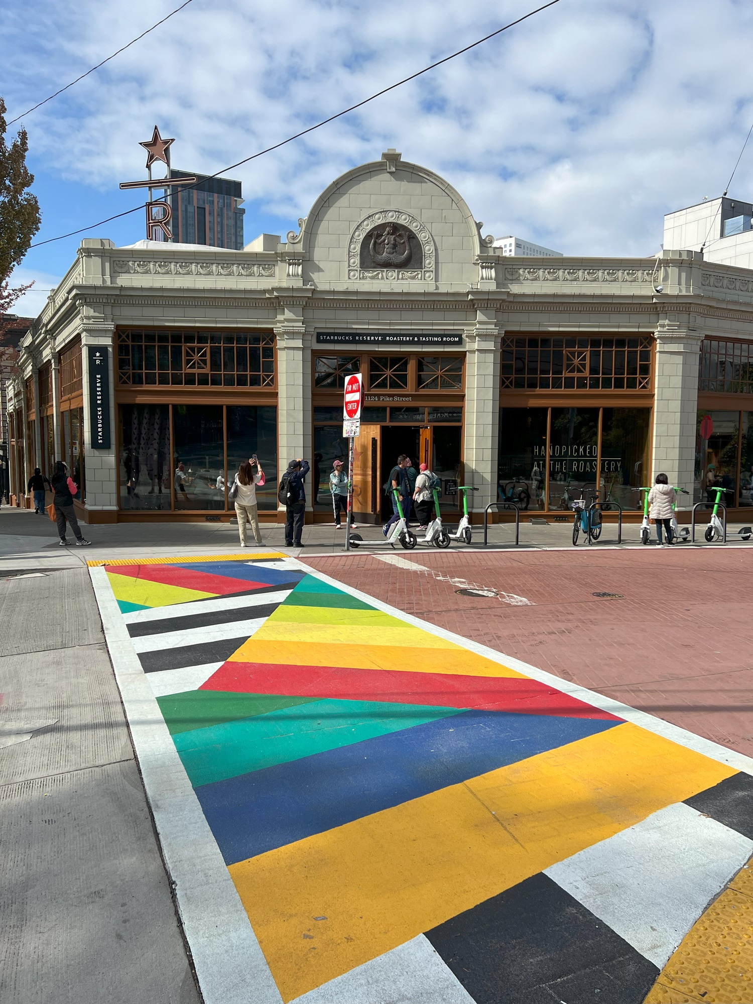
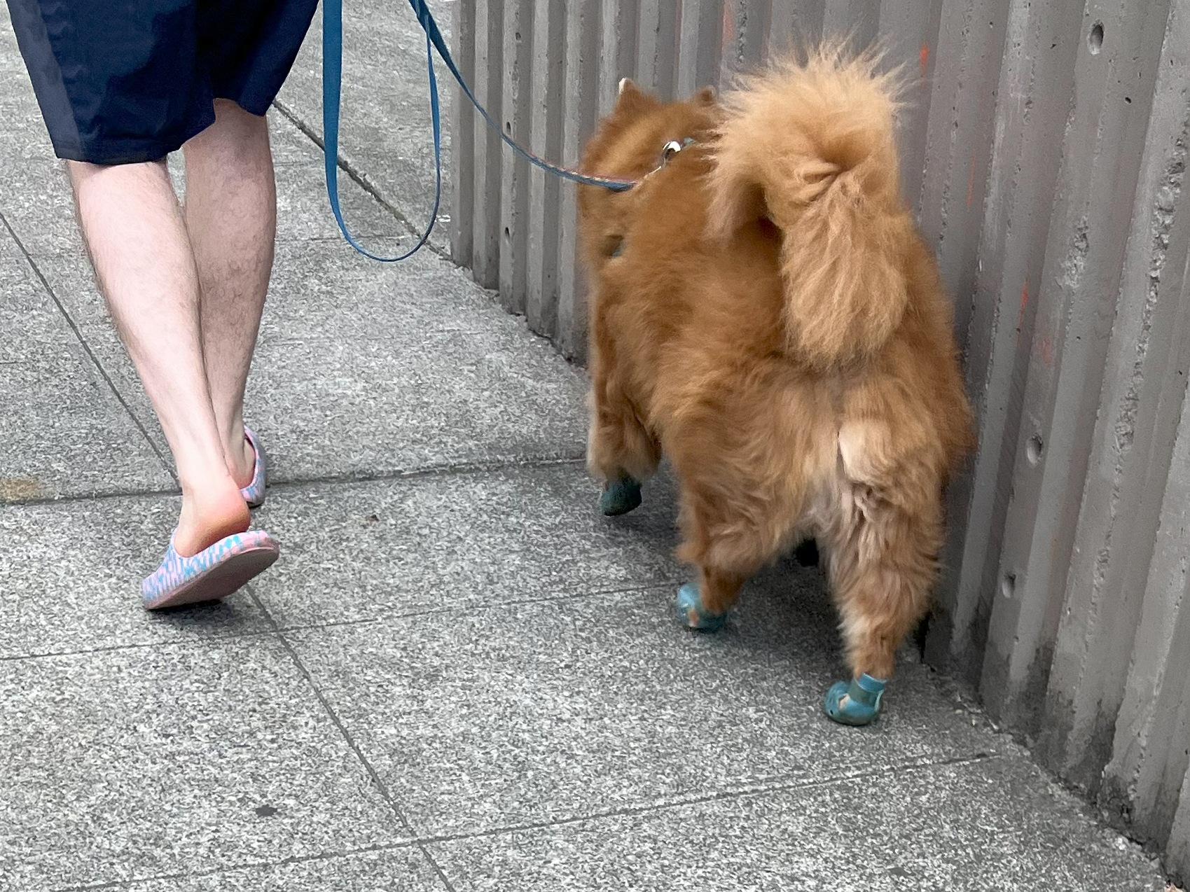
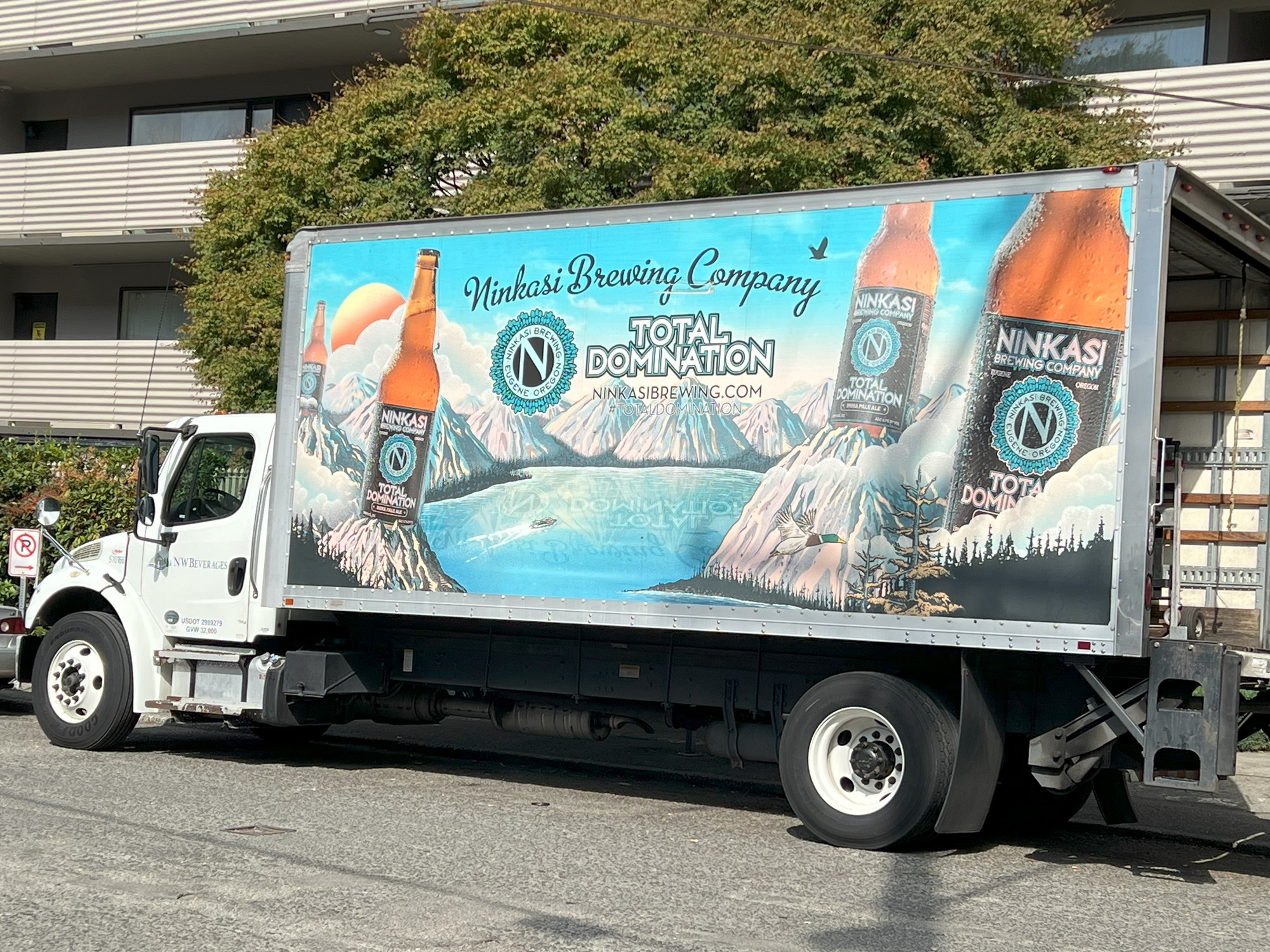
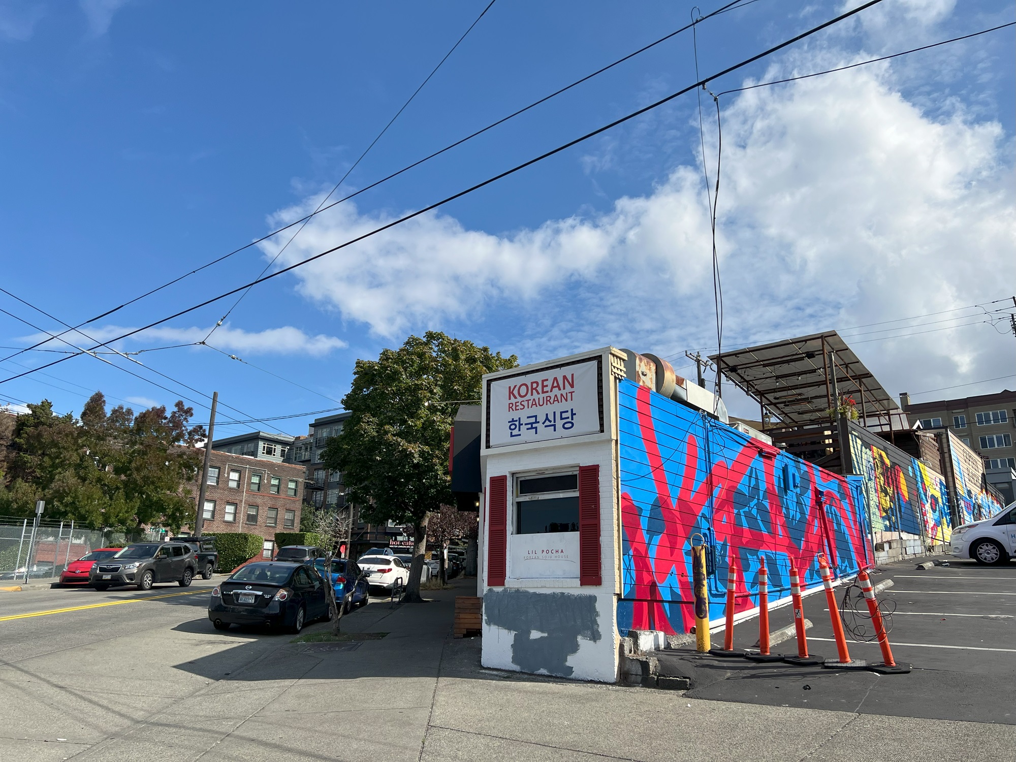
Top to bottom: The monorail station at Westlake Center. The Summit Convention Center, the addition to the original Seattle Convention Center. (The Arch + Summit Convention Centers hosted 160 events in 2023, up from 114 in 2022, but still came in with an operating loss of $23 million for 2023). Fall leaves at East Pike Street and Boren Avenue. The Starbucks Roastery at East Pike Street and Melrose Avenue. The pooch is wearing booties. Beer truck from Ninkasi Brewing Company in Eugene, Oregon. Korean Restaurant on Denny Way. (And now you know how to write Korean Restaurant in Korean!).
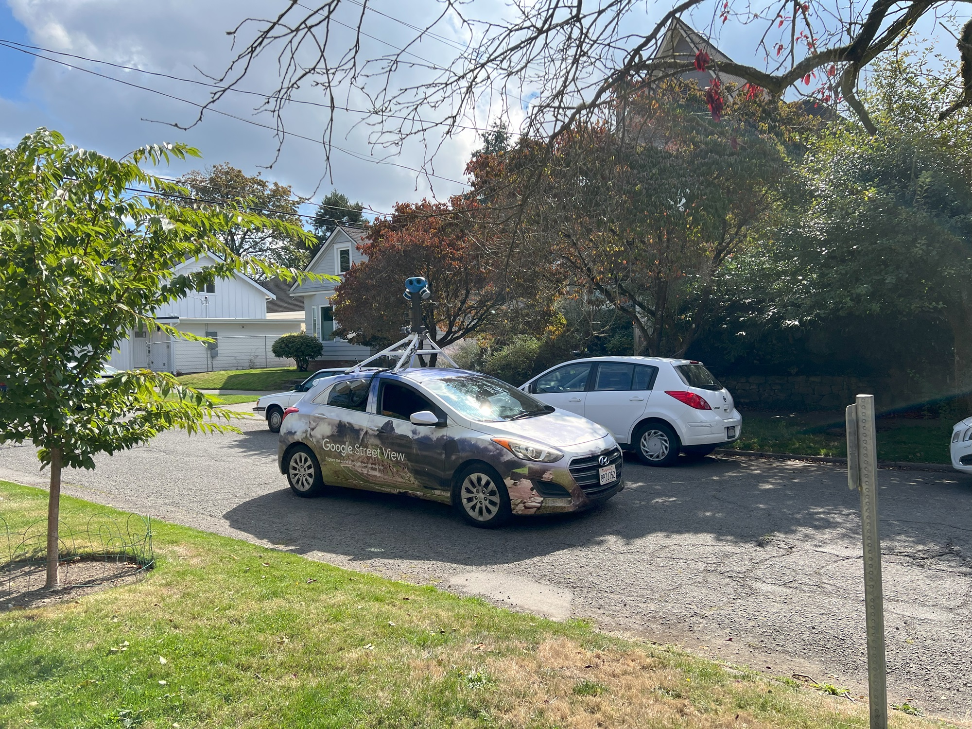
Hey! And here’s the Google Street View car at work. Maybe an image of me will make it onto the next update for Capitol Hill.
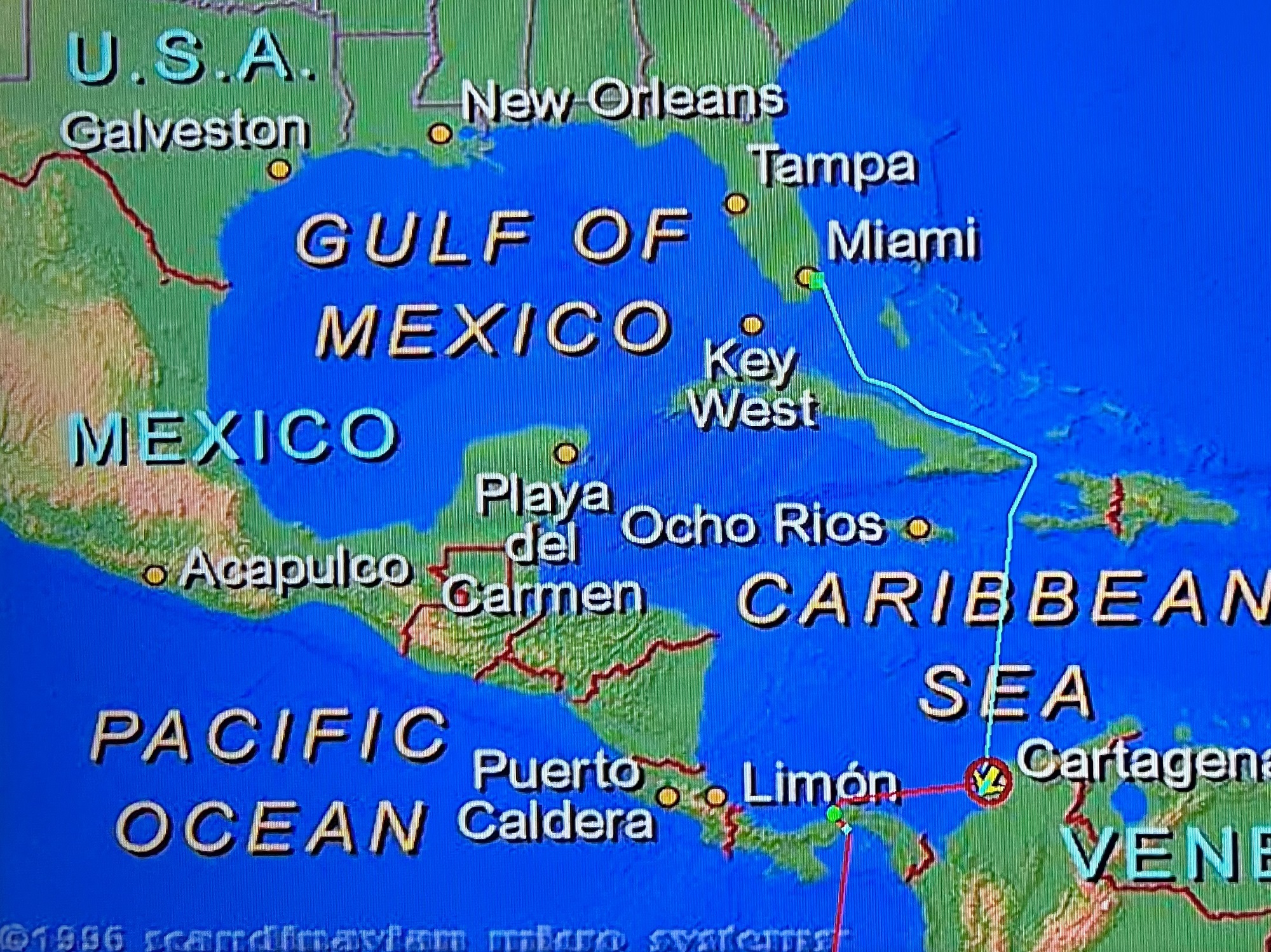
Here are my pictures of a ride today on the new northbound extension of the Sound Transit light rail system to downtown Lynnwood.
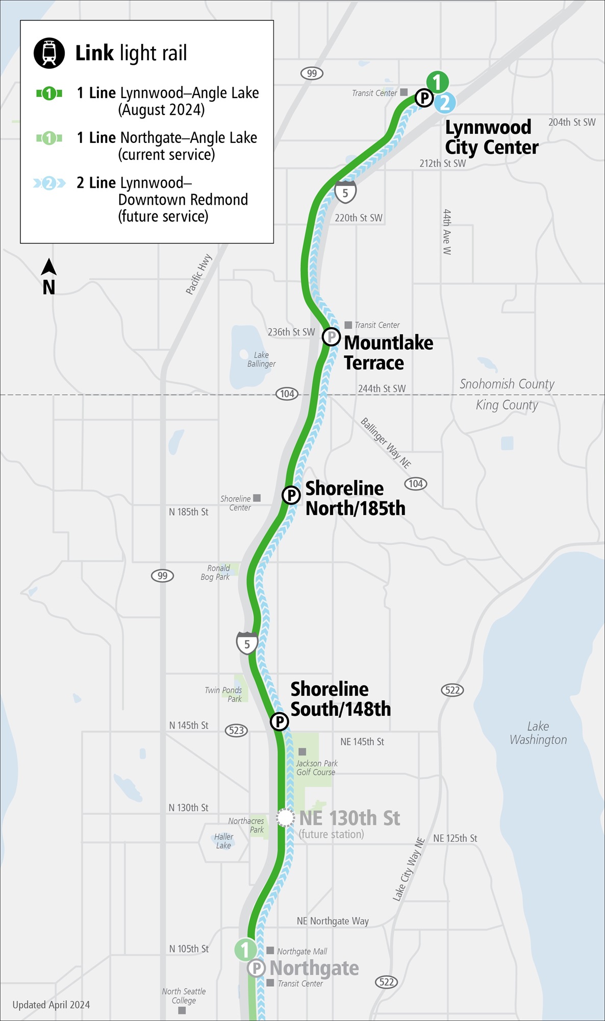
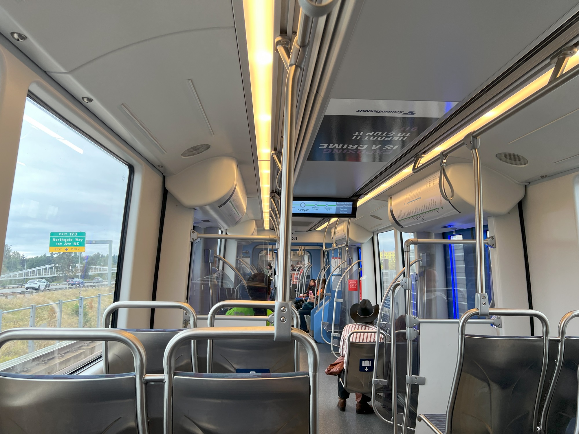
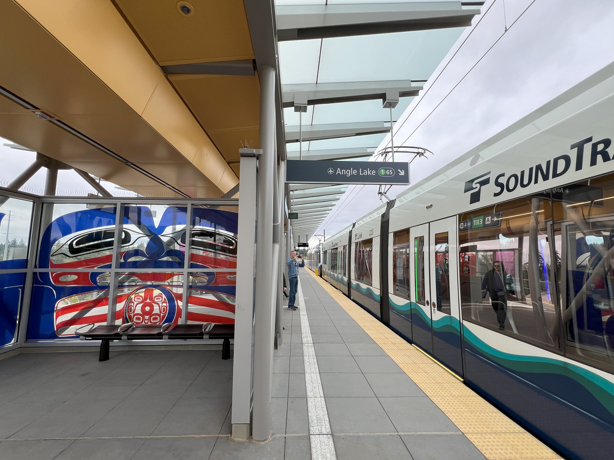
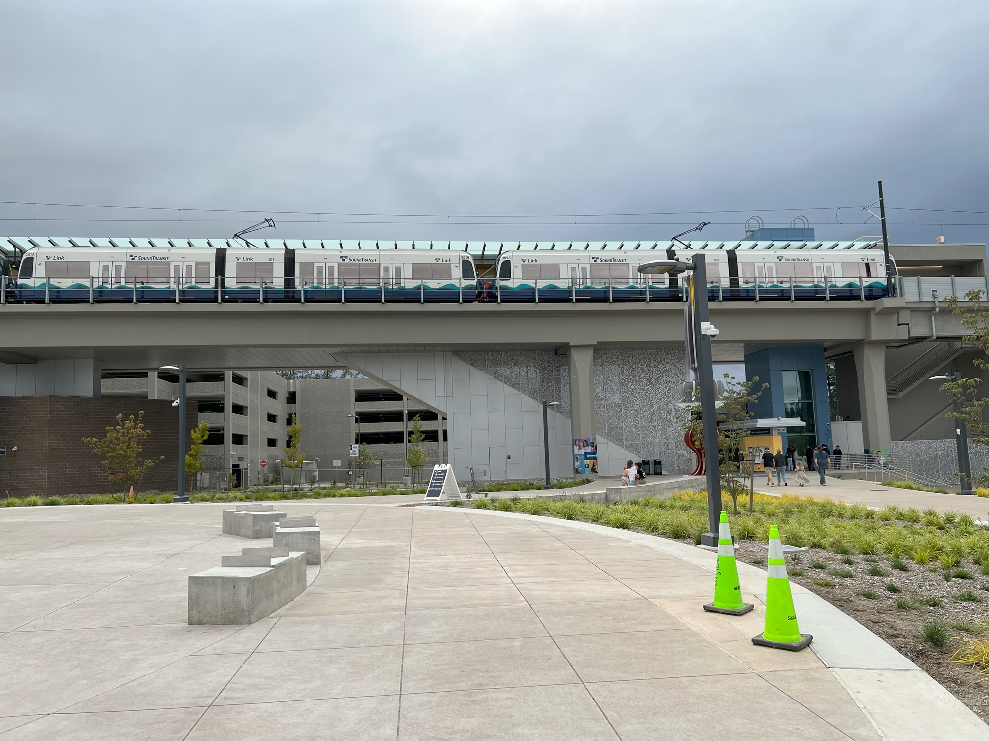
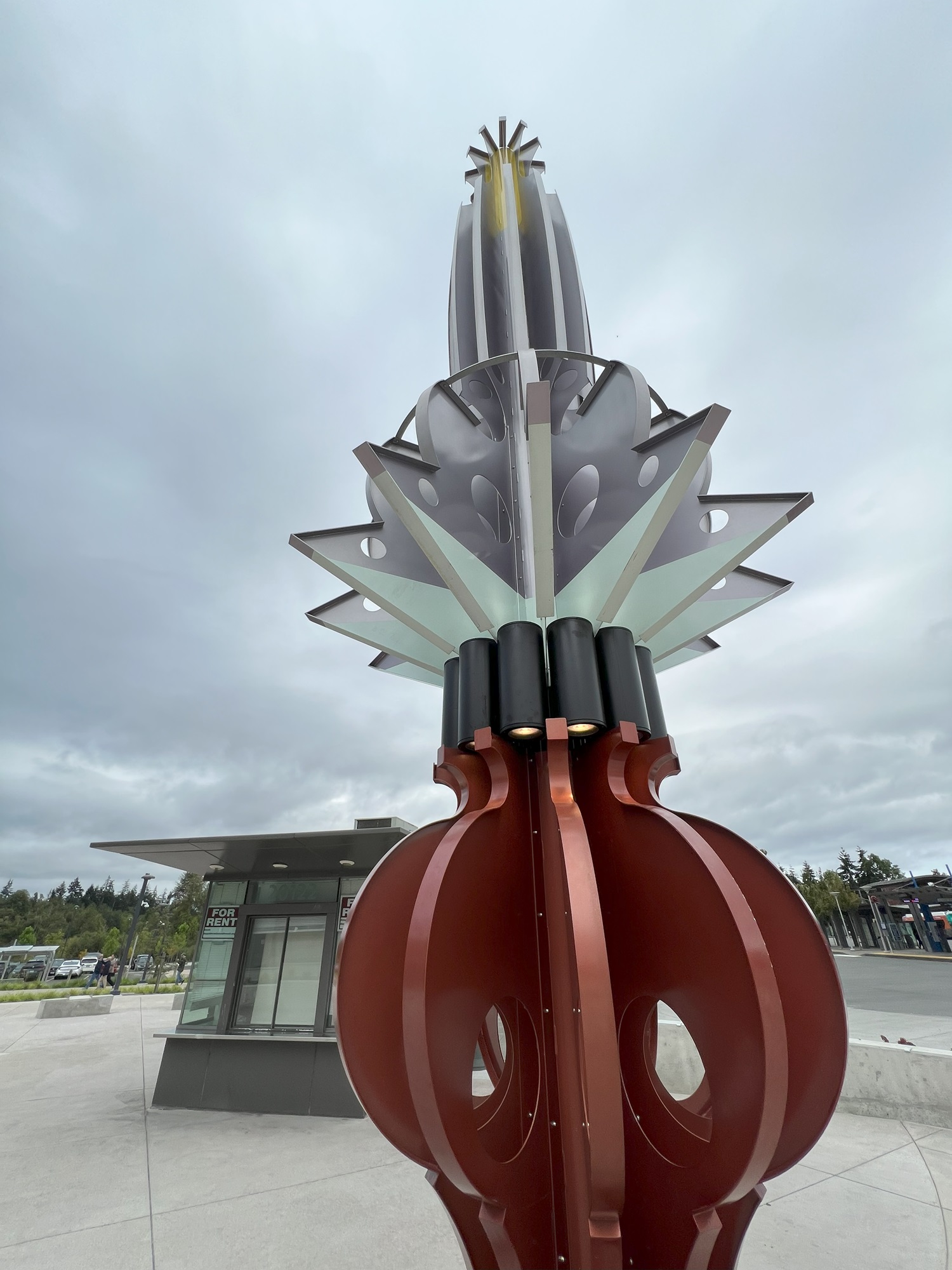
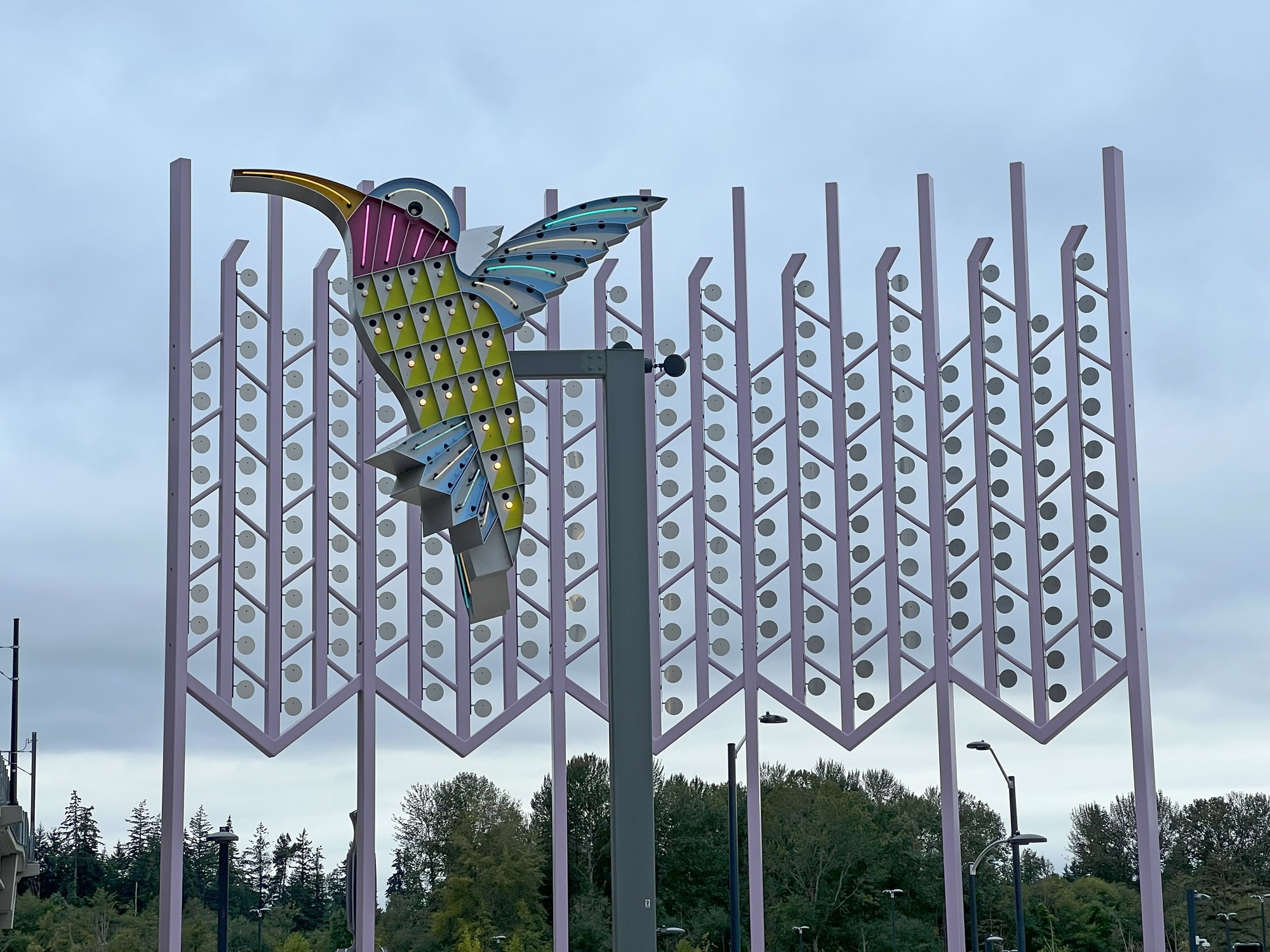
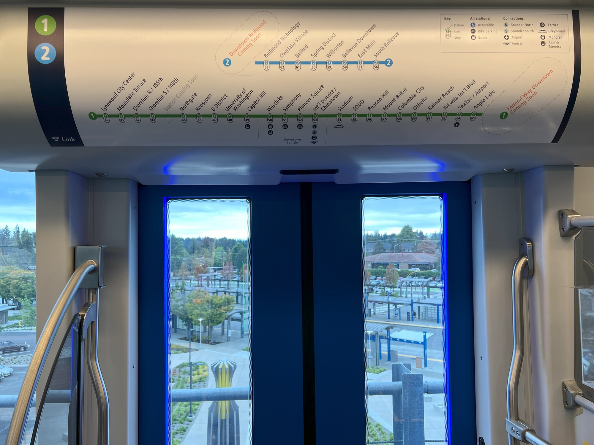
Here it is: the $3 billion extension from Northgate to Lynnwood with four new stations, 16 years in the making. Voters approved it with along with Obama’s election in 2008; planning was done from 2010-2016, design from 2016-2019, and construction from 2019-2024. The 1 Line extension hugs 8½ miles of Interstate 5 and crosses over it north of the Mountlake terrace station. A fifth station will open in 2026 at NE 130th Street. [Map from Sound Transit website]Northbound and approaching the existing Northgate station here. Interstate 5 traffic on the left. Much of the extension is elevated compared to Interstate 5, though, due to the uneven terrain there.Here is the view from the elevated rail and platform at the Lynnwood City Center station. There is a large parking garage at the back (not visible here), a parking lot on the left, and the canopies and bus stops of the Lynnwood Transit Center. Buses can be taken from here to Everett in the north, or to either of the ferry terminals at Edmonds and Mukilteo.Glass mural artwork on the boarding platform at the Lynnwood City Center station. The artist is Preston Singletary. The art was inspired by his Tlingit heritage and family, and influenced by his father’s recent death.Here’s the train at the Lynnwood City Center station, with the parking garage at the back of it.One of two identical sculptures called “Shift” down on the grounds below. The artist is Claudia Fitch and are a nod to the lamps from Lynnwood’s Interurban trolley system, which operated from 1910 to 1939.Here is Claudia Fitch’s “City Hummingbird” and “Kitchen Window Curtain” at Lynnwood City Center Station, to honor the history of neon road signs that once lined Highway 99 as well as the nature Pacific Northwesterners see in their own backyards. [Description of artwork and text from Seattle Times]Getting ready for the 30-minute ride back to Capitol Hill train station. The overhead graphic of the 2 Line (blue) and 1 Line (green) shows that more stations will open in the near future. Stations have numeric identifiers as well, which should make it easier for foreign language speakers and visitors to find the stations that they need to use.A peek into the future, looking at a little section of rail north of Lynnwood City Center station that has already been constructed. The next push north is scheduled for 2037 with stops at West Alderwood near the mall, Ash Way, Mariner, Highway 99 in South Everett (possibly) and Southwest Everett Industrial Center near Paine Field. Two final stations at Evergreen Way and downtown Everett are aimed for 2041, depending on funding.
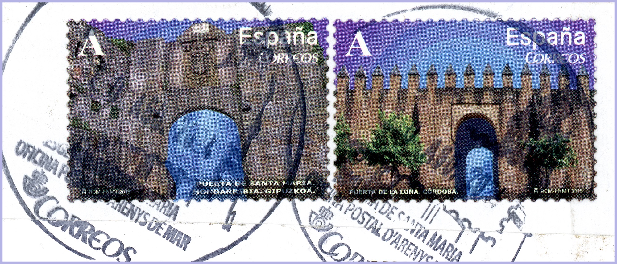
Let’s see what’s on these stamps from Spain.
They were put on an envelope sent to me from an Ebay seller from Barcelona.
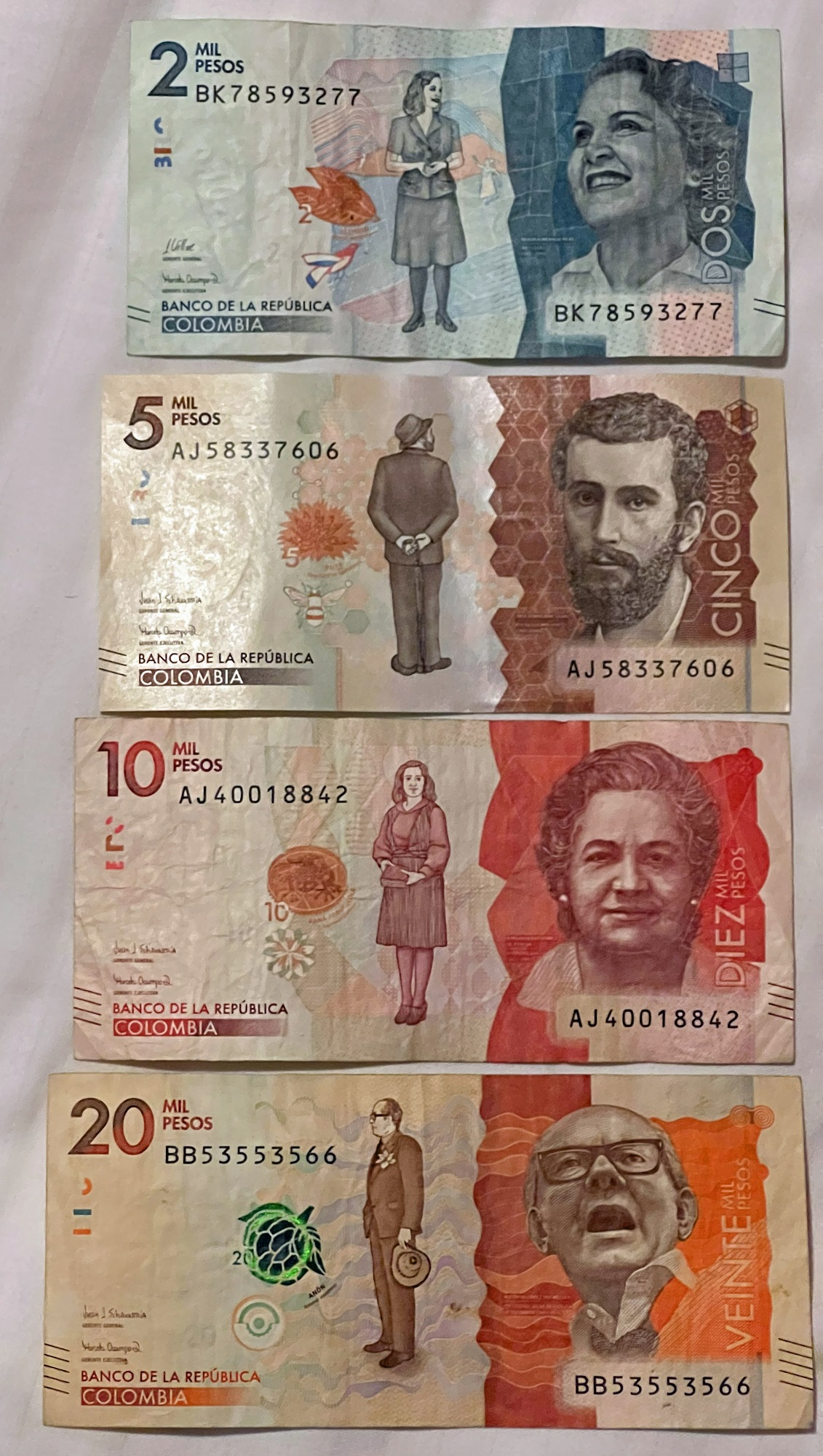
There was a single stamp from South Africa inside, to add to my collection .
Architecture of Gates in Spain Issued 2015, Jan. 2 Die Cut Perf. 13 | Booklet Stamps | Lithography 4010a Moon Gate, Cordoba | 42c | multi-colored 4010c St. Mary’s Gate, Hondarribia | 42c | multi-colored [Source: 2021 Scott Standard Postage Stamp Catalogue, Vol. 6A]
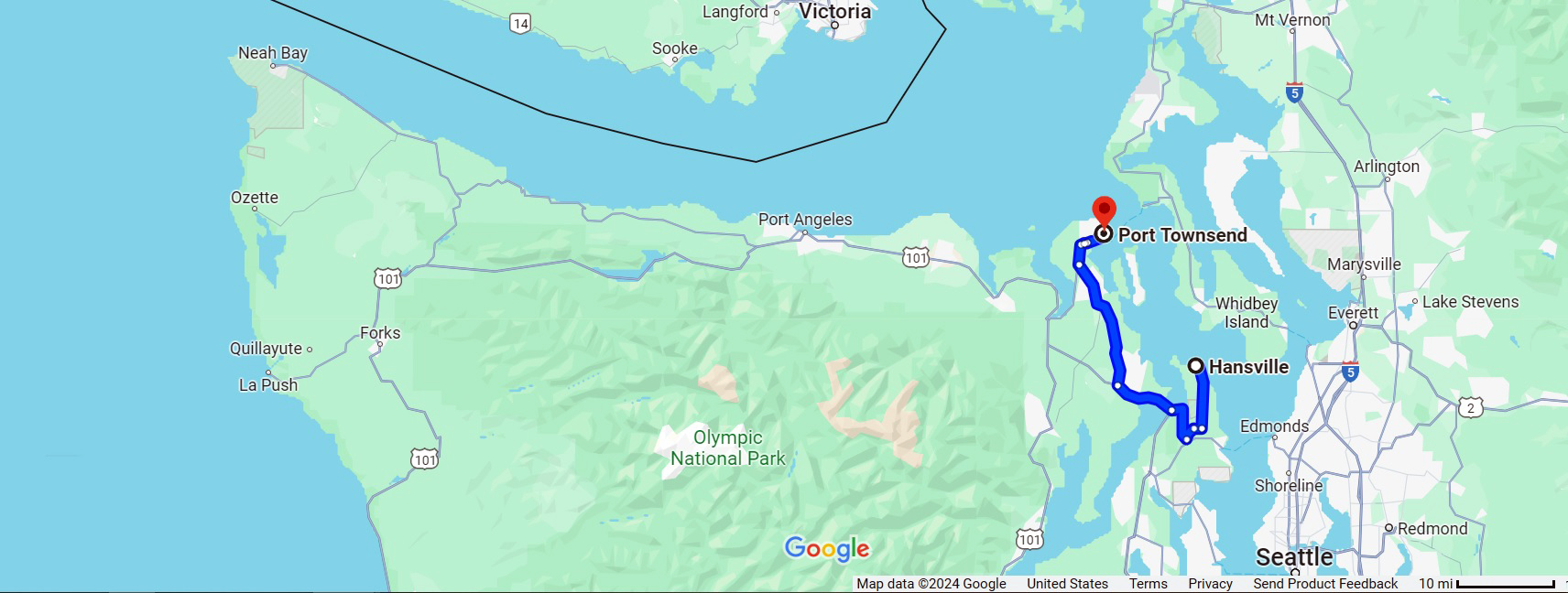
We drove up to Port Townsend from Hansville today— about an hour’s drive.
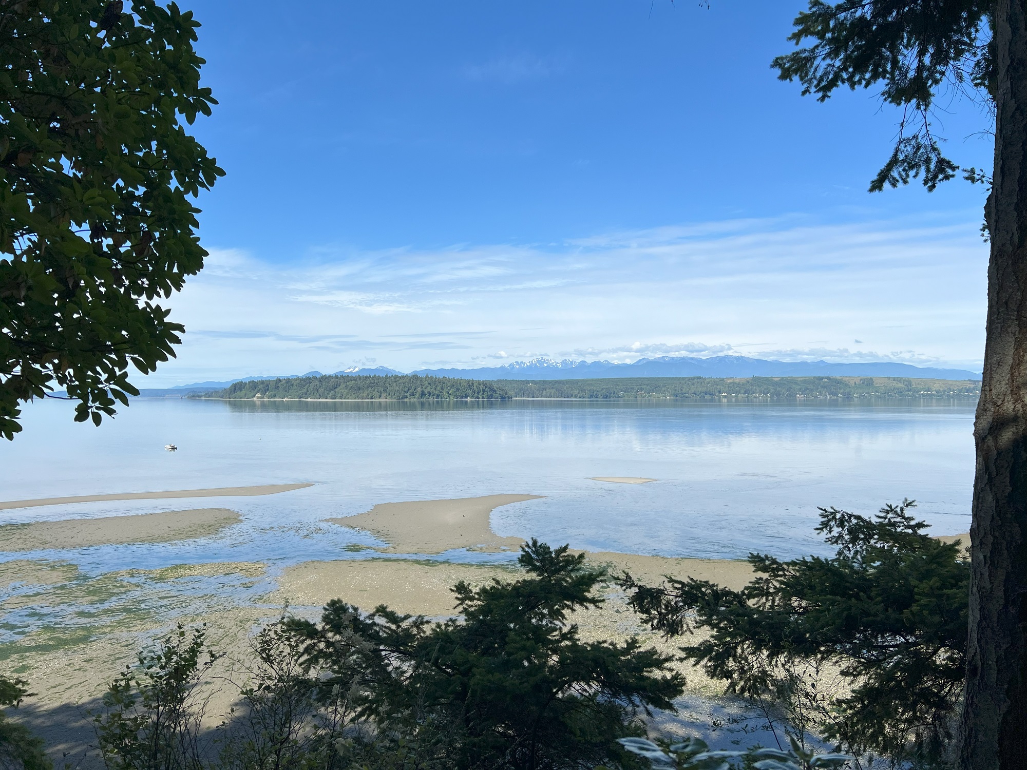
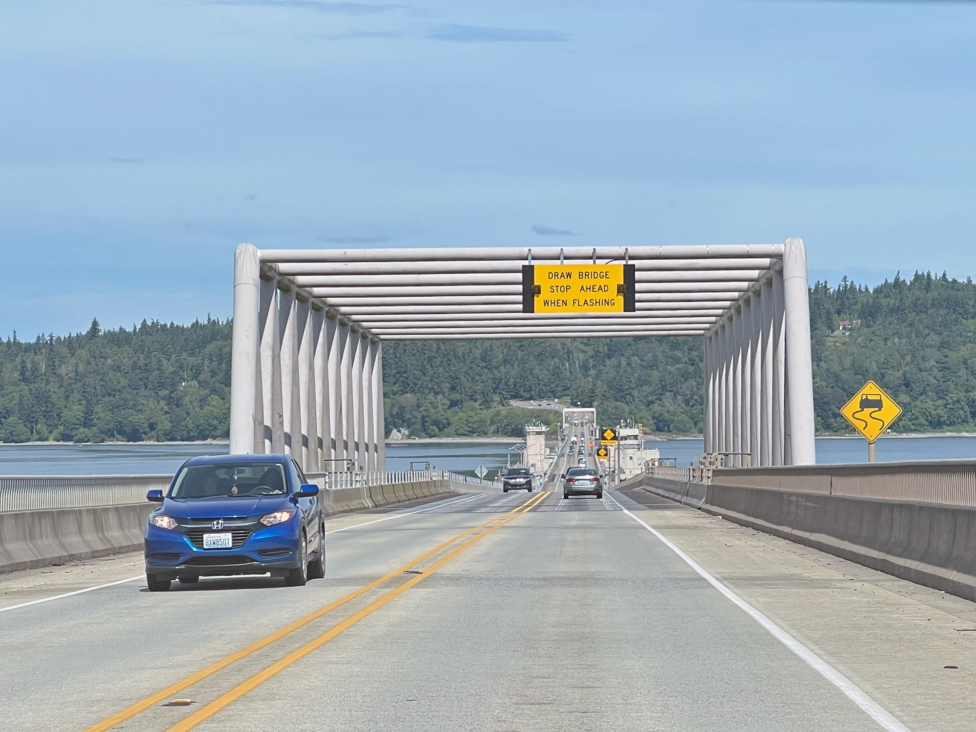
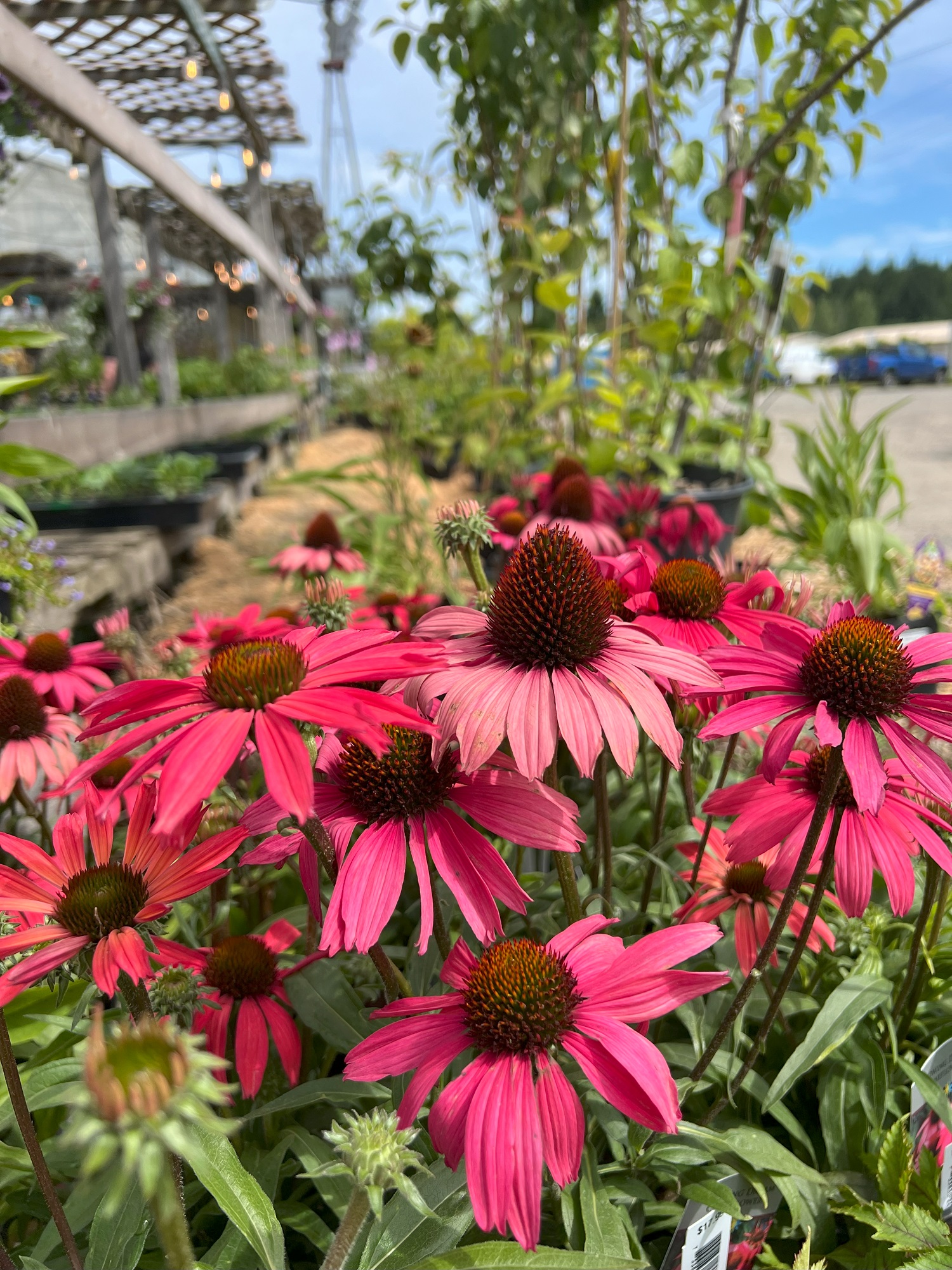
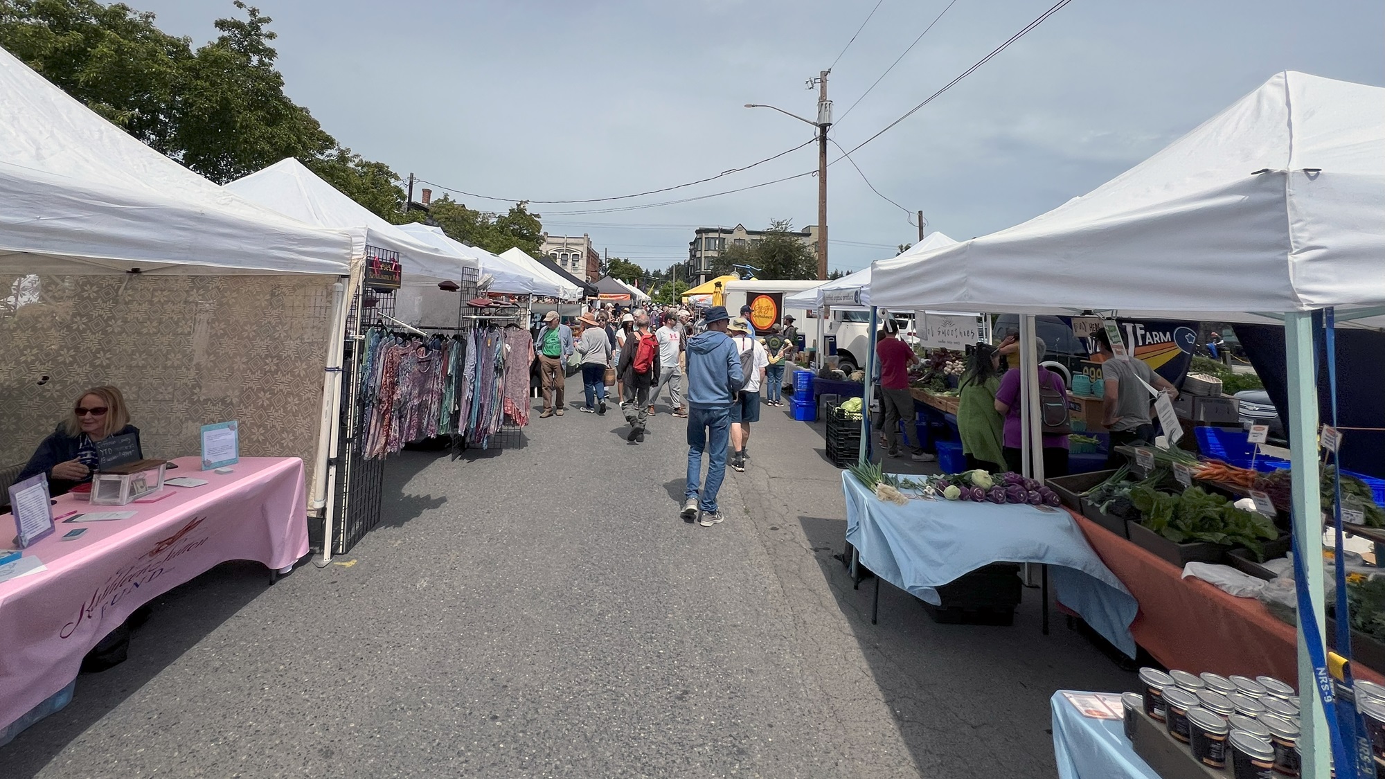
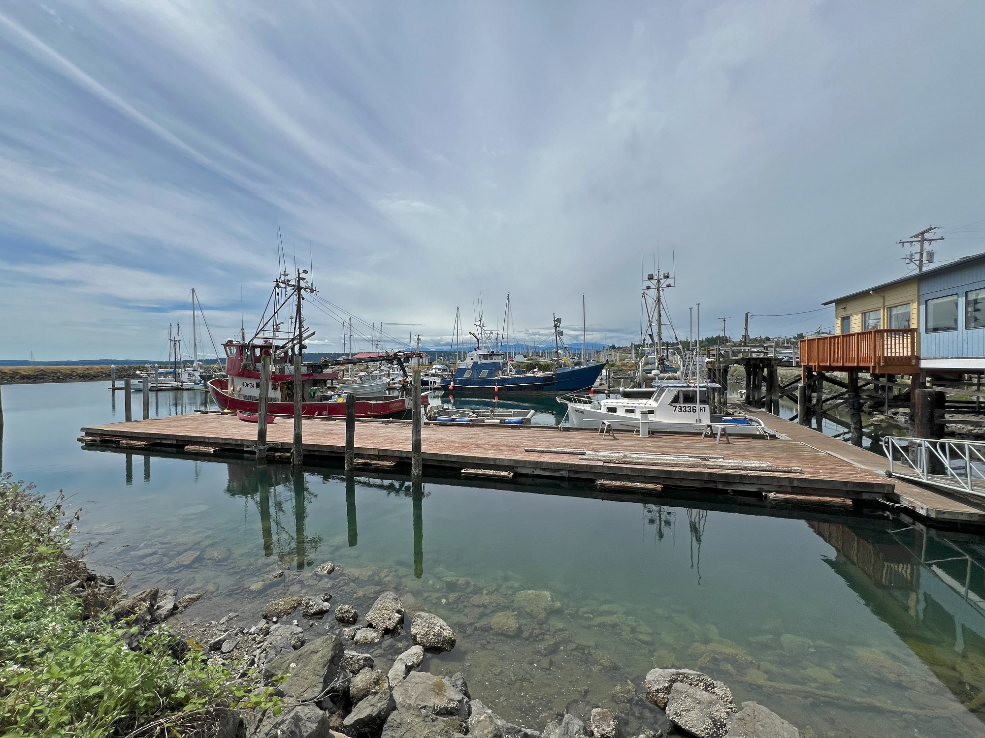
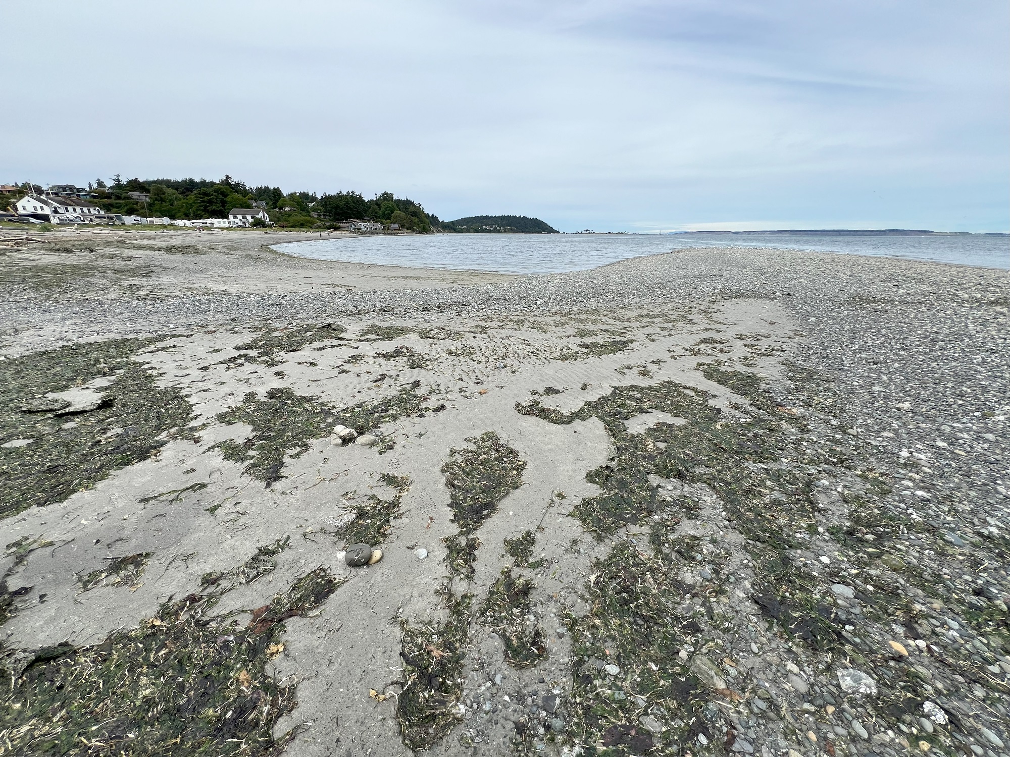
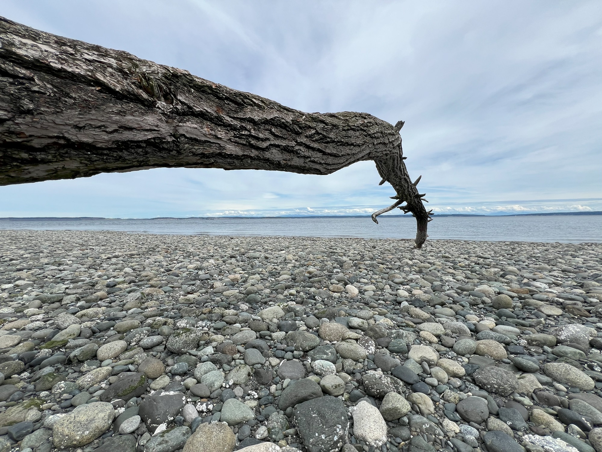
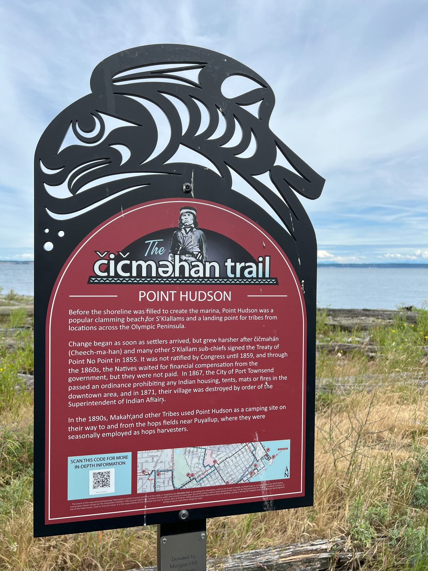
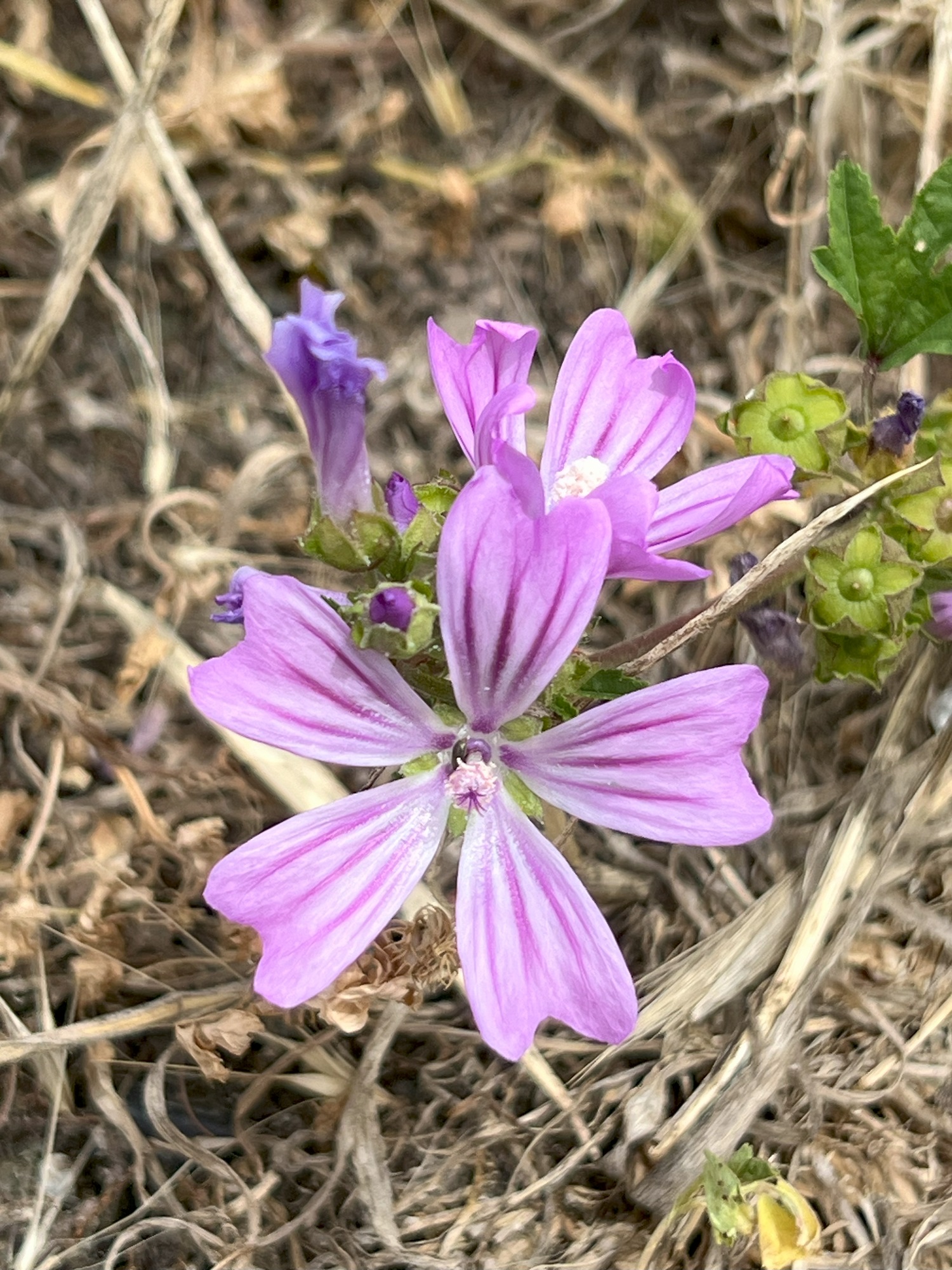
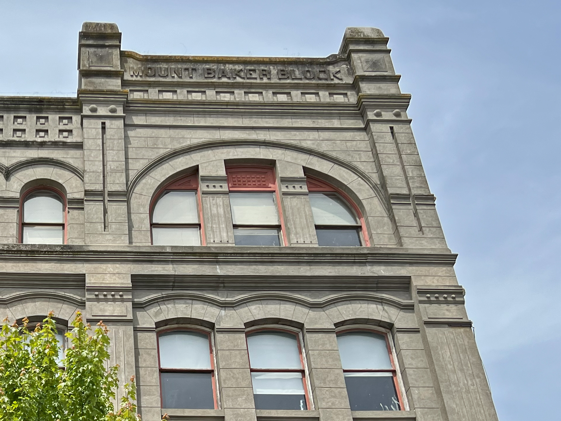
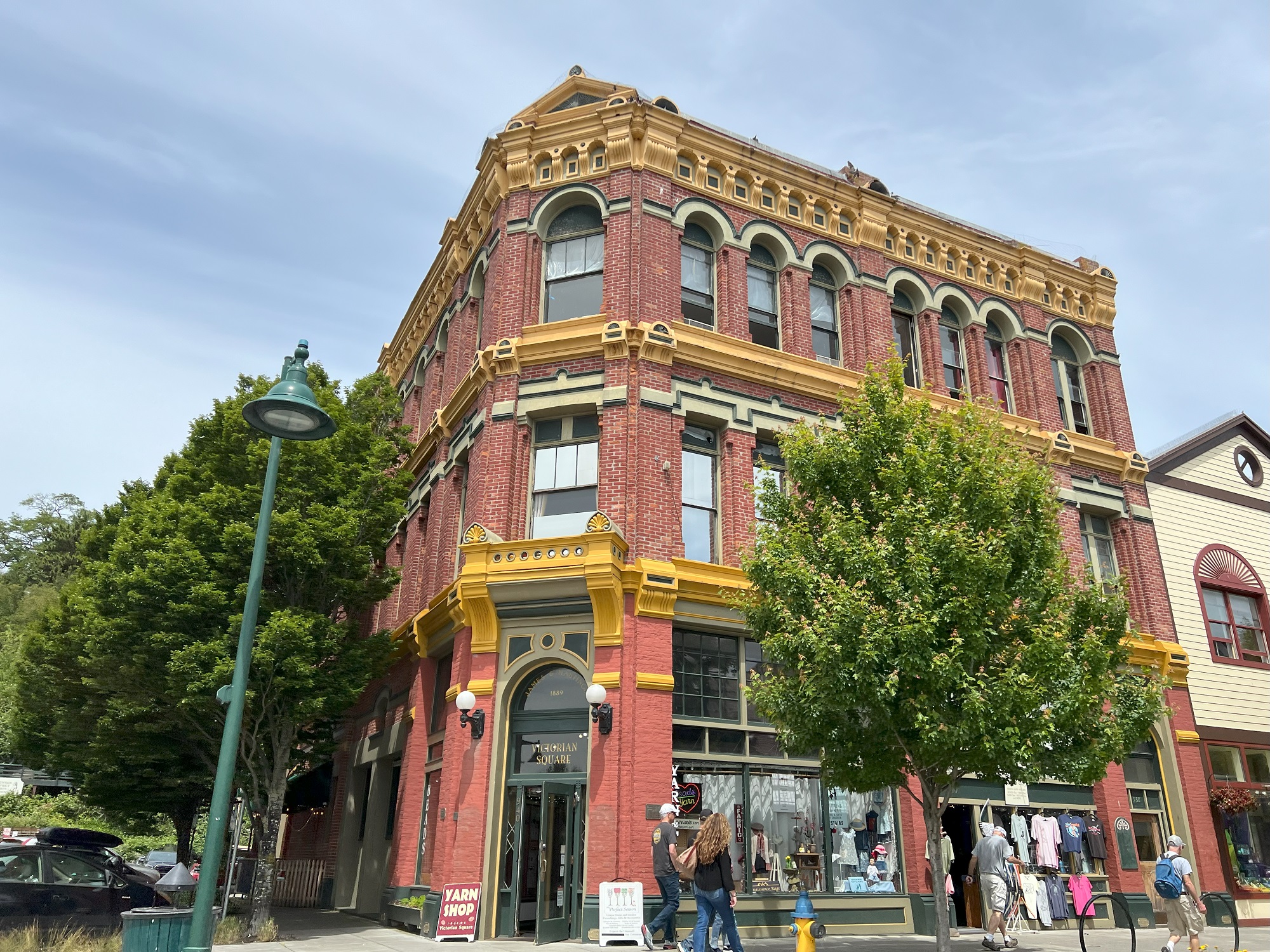
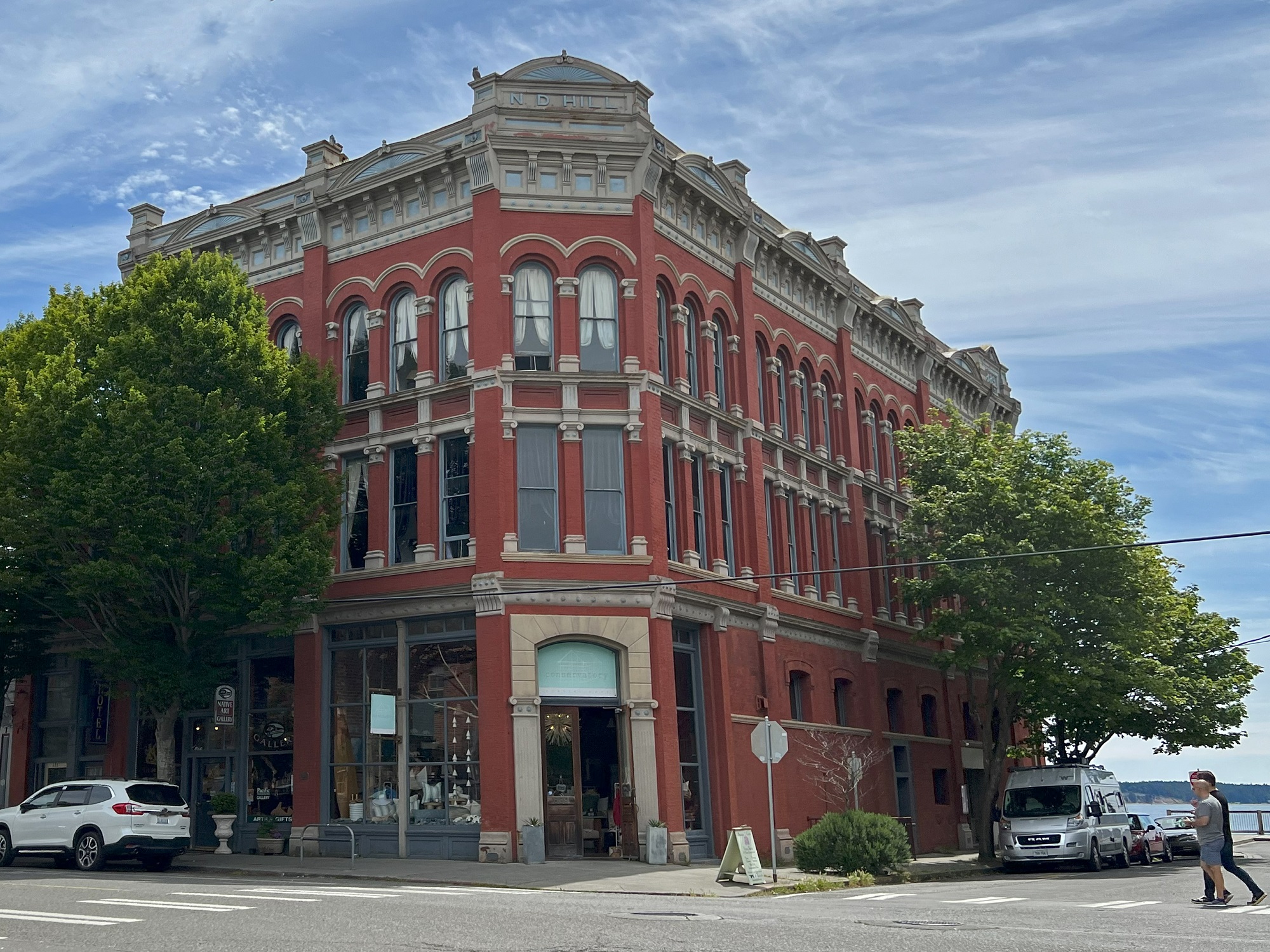
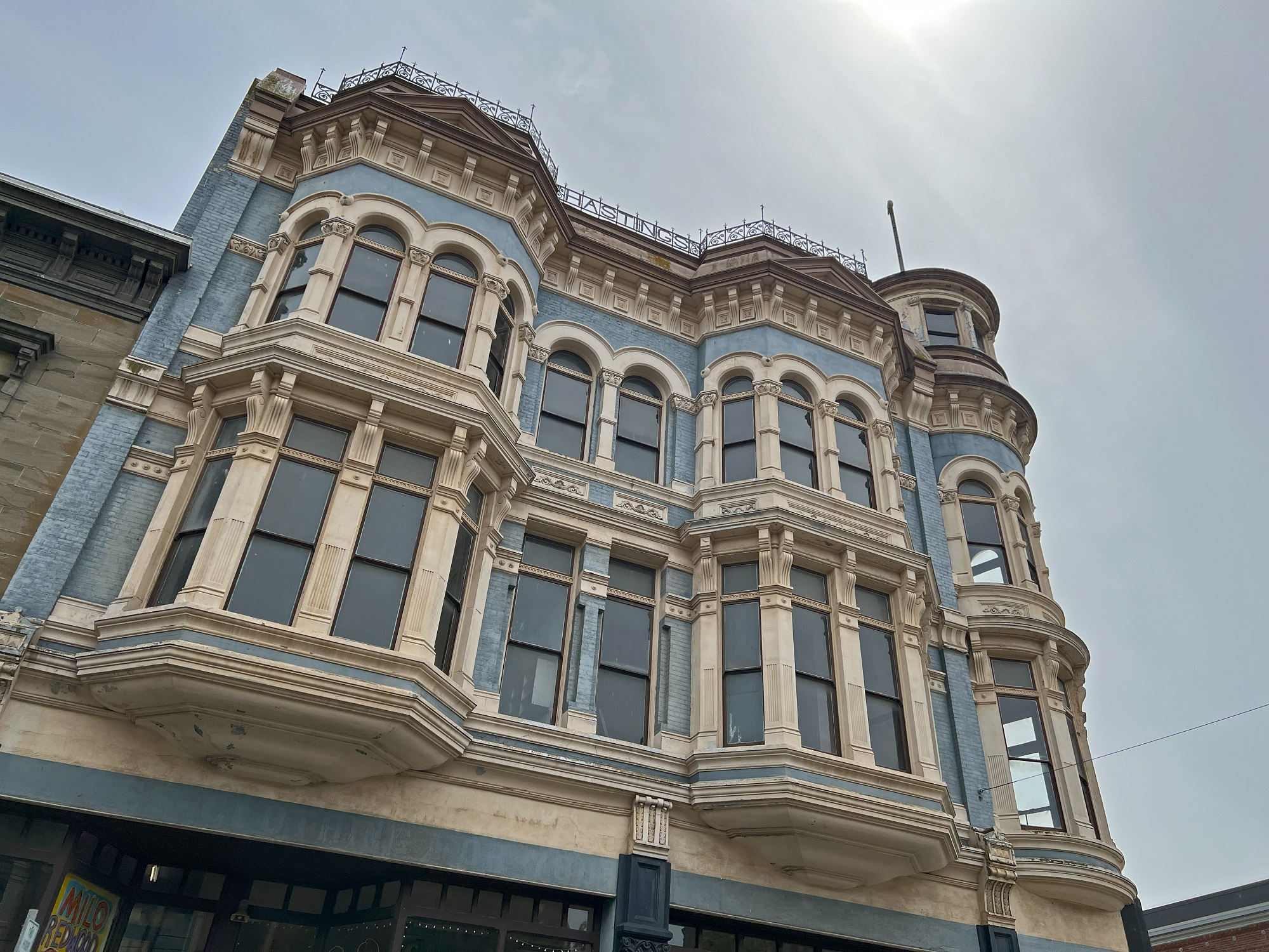
Port Townsend (pop. 10,148) is a city on the Quimper Peninsula (on the greater Olympic Peninsula) in Jefferson County. [From Wikipedia]The view this morning from Hansville on the Kitsap Peninsula across Hood Canal at low tide. Across the canal is the Olympic Peninsula, with the Olympic mountains in the distance.Crossing the Hood Canal Floating Bridge (constructed in 1961) to get to the Olympic Peninsula.A quick stop at the Chimacum Corner farmstand and nursery, on the way to Port Townsend. These are Sunny Days Ruby Echinacea, basking in the sun.We stopped by Saturday’s farmer’s market in Port Townsend.This little marina is by Sea J’s Cafe just south of Port Townsend’s downtown.This is the beach at Point Hudson, with Whidbey Island in the distance.The pebble and stone beach at Point Hudson also features a few uprooted trees and driftwood.For thousands of years before the settlers came to Port Townsend, the S’Klallam (“strong”) people lived in villages along the north coast of the Olympic Peninsula.These little wildflowers by Point Hudson are mallows (Malva sylvestris).The Mount Baker Building in downtown Port Townsend was built in 1889 and renovated in 1999. It was sold in 2020 for $6.8 million. At the time of its construction, negotiations were underway for the railroad to link Port Townsend to the rest of the country. Real estate price skyrocketed, the population of the town doubled, and Port Townsend dubbed itself “The Inevitable New York.” The railroad never arrived and the boom went bust. As a result, Port Townsend was left with many spectacular buildings and residences, some of which were never finished.The James & Hastings Building with its carved stone trimmings from the Victorian era was built in 1889, and restored in the 1990s and early 2002. It is at the corner of Tyler Street and Water Street.The ornate N.D. Hill Building (constructed 1889) at 635 Water Street was designed by noted Seattle architect Elmer H. Fisher. It is principally Italianate in design, but also shows Grecian and Romanesque influences.Here is the elegant four-story Hastings Building at 839 Water Street— built in the Victorian style, and completed in 1890.
I like to peek into the new townhomes that appear around Capitol Hill when I go for a walk.
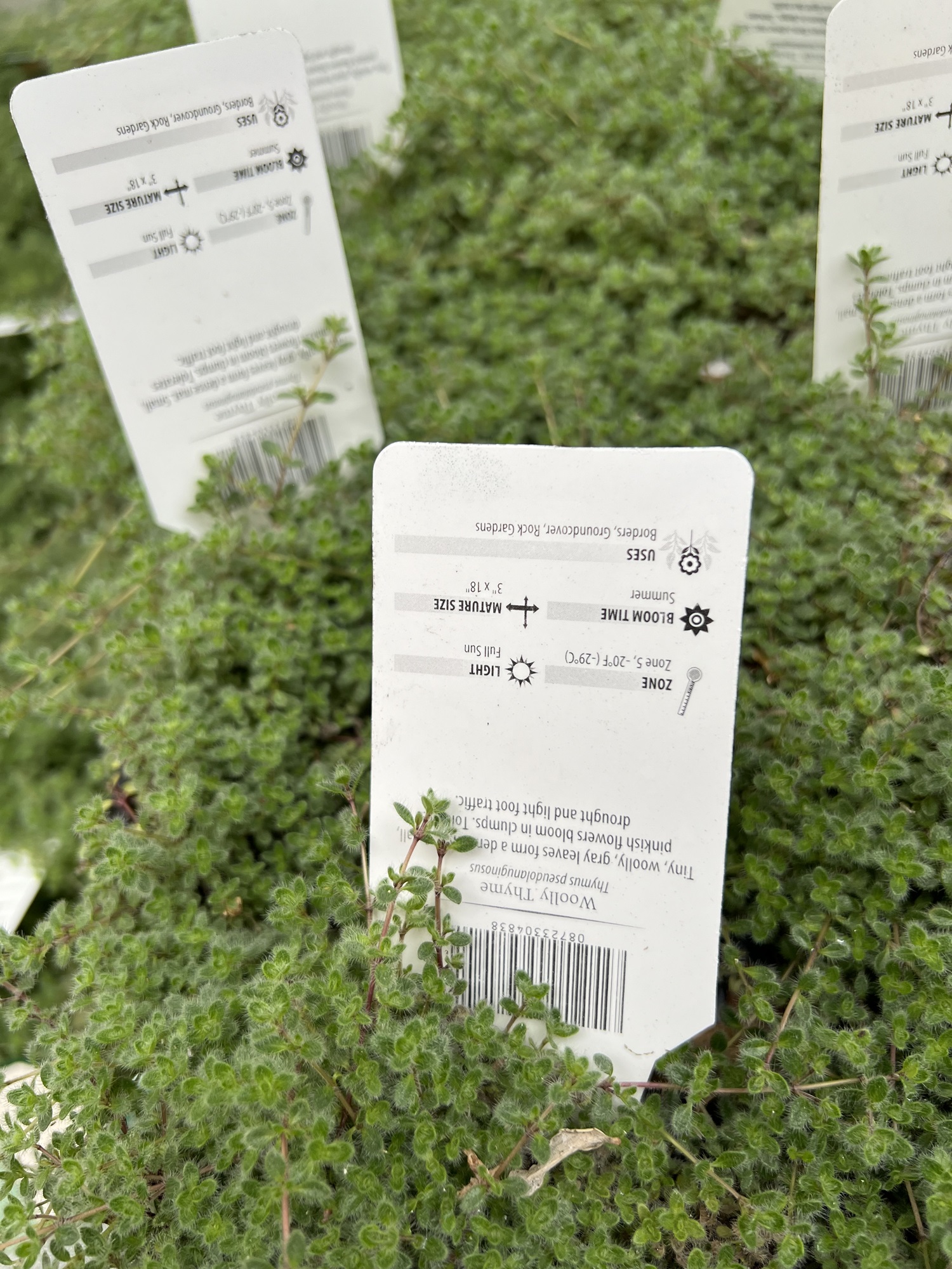
Here’s the first floor of the model townhome, one of 12 built in two blocks of six, at Capitol Hill’s 13th Ave E and E Roy St. Prices range from $900,000 (2 bed, 2 bath, 1,195 sq ft) to $1,285,000 (2 bed, 2 bath, 1,930 sq ft). This building is in a great location but one would have to be able to afford it— and accept features such as the galley kitchen (on the left, at the back of the first floor), and the flights of stairs connecting the three floors. Reflected in the window from across the street is 1910 landmark building The Maryland, a co-op with 20 units. Right next The Maryland it another 5-story building is under construction.The open space between the two buildings will feature lovely. I love this cute woolly thyme ground cover plants. Maybe I’ll get some for my own yard. It looks like I will have to find a spot with ‘full sunlight’, though.
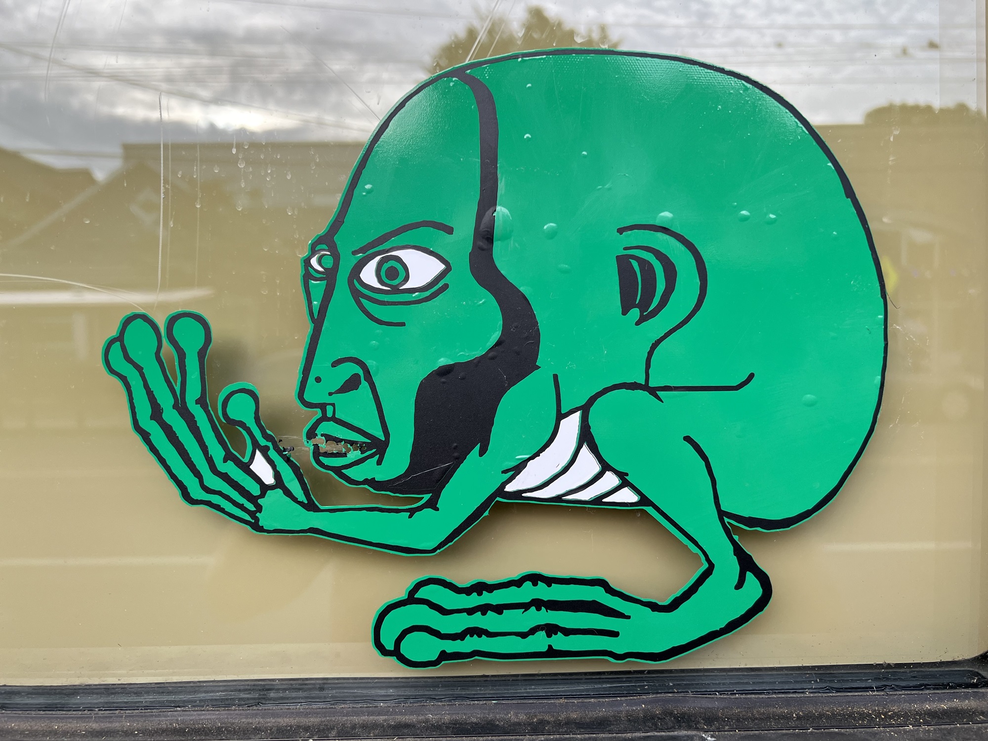
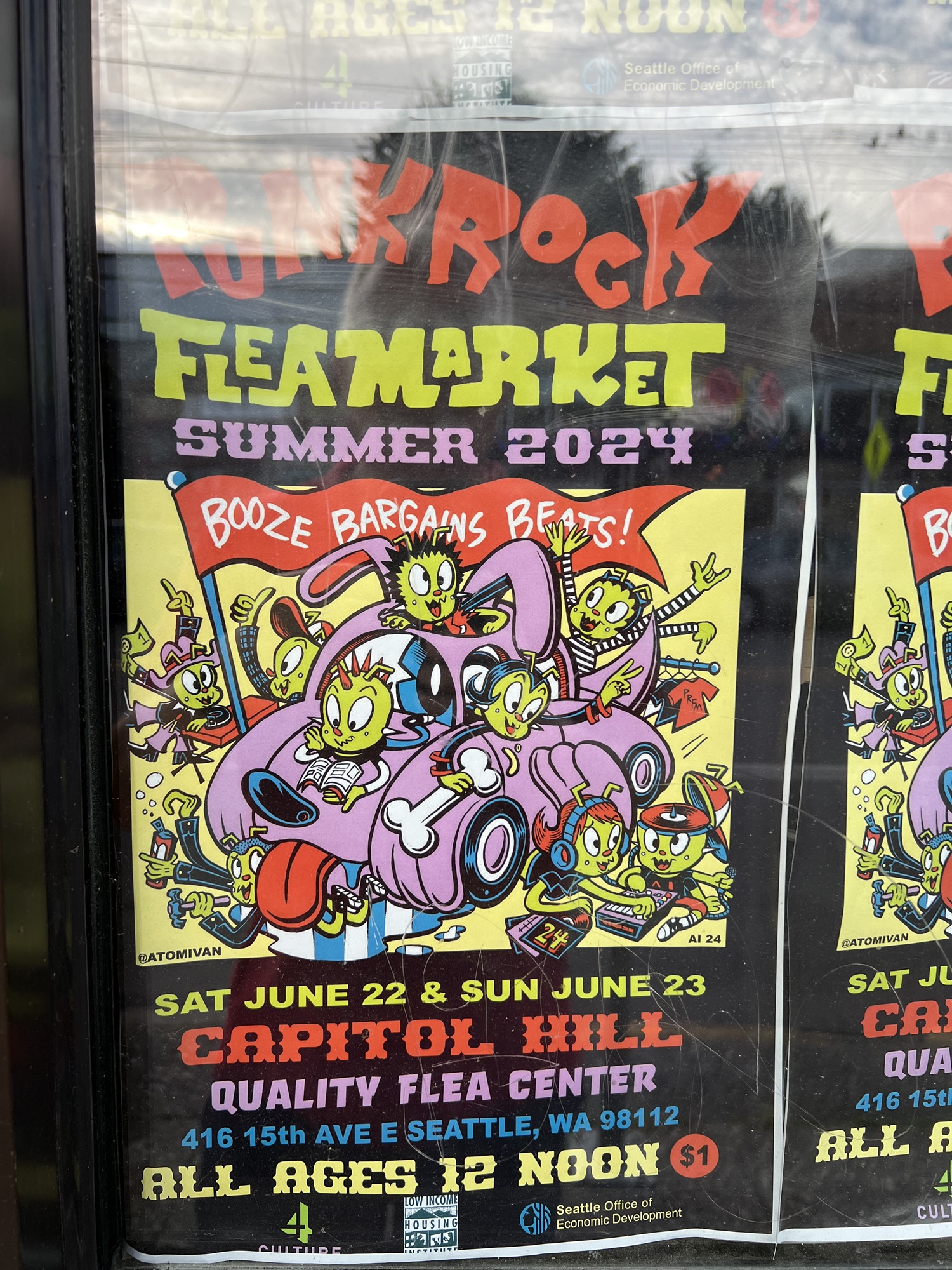
I believe this is a flea, and not an alien! (sticker on the window). ‘Flea market’ is a literal translation of the French “marché aux puces” (an outdoor bazaar in Paris, France), named after those pesky little parasites of the order Siphonaptera that like to infest the upholstery of old furniture and rugs brought out for sale.
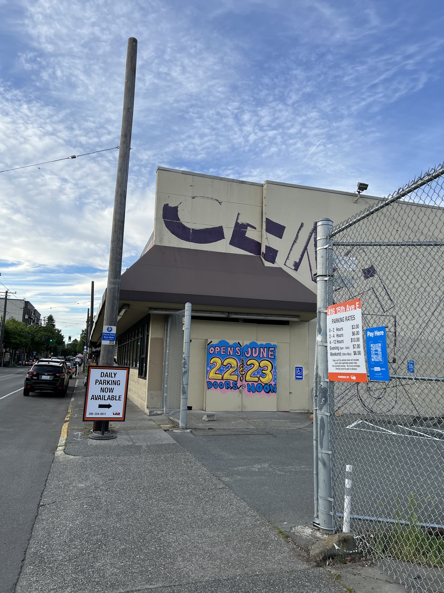
The long-abandoned grocery store building on 15th Ave East here in Capitol Hill will host a flea market the weekend after next.
This building will be demolished in another year or two, three— to make way for a proposed 6-story, 172-unit apartment building with retail stores.
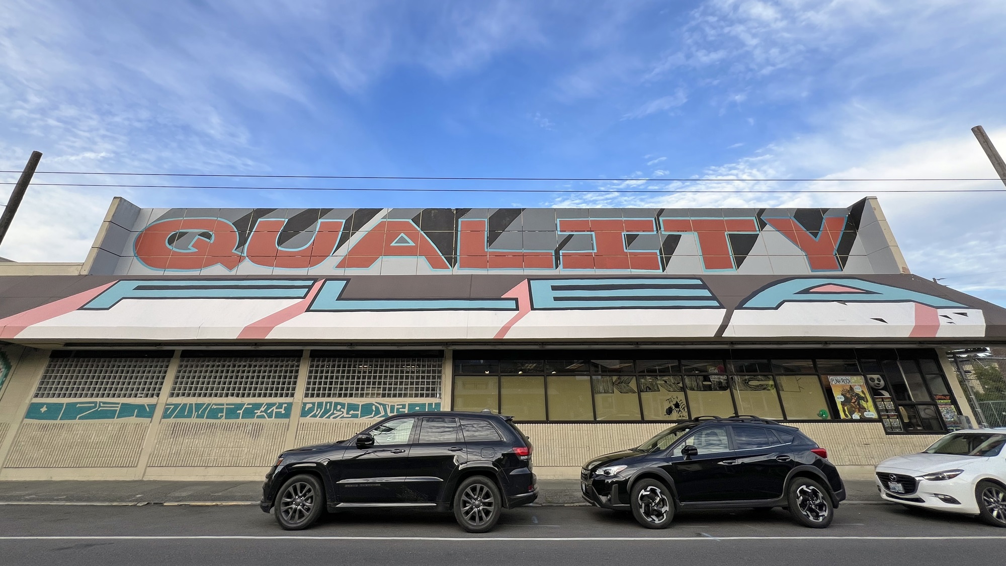
The little parking lot is now open daily, but the flea market will only be open on one Saturday and one Sunday, and I guess that’s it. Maybe the market will be held here again later this summer.‘Quality Flea’ says the storefront wall and canopy.A poster in the window.
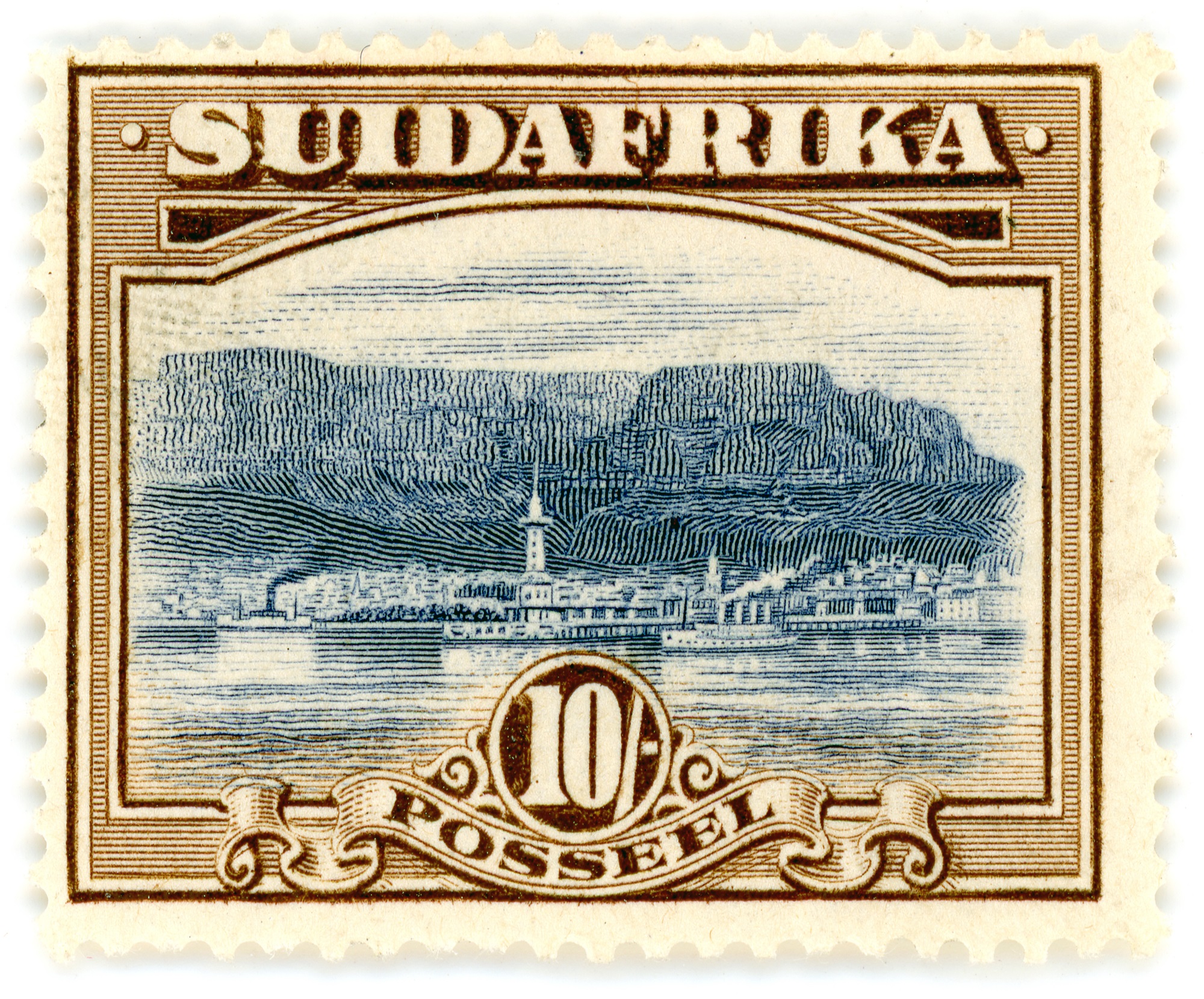
I bought this single stamp from a seller in Canada.
It’s the highest value stamp (10 shillings) in the series known as the 1927-1930 London Pictorials; the last South African stamps printed in London.
(After that stamps were printed in South Africa).
The Afrikaans-English se-tenant (joined) stamp pairs are very expensive (up to $200), but the single ones are $10 or so.
I’m still looking for an English one with ‘SOUTH AFRICA’ inscribed at the top.
From the 1927-1930 London Pictorials Issued 1927, Mar. 1 Perf. 14 | Engraved printing | Wmk. Multiple springbok’s heads 29 16 | 10sh | Bright blue and brown | Cape Town, Table Mountain and Table Bay [Source: 2016 Stanley Gibbons Stamp Catalogue for Commonwealth & British Empire Stamps 1840-1970) My notes: The prominent white tower might be Mouille Point Lighthouse— built in 1842 but demolished in 1908. To its right and further back would be Cape Town City Hall, a large Edwardian building built from honey-colored oolitic limestone imported from Bath in England, and located on the Grand Parade. It was completed in 1905 and is still there today.
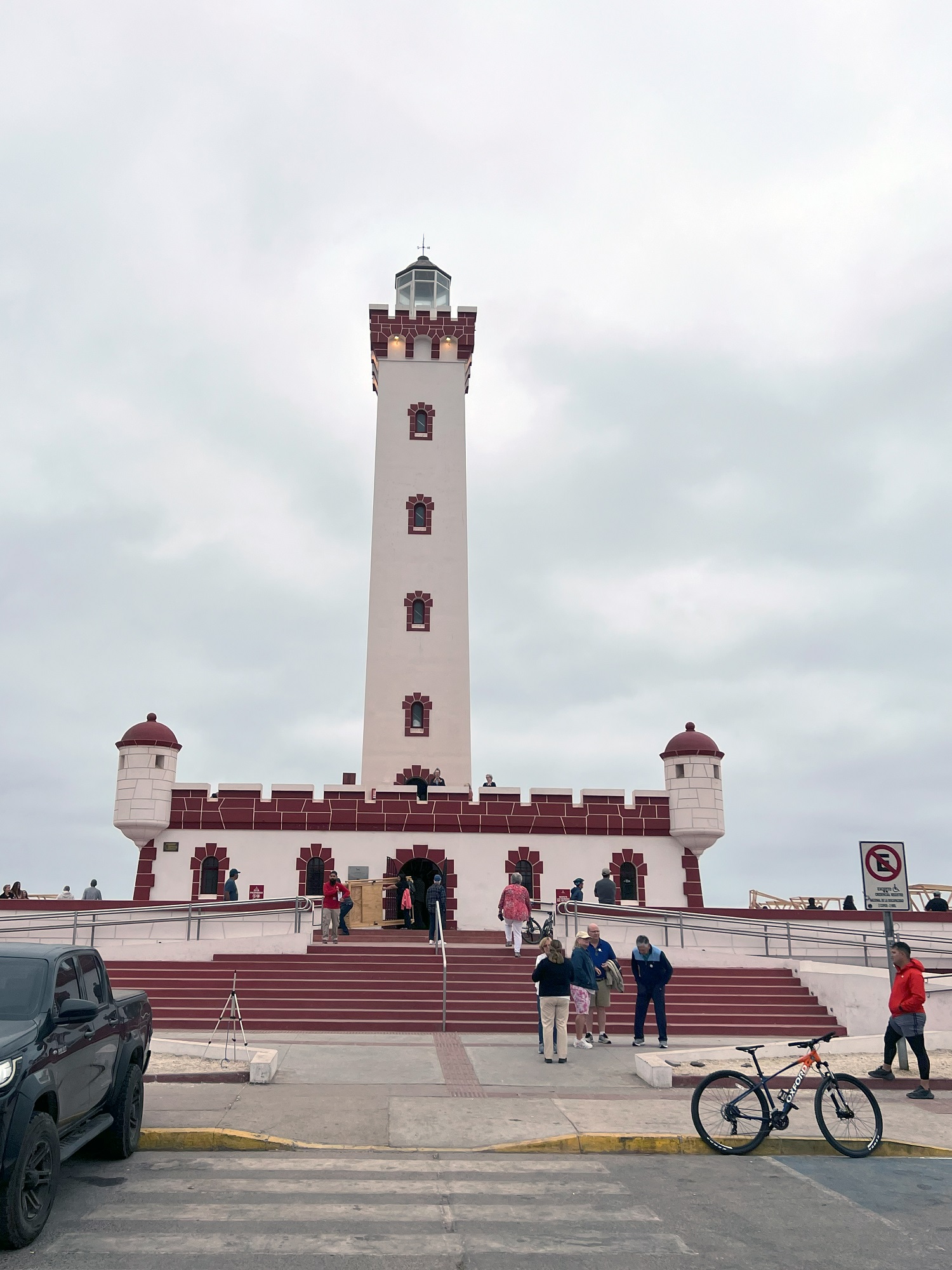
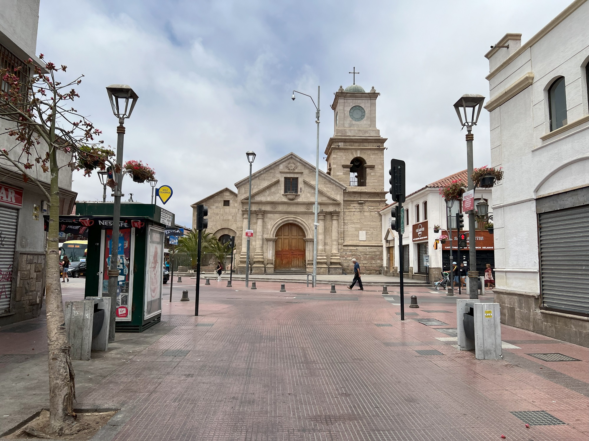
We arrived at the port city of Coquimbo this morning.
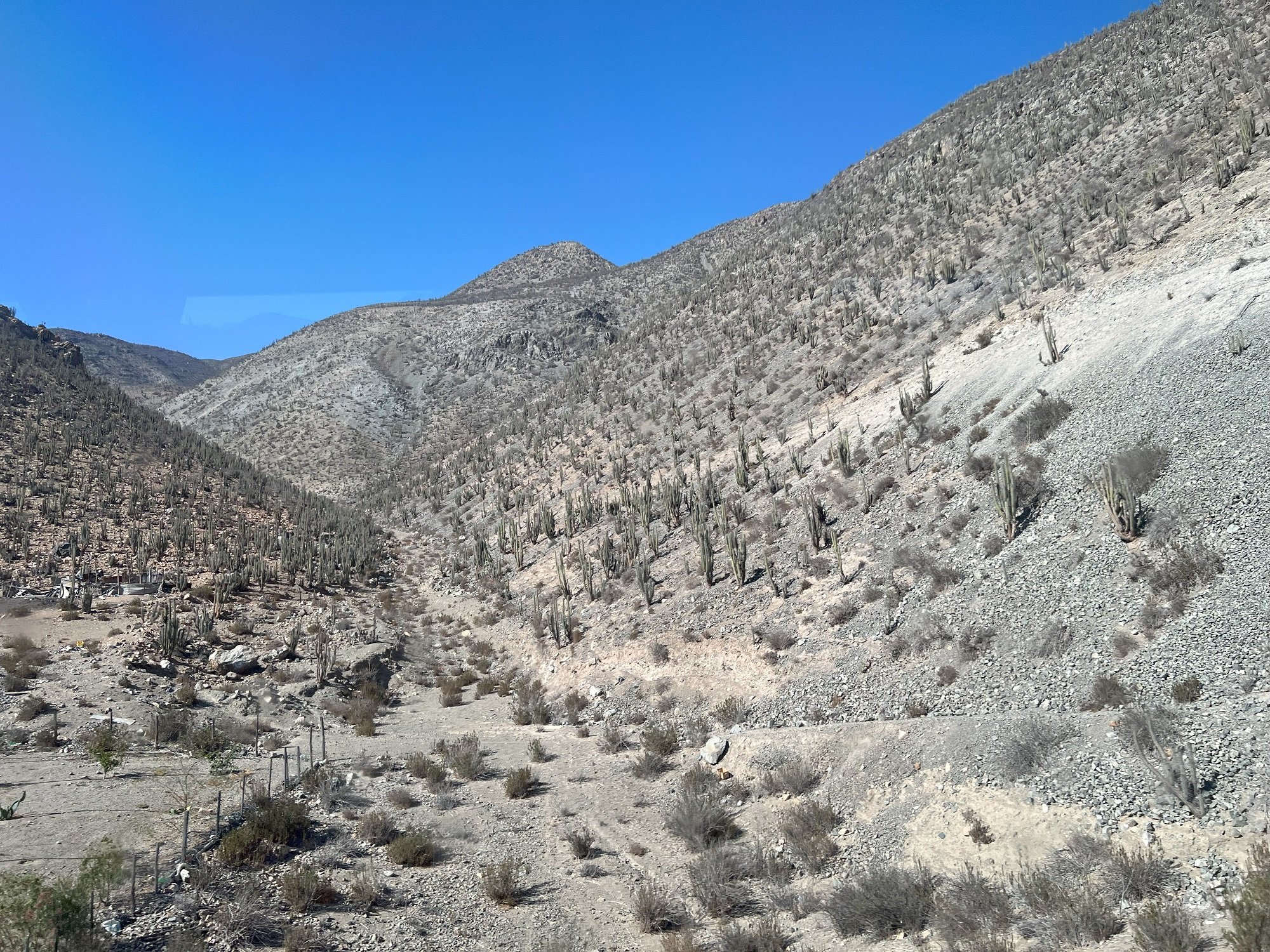
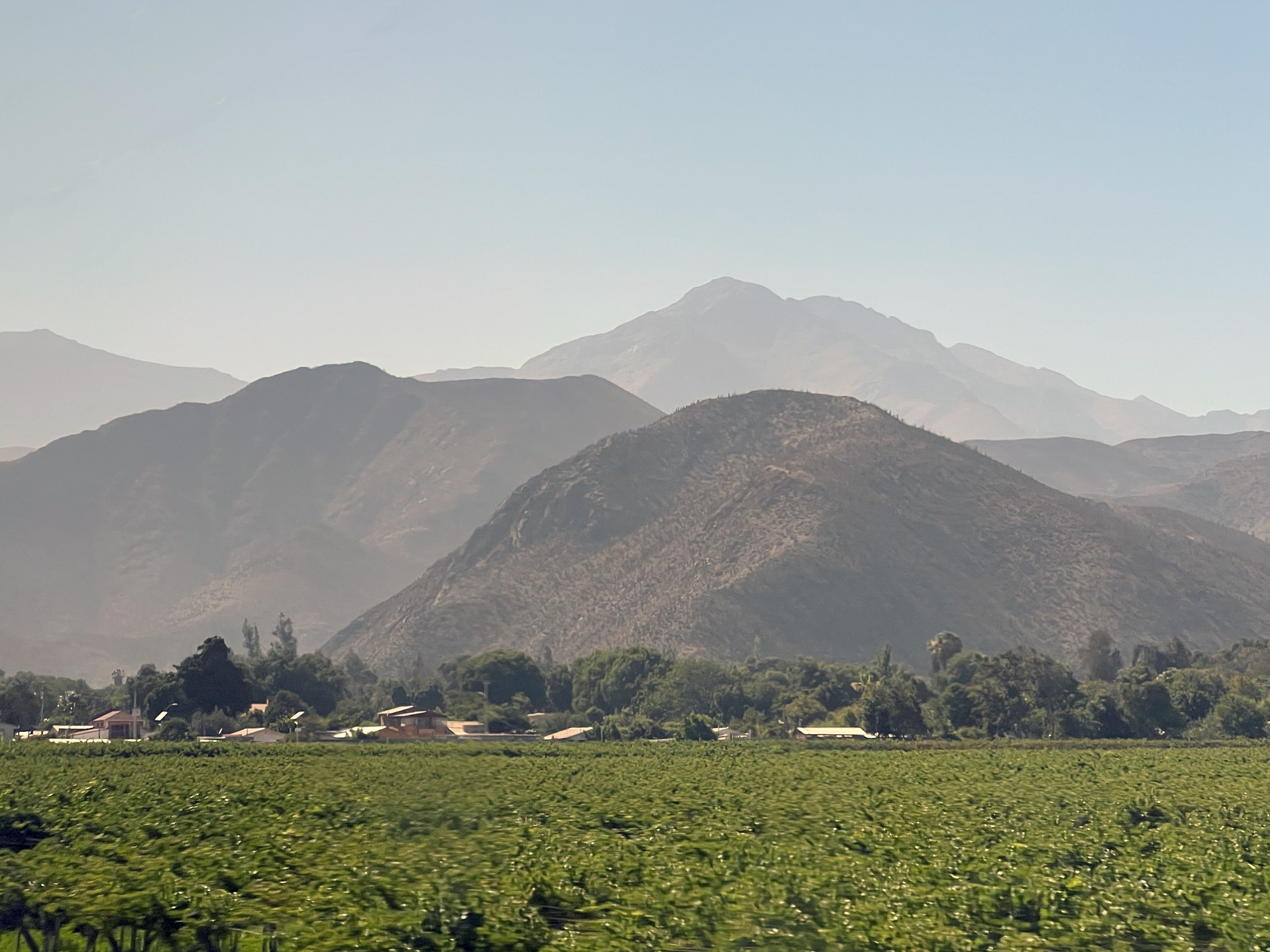
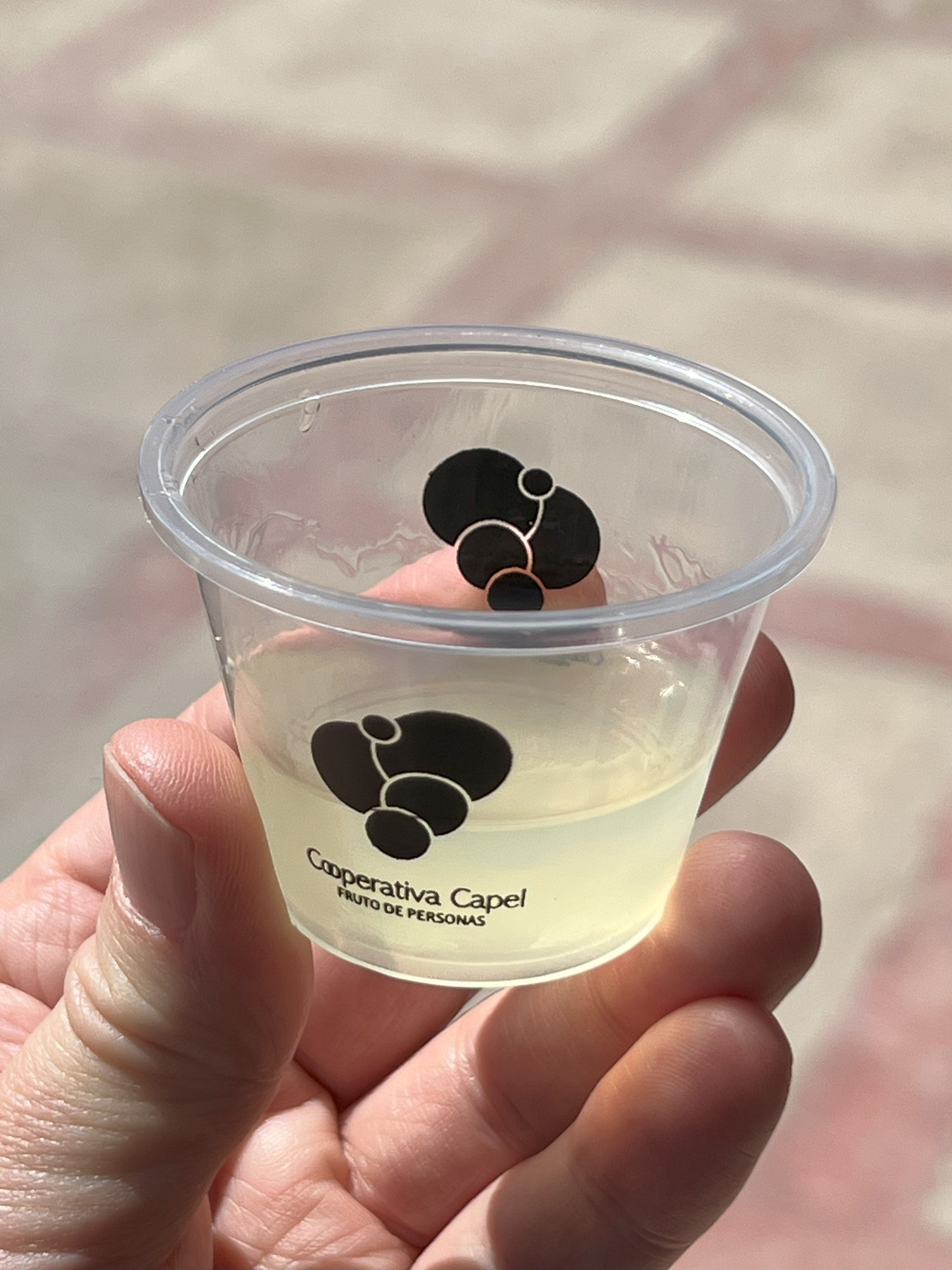
Our excursion today was a bus ride along the shoreline into the neighboring town of La Serena, followed by a drive inland to the commune of Vicuña (pop. 25,000).
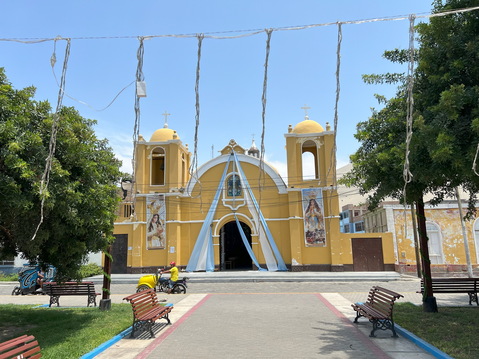
The Monumental Lighthouse of La Serena (Faro Monumental de La Serena) is located on the beach at the Avenida del Mar of La Serena. It was built between 1950 and 1951 at the request of President Gabriel González Videla.The beautiful, parched landscape and cactuses, as seen from our bus on Route 41 on the way to Vicuña.Lush green vineyards in the Elqui Valley.We stopped by a pisco distillery on the way to Vicuña . Here is my sample of pisco sour, made from distilled muscatel grapes and lemon juice. Pisco is the national drink of Peru, but a version of it is made in Chile as well.Here is the municipal theater house in Vicuña.We were one of four buses full of cruise ship tourists had lunch at this restaurant. We had an empanada appetizer, followed by a large steak with rice and tomato salad, and papaya for dessert. Oh, and they served pisco and original Coca-Cola for drinks.Back in Coquimbo, for our final stop at a little tourist market next to this church.
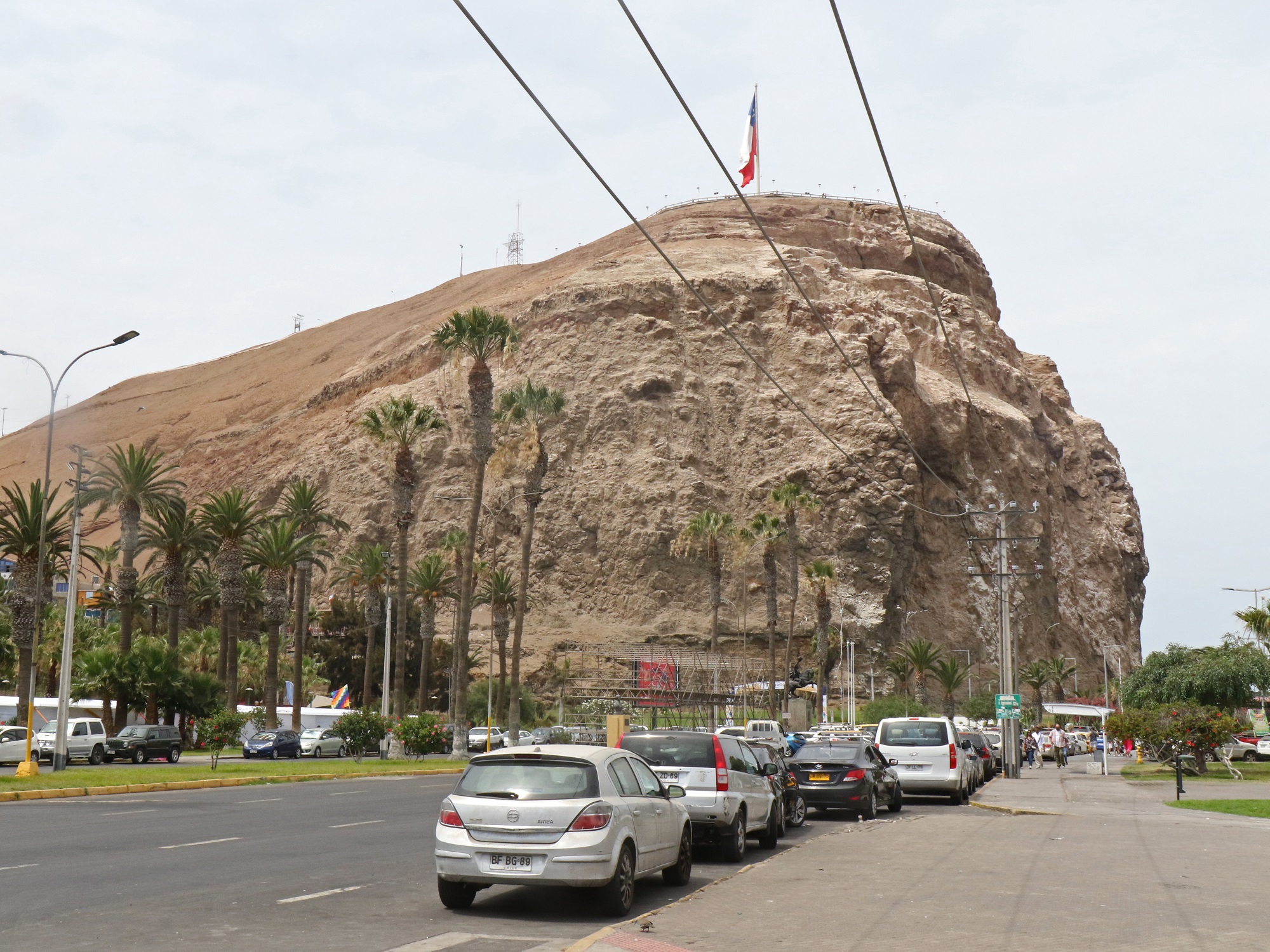
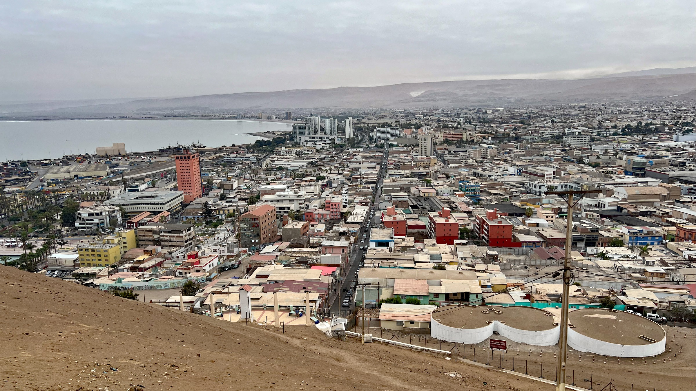
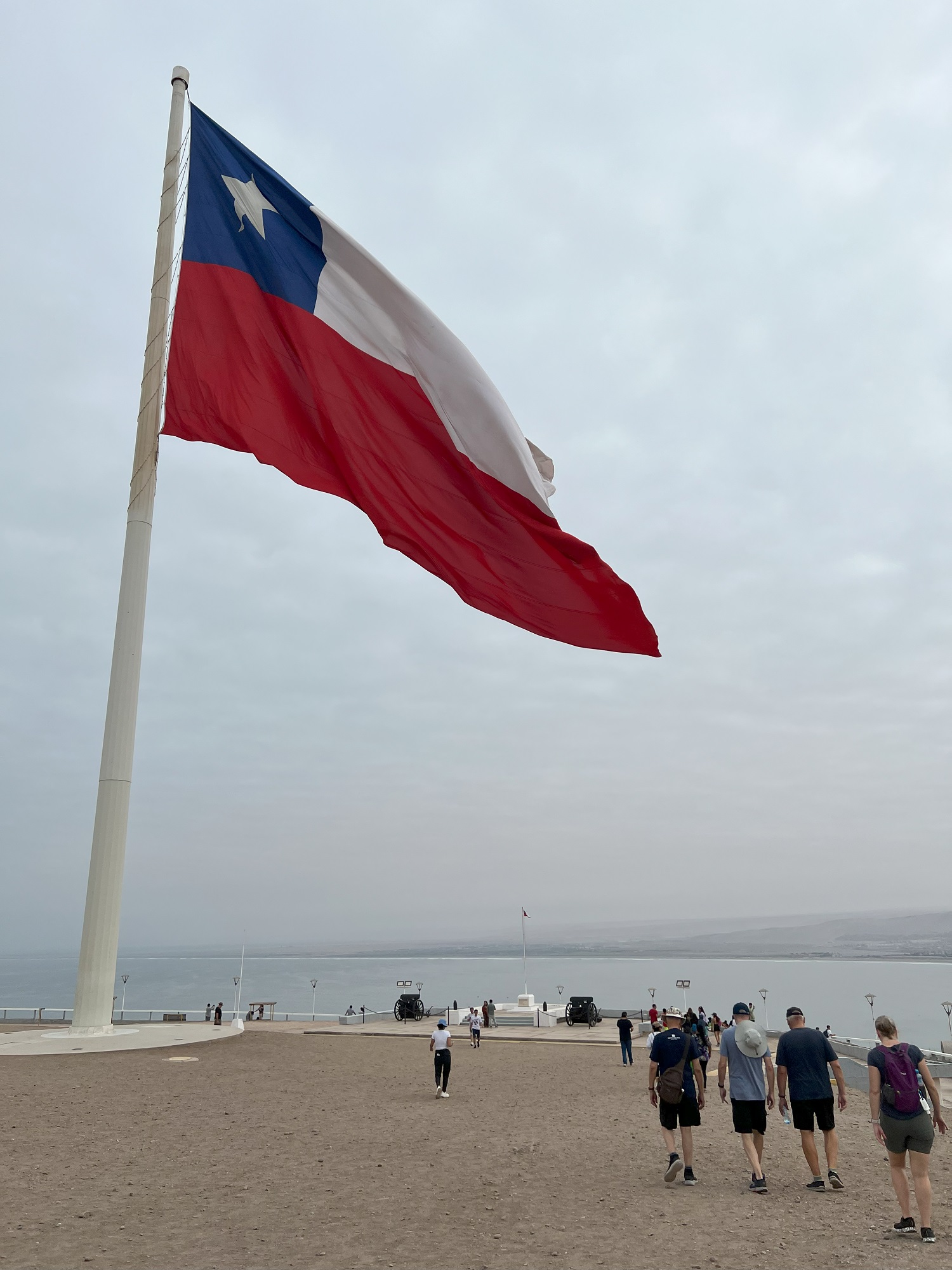
Our self-directed excursion into Arica this morning took us up the steep path to the top of the hill called Morro Arrica.
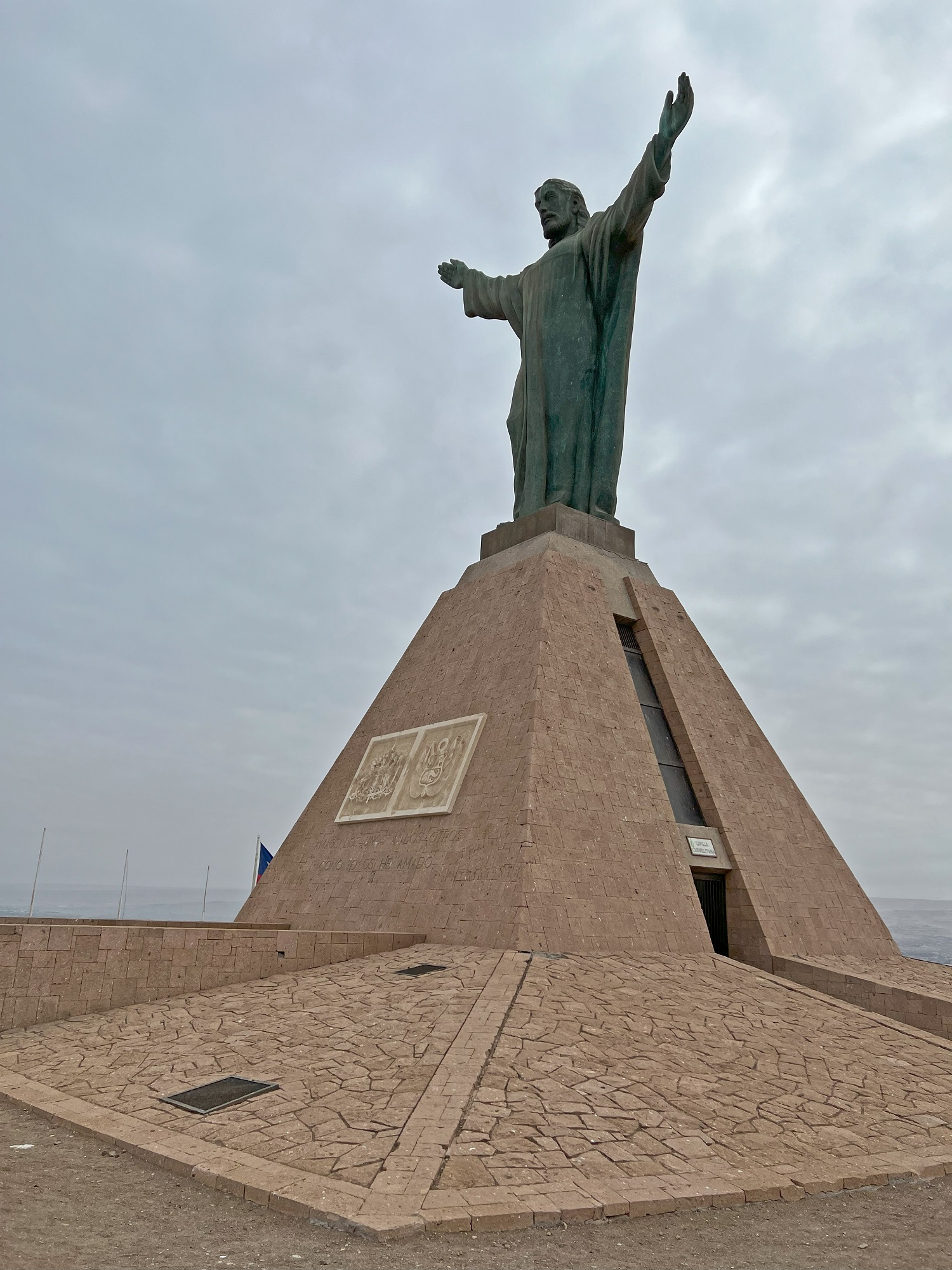
At the top there is an enormous Chilean flag, a museum and a statue called Christ of the Peace (a reference to the Treaty of Lima in 1929 that settled lingering territorial disputes between Peru and Chile).
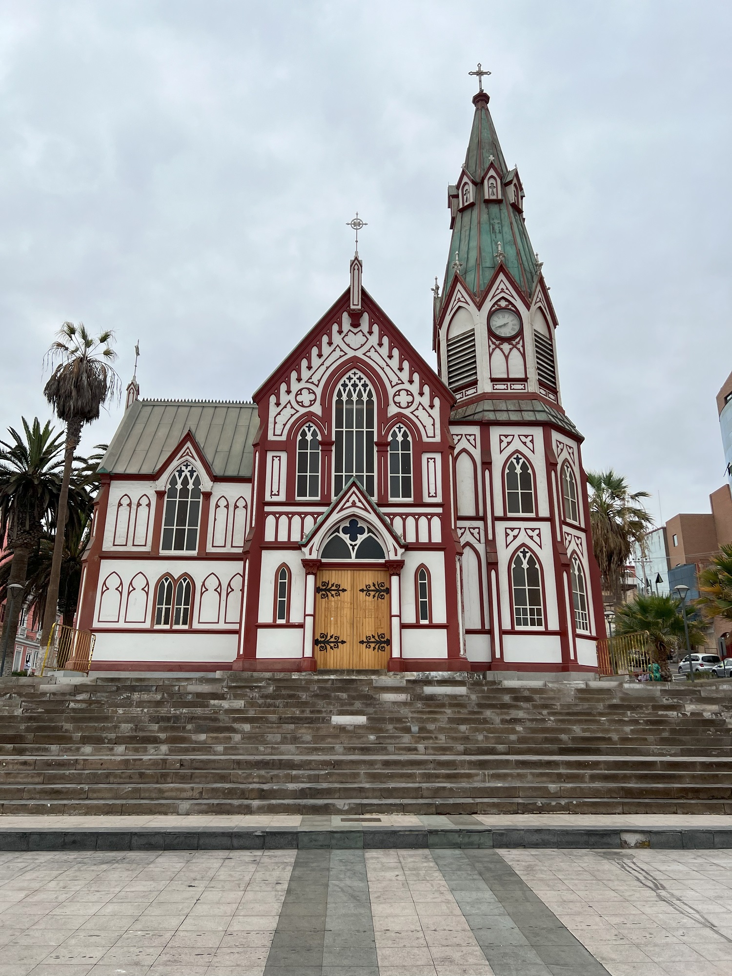
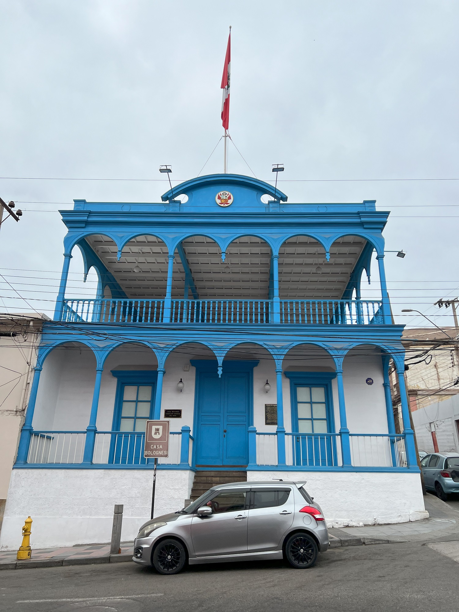
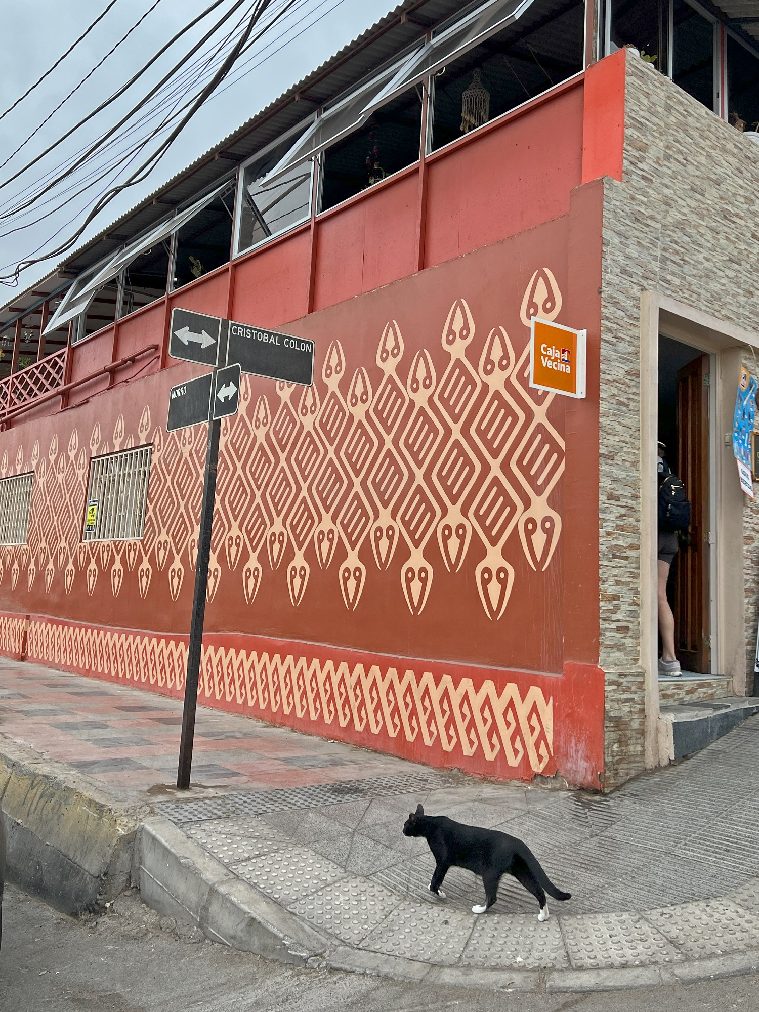
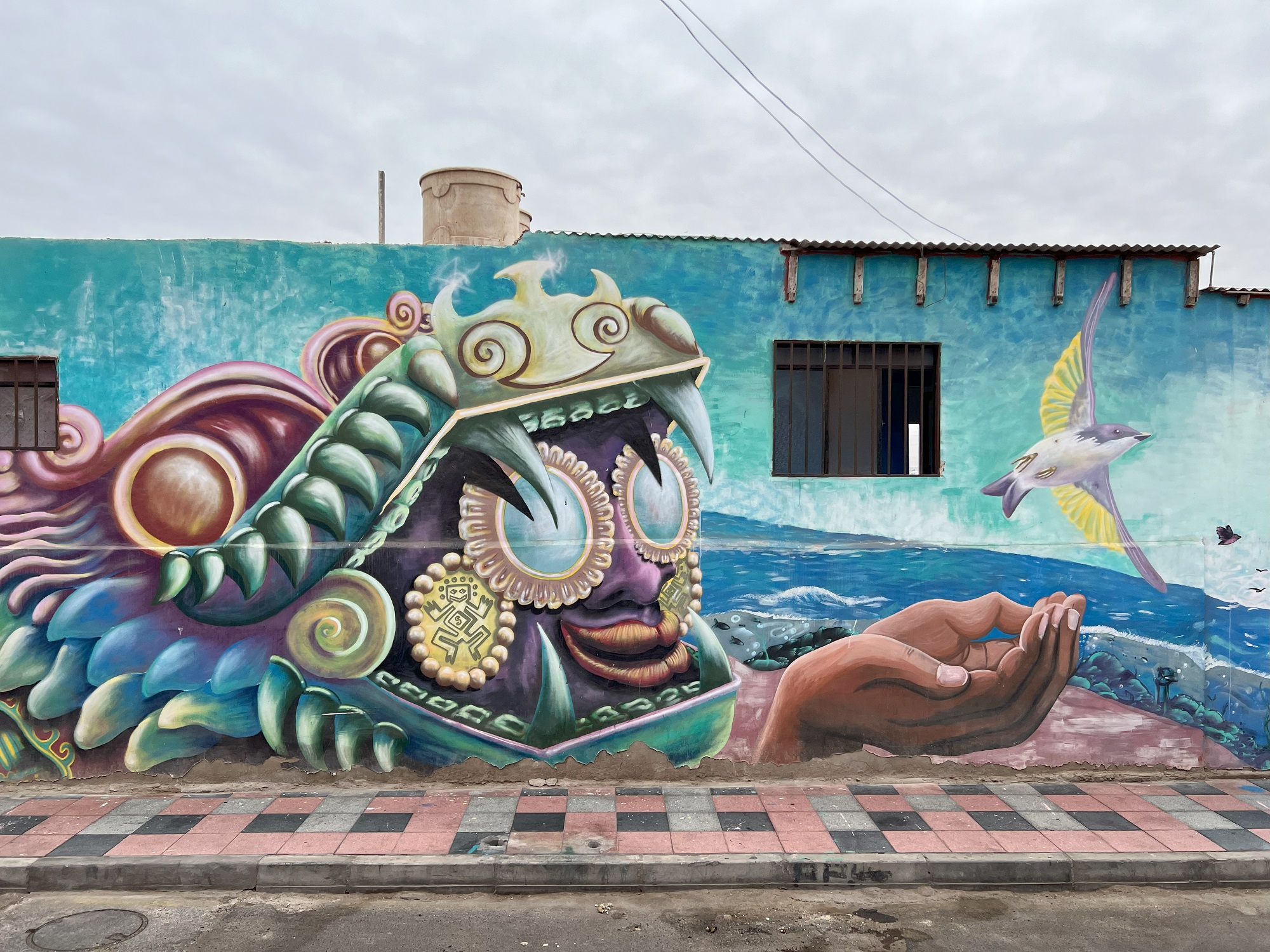
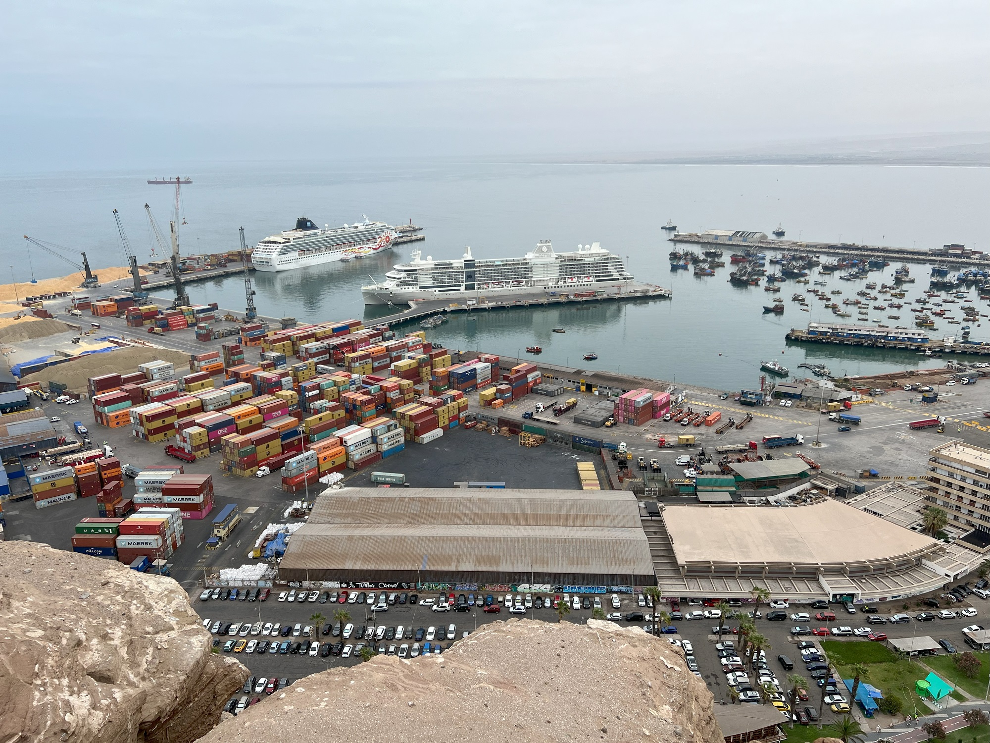
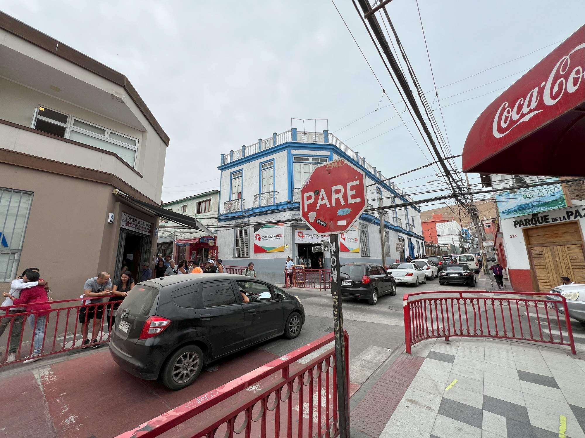
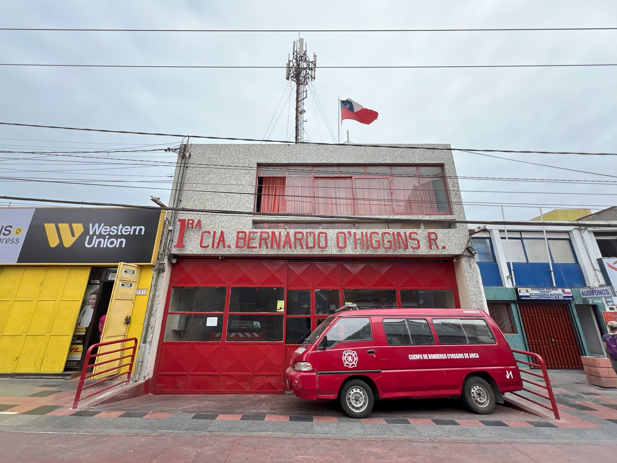
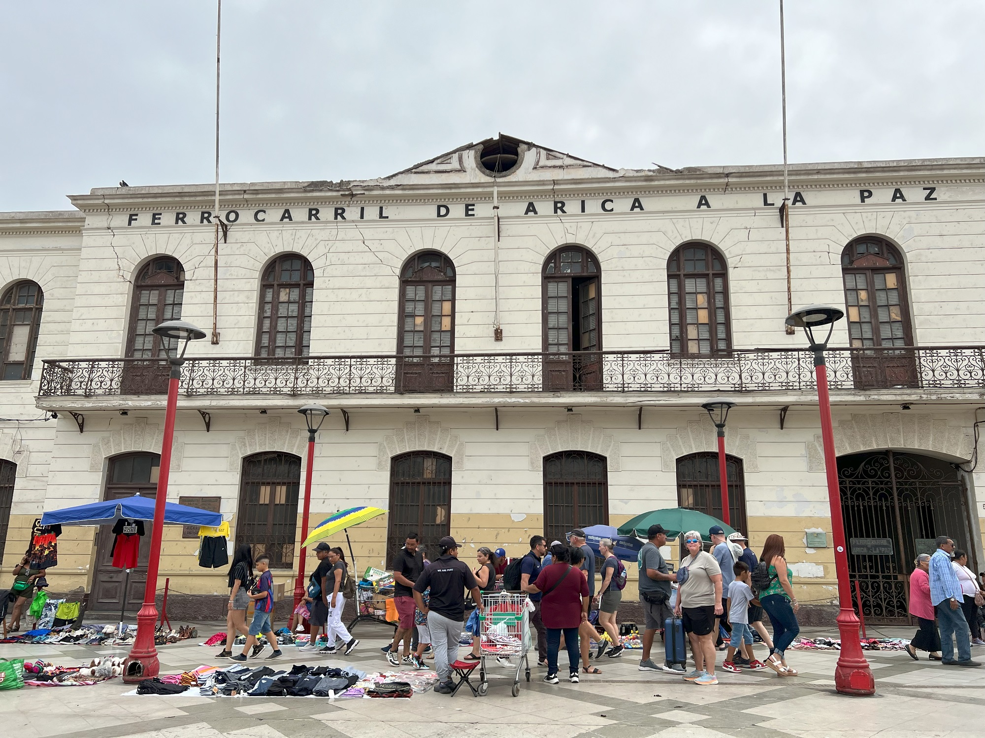
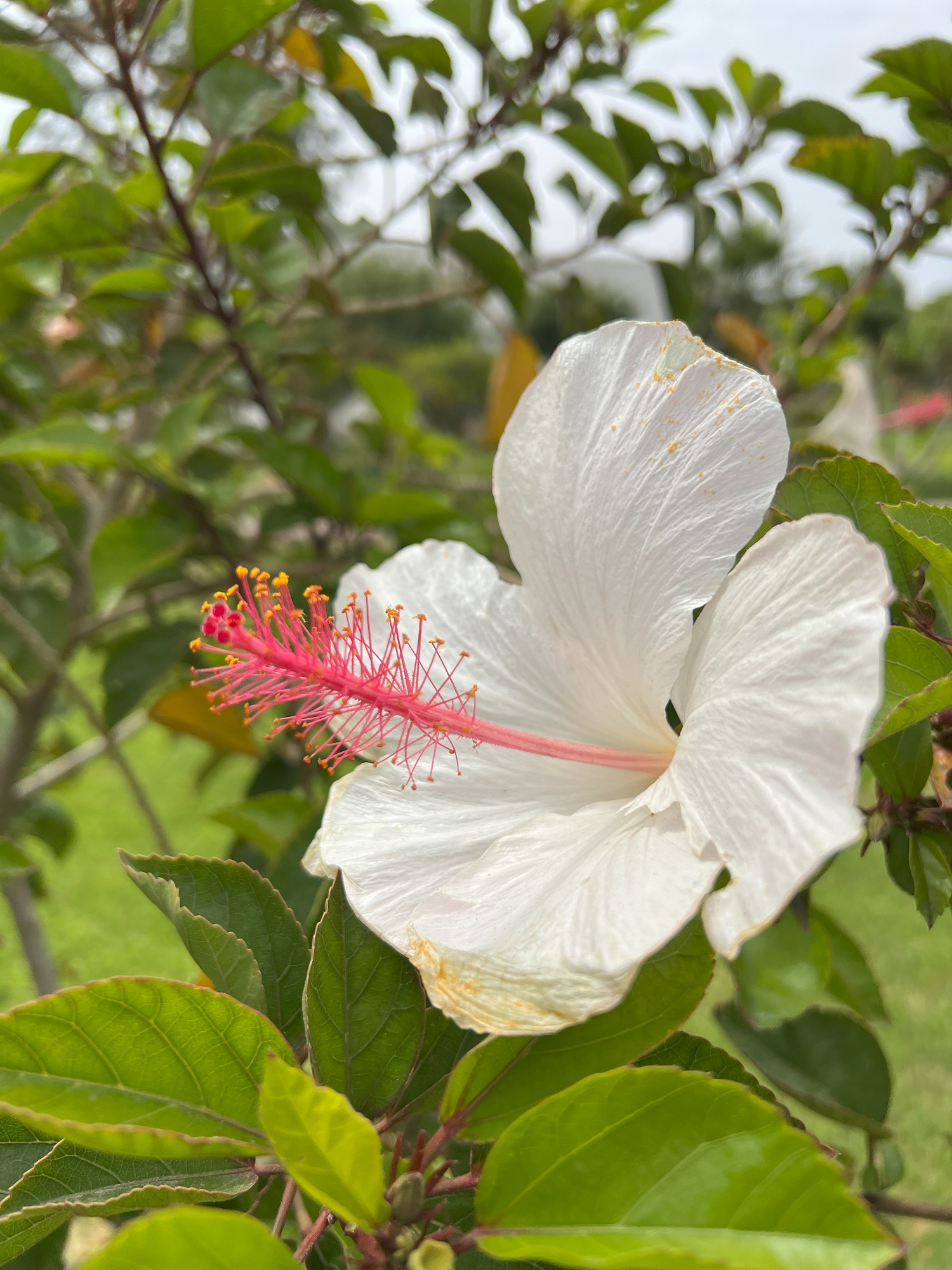
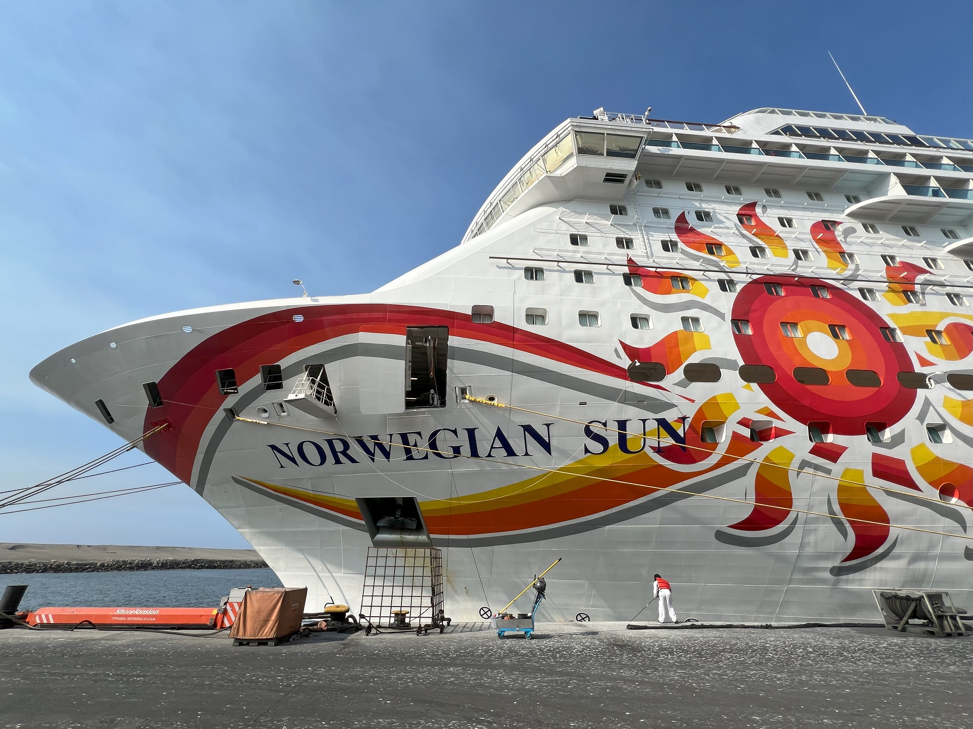
Morro de Arica is 139 m (459 ft) above sea level. It was the last bulwark of defense for the Peruvian troops who garrisoned the city during the War of the Pacific (1879–1883). Morro de Arica was assaulted and captured on June 7, 1880, by Chilean troops in the last part of the Tacna and Arica campaign.The Gothic San Marcos Cathedral dates from 1876 was designed by none other than the French architect Gustave Eiffel.We are now making our way up to the staircase that run op Morro de Arica. This is the consulate for Peru in Arica.Mural art at the corner of Cristobal Colon and Morro Street.More eye-catching mural art nearby.A view of the city from halfway up the staircase to the top of Morro de Arica.There is a giant Chilean flag at the top of Morro de Arica.Looking down at the cruise terminal with Norwegian Sun, Silver Nova and an assortment of fishing boats, presumably.Cristo de la Paz Statue at the top of Morro de Arica. Long after the War of the Pacific ended in 1883, the lingering territorial disputes between Peru and Chile were finally settled by the Treaty of Lima in 1929. In this Tacna-Arica compromise, the city of Arica officially became the northernmost point of Chile. As part of this sign of peace, the Cristo de la Paz statue was designed by Raul Valdivieso in 1987 and then erected in 1999 on Morro de Arica, the scene of the crushing Peruvian defeat in 1880. Also called the Cristo de la Concordia, this steel and bronze statue stands 36 feet on a concrete pedestal. The outstretched hands of Christ measure 33 ft across. [From encirclephotos.com]Downtown Arica.A compact fire station in downtown Arica.The administrative building of the Ferrocarril De Arica a La Paz railway was declared a national monument in 1990. There is a flea market of sorts on the promenade that runs in front of it.We found this white hibiscus in a park in downtown Arica.As we returned to the ship, there was live entertainment from a band and dancers— decked out in festive traditional Chilean costumes.
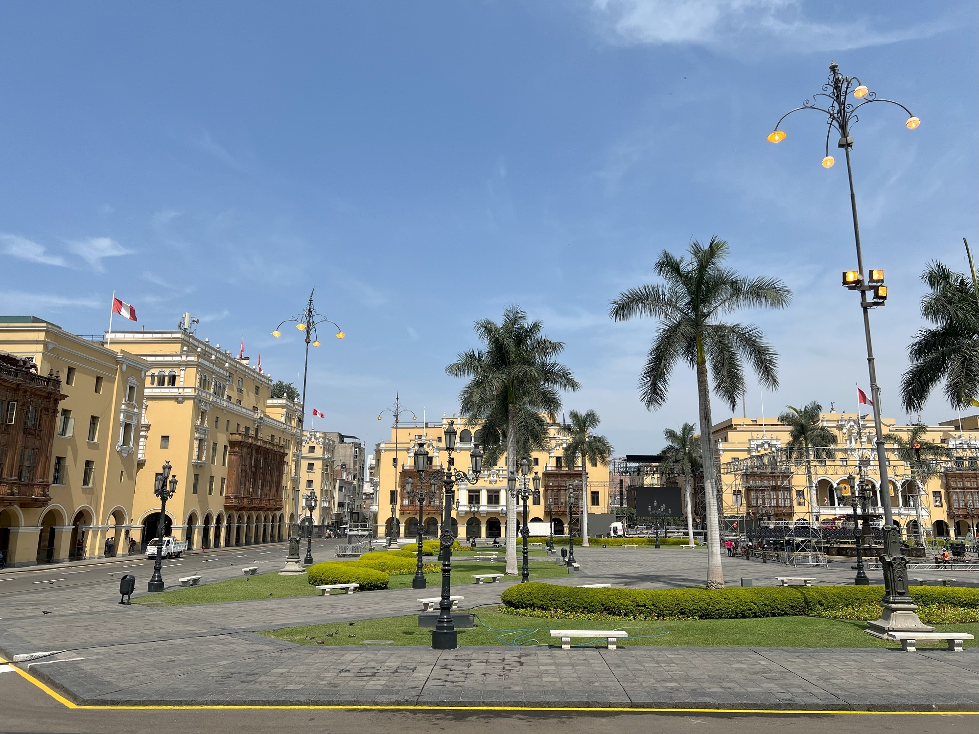
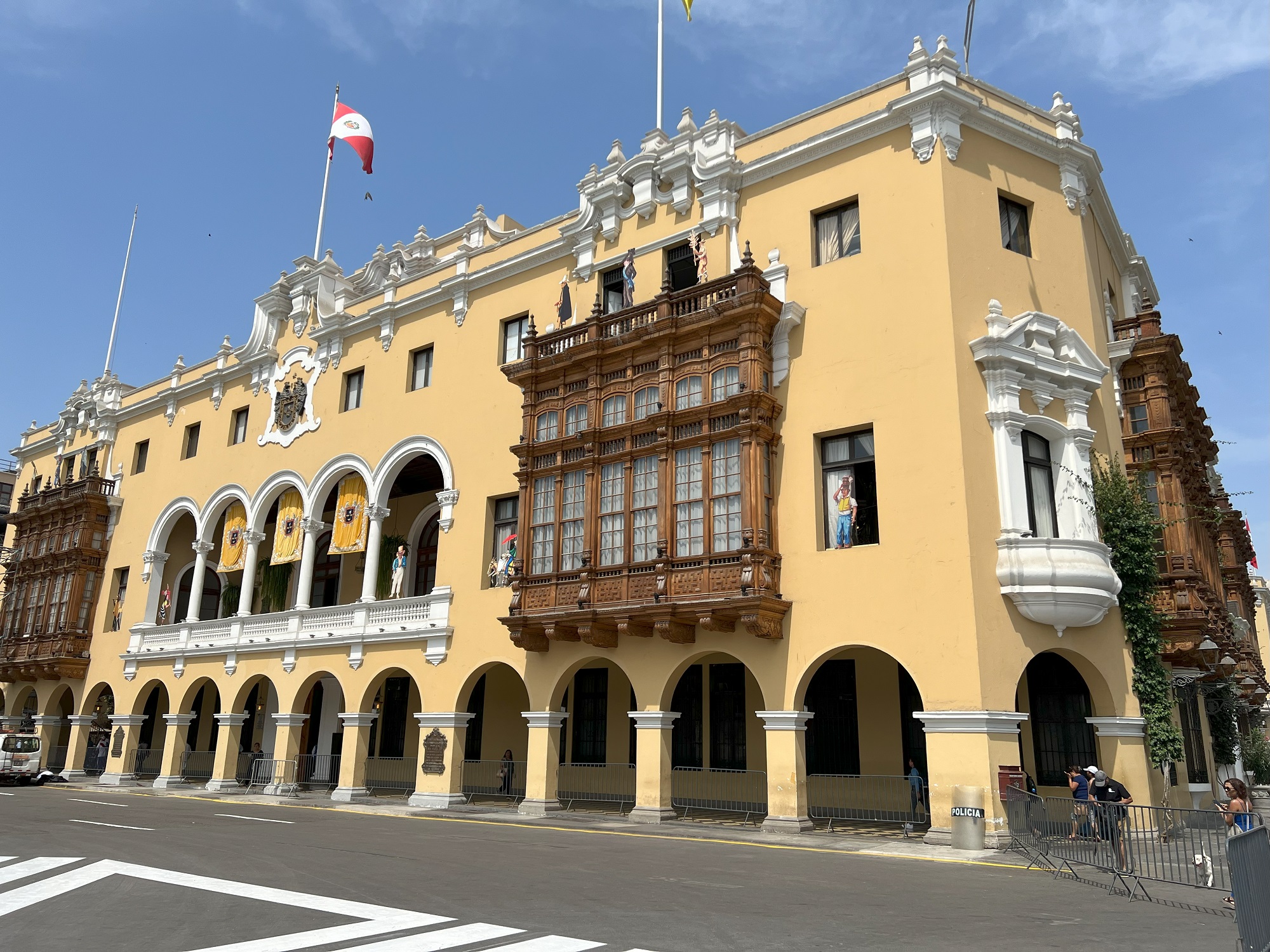
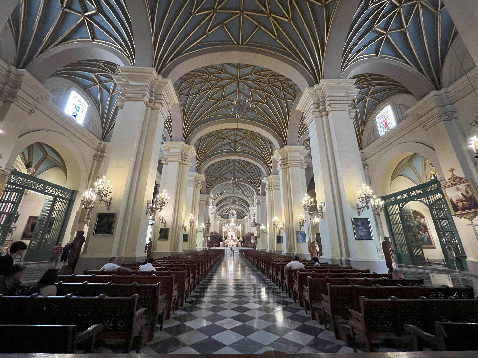
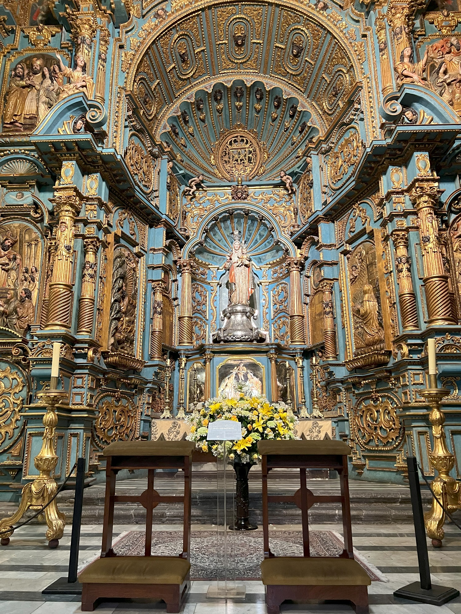
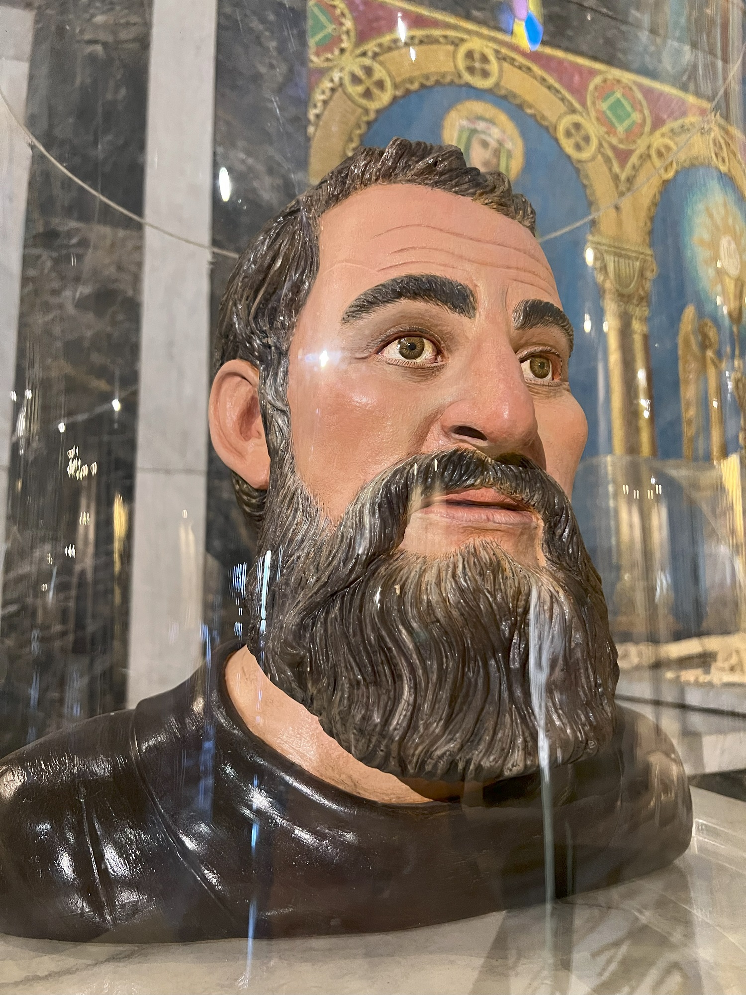
Today’s excursion into Lima took us to Lima Main Square (Plaza de Armas) with the Lima Cathedral just adjacent to it.
We also stopped by the Basilica and Convent of Santo Domingo.
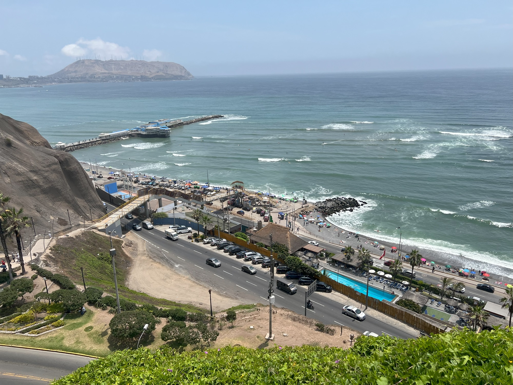
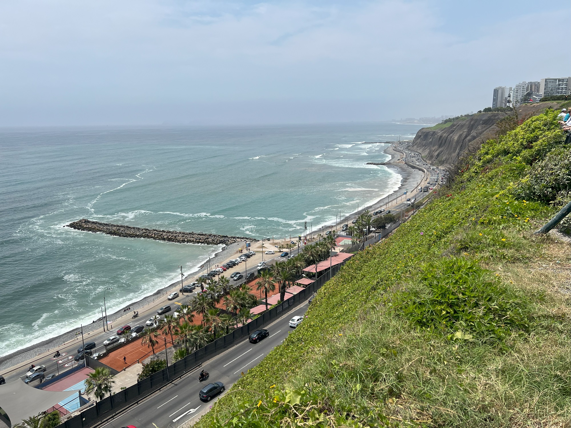
On the way back to Callao and the cruise terminal, we stopped at the Parque Domodossola in Miraflores for a look at the Pacific Ocean and the playas (beaches) below.
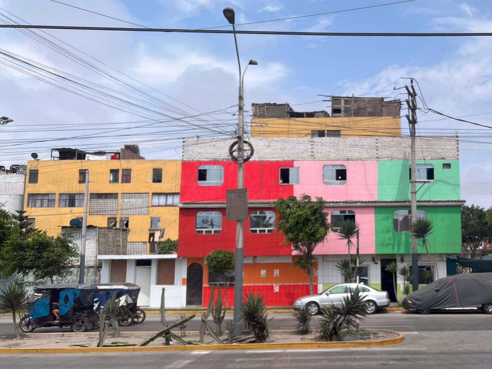
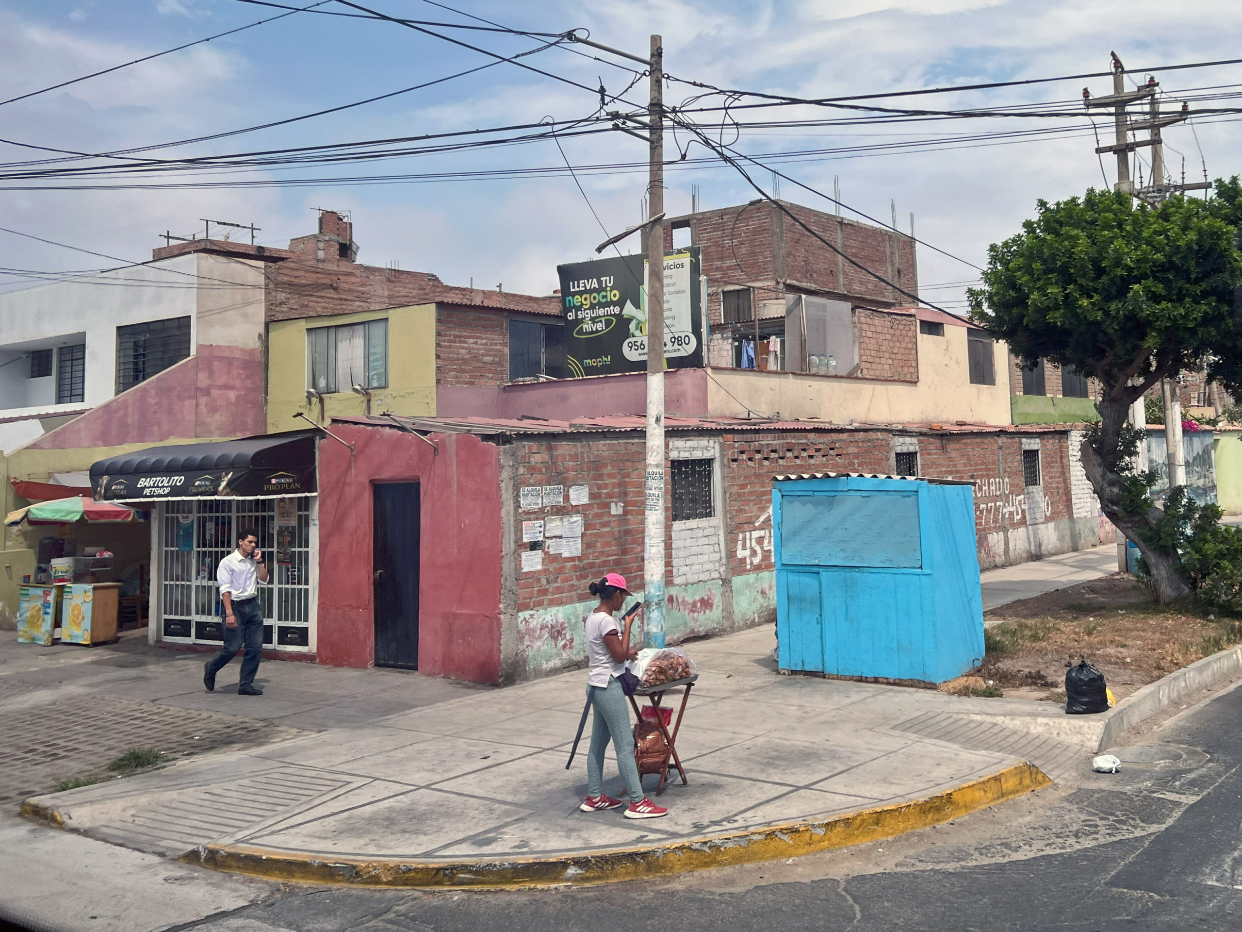
Colorful housing in Callao. We again drove through Callao (where the cruise terminal is) to get to central Lima.There are lots of street vendors to be seen in Callao, but also on the city streets in Lima.Lima Main Square (Plaza de Armas). Unfortunately we could not really walk around the square since preparations are underway for a major celebration.The Municipal Palace of Lima building that borders the square. The ornate wooden window frame is made from wood from Central America.Inside Lima Cathedral that also borders the main square. It is a Roman Catholic cathedral. This third and current Cathedral of Lima was built between 1602 and 1797.Several very ornate and Baroque-style altars are found in coves inside the church. This is of Mary Magdalene holding a golden rose.The bones of Francisco Pizarro are interred in the Lima Cathedral. Pizarro, Marquess of the Atabillos, was a Spanish conquistador, best known for his expeditions that led to the Spanish conquest of the Inca Empire. Born in Trujillo, Spain to a poor family, Pizarro chose to pursue fortune and adventure in the New World. He was assassinated in 1541 by Spanish soldiers. [Wikipedia]This is a beautiful and historic private house a stone’s throw away from the square that we toured. I did not write down the name of the family that owns it.Inside the Basilica and Convent of Santo Domingo.Looking towards the south from Parque Domodossola .. .. and looking north.Another viewpoint from the park, showing the cliffs along the shore. Peru lies outside the infamous ‘Ring of Fire’ series of fault lines, and do get earthquakes and tsunamis from time to time.
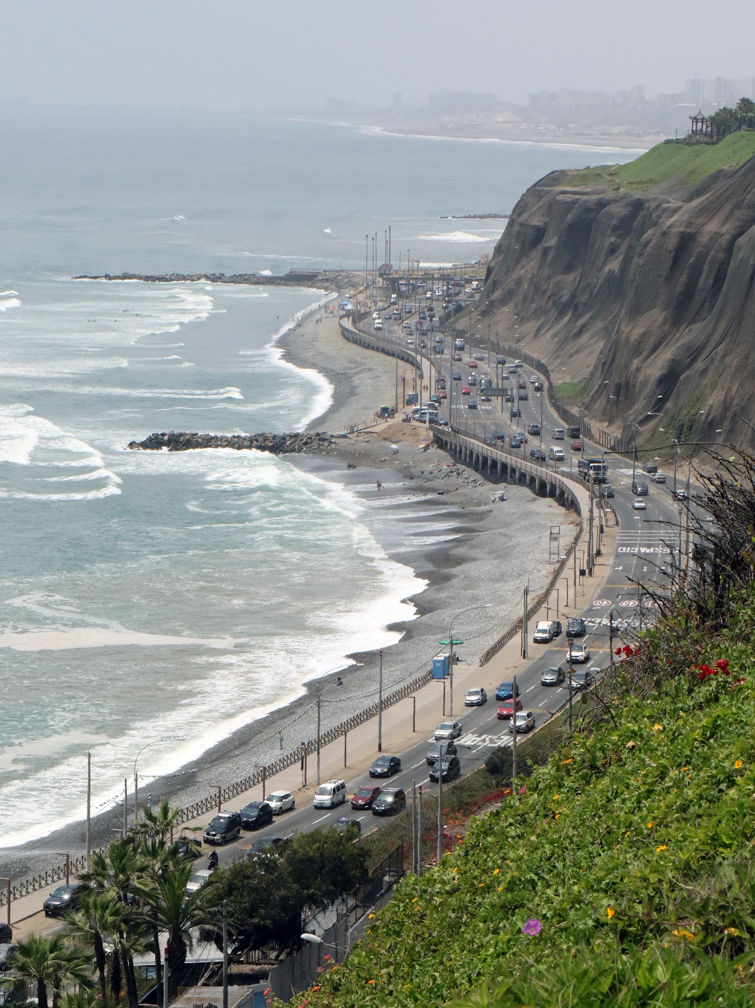
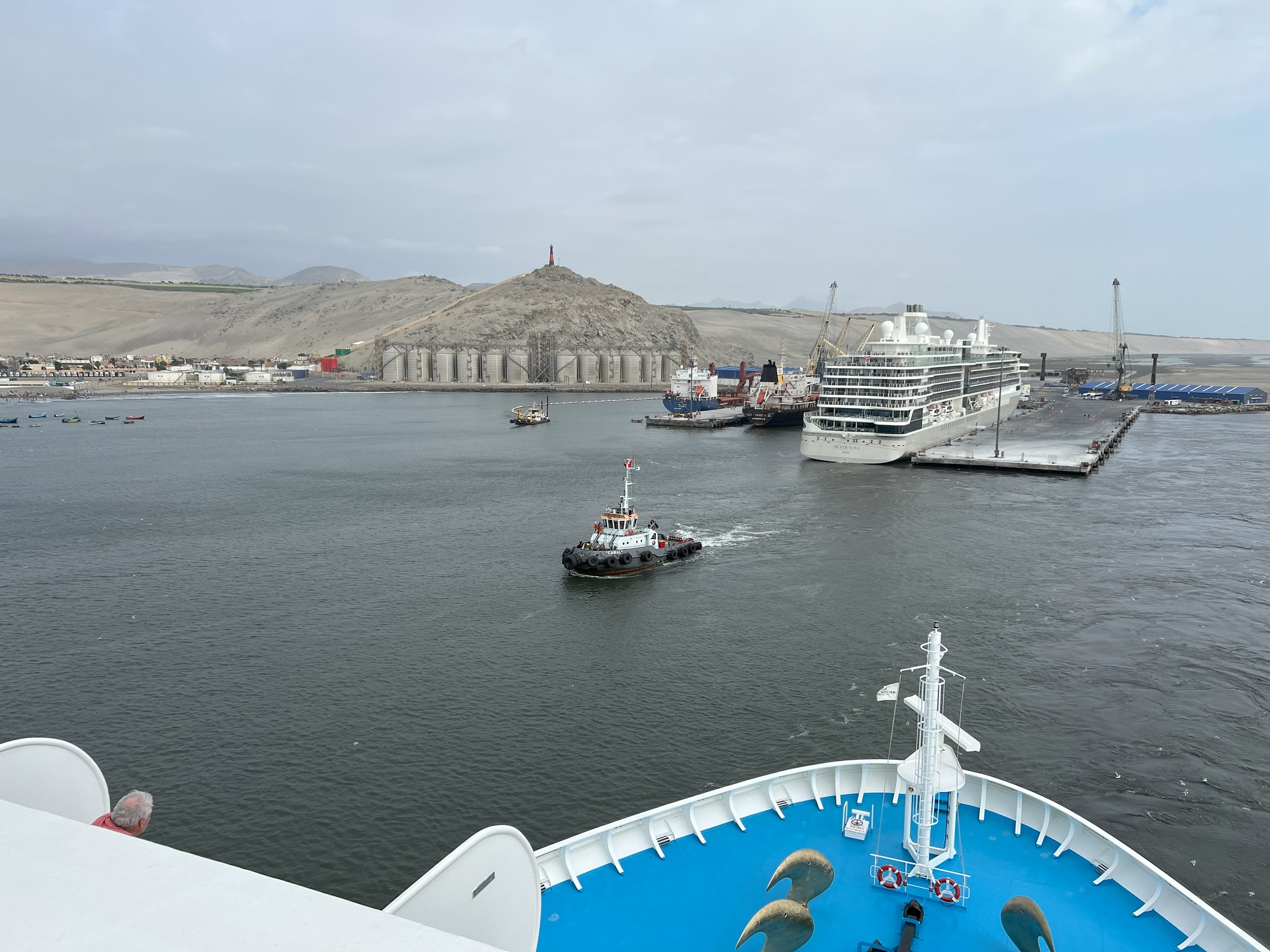
The Norwegian Sun made it into the port town of Salaverry at seven this morning (first picture).
There was a shuttle bus out to the main plaza in Salaverry (third picture), and from there my party of three were left to our own devices to find transport to the city of Trujillo (pop. about 1 million).
This whole area nearby is the site of the great prehistoric Moche and Chimu cultures before the Inca conquest and subsequent expansion.
We solicited a taxi for the 25-minute drive into Trujillo and all went well until we paid the driver in US dollars. Best we could tell that he was not happy with the quality of the $20 and two $5 dollar bills. The US dollars have to be changed into Peruvian Sol by moneychangers for him. Anyway, we gave him the newest dollar bills we had, and that solved the problem.
We used Uber to get back. That was cheaper and worked a lot better: no exchange of paper money needed.
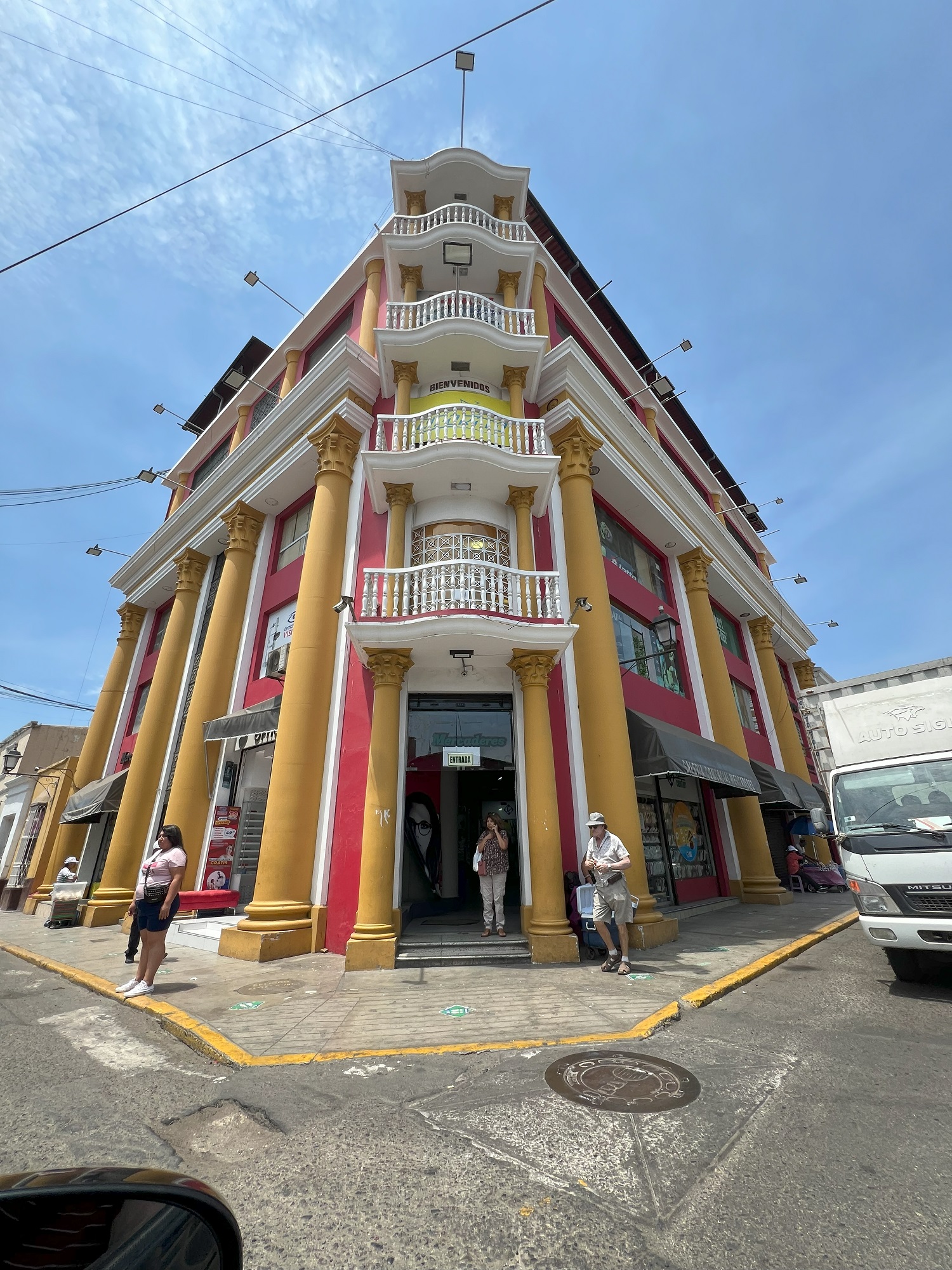
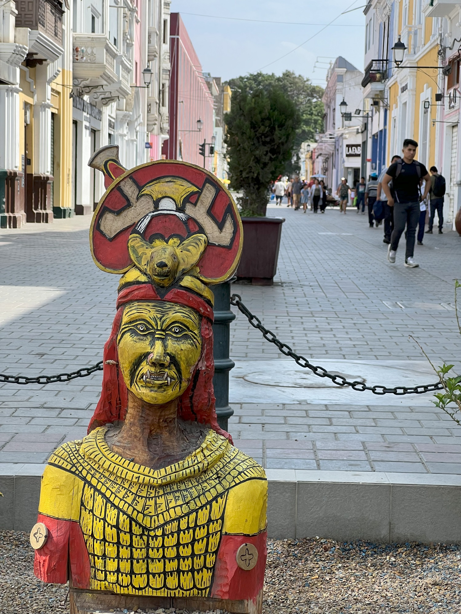
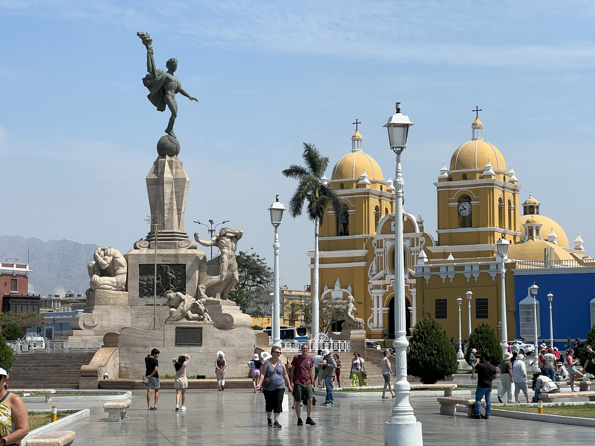
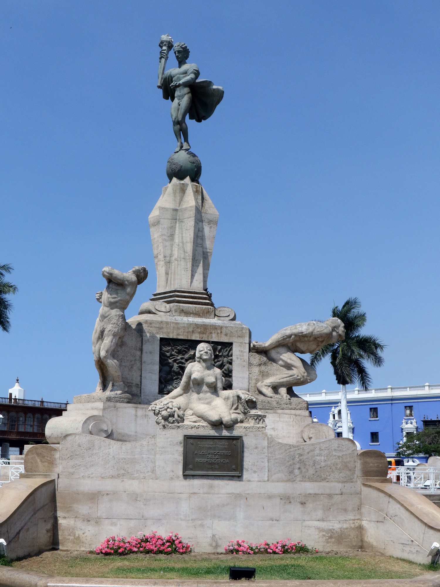
Look for the Plaza de Armas of Trujillo in the pictures below, with the Freedom Monument and the Cathedral of Trujillo nearby.
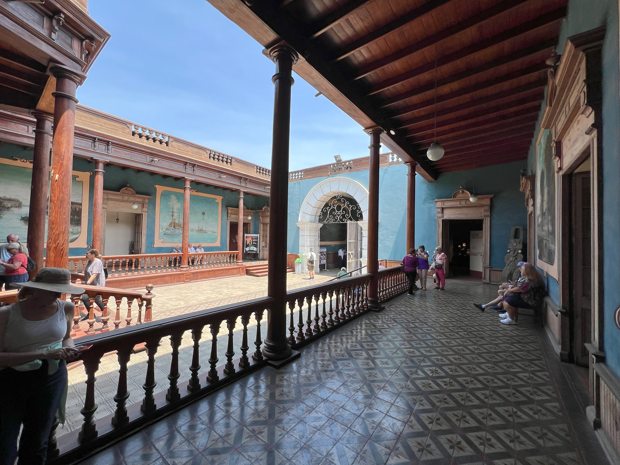
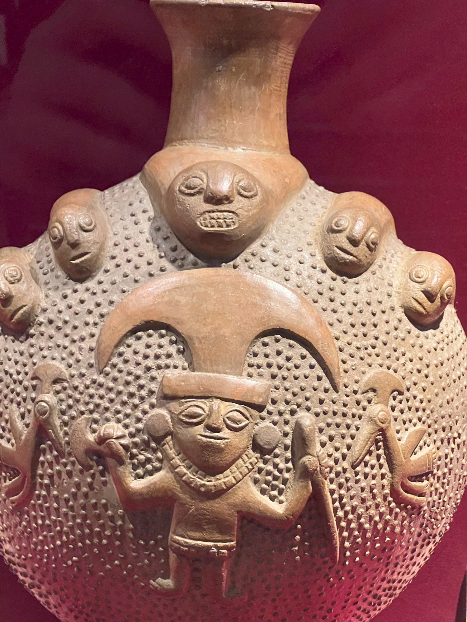
The beautiful building of UNT Archeology Museum and pictures of just a few of the displays inside, follow after that.
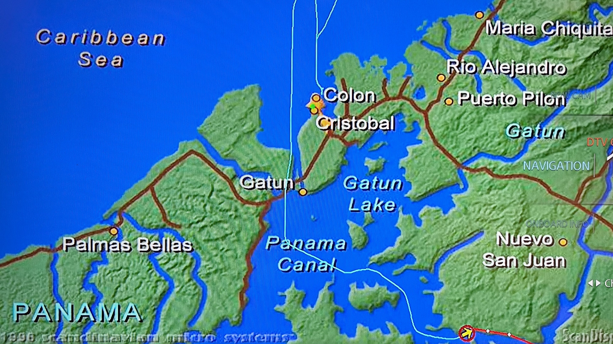
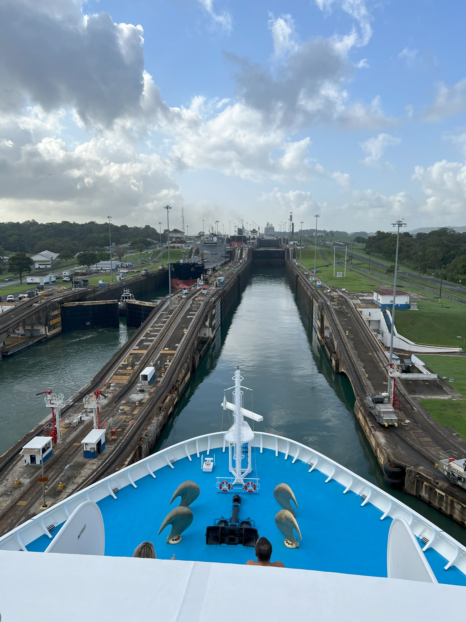
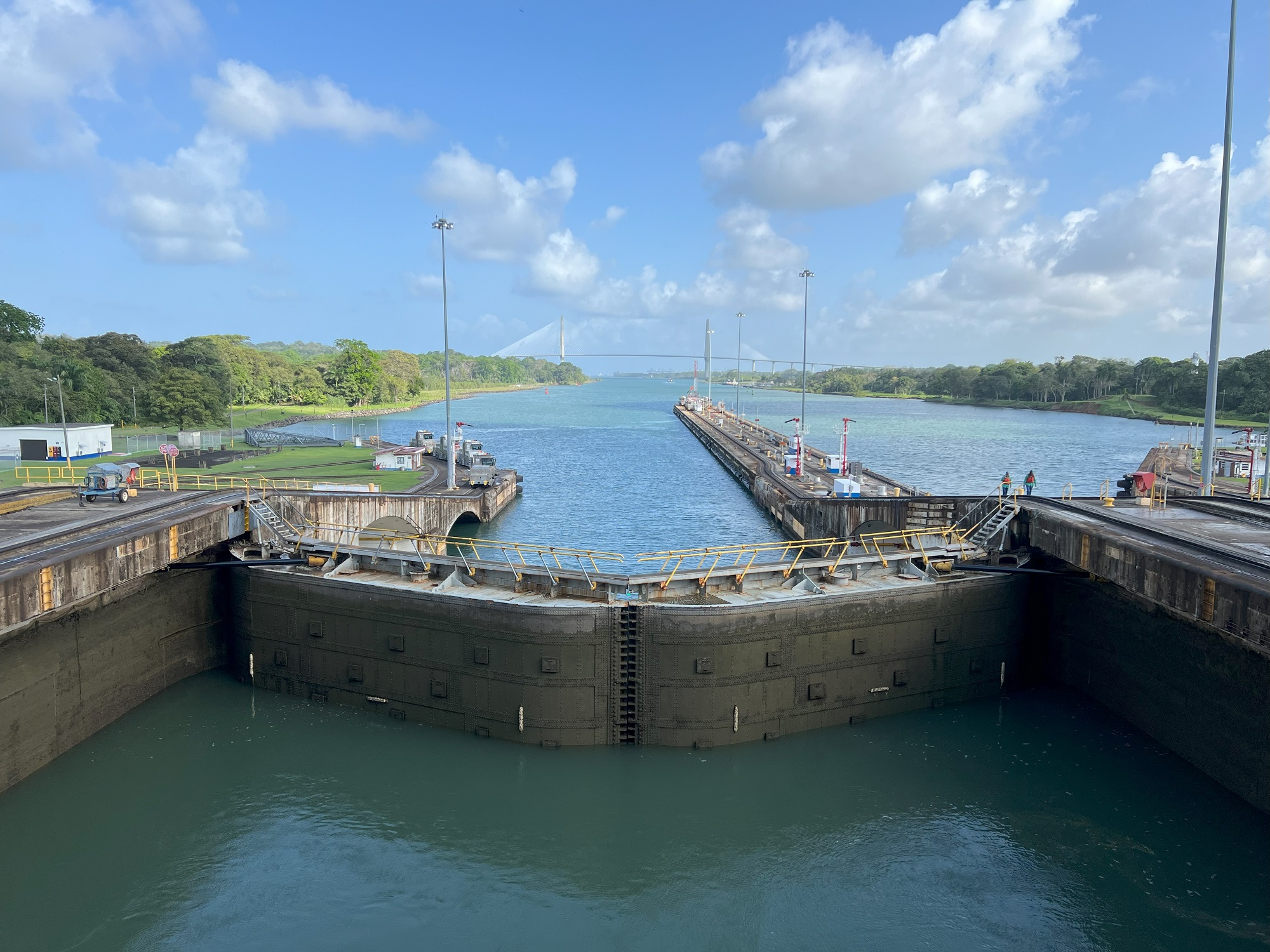
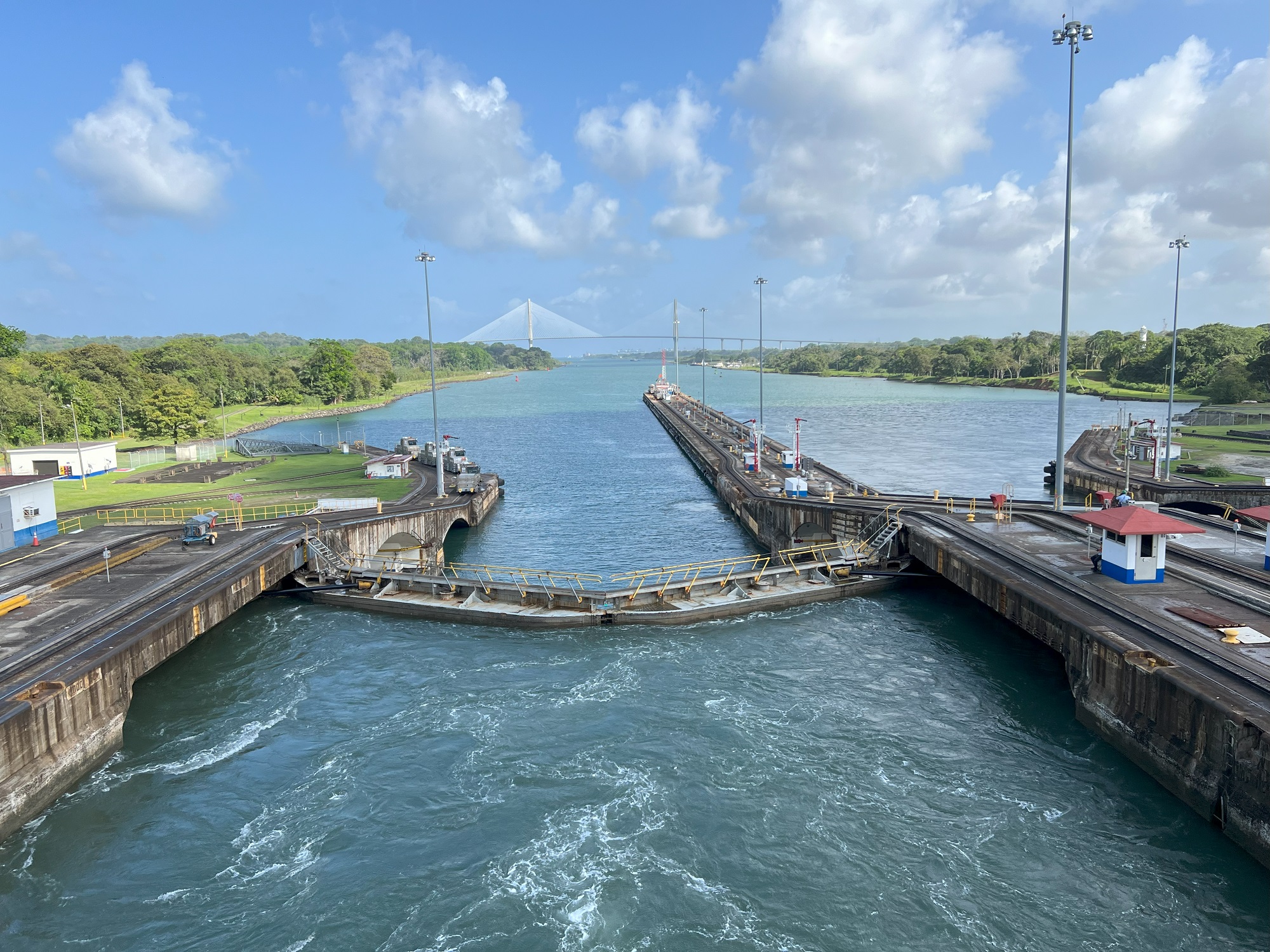
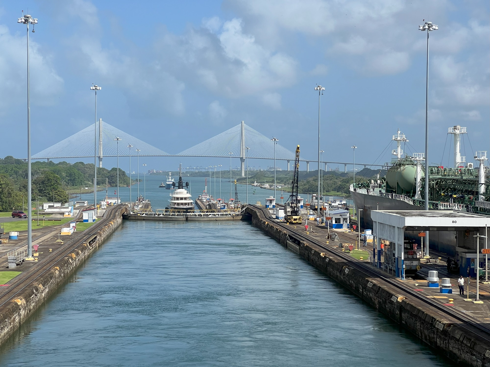
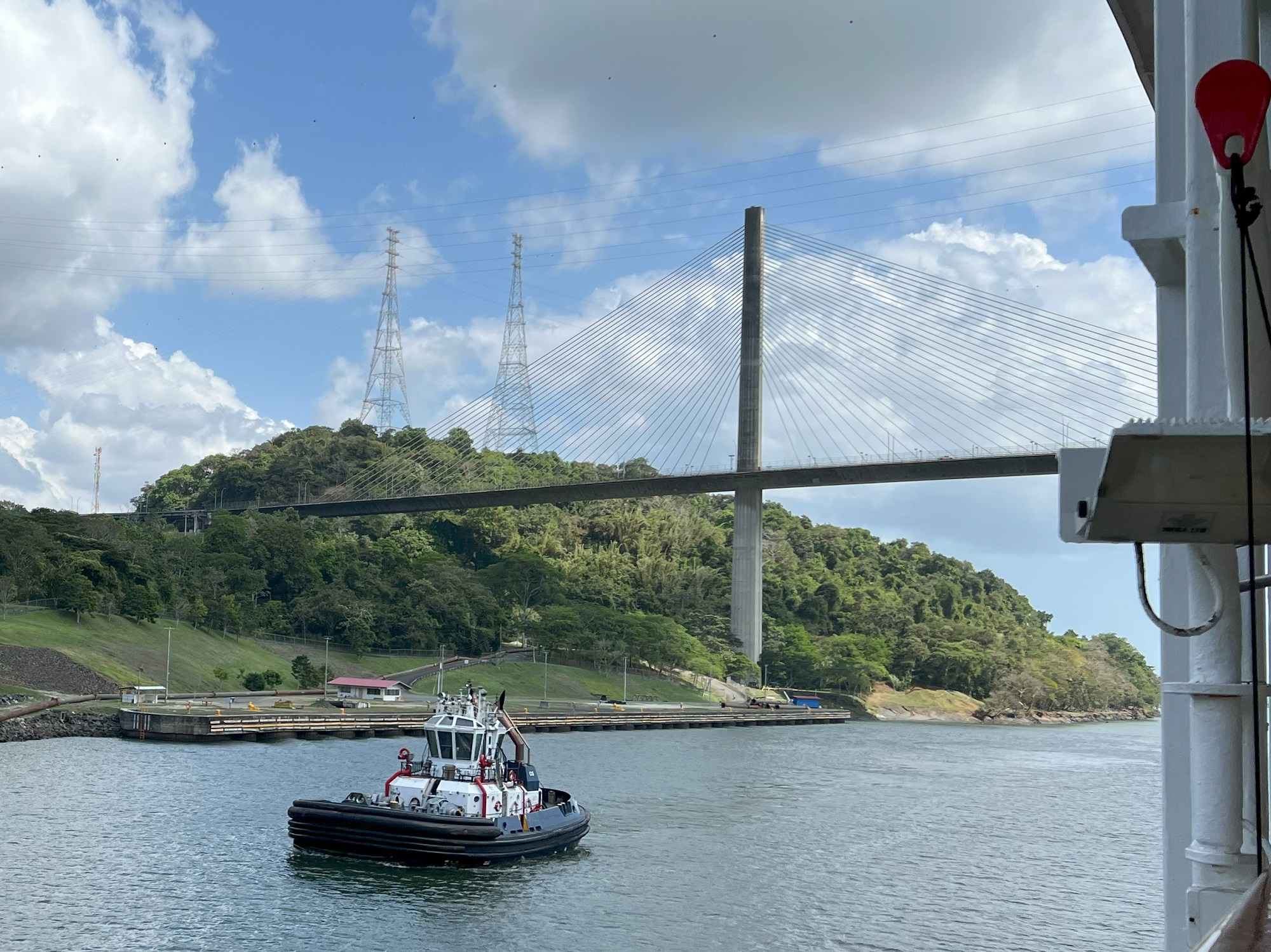
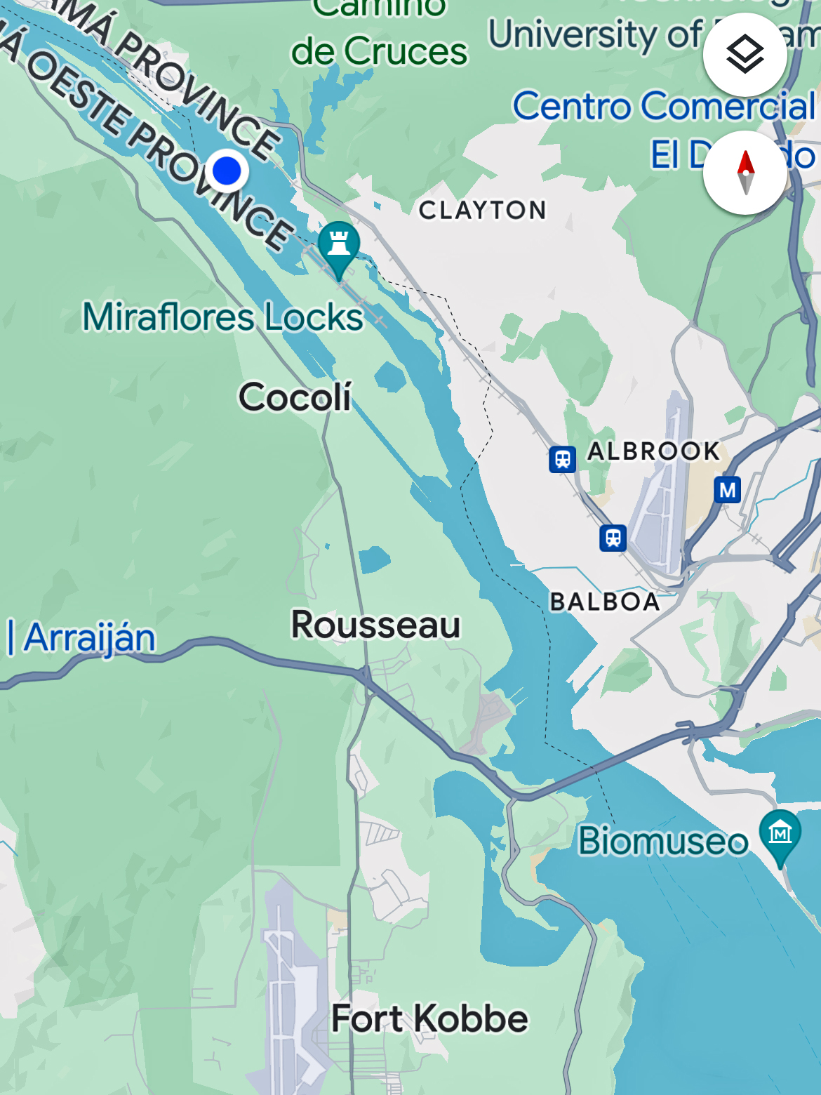
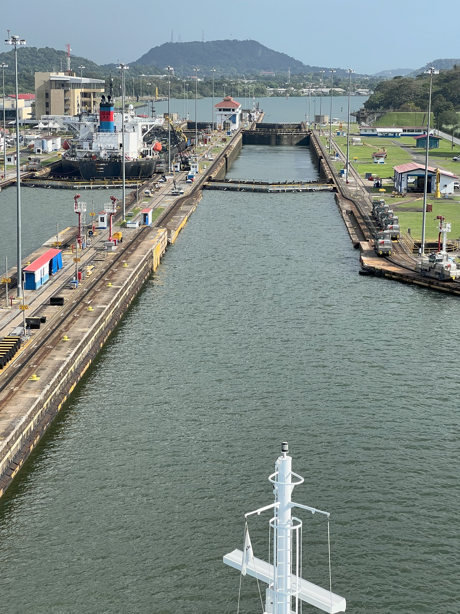
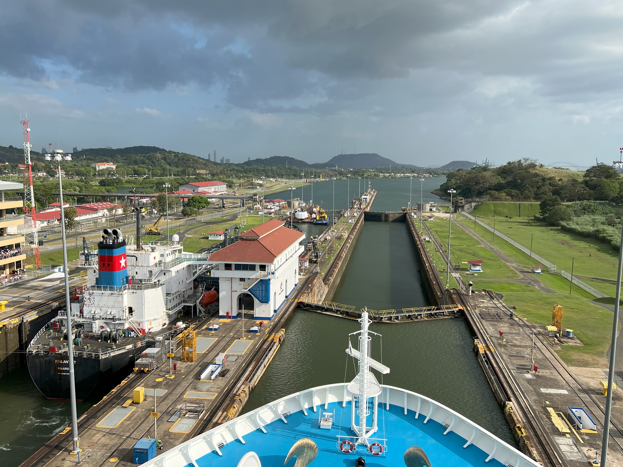
The Norwegian Sun’s position at 4.38 pm this afternoon: leaving Gatun Lake to enter the Miraflores Locks. [Image: The ship’s navigation TV channel]We traversed the engineering marvel called the Panama Canal today.
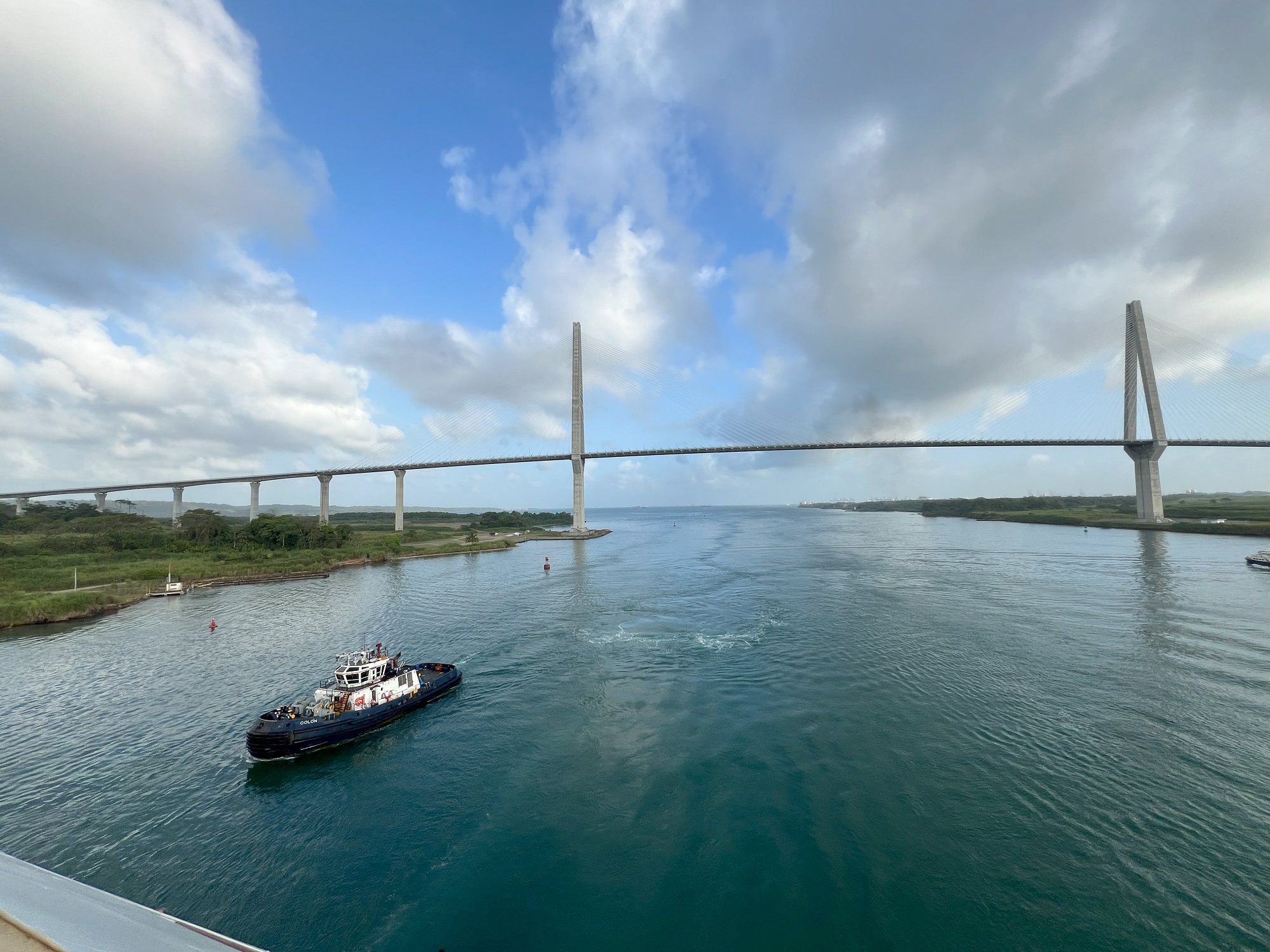
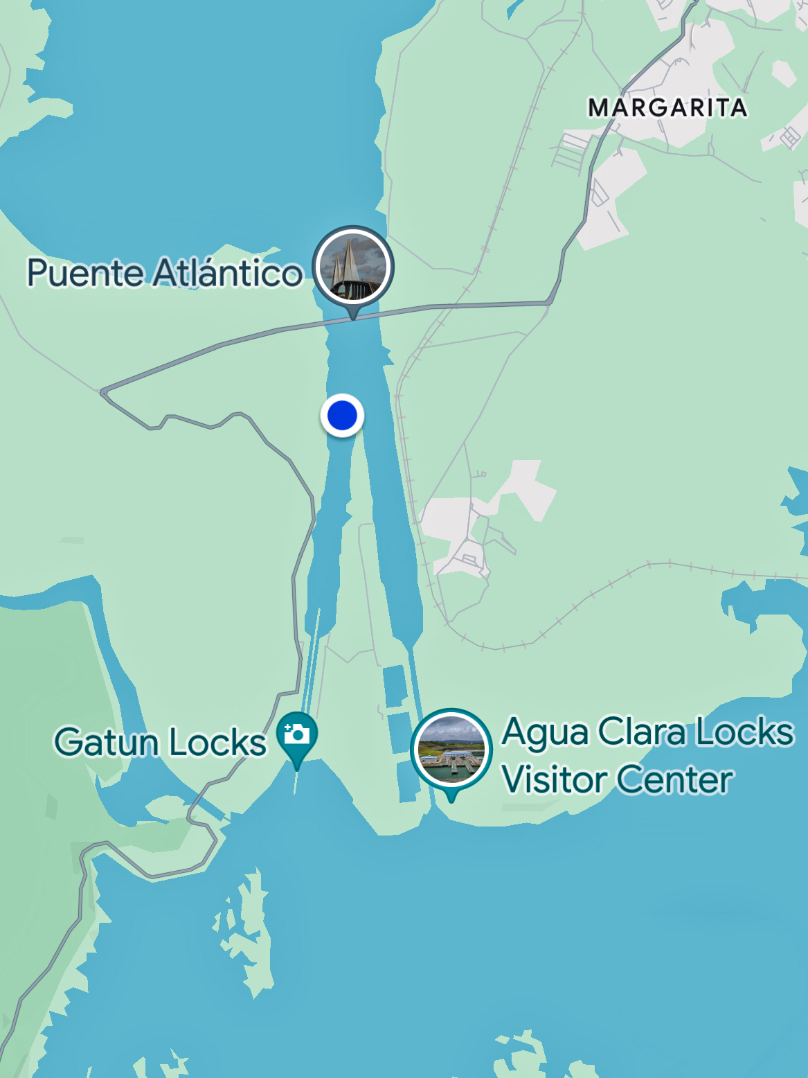
First up to admire was the Atlantic Bridge (Puente Atlántico), the new 15,092 ft (4,600 m) suspension bridge completed in 2019.
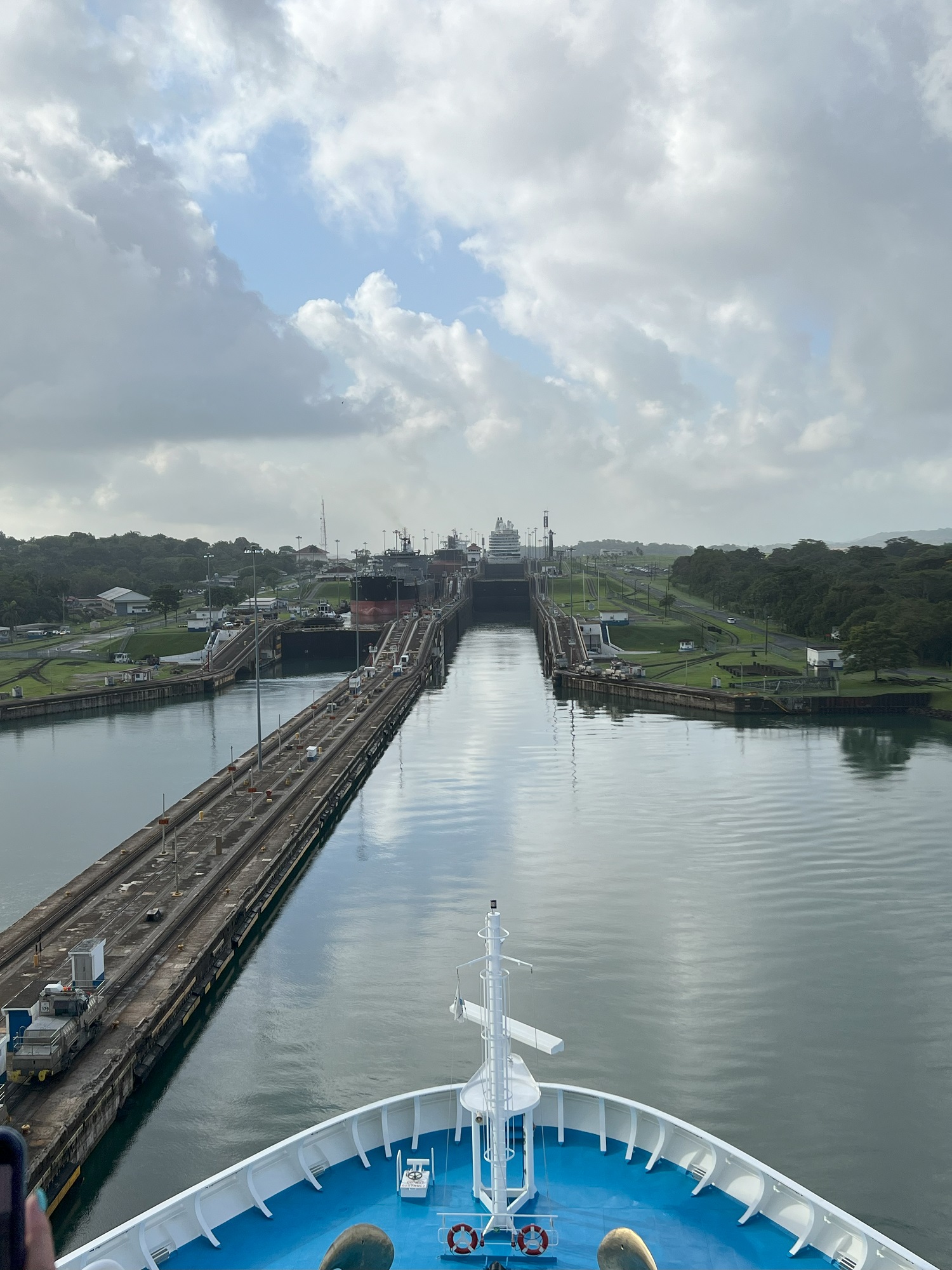
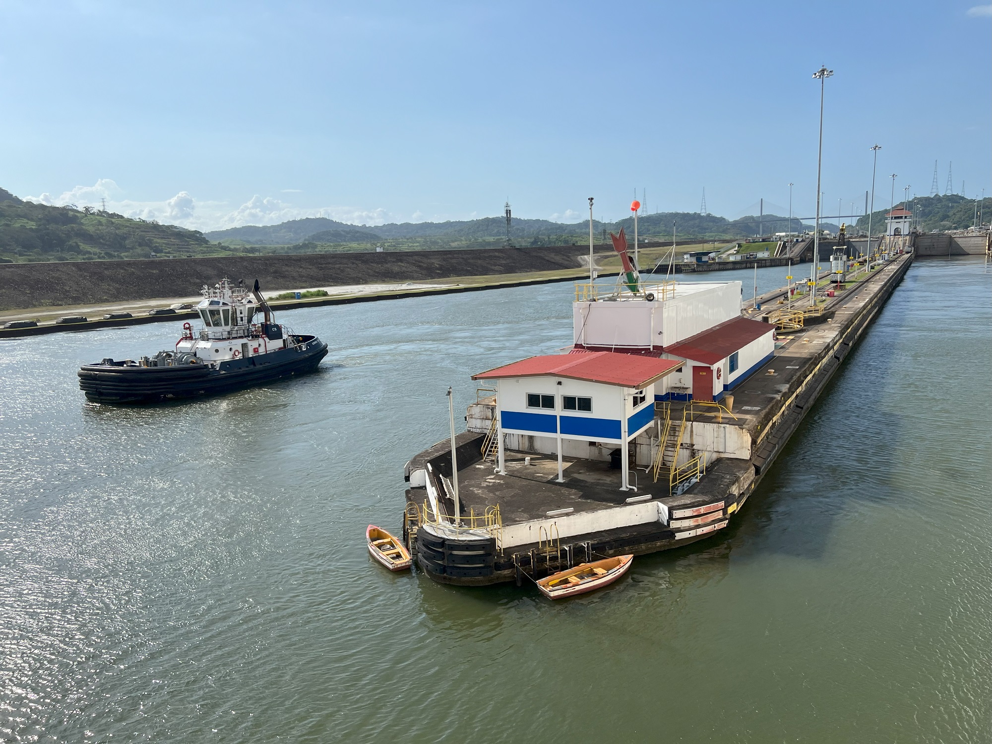
Then we entered the Gatun Locks.
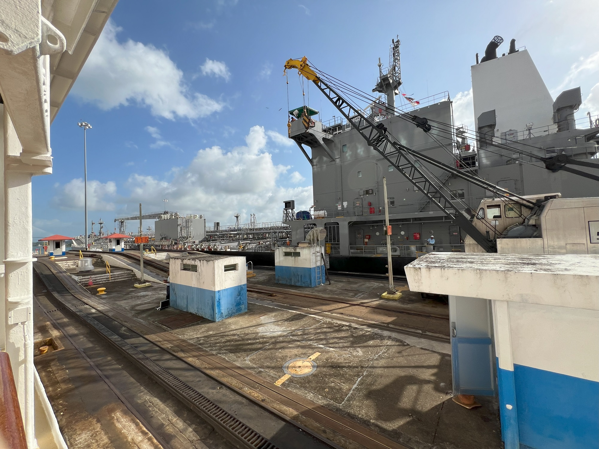
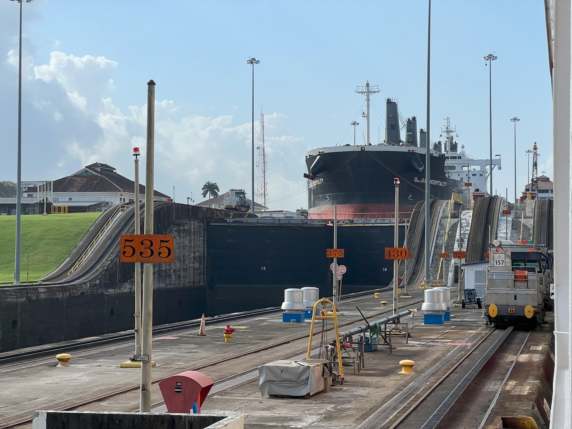
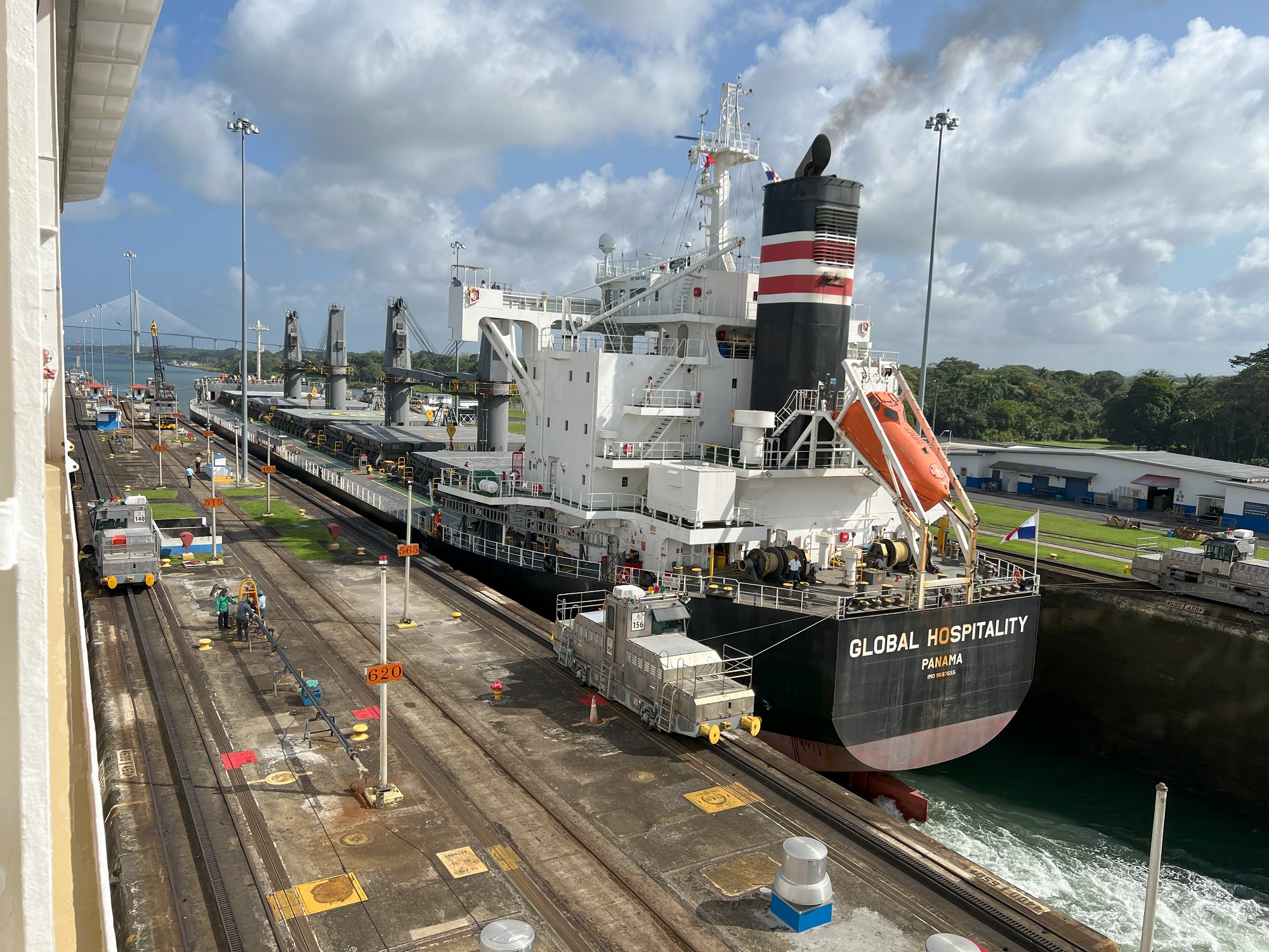
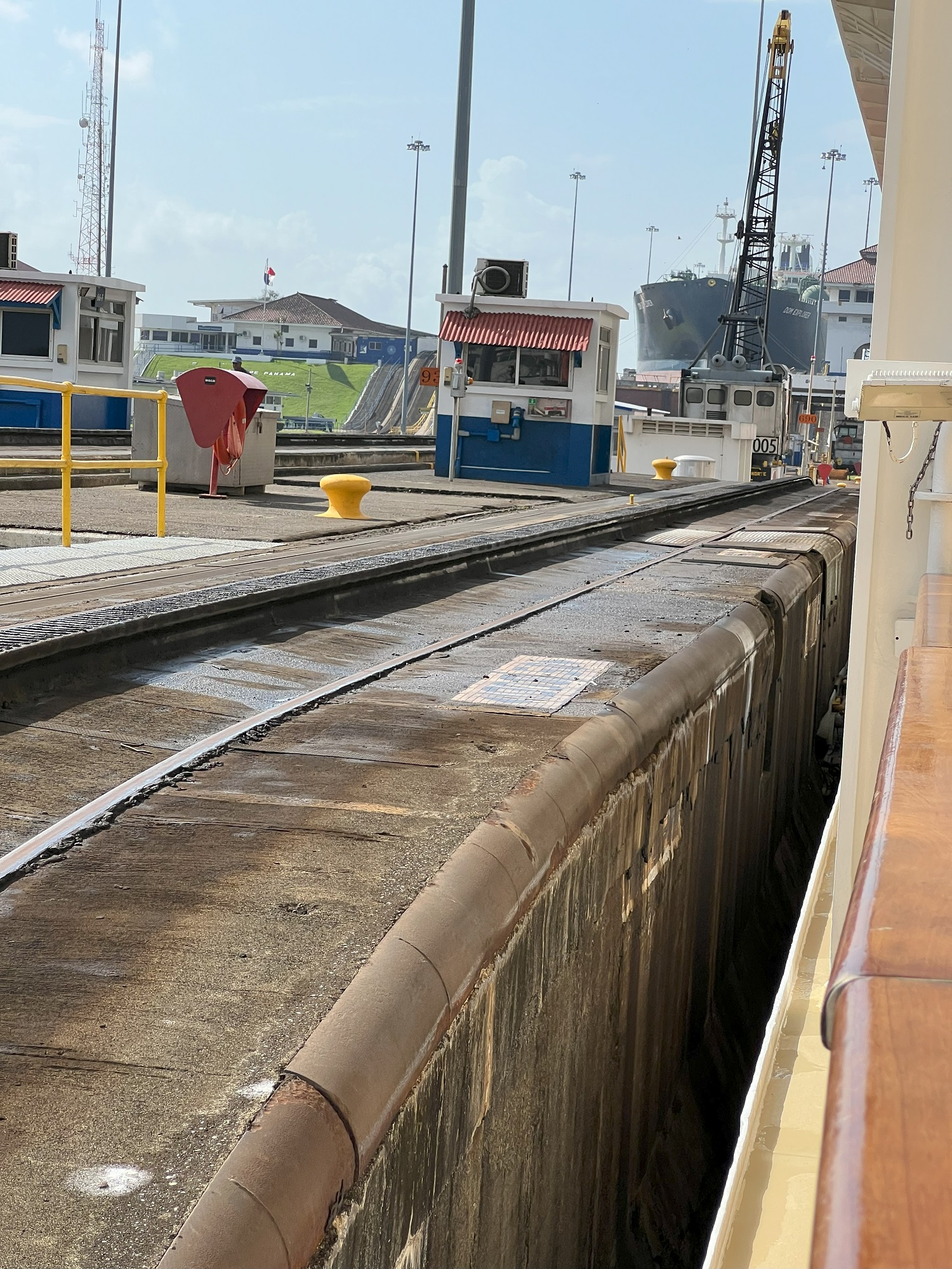
This sequence of three locks opened in 1914, is the largest of the locks in the Panama Canal and lift ships up 85 ft (25.9 m) to the level of the sprawling Gatun Lake.
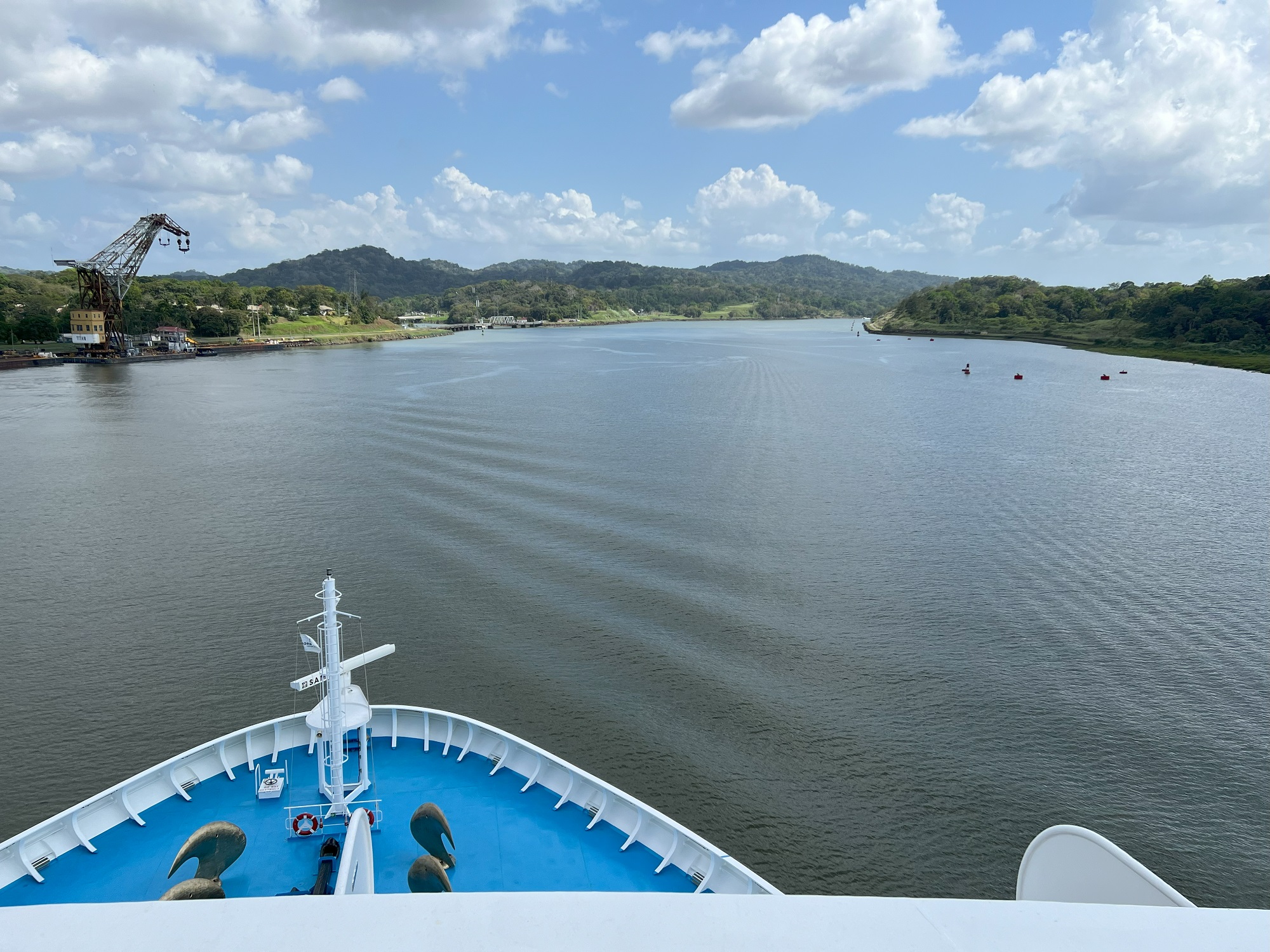
The man-made Gatun Lake lies between the two sets of locks that lifts and lowers vessels, and therefore allows passage to the Pacific Ocean or the Atlantic Ocean.
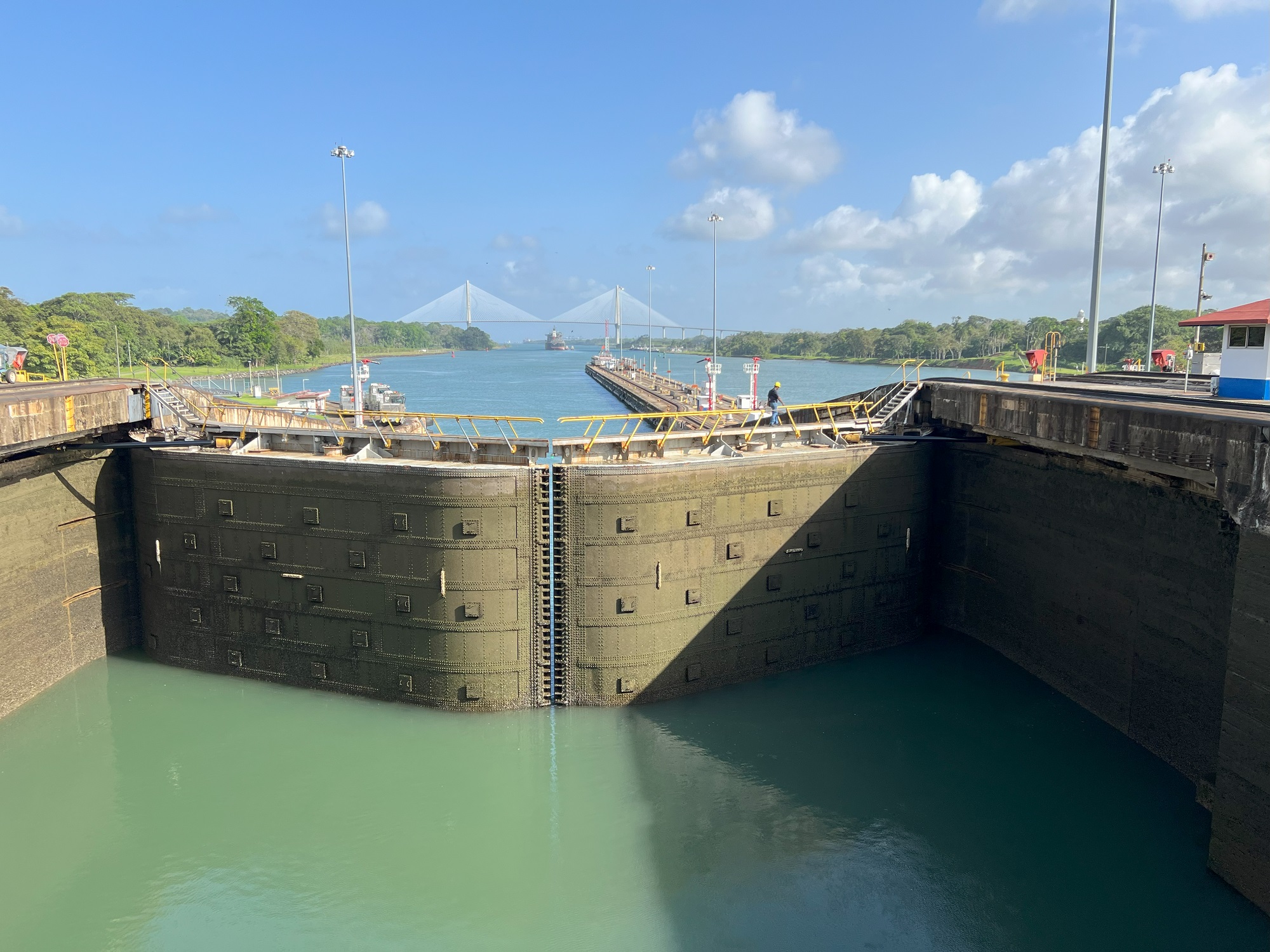
After crossing Gatun Lake, we passed under the Centennial Bridge (Puente Centenario). This bridge opened in 2004 and spans 3,451 ft (1,052 m).
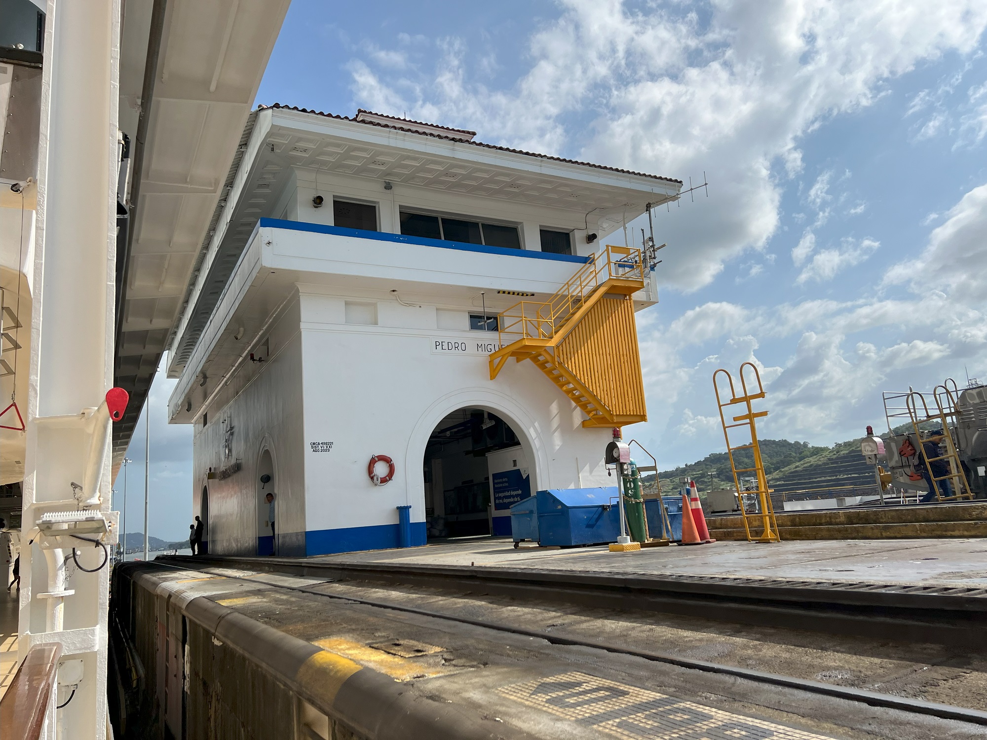
Soon after that it was time to enter the Pedro Miguel Locks and the Miraflores Locks. These locks lowered the Norwegian Sun to the level of the Atlantic Ocean— the ocean that used to be a continent away from the Pacific, and not a mere 51 miles (82 km).
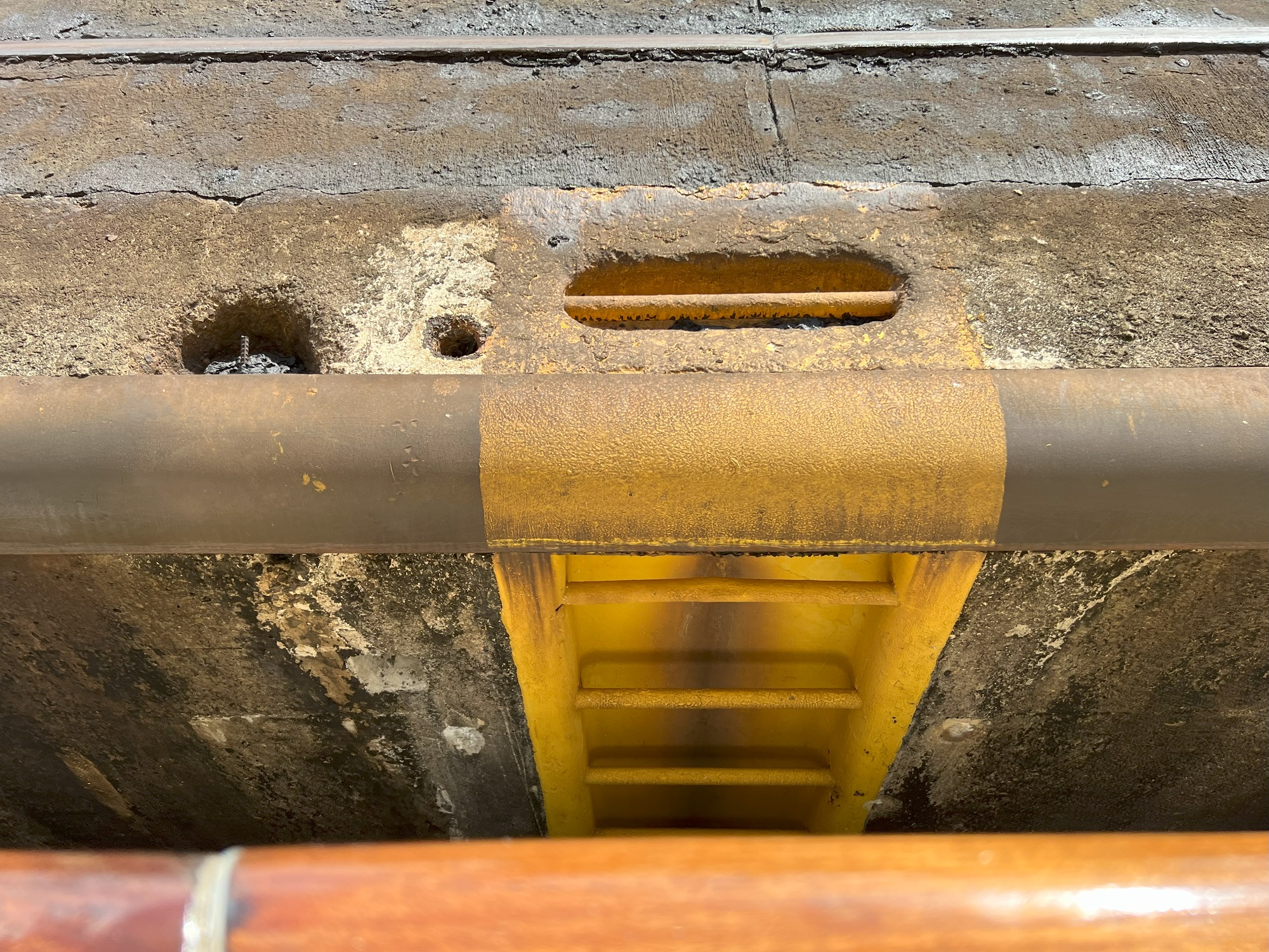
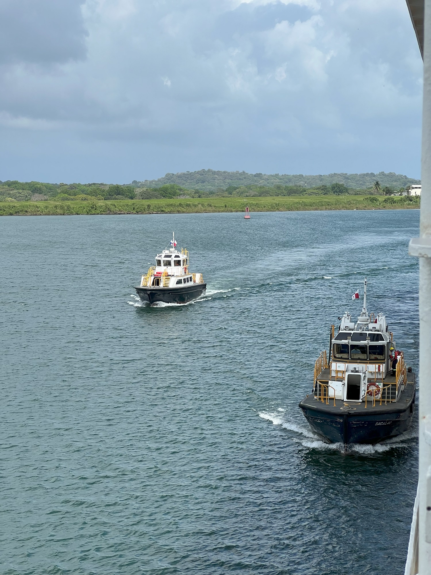
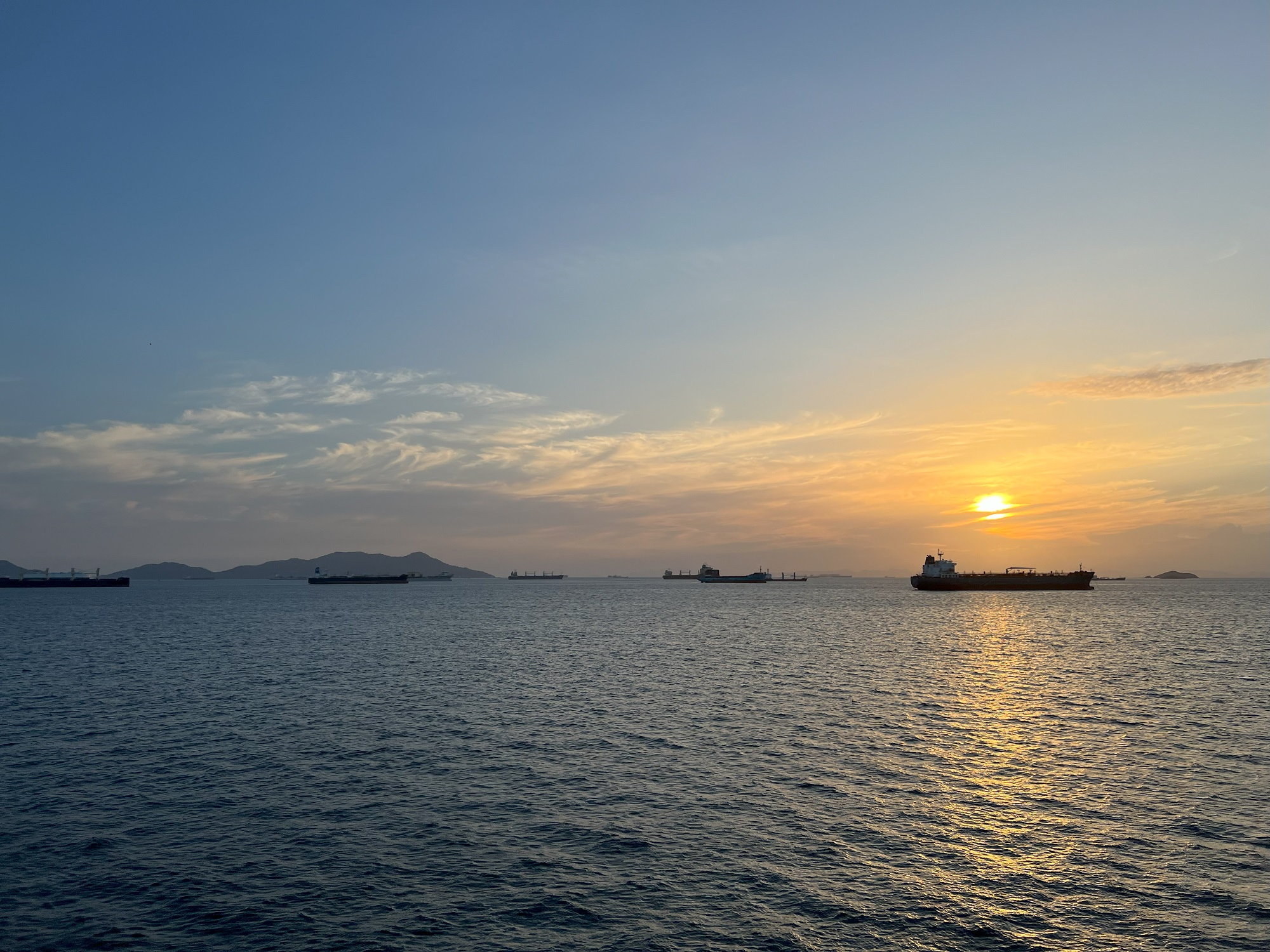
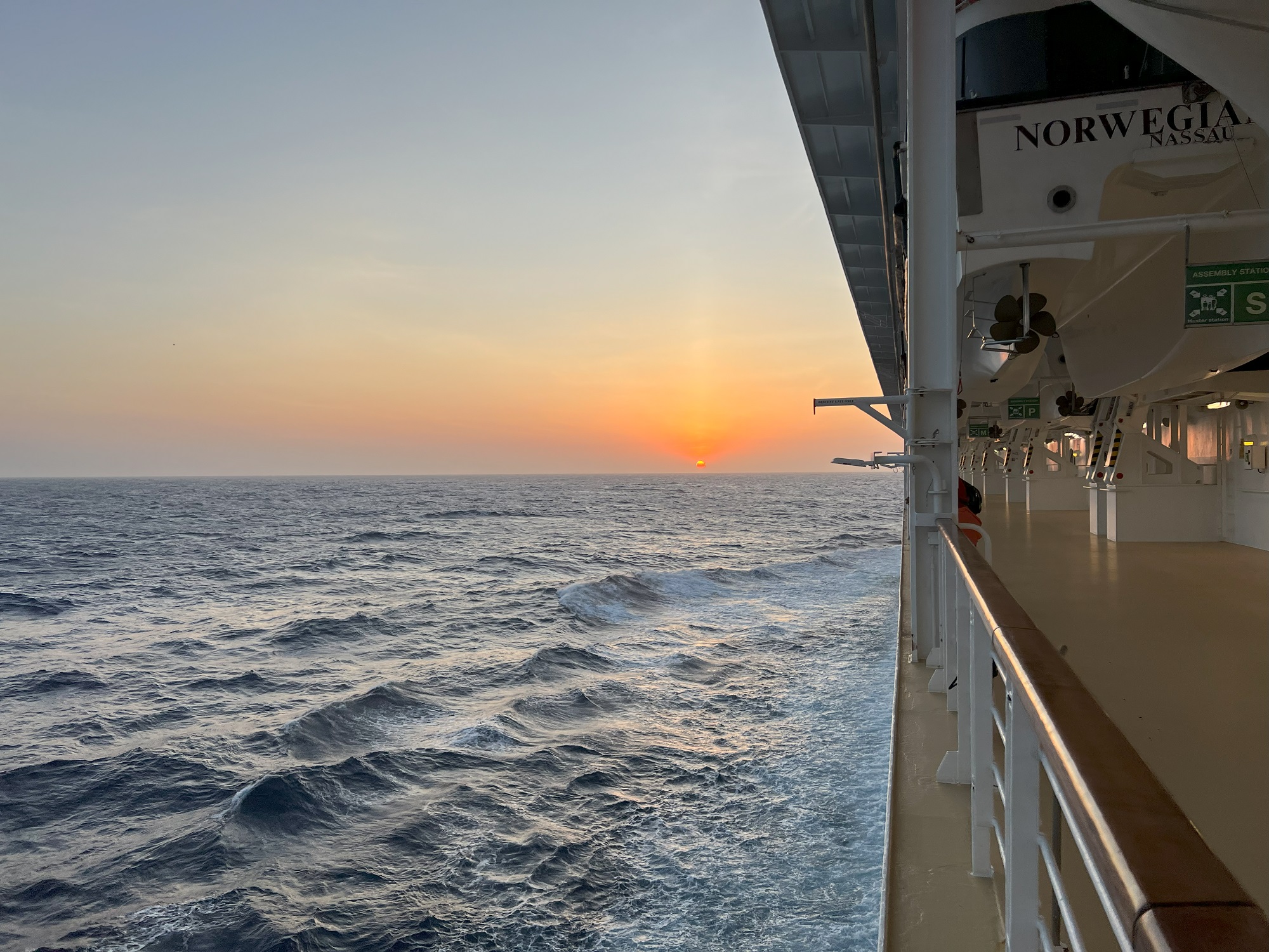
Atlantic Bridge (Puente Atlántico), the new 15,092 ft (4,600 m) suspension bridge completed in 2019.Entering the Gatun Locks. The newer, wider Agua Clara Locks to the right were completed in 2016.Approaching the Gatun Locks. Will she be able to squeeze in? (Yes.)Entering the Gatun Locks.No, we’re not on dry land— still floating but inside the lock. Another ‘Panamax’ size* vessel is coming through in the opposite direction. *The Panamax dimensions give clear parameters for ships destined to traverse the Panama Canal and have influenced the design of cargo ships, naval vessels, and passenger ships.Gatun Lake lies 85 ft (25.9 m) above sea level, and here comes the second (of three) Gatun locks that will raise the ship. Look for the mule on the right edge of the picture. These are powerful electric locomotives that run on paired 5 ft (1,524 mm) broad gauge railway tracks, tethered to the ship on both sides with cables, to guide it through the locks.Now Norwegian Sun is inside the lock, with the gates in front of her bow closed, and this one at her stern as well. (Looking back at the Atlantic Bridge in the distance). The lock is about to be filled with water to raise her up.Getting there ..The lock is filled, and the one at the front of the ship has been opened. We have started to move forward, into the next lock.A view of how the mule on the tracks is attached to a vessel.There is very, very little room to spare between the hull of Norwegian Sun and the walls of the lock.Tight. Very tight. I am not sure what this gap in inches is, but it seems to be less than a foot. Another look back as we leave the first of the Gatun Locks.Now out of the Gatun Locks, and on the large and sprawling Gatun Lake. More than a dozen crew from Norwegian Sun stepped onto this boat alongside Norwegian Sun.Crossing Gatun Lake. This is the area that we looked down onto yesterday, from the observation tower that we had reached with the Gamboa Aerial Tramway nearby.Approaching the Centennial Bridge (Spanish: Puente Centenario) that was completed in 2004.Inside the Pedro Miguel Locks, the first of the locks that will lower the Norwegian Sun back to sea level.Leaving the Pedro Miguel Locks.Approaching the Miraflores Locks.Approaching the two locks called the Miraflores Locks.Another tight fit: inside the Miraflores Locks.Sunset— our first one over the Atlantic Ocean.
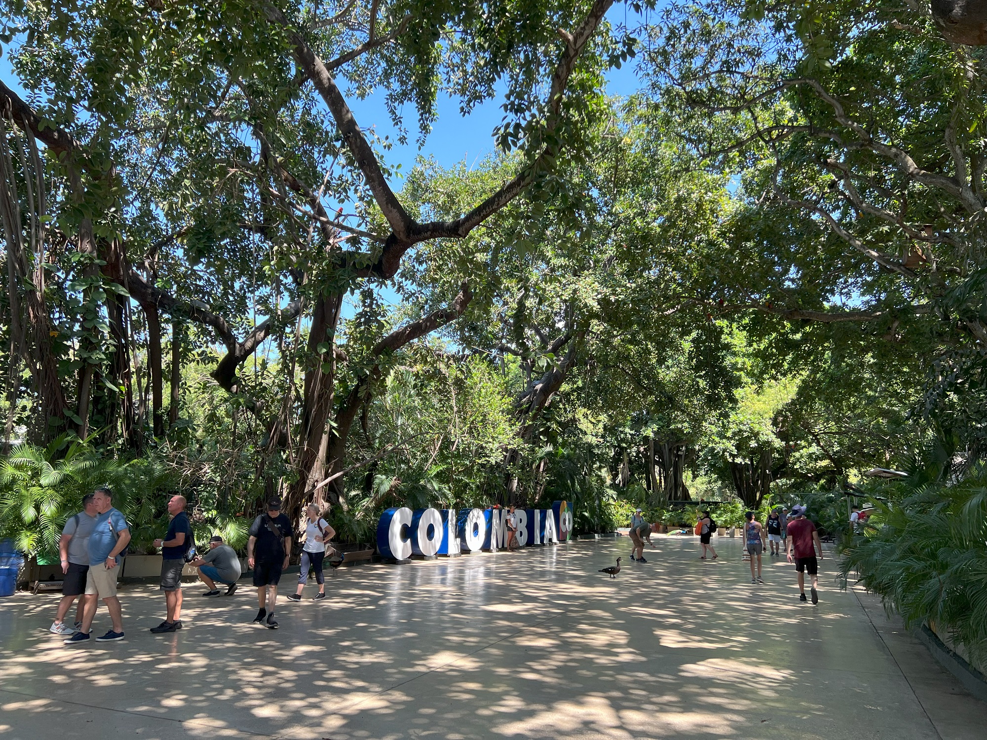
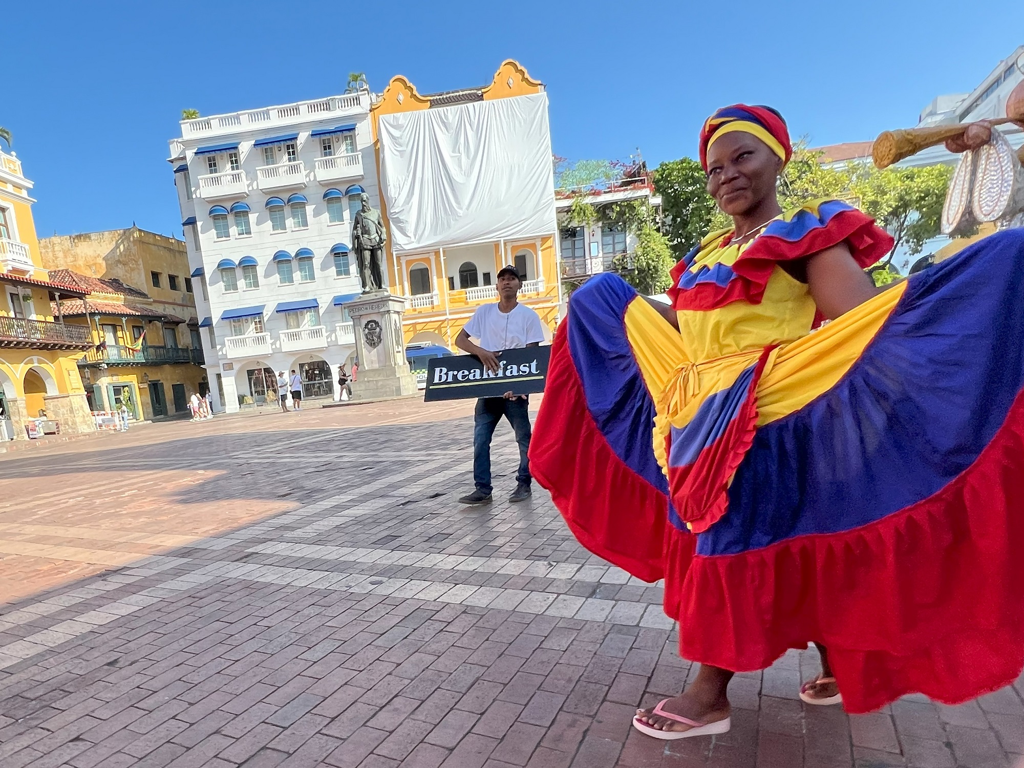
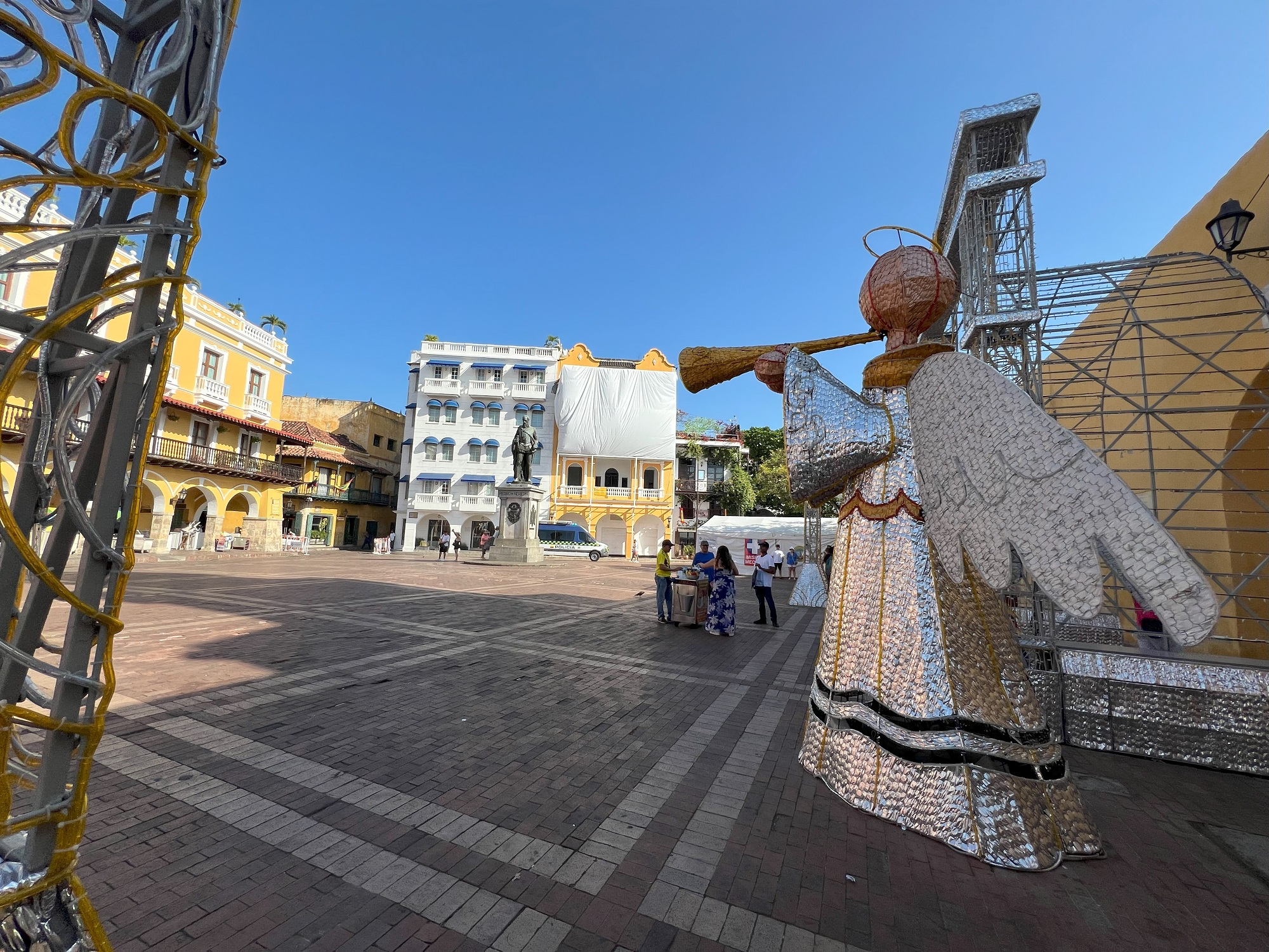
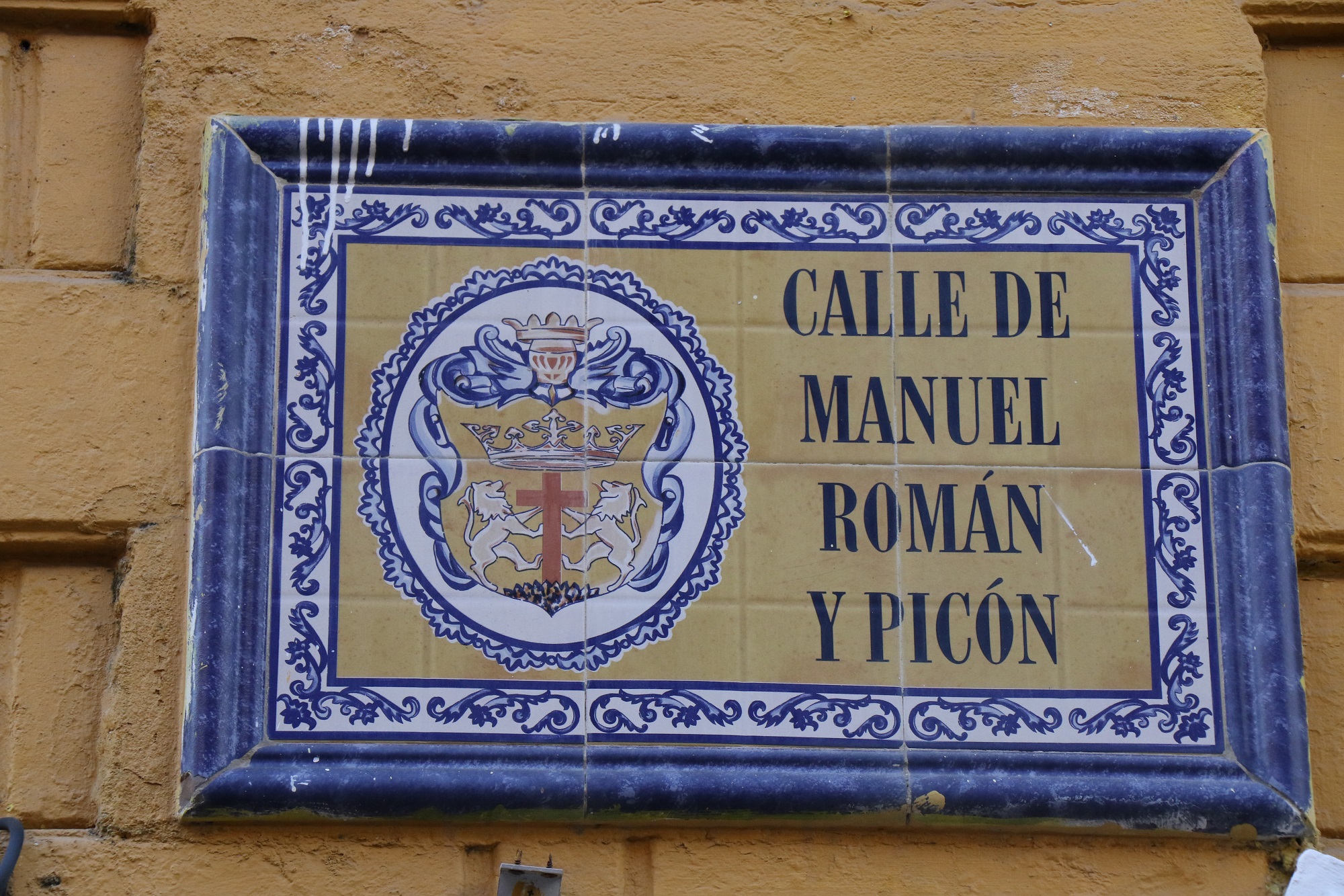
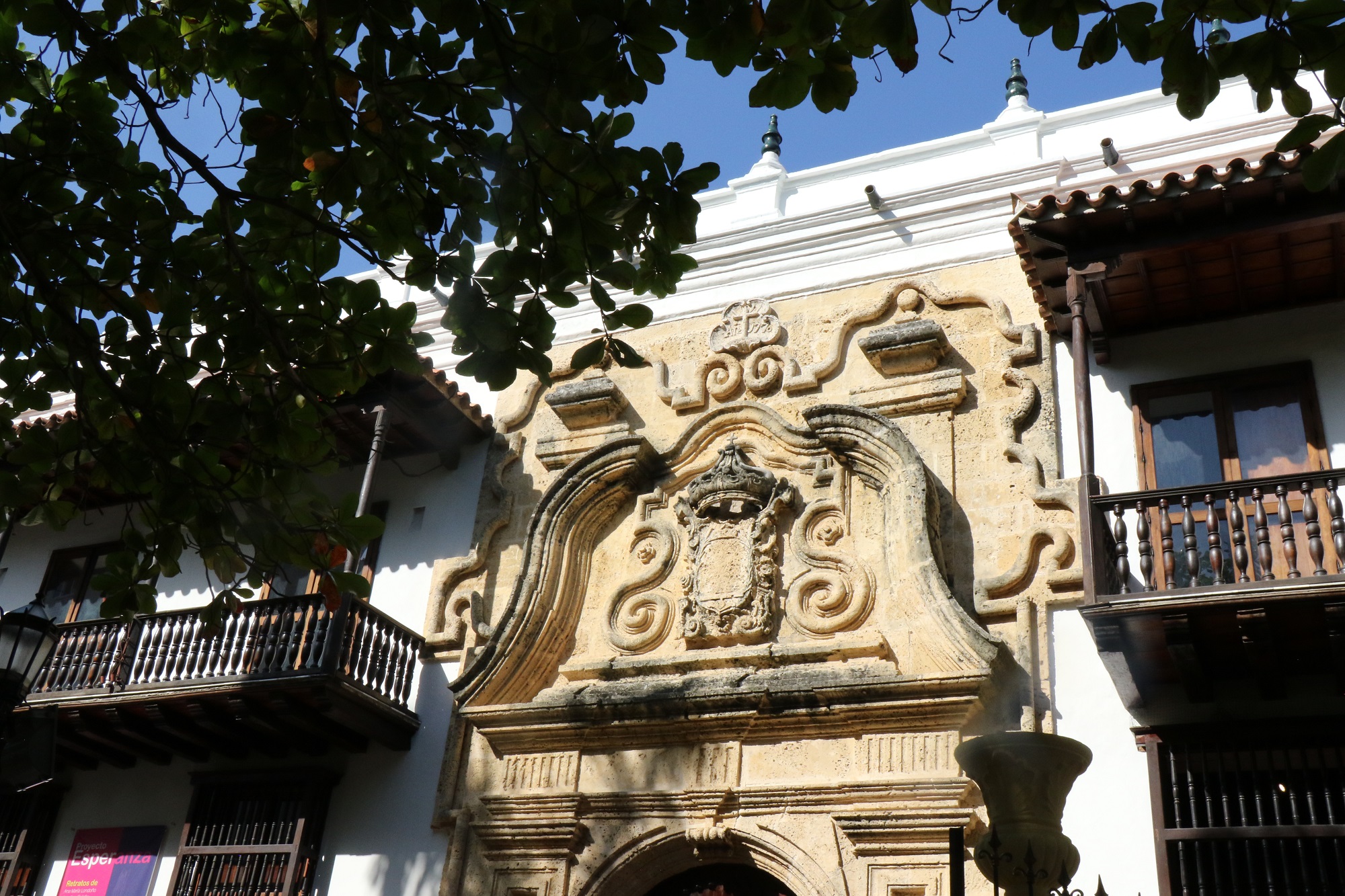
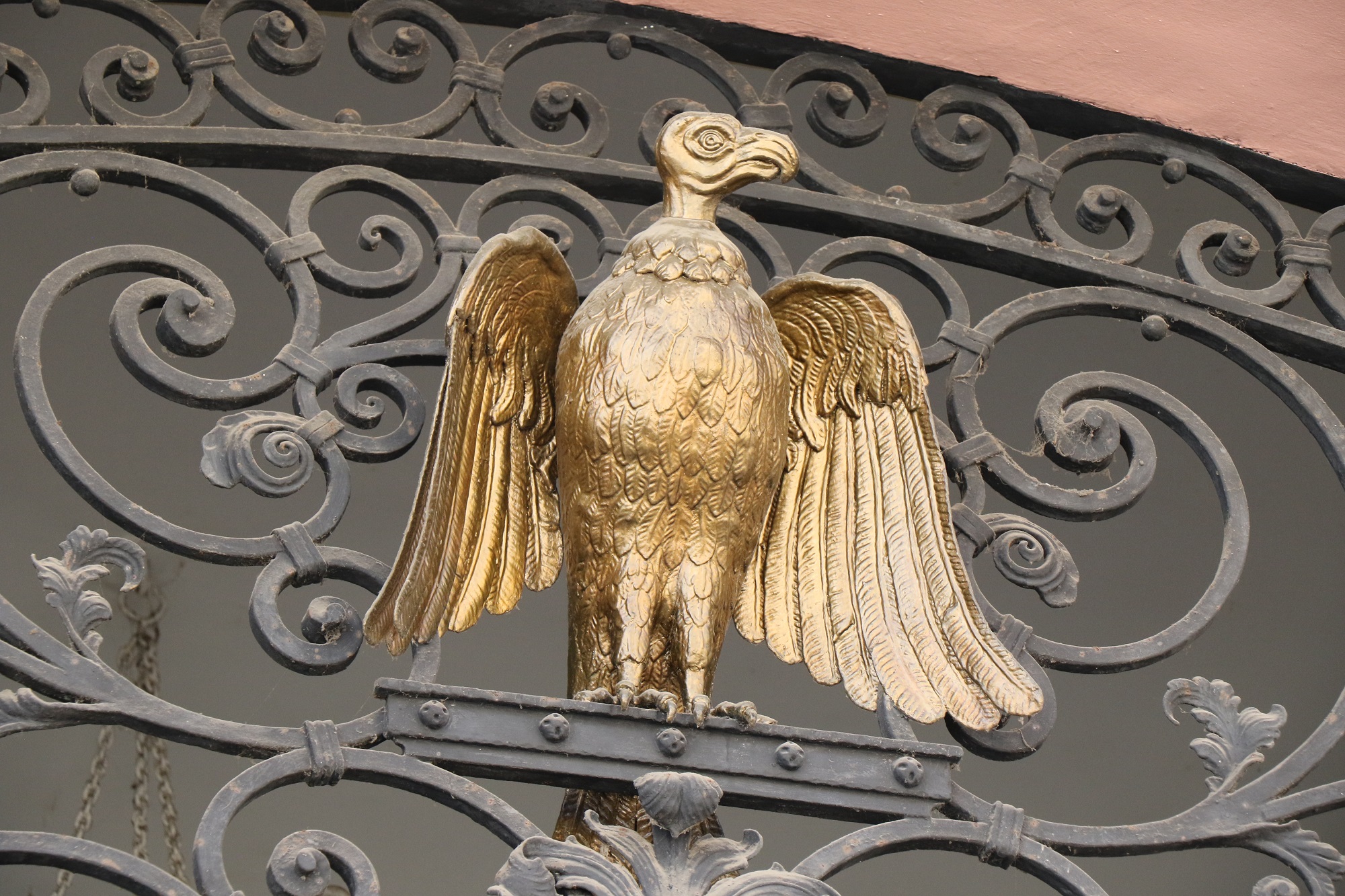
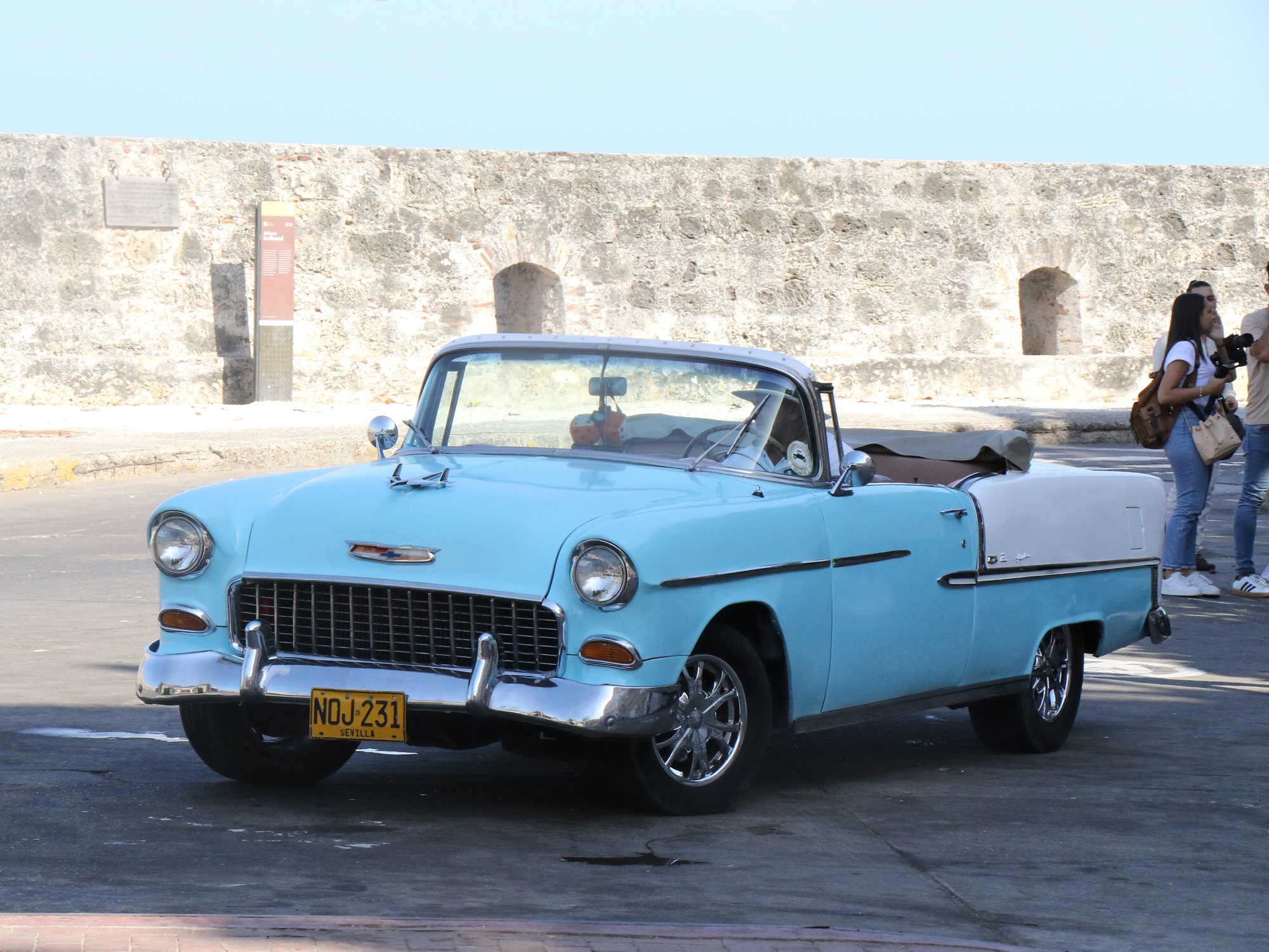
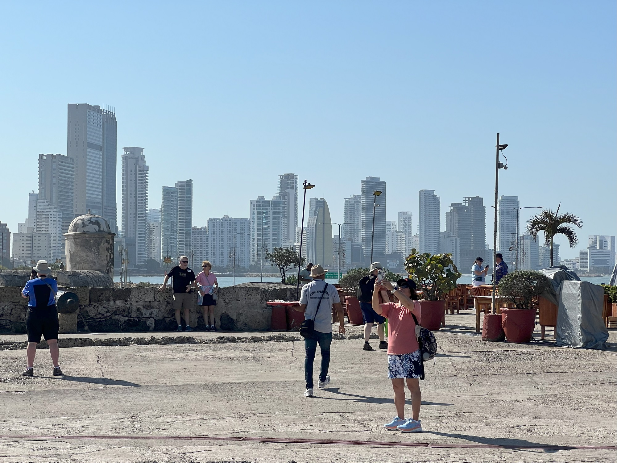
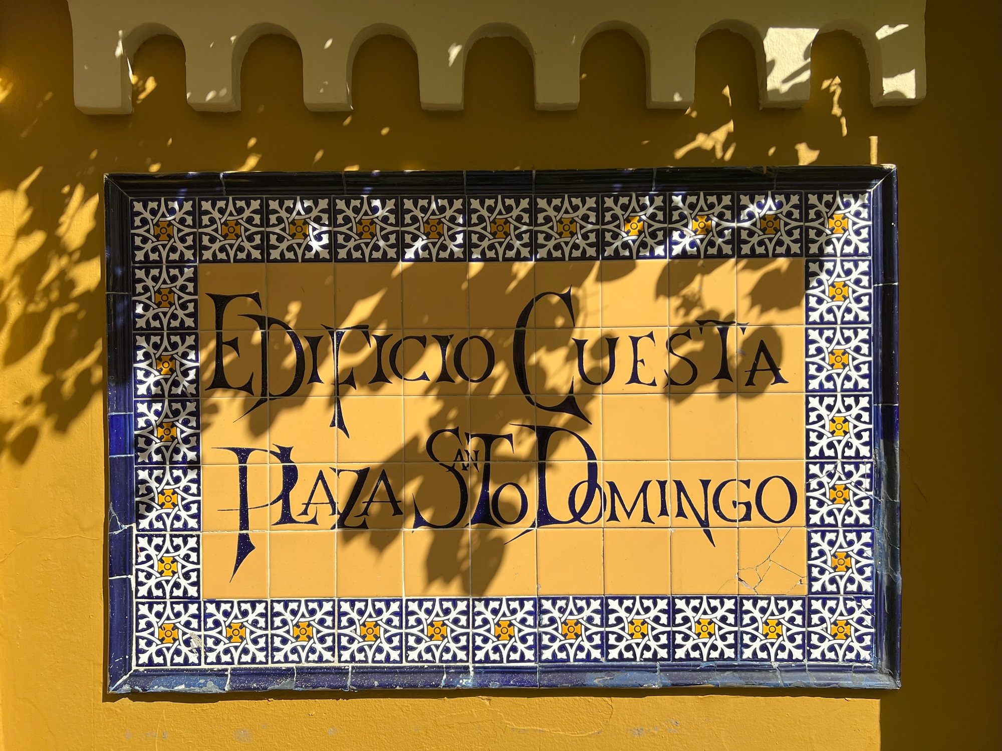
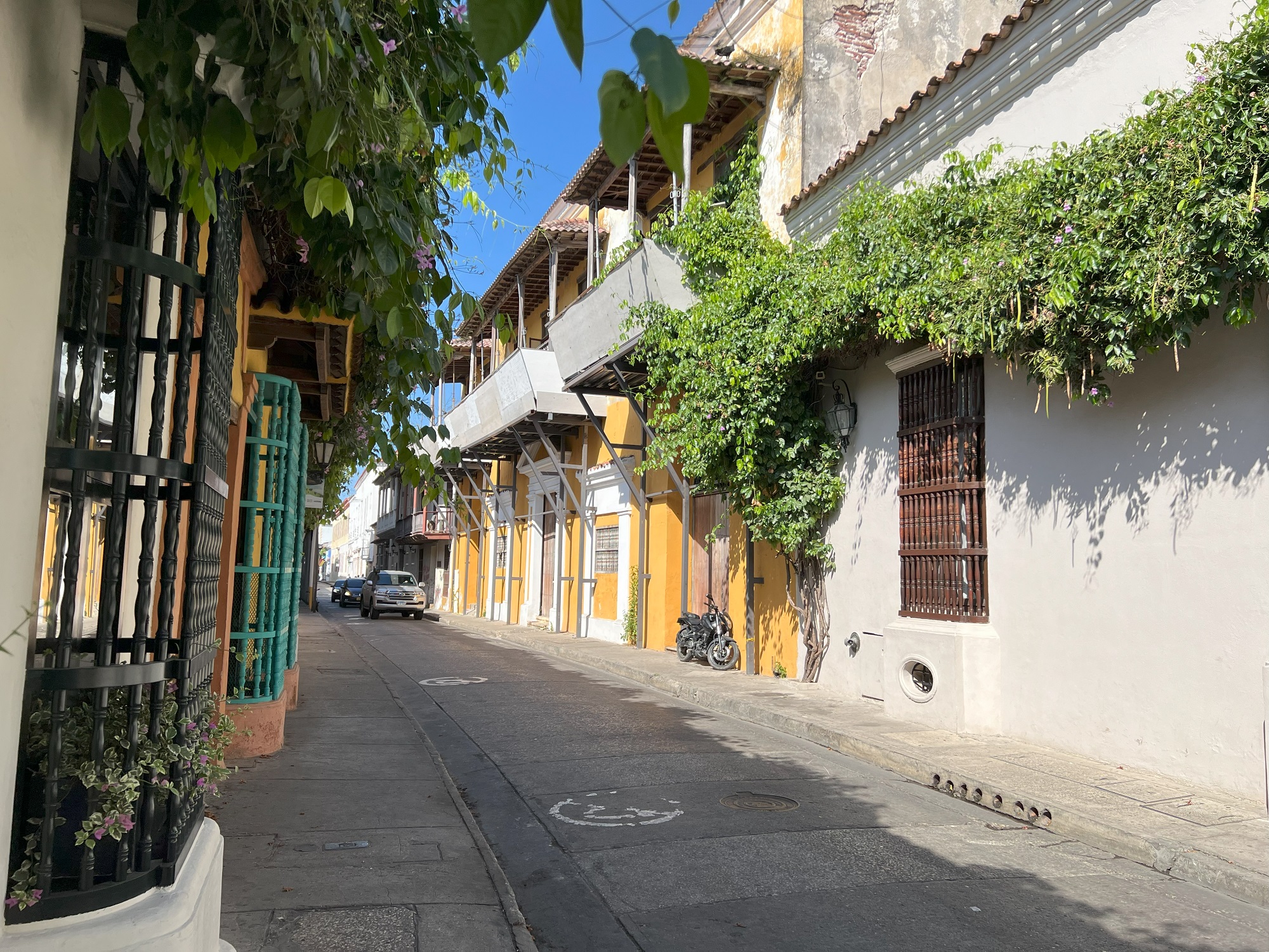
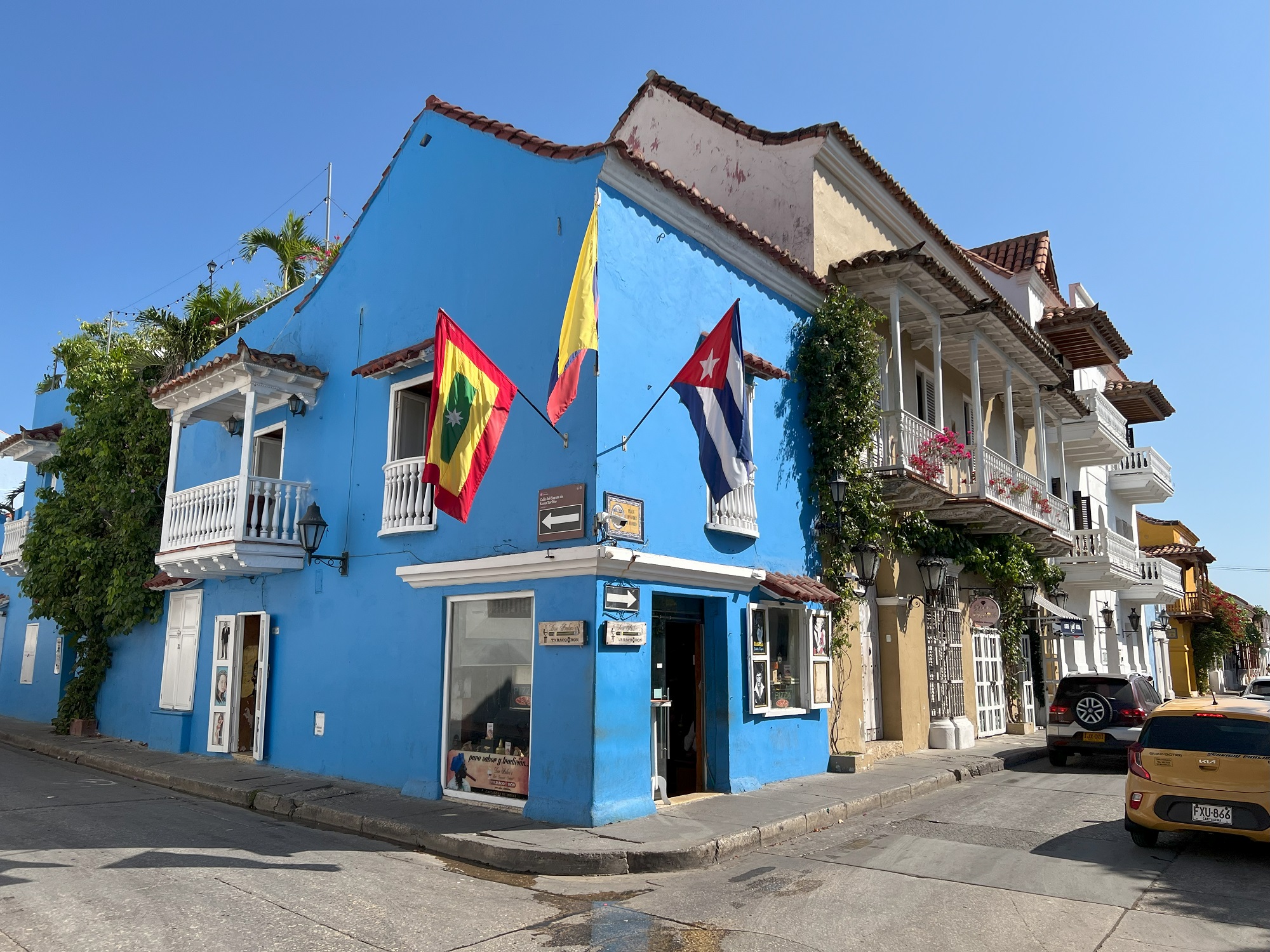
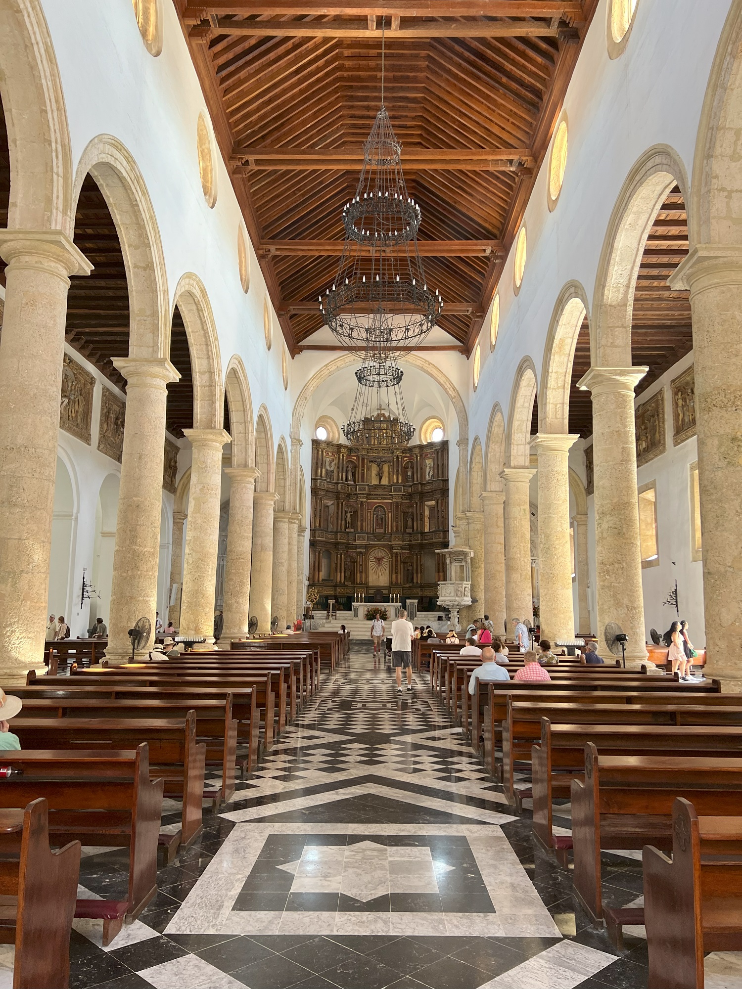
Cartagena (pop. 914,500 in 2020) is a port city on Colombia’s Caribbean coast. By the sea is the walled Old Town, founded in the 16th century, with squares, cobblestone streets and colorful colonial buildings. With a tropical climate, the city is also a popular beach destination.
– Google
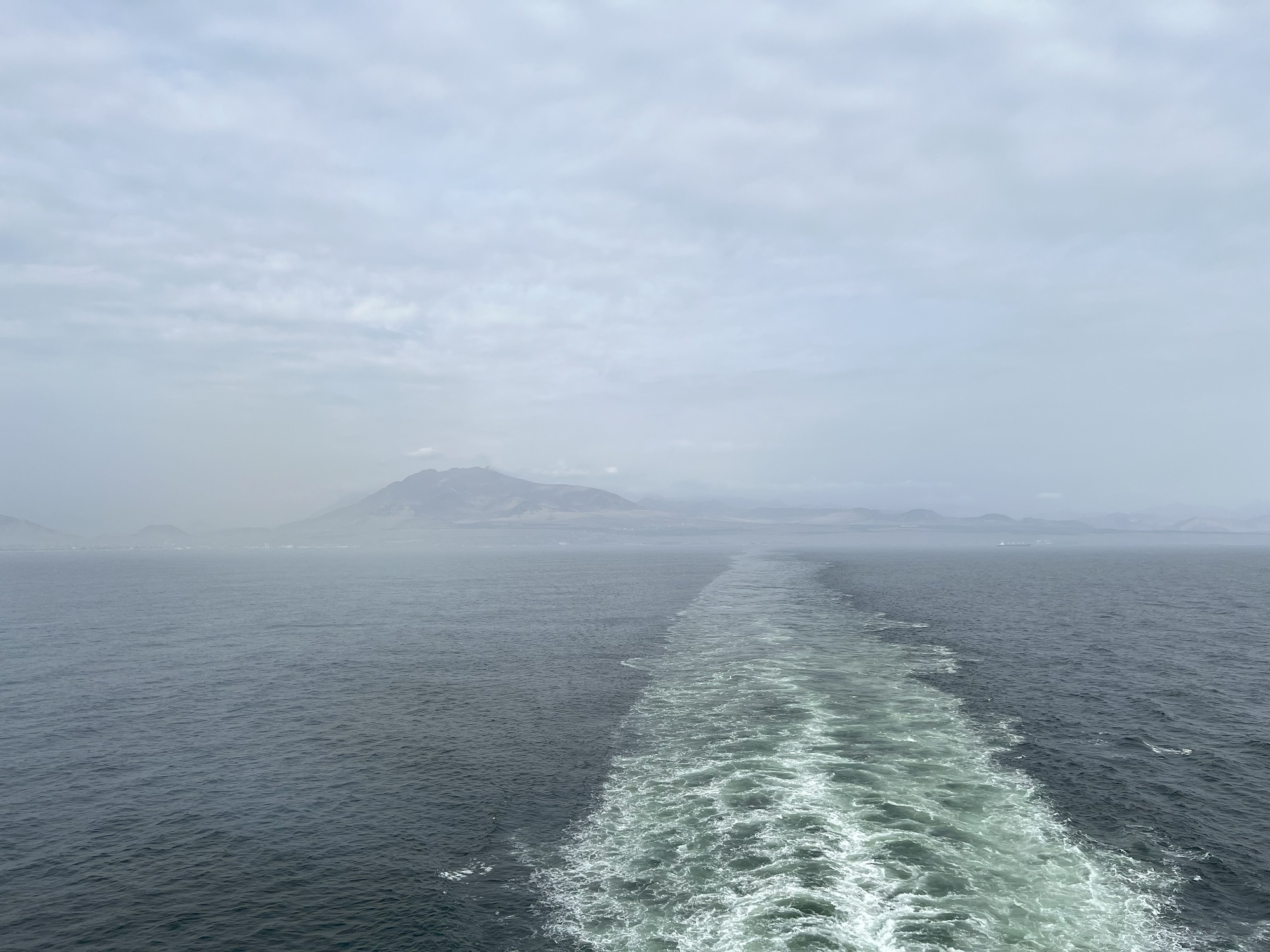
Late Monday afternoon we left Cartagena and sailed almost due west, towards Colon at the northern end of the Panama Canal.
We spent some three hours in the Old Town of Cartagena this morning, and came away with a good impression.
Just be prepared to say no gracias many times, to the street vendors selling t-shirts, hats, bottled water and soda, souvenirs and cubanos (cigars).
The day temperature rose rapidly through the morning, and it was already 90 °F (32 °C) when our taxi driver met us to take us back to the ship.
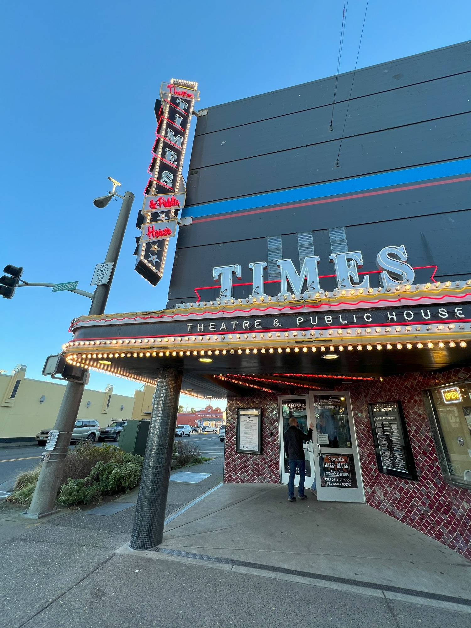
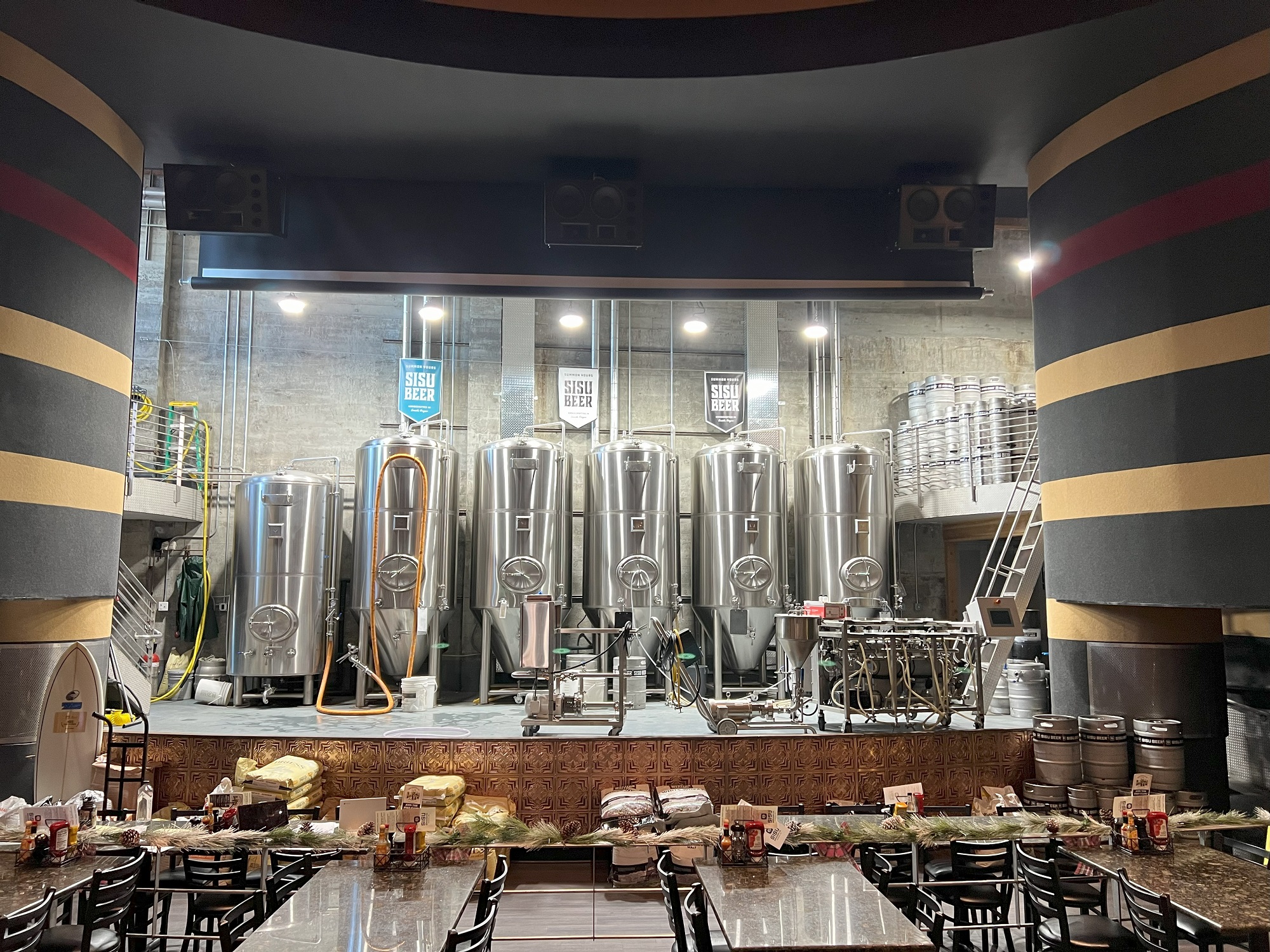
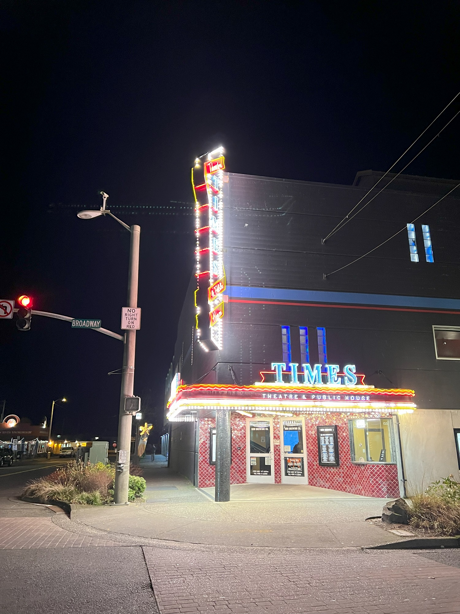
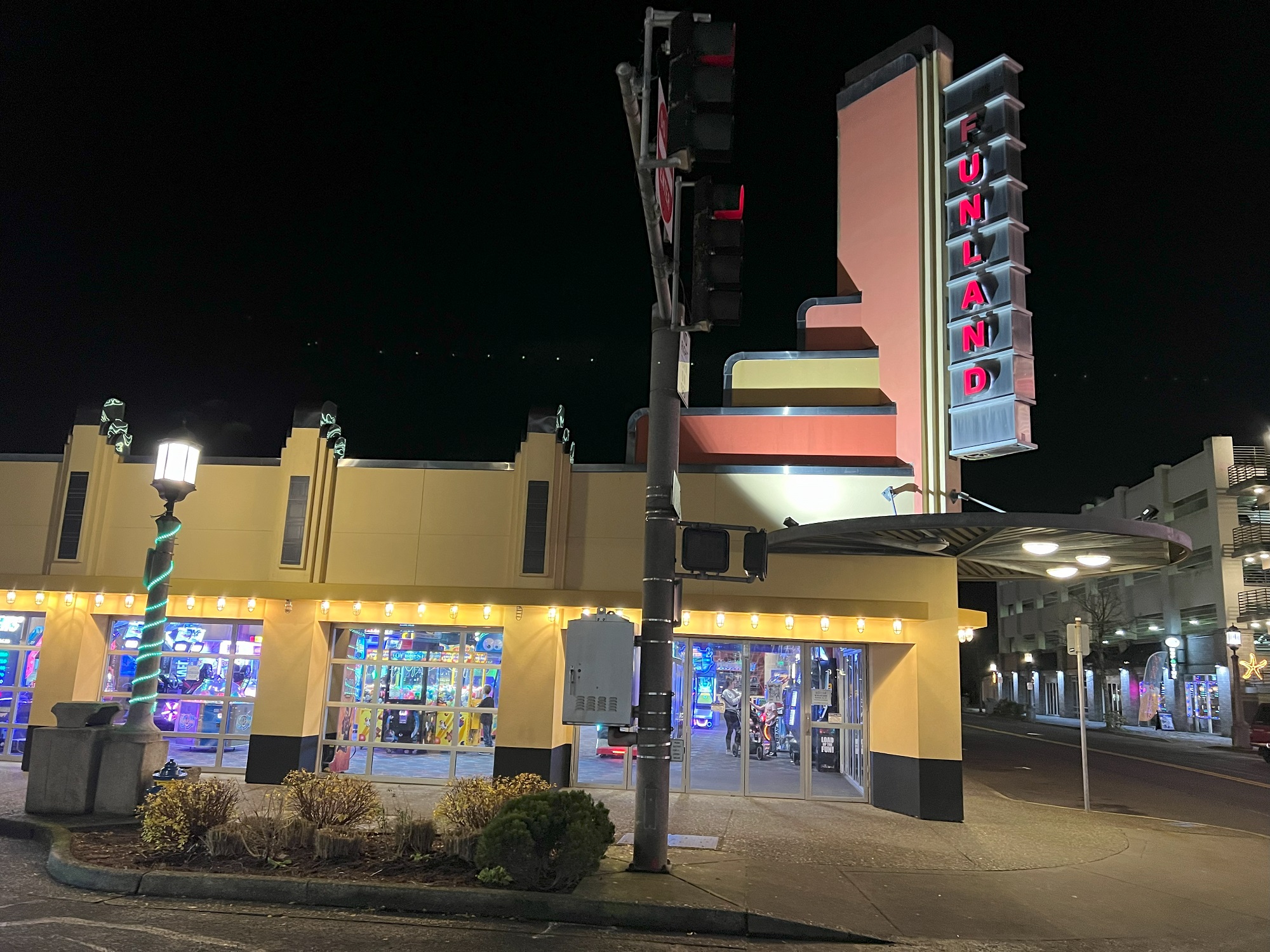
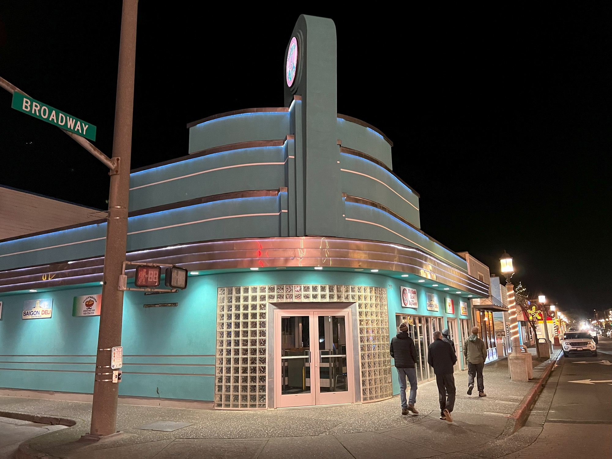
These art deco buildings are around the corner of Broadway and South Columbia Street in Seaside.
In 2018 Sisu Brewing Co. was established in the Times Theatre & Public House building that originally opened in the 1940s. There is still a screen that can be lowered in front of the stainless steel brew kettles on the inside, though, to show televised sporting events.


 .
.