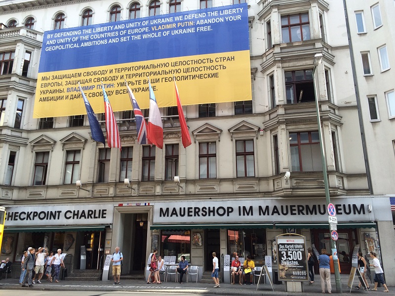
It looks to me from all the tourist buses and hubbub around Checkpoint Charlie* that it is Berlin’s top tourist destination, beating out even the very popular Brandenburg Gate and the Reichstag building. I did not make it into the Checkpoint Charlie Museum (the line was too long), but there was a series of chronological, annotated pictures on display outdoors which I found very moving.
*Charlie is the ‘C’ in the NATO phonetic alphabet, not a person’s name. For more information that I could possibly document here, check out the excellent Wikipedia entries for Berlin Wall and Checkpoint Charlie.
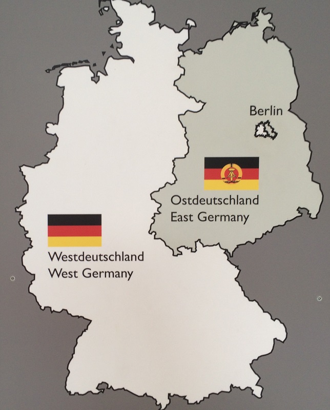
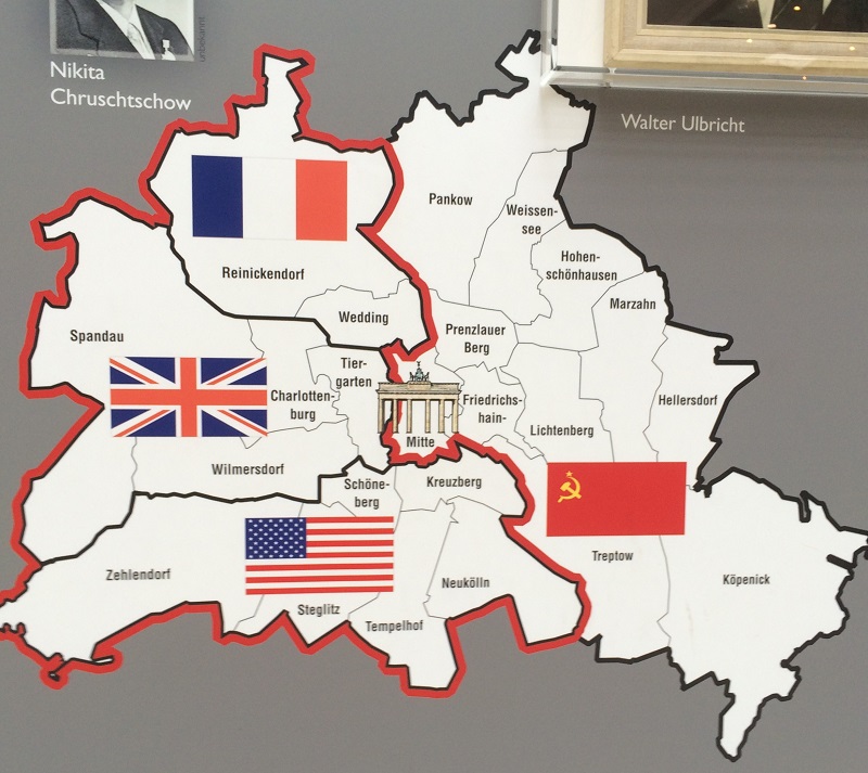
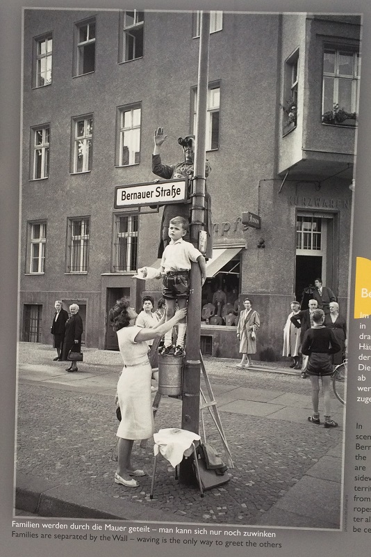
Here is West Germany and East Germany after World War II. West Berlin was a free city and political enclave surrounded by East Berlin and East Germany that existed between 1949 and 1990. It was located some 100 miles east of the East/West German border and was accessible by land from West Germany only by a narrow rail and highway corridor (from Wikipedia). [Picture from a display in the Potsdamer Platz Arcade, commemorating the 25th anniversary of the unification in Germany ].And here is greater Berlin with its four sectors : American, British, French, USSR [Picture from a display in the Potsdamer Platz Arcade, commemorating the 25th anniversary of the unification in Germany ].Families were separated by the very closing of the East-West sector boundary. The wall was built to stop an on-going and massive migration of people from the East to the West. [Picture from a display in the Potsdamer Platz Arcade, commemorating the 25th anniversary of the unification in Germany ].
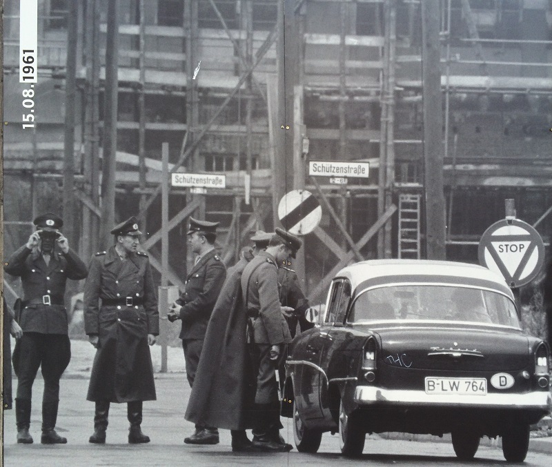
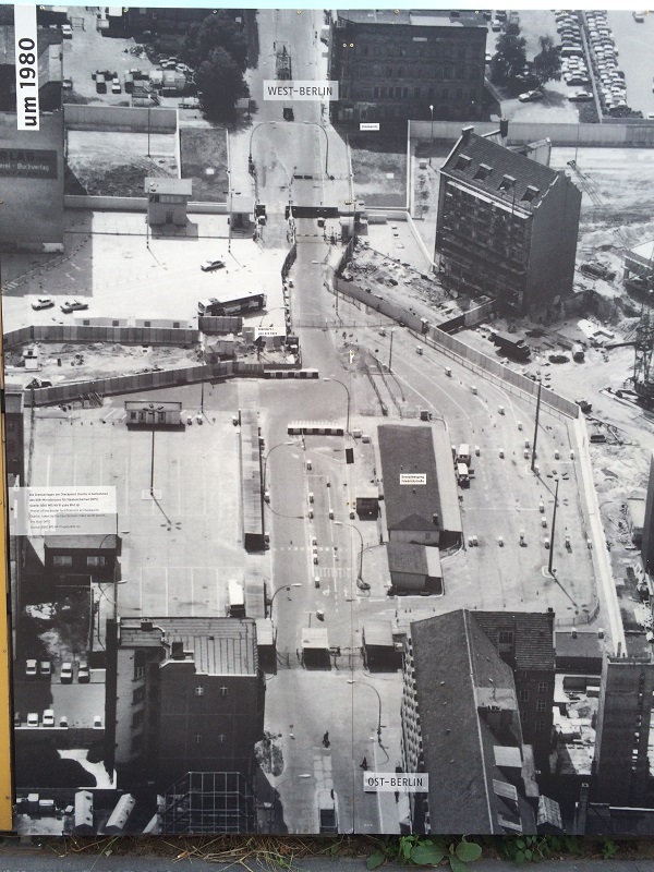
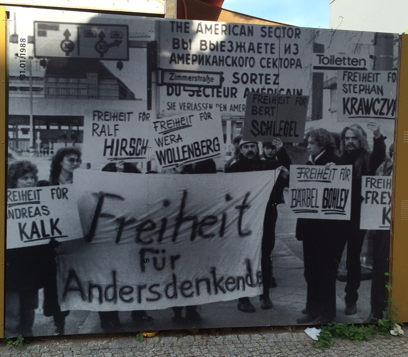
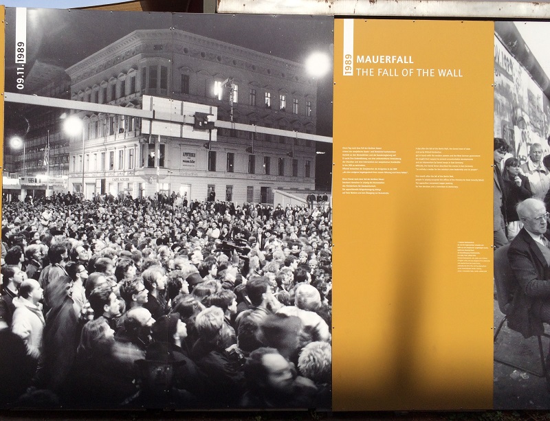
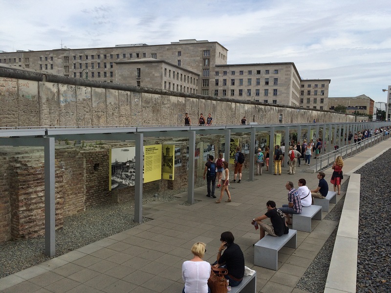
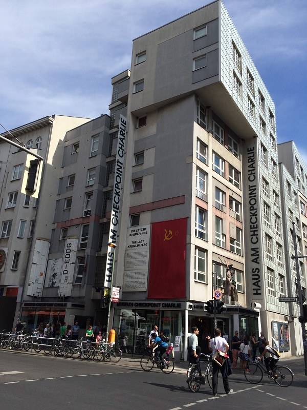
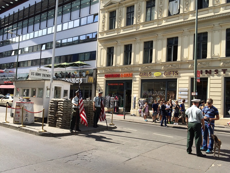
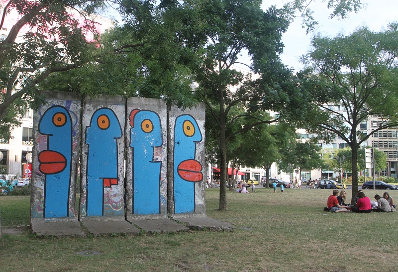
The next few pictures are from an outdoor display at Checkpoint Charlie. This one taken in 1961, so shortly after construction and completion of the wall.This picture shows that the Wall really is not a single ‘wall’ but several walls that create no-man’s land death strip areas that were patrolled by armed guards. Look for the ‘you are here’ caption in the middle of the picture, the location of the Checkpoint Charlie gate. Developers demolished the East German checkpoint watchtower in 2000, but a substitute symbolic guard house is still there.Protesters in 1988 with the names of their family and friends that have been jailed, presumably for attempting to cross the wall.The fall of the Berlin Wall, on 9 November 1989.This is an outdoor museum two blocks from the Checkpoint, called Topography des Terrors. It is dedicated to the history of the Wall and its victims. Alongside the edge is a remaining section of the Wall.The Checkpoint Charlie Museum.Another picture of the Museum Building (is it my imagination, or do I see ominous dictator-Communist rule edges in the architecture?).Here is the little guardhouse model complete with sandbags and ‘guards’. (They are resumably working for the museum. They accept payments from any tourists that want to pose with them for a picture).This is a section of the wall in its original place (in a park nearby Potsdamer Platz), but now with artwork painted on it.