
After the 7.7-magnitude earthquake on Friday, the internet was filled with videos, images and social media posts documenting the damage in Thailand.
But across the border in Myanmar, where the devastating quake was centered, there has been a far murkier picture about the scale of the diaster.
Information from Myanmar has been harder to come by in part because of the country’s history of internet censorship. In recent years, the military has repeatedly shut off the internet and cut access to social media, digitally isolating the country from the rest of the world.
– Adam Satariano and Paul Mozur reporting for the New York Times
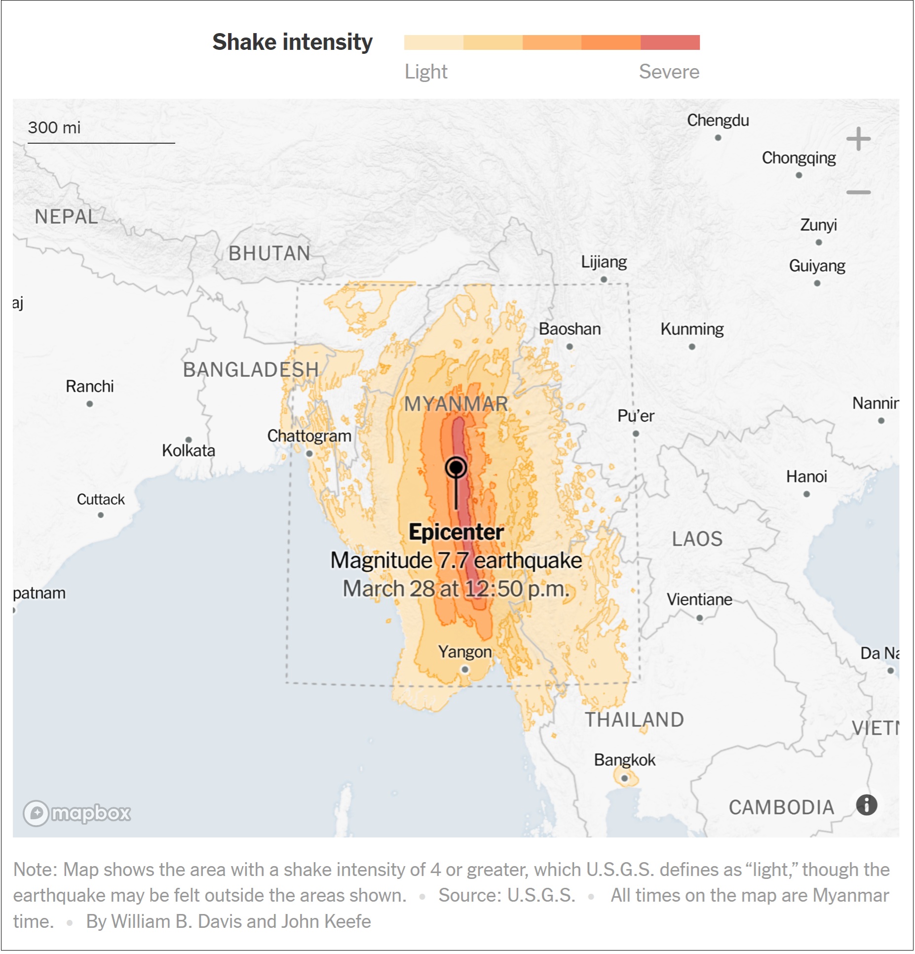
Central Myanmar, the scene of a powerful earthquake on Friday, lies near the eastern end of one of the world’s most active zones of seismic activity: the Alpide Belt, which extends from the Mediterranean Sea eastward through Turkey, Iran and Afghanistan, then along the Himalayas to Myanmar and finally Indonesia.
The epicenter of the quake on Friday was near Mandalay, Myanmar’s second-largest city with more than a million people. While much of Myanmar is susceptible to earthquakes, Mandalay and the surrounding towns sit right on top of one of four places in the country that are particularly prone to unusually powerful quakes, according to the United Nations Human Settlements Program. The other three places are in much less populated parts of the country.
– Keith Bradsher reporting for the New York Times